The Americas Collection (page 2)

"The Americas: A Tapestry of Natural Wonders and Historical Significance" Embark on a journey through the captivating landscapes and rich history of the Americas

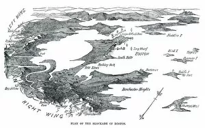
Background imageThe Americas Collection: Blockade of Boston

Blockade of Boston
Vintage engraving from 1861 showing the Plan of the Blockade of Boston during the American Revolutionary War

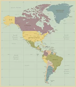
Background imageThe Americas Collection: Vintage Map of North and South America

Vintage Map of North and South America
534055040

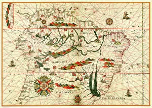
Background imageThe Americas Collection: Map of South America

Map of South America, from a Spanish Atlas, 1582

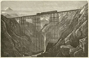
Background imageThe Americas Collection: Viaduct of the Lima Oroya Railway (Peru), published in 1872

Viaduct of the Lima Oroya Railway (Peru), published in 1872
Viaduct of the Lima Oroya Railway (Peru), built by the German architect Albert Fink (1827-1897). Woodcut engraving, published in 1872

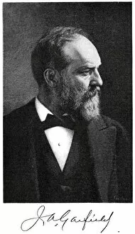
Background imageThe Americas Collection: James A. Garfield

James A. Garfield
" Vintage engraving from 1881 showing James A. Garfield the 20th President of the United States, serving from March 4, 1881 until his death on September 19, 1881, a mere 200 days in office

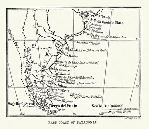
Background imageThe Americas Collection: Antique Map of the East Coast of Patagonia

Antique Map of the East Coast of Patagonia in the 16th Century

Background imageThe Americas Collection: Vintage photo frame 1900

Vintage photo frame 1900
Photo Greeting Card 1900 s

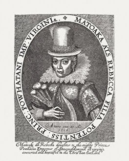
Background imageThe Americas Collection: Pocahontas (c. 1596-1617), Native American, wood engraving, published in 1884

Pocahontas (c. 1596-1617), Native American, wood engraving, published in 1884
Pocahontas (born Matoaka, known as Amonute, and later known as Rebecca Rolfe, c. 1596 - 1617), Native American. She was an intermediary between the trunks of the Virginia Algonquian

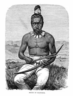
Background imageThe Americas Collection: Native American of California

Native American of California
Vintage engraving showing a Native American of California, 1873

Background imageThe Americas Collection: Marquette and Joliet discovering the Mississippi

Marquette and Joliet discovering the Mississippi

Background imageThe Americas Collection: Edgar Allan Poe

Edgar Allan Poe January 19, 1809 - October 7, 1849) was an American author, poet, editor, and literary critic, considered part of the American Romantic Movement

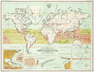
Background imageThe Americas Collection: Winds - Map of the world 1861

Winds - Map of the world 1861
Map of the world - Winds over the globe - storms and hurricanes

Background imageThe Americas Collection: the world 1877

the world 1877
antique map of the world - 1877

Background imageThe Americas Collection: map of the world 1867

map of the world 1867
meteorological map of the world 1867 - showing isothermal lines

Background imageThe Americas Collection: Map of the world 1861

Map of the world 1861
Map of the world - The distribution of Earthquakes and Volcanoes over the globe

Background imageThe Americas Collection: Animals - Map of the world 1861

Animals - Map of the world 1861
Map of the world - The distributions of animals

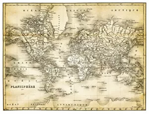
Background imageThe Americas Collection: map of the world 1873

map of the world 1873
antique map of the world - from a french atlas - 1872

Background imageThe Americas Collection: Climate map of the world 1861

Climate map of the world 1861
Map of the world - Climatological Chart

Background imageThe Americas Collection: map of the world 1855

map of the world 1855
map of the world illustrating the principal features of the land and the co-tidal lines - 1855

Background imageThe Americas Collection: Agricultural Map of the world 1861

Agricultural Map of the world 1861
map of the world showing the distribution of the most important Tress, Shrubs, Grains and Fruits according to zones of climate and moisture plants

Background imageThe Americas Collection: South America, river and mountains map

South America, river and mountains map
Illustrator of a South America, river and mountains map

Background imageThe Americas Collection: Benjamin franklin (XXXL)

Benjamin franklin (XXXL)
Portrait of Benjamin Franklin, engraved by

Background imageThe Americas Collection: Toddlers In Field Of Daisies. They Wear Fancy Clothes Dress And Suit

Toddlers In Field Of Daisies. They Wear Fancy Clothes Dress And Suit
UNITED STATES - CIRCA 1950s: Toddlers In Field Of Daisies. They Wear Fancy Clothes Dress And Suit. The Girl Holds Daisy Bouquet While The Boy Pulls Daisy Petals For Loves Me Not Game

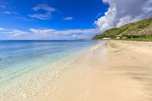
Background imageThe Americas Collection: Beautiful beach, turquoise sea, Carambola Beach, South Friars Bay, St. Kitts, St
Beautiful beach, turquoise sea, Carambola Beach, South Friars Bay, St. Kitts, St. Kitts and Nevis, Leeward Islands, West Indies, Caribbean, Central America

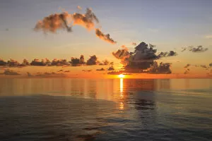
Background imageThe Americas Collection: Sunset over beautiful calm sea, interesting clouds, vibrant colours, St. Kitts, St

Sunset over beautiful calm sea, interesting clouds, vibrant colours, St. Kitts, St. Kitts and Nevis, Leeward Islands, West Indies, Caribbean, Central America

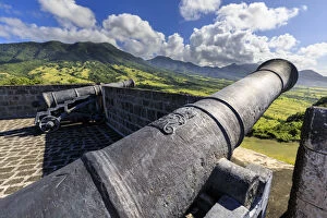
Background imageThe Americas Collection: Cannons, royal insignia, Brimstone Hill Fortress National Park

Cannons, royal insignia, Brimstone Hill Fortress National Park, UNESCO World Heritage Site, St. Kitts and Nevis, Leeward Islands, West Indies, Caribbean, Central America

Background imageThe Americas Collection: Beautiful beach, turquoise sea, South Friars Bay, Saint George Basseterre Parish, St

Beautiful beach, turquoise sea, South Friars Bay, Saint George Basseterre Parish, St. Kitts, St. Kitts and Nevis, Leeward Islands, West Indies, Caribbean, Central America

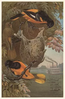
Background imageThe Americas Collection: Baltimore oriole (Icterus galbula), lithograph, published in 1882

Baltimore oriole (Icterus galbula), lithograph, published in 1882
Baltimore oriole (Icterus galbula). Lithograph, published in 1882

Background imageThe Americas Collection: Antique map of New Hampshire USA 19th century 1819

Antique map of New Hampshire USA 19th century 1819
This is a copperplate engraving, a 19th century map of New Hampshire in the United States of America, with hand-coloured borders with Canada, Maine, Massachusetts and Vermont

Background imageThe Americas Collection: Engraving: Map of North America

Engraving: Map of North America
Engraved illustrations of the Theory of the Art of Drawing from Iconographic Encyclopedia of Science, Literature and Art, Published in 1851. Copyright has expired on this artwork. Digitally restored

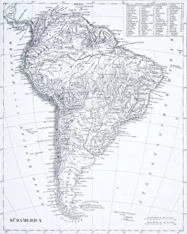
Background imageThe Americas Collection: Engraving: South America

Engraving: South America
Engraved illustrations of South America from Iconographic Encyclopedia of Science, Literature and Art, Published in 1851. Copyright has expired on this artwork. Digitally restored

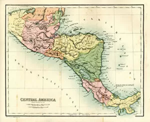
Background imageThe Americas Collection: Antique map - Central America

Antique map - Central America
Antique map of Central America, 1864

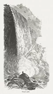
Background imageThe Americas Collection: Niagara Falls, American side, New York, USA, published in 1880

Niagara Falls, American side, New York, USA, published in 1880
Niagara Falls, American side, New York, USA. Wood engraving, published in 1880

Background imageThe Americas Collection: Niagara Falls, 19th Century

Niagara Falls, 19th Century
Vintage engraving of Niagara Falls, 19th Century

Background imageThe Americas Collection: Yosemite National Park, USA, wood engraving, published in 1872

Yosemite National Park, USA, wood engraving, published in 1872
Yosemite National Park, California, USA. Wood engraving, published in 1872

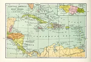
Background imageThe Americas Collection: Antique Map of Central America and West Indes

Antique Map of Central America and West Indes
Vintage map of Central America and West Indes, from 1894

Background imageThe Americas Collection: John Hancock Tower At Back Bay In Summer, Boston, Ma

John Hancock Tower At Back Bay In Summer, Boston, Ma

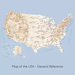
Background imageThe Americas Collection: Map of the USA general reference

Map of the USA general reference
Vector illustration of a map of the United States of America. The reference map used in the creation of this illustration is public domain map available at the University of Texas website: http

Background imageThe Americas Collection: Map of United States with Watercolor Texture - Raster Illustration

Map of United States with Watercolor Texture - Raster Illustration
An abstract map of the United States with a multicoloured, rainbow hand painted watercolor texture. Map is isolated on a white background. Raster illustration

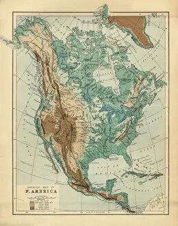
Background imageThe Americas Collection: North America Physical Map, Engraving, 1892

North America Physical Map, Engraving, 1892
Very rare, beautifully detailed engraving of North America Physical Map, Engraving, Published in 1892. Original edition from my own archives. Copyright has expired on this artwork. Digitally restored

Background imageThe Americas Collection: Cuts of lamb or mutton diagram

Cuts of lamb or mutton diagram
Poster with detailed diagram cutting lamb

Background imageThe Americas Collection: American Native

American Native
Antique illustration of a American Native

Background imageThe Americas Collection: Spanish Priests Soldiers Attacked Indigenous

Spanish Priests Soldiers Attacked Indigenous
Spanish priests and soldiers attacked by indigenous people after their arrival in the Americas. After a late 16th century work by Theodor de Bry

Background imageThe Americas Collection: Map of North and South America by Andre Thevet, 1516 - 1590. Thevet was a French Franciscan priest

Map of North and South America by Andre Thevet, 1516 - 1590. Thevet was a French Franciscan priest, author and traveller

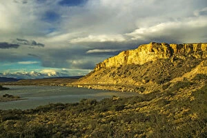
Background imageThe Americas Collection: Rio La Leona flows through the Patagonian Steppe near El Calafate, Patagonia, Argentina

Rio La Leona flows through the Patagonian Steppe near El Calafate, Patagonia, Argentina
Rio La Leona flows through the Patagonian Steppe with its arid landscape and the famous National Route 40 in squally sunlight near El Calafate in Santa Cruz Province; Patagonia, Argentina

Background imageThe Americas Collection: Golden Gate Bridge Sunrise From Marin San Francisco, California, United States

Golden Gate Bridge Sunrise From Marin San Francisco, California, United States

Background imageThe Americas Collection: Benjamin Franklin Bridge

Benjamin Franklin Bridge

Background imageThe Americas Collection: Fireworks Over Harbour

Fireworks Over Harbour


For sale as Licensed Images

Choose your image, Select your licence and Download the media

"The Americas: A Tapestry of Natural Wonders and Historical Significance" Embark on a journey through the captivating landscapes and rich history of the Americas, where every corner unveils a new adventure. From the majestic Nevis Peak in St. Kitts and Nevis to the towering Mount Nevis, this region is home to awe-inspiring volcanic formations that have shaped its unique topography. Immerse yourself in the vibrant tapestry of cultures found in the West Indies, nestled within the turquoise waters of the Caribbean. Explore their fascinating heritage as you navigate through an intricately detailed USA Road Map or delve into Saint Lucia's past with a 19th-century map that offers glimpses into bygone eras. Travel back in time with an Iowa 1852 Map or marvel at an Antique Map of Western USA, tracing early explorations across vast territories. Discover how our understanding of geography has evolved over centuries with maps like World map from 1520 or Map of the world according to Strabo from ancient times to more recent ones like Map of the world, 1720. Witness human ingenuity come alive through lithographs depicting Panama Canal Project published in 1880 - a testament to mankind's determination to connect continents and reshape global trade routes. Delve into nature's wonders with a detailed Map of Yellowstone National Park, USA, showcasing its breathtaking geothermal features and diverse wildlife. Finally, gaze upon a Caribbean map that showcases not only stunning coastlines but also highlights cultural diversity across nations. For an extraordinary perspective, explore South America at night through satellite imagery capturing twinkling city lights against darkened landscapes. The Americas beckon adventurers seeking both natural beauty and historical significance; it is a land where ancient traditions meet modern aspirations amidst breathtaking scenery. So grab your maps and embark on an unforgettable journey filled with wonderment.