The Americas Collection (page 3)

"The Americas: A Tapestry of Natural Wonders and Historical Significance" Embark on a journey through the captivating landscapes and rich history of the Americas

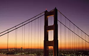
Background imageThe Americas Collection: Golden Gate Bridge Sunrise From Marin San Francisco, California, United States

Golden Gate Bridge Sunrise From Marin San Francisco, California, United States

Background imageThe Americas Collection: Benjamin Franklin Bridge

Benjamin Franklin Bridge

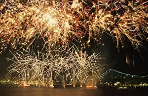
Background imageThe Americas Collection: Fireworks Over Harbour

Fireworks Over Harbour

Background imageThe Americas Collection: Broadway Sign And Empire State Building

Broadway Sign And Empire State Building

Background imageThe Americas Collection: Statue Of Jesus Outside Church

Statue Of Jesus Outside Church

Background imageThe Americas Collection: Ackees And Other Fruits For Sale On Stall, Negril, Jamaica

Ackees And Other Fruits For Sale On Stall, Negril, Jamaica

Background imageThe Americas Collection: Stuffed Crab Shells, Jakes, Treasure Beach, St Elizabeth, Jamaica

Stuffed Crab Shells, Jakes, Treasure Beach, St Elizabeth, Jamaica

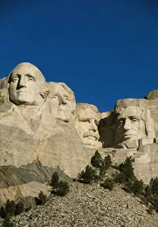
Background imageThe Americas Collection: Mount Rushmore

Mount Rushmore

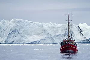
Background imageThe Americas Collection: A Midnight Cruise Around The Ilulissat Ice Fjord, One Of Unesco World Heritage Sites. Greenland

A Midnight Cruise Around The Ilulissat Ice Fjord, One Of Unesco World Heritage Sites. Greenland

Background imageThe Americas Collection: Detail Of Banana Leaf, Blue Mountains, Jamaica

Detail Of Banana Leaf, Blue Mountains, Jamaica

Background imageThe Americas Collection: Detail of palm tree, Grenada

Detail of palm tree, Grenada

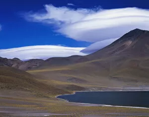
Background imageThe Americas Collection: Chile, Atacama, Laguna Miscante, Landscape

Chile, Atacama, Laguna Miscante, Landscape

Background imageThe Americas Collection: A Midnight Cruise Around The Ilulissat Ice Fjord, One Of Unesco World Heritage Sites. Greenland

A Midnight Cruise Around The Ilulissat Ice Fjord, One Of Unesco World Heritage Sites. Greenland

Background imageThe Americas Collection: View Of The Mountainous West Coast Of Greenland. Greenland

View Of The Mountainous West Coast Of Greenland. Greenland

Background imageThe Americas Collection: Moraine Lake

Moraine Lake

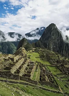
Background imageThe Americas Collection: Machu Picchu

Machu Picchu

Background imageThe Americas Collection: Wood In Autumn

Wood In Autumn

Background imageThe Americas Collection: Swift River

Swift River

Background imageThe Americas Collection: Fall Foliage & Painted Building

Fall Foliage & Painted Building

Background imageThe Americas Collection: Stream In Autumn

Stream In Autumn

Background imageThe Americas Collection: Mountains And Lakes, Dempster Highway

Mountains And Lakes, Dempster Highway

Background imageThe Americas Collection: Waters Off The West Coast Of Barbados, Beach Water Ocean Horizon

Waters Off The West Coast Of Barbados, Beach Water Ocean Horizon

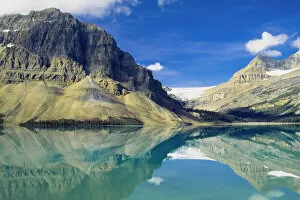
Background imageThe Americas Collection: Bow Lake, Alberta, Canada

Bow Lake, Alberta, Canada

Background imageThe Americas Collection: Trafalgar Falls

Trafalgar Falls

Background imageThe Americas Collection: Sunset Over Pacific

Sunset Over Pacific

Background imageThe Americas Collection: Lake O hara In Canadian Rockies

Lake O hara In Canadian Rockies

Background imageThe Americas Collection: Fishermen Holding Nets In Sea At Sunset

Fishermen Holding Nets In Sea At Sunset

Background imageThe Americas Collection: Central Park In Falling Snow

Central Park In Falling Snow

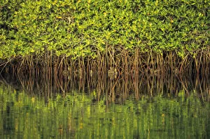
Background imageThe Americas Collection: Mangroves Reflected In The Water At Black Turtle Cove, Santa Cruz Island, Galapagos Islands, Ecuador

Mangroves Reflected In The Water At Black Turtle Cove, Santa Cruz Island, Galapagos Islands, Ecuador

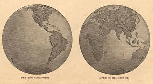
Background imageThe Americas Collection: Old, Map of Eastern and Western Hemispheres, From 1875

Old, Map of Eastern and Western Hemispheres, From 1875
Old black and white illustration of the Eastern Hemisphere and the Western Hemisphere, from the 1800 s

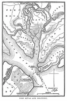
Background imageThe Americas Collection: Battle of Port Royal

Battle of Port Royal
Vintage engraving from 1863 of a map of the Battle of Port Royal which was one of the earliest amphibious operations of the American Civil War

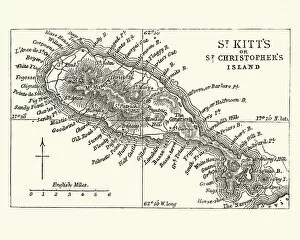
Background imageThe Americas Collection: Map of Saint Kitts, 19th Century

Map of Saint Kitts, 19th Century
Vintage engraving of a Map of Saint Kitts, 19th Century. Saint Kitts and Nevis, also known as the Federation of Saint Christopher and Nevis, [4] is an island country in the West Indies

Background imageThe Americas Collection: animal behaviour, perching, physical stance, sitting, group of animals, flock of birds

animal behaviour, perching, physical stance, sitting, group of animals, flock of birds
Light-mantled albatross on a cliff top nest, on South Georgia Island in the Falklands

Background imageThe Americas Collection: Aztec people, Mexican culture between the 14th-16th century

Aztec people, Mexican culture between the 14th-16th century
Illustration of a Aztec people, Mexican culture between the 14th-16th century

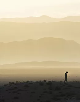
Background imageThe Americas Collection: Man standing in desert silhouette

Man standing in desert silhouette
Man silhouetted and walking below hills of the Nevada desert at sunsest

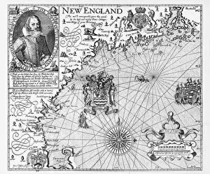
Background imageThe Americas Collection: Map of New England by Explorer John Smith, Circa 1624

Map of New England by Explorer John Smith, Circa 1624
Beautifully Illustrated Antique Engraved Victorian Illustration of Historical Map of New England from Explorer Captain John Smith, Circa 1624. Source: Original edition from my own archives

Background imageThe Americas Collection: Michigan 1852 Map

Michigan 1852 Map

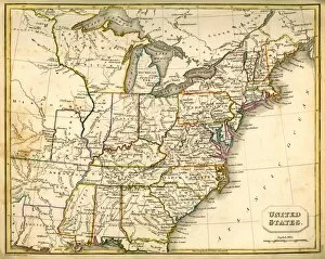
Background imageThe Americas Collection: Antquie Map of the United States

Antquie Map of the United States
Vintage map of the United States of America from 1837

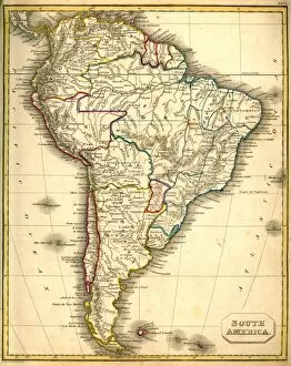
Background imageThe Americas Collection: Antquie Map of South America

Antquie Map of South America
Vintage map of South America from 1837

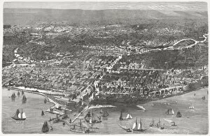
Background imageThe Americas Collection: Chicago before the Great City Fire in 1871, published 1872

Chicago before the Great City Fire in 1871, published 1872
Birds eye view of Chicago before the Great City Fire in 1871. Legend: 1) West-side, 2) Union-park, 3) Gasworks, 4) Lincoln-park, 5) Washington-place, 6) Promenade, 7) North-side, 8) Waterworks

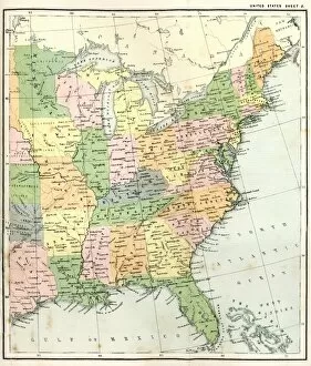
Background imageThe Americas Collection: Antique Map of Eastern USA

Antique Map of Eastern USA
Antique Map from 1867 of Eastern United States of America

Background imageThe Americas Collection: map of the world 1823

map of the world 1823
map of the world - 1823 very detailed lithography

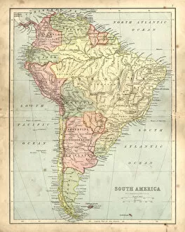
Background imageThe Americas Collection: Antique damaged map of South America in the 19th Century

Antique damaged map of South America in the 19th Century
Vintage engraving of a Antique map of South America in the 19th Century, 1873

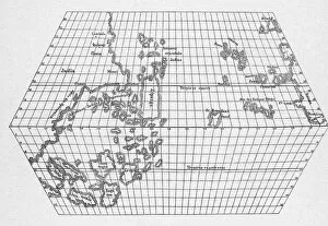
Background imageThe Americas Collection: Toscanellis Map Of World

Toscanellis Map Of World
Toscanellis world map, showing Europe and India facing each other, omitting the Americas, 15th century. (Kean Collection/Getty Images)

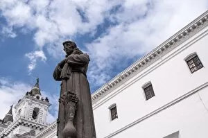
Background imageThe Americas Collection: Quitos Colonial Church and Monastery of Saint Francis

Quitos Colonial Church and Monastery of Saint Francis
The Church and convent of St. Francis is located in the South American capital city of Quito, Ecuador. This Roman Catholic church was constructed between the years 1550 and 1660
Background imageThe Americas Collection: Antelope Island in Lake Powell, Page, Arizona, USA

Antelope Island in Lake Powell, Page, Arizona, USA

Background imageThe Americas Collection: View of the Grand Canyon at night with full moon, viewing point Mather Point, South Rim

View of the Grand Canyon at night with full moon, viewing point Mather Point, South Rim, Grand Canyon, at Tusayan, Arizona, USA

Background imageThe Americas Collection: Golden Barrel Cactus, Golden Ball Cactus or Mother-in-Laws Cushion -Echinocactus grusonii

Golden Barrel Cactus, Golden Ball Cactus or Mother-in-Laws Cushion -Echinocactus grusonii-, several cacti


For sale as Licensed Images

Choose your image, Select your licence and Download the media

"The Americas: A Tapestry of Natural Wonders and Historical Significance" Embark on a journey through the captivating landscapes and rich history of the Americas, where every corner unveils a new adventure. From the majestic Nevis Peak in St. Kitts and Nevis to the towering Mount Nevis, this region is home to awe-inspiring volcanic formations that have shaped its unique topography. Immerse yourself in the vibrant tapestry of cultures found in the West Indies, nestled within the turquoise waters of the Caribbean. Explore their fascinating heritage as you navigate through an intricately detailed USA Road Map or delve into Saint Lucia's past with a 19th-century map that offers glimpses into bygone eras. Travel back in time with an Iowa 1852 Map or marvel at an Antique Map of Western USA, tracing early explorations across vast territories. Discover how our understanding of geography has evolved over centuries with maps like World map from 1520 or Map of the world according to Strabo from ancient times to more recent ones like Map of the world, 1720. Witness human ingenuity come alive through lithographs depicting Panama Canal Project published in 1880 - a testament to mankind's determination to connect continents and reshape global trade routes. Delve into nature's wonders with a detailed Map of Yellowstone National Park, USA, showcasing its breathtaking geothermal features and diverse wildlife. Finally, gaze upon a Caribbean map that showcases not only stunning coastlines but also highlights cultural diversity across nations. For an extraordinary perspective, explore South America at night through satellite imagery capturing twinkling city lights against darkened landscapes. The Americas beckon adventurers seeking both natural beauty and historical significance; it is a land where ancient traditions meet modern aspirations amidst breathtaking scenery. So grab your maps and embark on an unforgettable journey filled with wonderment.