The Americas Collection (page 5)

"The Americas: A Tapestry of Natural Wonders and Historical Significance" Embark on a journey through the captivating landscapes and rich history of the Americas

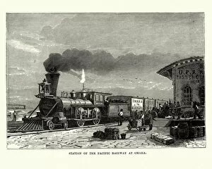
Background imageThe Americas Collection: Steam train, station of Pacific Railway at Omaha, 19th Century

Steam train, station of Pacific Railway at Omaha, 19th Century
Vintage engraving of a station of the Pacific Railway at Omaha, 19th Century

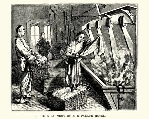
Background imageThe Americas Collection: Chinese workers doing laundry in the the Palace hotel

Chinese workers doing laundry in the the Palace hotel
Vintage engraving of chinese workers doing laundry in the the Palace hotel, San Francisco, 19th Century

Background imageThe Americas Collection: Tobacco smoker in 17th Century

Tobacco smoker in 17th Century
illustration of a Tobacco smoker in 17th Century

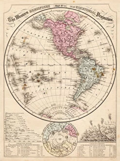
Background imageThe Americas Collection: Western Hemisphere map 1867

Western Hemisphere map 1867
Mitchells Modern Atlas - Published by E.H. Buttler & Co - Philadelphia 1867

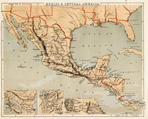
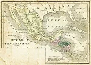
Background imageThe Americas Collection: Mexico and Central America map 1869

Mexico and Central America map 1869
Cornells Grammars-School Geography - S.S. Cornell - New York D. Appleton and Company 1869

Background imageThe Americas Collection: Mexico and Central America map 1856

Mexico and Central America map 1856
Colton and Fitchs Modern School Geography by George W. Fitch - New York 1856

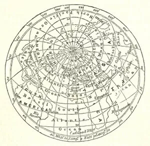
Background imageThe Americas Collection: Victorian map of the Arctic Circle

Victorian map of the Arctic Circle
A Victorian map of the Arctic Circle and beyond. From Peter Parleyas Annual - A Christmas and New Yearas Present for Young Peoplea published in London by Darton & Co in 1851

Background imageThe Americas Collection: Engraved Chart of United States Time Zones, Circa 1883

Engraved Chart of United States Time Zones, Circa 1883
Beautifully Illustrated Antique Engraved Victorian Illustration of an Engraved Chart of United States Time Zones and Standard Railway Time, Circa 1883. Original edition from my own archives

Background imageThe Americas Collection: Boston, Massachusetts, USA, wood engraving, published in 1882

Boston, Massachusetts, USA, wood engraving, published in 1882
Map of Boston, Massachusetts, USA. Wood engraving, published in 1882

Background imageThe Americas Collection: Map of North America

Map of North America
Engraved illustrations of a Map of North America from Iconographic Encyclopedia of Science, Literature and Art, Published in 1851. Copyright has expired on this artwork. Digitally restored

Background imageThe Americas Collection: Victorian Map of North America

Victorian Map of North America
Engraved illustrations of the Physical Map of South America from Iconographic Encyclopedia of Science, Literature and Art, Published in 1851. Copyright has expired on this artwork. Digitally restored

Background imageThe Americas Collection: United States area: Acquisition and transfer of territory 1780 to 1870

United States area: Acquisition and transfer of territory 1780 to 1870
United States area: Acquisition and transfer of territory 1780 to1870

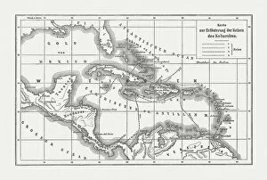
Background imageThe Americas Collection: Voyages of Christopher Columbus, wood engraving, published c. 1882

Voyages of Christopher Columbus, wood engraving, published c. 1882
Map with the routes of the four voyages of Christopher Columbus in the Caribbean Sea. Wood engraving, published c. 1882

Background imageThe Americas Collection: Western Hemisphere 1852 Map

Western Hemisphere 1852 Map

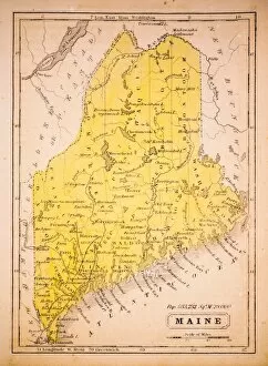
Background imageThe Americas Collection: Maine 1852 Map

Maine 1852 Map

Background imageThe Americas Collection: Massachusetts 1852 Map

Massachusetts 1852 Map

Background imageThe Americas Collection: Rhode Island 1852 Map

Rhode Island 1852 Map

Background imageThe Americas Collection: Connecticut 1852 Map

Connecticut 1852 Map

Background imageThe Americas Collection: New England 1852 Map

New England 1852 Map

Background imageThe Americas Collection: New York 1852 Map

New York 1852 Map

Background imageThe Americas Collection: New Jersey, Pennsylvania, Delaware and Maryland 1852 Map

New Jersey, Pennsylvania, Delaware and Maryland 1852 Map

Background imageThe Americas Collection: Middle States 1852 Map

Middle States 1852 Map

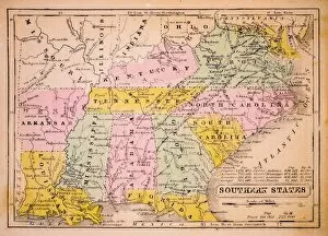
Background imageThe Americas Collection: Southern States 1852 Map

Southern States 1852 Map

Background imageThe Americas Collection: Indiana 1852 Map

Indiana 1852 Map

Background imageThe Americas Collection: Western States 1852 Map

Western States 1852 Map

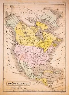
Background imageThe Americas Collection: North America 1852 Map

North America 1852 Map

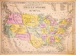
Background imageThe Americas Collection: United States 1852 Map

United States 1852 Map

Background imageThe Americas Collection: Mexico, Texas, Guatimala and West Indies 1852 Map

Mexico, Texas, Guatimala and West Indies 1852 Map

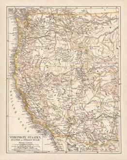
Background imageThe Americas Collection: United States of America, West Coast, ithograph, published in 1878

United States of America, West Coast, ithograph, published in 1878
United States of America, States on the Pacific Ocean. Lithograph, published in 1878

Background imageThe Americas Collection: United States of America, States on Mississippi river, lithograph published 1878

United States of America, States on Mississippi river, lithograph published 1878
United States of America, States on the Mississippi river. Lithograph, published in 1878

Background imageThe Americas Collection: United States of America, Mexico and Central America, published in 1878

United States of America, Mexico and Central America, published in 1878
United States of America, Mexico and Central America. Lithograph, published in 1878

Background imageThe Americas Collection: Map of Brazil. Lithograph, lithograph, published in 1874

Map of Brazil. Lithograph, lithograph, published in 1874
Antique map of Brazil. Lithograph, published in 1874

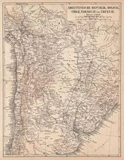
Background imageThe Americas Collection: Argentina, Bolivia, Chile, Paraguay and Uruguay, lithograph, published in 1874

Argentina, Bolivia, Chile, Paraguay and Uruguay, lithograph, published in 1874
South American countries: Argentina, Bolivia, Chile, Paraguay and Uruguay. Lithograph, published in 1874

Background imageThe Americas Collection: North America 1850 Engraving

North America 1850 Engraving
Engraved illustrations of the Physical Map of North America from Iconographic Encyclopedia of Science, Literature and Art, Published in 1851. Copyright has expired on this artwork. Digitally restored

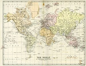
Background imageThe Americas Collection: Antique Map of the World

Antique Map of the World
Vintage map of the World from 1884

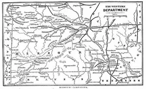
Background imageThe Americas Collection: Missouri Campaigns

Missouri Campaigns
Vintage engraving from 1863 of a map of the Missouri Campaigns from the time of the American Civil War

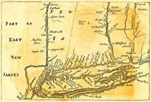
Background imageThe Americas Collection: Vintage Map of New York

Vintage Map of New York at the beginning of the 18th Century. from 1880

Background imageThe Americas Collection: Antique USA Map

Antique USA Map
USA Map, - Antique style. Includes mountains and water bodies. - vector illustration

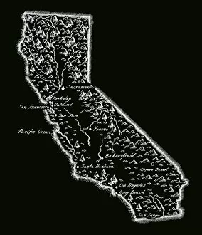
Background imageThe Americas Collection: Antique California

Antique California
California Map, - Antique style. Includes mountains and water bodies. High detail - vector illustration

Background imageThe Americas Collection: Antique Chile

Antique Chile
Chile Map, - Antique style. Includes mountains and water bodies. High detail - vector illustration

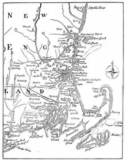
Background imageThe Americas Collection: Vintage Map of New England

Vintage Map of New England at the beginning of the 18th century

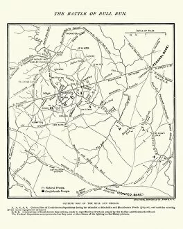
Background imageThe Americas Collection: Map of the Battle of Bull Run

Map of the Battle of Bull Run
Vintage engraving of a Map of the Battle of Bull Run, The Century Magazine, 1884

Background imageThe Americas Collection: Antique damaged map of North America in the 19th Century

Antique damaged map of North America in the 19th Century
Vintage engraving of a Antique map of North America in the 19th Century, 1873

Background imageThe Americas Collection: South America Physical Map, Engraving, 1892

South America Physical Map, Engraving, 1892
Very rare, beautifully detailed engraving of South America Physical Map, Engraving, Published in 1892. Original edition from my own archives. Copyright has expired on this artwork. Digitally restored

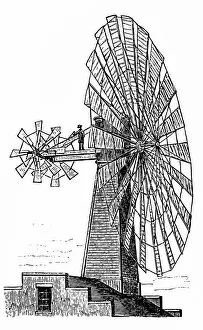
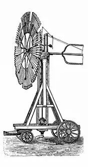
Background imageThe Americas Collection: Wind motor

Wind motor
large wind motor with an auxiliary wheels

Background imageThe Americas Collection: Wheeled Wind motor

Wheeled Wind motor
large Wheeled Wind motor

Background imageThe Americas Collection: Spectral Bat

Spectral Bat
Engraving From 1898 Of The Spectral Bat Or False Vampire Bat

Background imageThe Americas Collection: Wind turbine by Wulf

Wind turbine by Wulf


For sale as Licensed Images

Choose your image, Select your licence and Download the media

"The Americas: A Tapestry of Natural Wonders and Historical Significance" Embark on a journey through the captivating landscapes and rich history of the Americas, where every corner unveils a new adventure. From the majestic Nevis Peak in St. Kitts and Nevis to the towering Mount Nevis, this region is home to awe-inspiring volcanic formations that have shaped its unique topography. Immerse yourself in the vibrant tapestry of cultures found in the West Indies, nestled within the turquoise waters of the Caribbean. Explore their fascinating heritage as you navigate through an intricately detailed USA Road Map or delve into Saint Lucia's past with a 19th-century map that offers glimpses into bygone eras. Travel back in time with an Iowa 1852 Map or marvel at an Antique Map of Western USA, tracing early explorations across vast territories. Discover how our understanding of geography has evolved over centuries with maps like World map from 1520 or Map of the world according to Strabo from ancient times to more recent ones like Map of the world, 1720. Witness human ingenuity come alive through lithographs depicting Panama Canal Project published in 1880 - a testament to mankind's determination to connect continents and reshape global trade routes. Delve into nature's wonders with a detailed Map of Yellowstone National Park, USA, showcasing its breathtaking geothermal features and diverse wildlife. Finally, gaze upon a Caribbean map that showcases not only stunning coastlines but also highlights cultural diversity across nations. For an extraordinary perspective, explore South America at night through satellite imagery capturing twinkling city lights against darkened landscapes. The Americas beckon adventurers seeking both natural beauty and historical significance; it is a land where ancient traditions meet modern aspirations amidst breathtaking scenery. So grab your maps and embark on an unforgettable journey filled with wonderment.