
Topography Collection (#4)

"Exploring the World's Varied Topography

Background imageTopography Collection: Port Lyttelton, New Zealand with the Entrance to the New Graving Dock (engraving)

Port Lyttelton, New Zealand with the Entrance to the New Graving Dock (engraving)
1624349 Port Lyttelton, New Zealand with the Entrance to the New Graving Dock (engraving) by English School, (19th century); Private Collection; (add.info.: Port Lyttelton)

Background imageTopography Collection: The Rescue of a Castaway, Crew from Heard Island, near Kerguelen (engraving)

The Rescue of a Castaway, Crew from Heard Island, near Kerguelen (engraving)
1044014 The Rescue of a Castaway, Crew from Heard Island, near Kerguelen (engraving) by English School, (19th century); Private Collection; (add.info.: The Rescue of a Castaway)

Background imageTopography Collection: 1940s East Africa - train Limuru escarpment, Kenya

1940s East Africa - train Limuru escarpment, Kenya
1940s East Africa - train descending the Limuru escarpment, Kenya Photograph by a British army recruitment officer stationed in East Africa and the Middle East during World War II

Background imageTopography Collection: India - the Amir of Kabul Afghanistan 1860s

India - the Amir of Kabul Afghanistan 1860s
19th century vintage photograph India - the Amir of Kabul Afghanistan Shepherd and Robertson, 1860s

Background imageTopography Collection: India - a maharaja, child prince and his officials 1860s

India - a maharaja, child prince and his officials 1860s
19th century vintage photograph India - India - a maharaja and his officials, Shepherd and Robertson, 1860s

Background imageTopography Collection: India - a maharaja and his officials

India - a maharaja and his officials
19th century vintage photograph - India - a maharaja and his officials

Background imageTopography Collection: The Rocky Path of a Mountain Burn (engraving)

The Rocky Path of a Mountain Burn (engraving)
1618800 The Rocky Path of a Mountain Burn (engraving) by Jutsum, Henry (1816-69); Private Collection; (add.info.: The Rocky Path of a Mountain Burn)

Background imageTopography Collection: The Cultivation of Tea in Assam (engraving)

The Cultivation of Tea in Assam (engraving)
1053618 The Cultivation of Tea in Assam (engraving) by English School, (19th century); Private Collection; (add.info.: The Cultivation of Tea in Assam)

Background imageTopography Collection: Brockwell Park, near Herne Hill and Dulwich, to be purchased for the Public Recreation (engraving)

Brockwell Park, near Herne Hill and Dulwich, to be purchased for the Public Recreation (engraving)
1596451 Brockwell Park, near Herne Hill and Dulwich, to be purchased for the Public Recreation (engraving) by Gilbert, John (1817-97) (after); Private Collection; (add.info.: Brockwell Park)

Background imageTopography Collection: Indian NCOs of the Guides cavalry, 1879 (b / w photo)

Indian NCOs of the Guides cavalry, 1879 (b / w photo)
5920371 Indian NCOs of the Guides cavalry, 1879 (b/w photo) by Burke, John (fl.1878-79); National Army Museum, London; (add.info.: Indian NCOs of the Guides cavalry, 1879)

Background imageTopography Collection: The Zulu War, View of the Spot where the Prince Imperial was killed, looking East (engraving)

The Zulu War, View of the Spot where the Prince Imperial was killed, looking East (engraving)
1099689 The Zulu War, View of the Spot where the Prince Imperial was killed, looking East (engraving) by Prior, Melton (1845-1910) (after); Private Collection; (add.info.: The Zulu War)

Background imageTopography Collection: Sketches in Roundhay Park, Leeds, opened this Week by Prince Arthur (engraving)

Sketches in Roundhay Park, Leeds, opened this Week by Prince Arthur (engraving)
1588900 Sketches in Roundhay Park, Leeds, opened this Week by Prince Arthur (engraving) by English School, (19th century); Private Collection; (add.info.: Sketches in Roundhay Park, Leeds)

Background imageTopography Collection: Sketches of St Kilda, Western Hebrides (engraving)

Sketches of St Kilda, Western Hebrides (engraving)
1596118 Sketches of St Kilda, Western Hebrides (engraving) by English School, (19th century); Private Collection; (add.info.: Sketches of St Kilda, Western Hebrides)

Background imageTopography Collection: The Zulu War, Fort Melvill, near Isandhlwana (engraving)

The Zulu War, Fort Melvill, near Isandhlwana (engraving)
1106701 The Zulu War, Fort Melvill, near Isandhlwana (engraving) by English School, (19th century); Private Collection; (add.info.: The Zulu War, Fort Melvill, near Isandhlwana)

Background imageTopography Collection: The Zulu War, Luneberg and the Pongola River (engraving)

The Zulu War, Luneberg and the Pongola River (engraving)
1106638 The Zulu War, Luneberg and the Pongola River (engraving) by English School, (19th century); Private Collection; (add.info.: The Zulu War, Luneberg and the Pongola River)

Background imageTopography Collection: The Zulu War, View of the Spot where the Prince Imperial was killed, looking West (engraving)

The Zulu War, View of the Spot where the Prince Imperial was killed, looking West (engraving)
1099688 The Zulu War, View of the Spot where the Prince Imperial was killed, looking West (engraving) by Prior, Melton (1845-1910) (after); Private Collection; (add.info.: The Zulu War)

Background imageTopography Collection: Mountains From Champoluc; Italy

Mountains From Champoluc; Italy

Background imageTopography Collection: Turquoise Ocean Water Off Tunnels Beach; Kauai, Hawaii, United States Of America

Turquoise Ocean Water Off Tunnels Beach; Kauai, Hawaii, United States Of America

Background imageTopography Collection: City map of Erfurt, Germany, lithograph, published in 1897

City map of Erfurt, Germany, lithograph, published in 1897
City map of Erfurt with street directory, Thuringia, Germany. Lithograph, published in 1897

Background imageTopography Collection: Steamer Bonnie Princess

Steamer Bonnie Princess
Colour lantern slide depicting steamer Bonnie Princess leaving quayside. Date: circa 1890s

Background imageTopography Collection: Happy Valley, Llandudno

Happy Valley, Llandudno
Lantern slide depicting Happy Valley, Llandudno Date: circa 1890s

Background imageTopography Collection: 1706, De La Feuille Map of Europe, topography, cartography, geography, land, illustration

1706, De La Feuille Map of Europe, topography, cartography, geography, land, illustration
1706, De La Feuille Map of Europe

Background imageTopography Collection: 1750, Homann Heirs Map of Poland, topography, cartography, geography, land, illustration

1750, Homann Heirs Map of Poland, topography, cartography, geography, land, illustration
1750, Homann Heirs Map of Poland

Background imageTopography Collection: 1890, Bacon Travelers Pocket Map of London, England, topography, cartography

1890, Bacon Travelers Pocket Map of London, England, topography, cartography
1890, Bacon Travelers Pocket Map of London, England

Background imageTopography Collection: 1865, Spruner Map of Israel, Canaan, or Palestine in Ancient Times, topography, cartography

1865, Spruner Map of Israel, Canaan, or Palestine in Ancient Times, topography, cartography
1865, Spruner Map of Israel, Canaan, or Palestine in Ancient Times

Background imageTopography Collection: 1570, Ortelius Map of Asia, first edition, Abraham Ortelius, also Orthellius, 1527 - 1598

1570, Ortelius Map of Asia, first edition, Abraham Ortelius, also Orthellius, 1527 - 1598, Flemish, Netherlandish cartographer and geographer

Background imageTopography Collection: Antique India Map

Antique India Map
India Map, - Antique style. Includes mountains and water bodies. High detail - vector illustration

Background imageTopography Collection: London and Environs Historical Map, Engraving, 1892

London and Environs Historical Map, Engraving, 1892
Very rare, beautifully detailed engraving of London and Environs Historical Map, Engraving, Published in 1892. Original edition from my own archives. Copyright has expired on this artwork

Background imageTopography Collection: Apollo Panoramic

Apollo Panoramic
View of Station 11 Vertical Panoramic North Ray taken during the third Extravehicular Activity (EVA) 3. Image was created using Apollo 16 images

Background imageTopography Collection: Tranquil ocean at night against starry sky and moon

Tranquil ocean at night against starry sky and moon

Background imageTopography Collection: View of Burns Cliff on Mars

View of Burns Cliff on Mars
The Mars Exploration Rover Opportunity captured this view of Burns Cliff after driving right to the base of this southeastern portion of the inner wall of Endurance Crater

Background imageTopography Collection: Detail of London Wall East of Smithfield from Civitas Londinium (woodblock print)

Detail of London Wall East of Smithfield from Civitas Londinium (woodblock print)
XJF1766044 Detail of London Wall East of Smithfield from Civitas Londinium (woodblock print) by Agas, Ralph (c.1540-1621); Private Collection; (add.info.: Known as the Agas Map)

Background imageTopography Collection: Vietnam, Relief Map with Border and Mask

Vietnam, Relief Map with Border and Mask
Relief map of Vietnam (with border and mask). This image was compiled from data acquired by landsat 5 & 7 satellites combined with elevation data

Background imageTopography Collection: State of Massachusetts, United States, Relief Map

State of Massachusetts, United States, Relief Map
Relief map of the State of Massachusetts, United States. This image was compiled from data acquired by LANDSAT 5 & 7 satellites combined with elevation data

Background imageTopography Collection: Niger, Satellite Image

Niger, Satellite Image
Satellite view of Niger. This image was compiled from data acquired by LANDSAT satellite

Background imageTopography Collection: Province of Hunan, China, Relief Map

Province of Hunan, China, Relief Map
Relief map of the province of Hunan, China. This image was compiled from data acquired by LANDSAT 5 & 7 satellites combined with elevation data

Background imageTopography Collection: Canton of Appenzell Ausserrhoden, Switzerland, Relief Map

Canton of Appenzell Ausserrhoden, Switzerland, Relief Map
Relief map of the canton of Appenzell Ausserrhoden, Switzerland. This image was compiled from data acquired by LANDSAT 5 & 7 satellites combined with elevation data

Background imageTopography Collection: Storm Clouds Over The Mediterranean Along The Amalfi Coast; Praiano, Campania, Italy

Storm Clouds Over The Mediterranean Along The Amalfi Coast; Praiano, Campania, Italy

Background imageTopography Collection: The Surreal Landscape Of Bolivias Altiplano Region, Near Uyuni; Bolivia

The Surreal Landscape Of Bolivias Altiplano Region, Near Uyuni; Bolivia

Background imageTopography Collection: Waterton Valley In Waterton Lakes National Park; Alberta, Canada

Waterton Valley In Waterton Lakes National Park; Alberta, Canada

Background imageTopography Collection: Old Baptist Church

Old Baptist Church - Black and white lantern slide. Old church converted to petrol station.. Part of Box 399. Boswell Collection. Date: circa 1900

Background imageTopography Collection: 1818, Pinkerton Map of Chile, John Pinkerton, 1758 - 1826, Scottish antiquarian, cartographer

1818, Pinkerton Map of Chile, John Pinkerton, 1758 - 1826, Scottish antiquarian, cartographer, UK

Background imageTopography Collection: 1784, Bocage Map of the City of Athens in Ancient Greece, topography, cartography

1784, Bocage Map of the City of Athens in Ancient Greece, topography, cartography
1784, Bocage Map of the City of Athens in Ancient Greece

Background imageTopography Collection: 1865, Spruner Map of the British Isles, England, Scotland, Ireland, topography, cartography

1865, Spruner Map of the British Isles, England, Scotland, Ireland, topography, cartography
1865, Spruner Map of the British Isles, England, Scotland, Ireland

Background imageTopography Collection: 1839, Bradford Map of New York City, New York, topography, cartography, geography

1839, Bradford Map of New York City, New York, topography, cartography, geography
1839, Bradford Map of New York City, New York

Background imageTopography Collection: 1770, Bonne Map of China, Korea, Japan and Formosa, Rigobert Bonne 1727 - 1794, one

1770, Bonne Map of China, Korea, Japan and Formosa, Rigobert Bonne 1727 - 1794, one of the most important cartographers of the late 18th century

Background imageTopography Collection: 1683, Mortier Map of North America, the West Indies, and the Atlantic Ocean, topography

1683, Mortier Map of North America, the West Indies, and the Atlantic Ocean, topography
1683, Mortier Map of North America, the West Indies, and the Atlantic Ocean

Background imageTopography Collection: Budapest city map

Budapest city map
Illustration of a Budapest city map


For sale as Licensed Images

Choose your image, Select your licence and Download the media

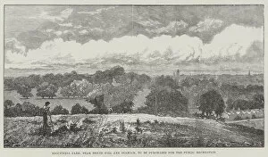
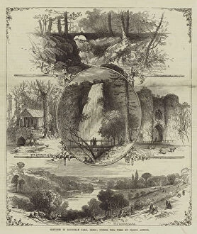
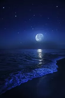
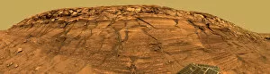
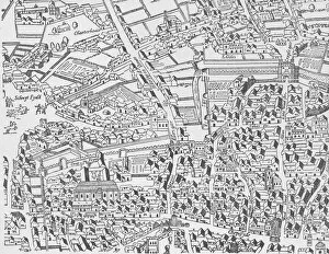
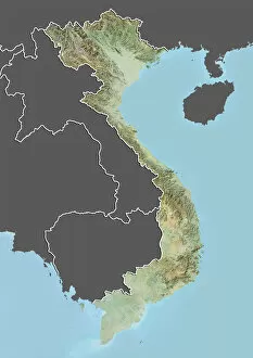
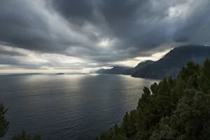
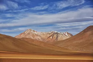
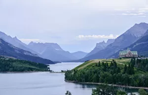
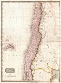
"Exploring the World's Varied Topography: From Ancient Greece to Antarctica" Embark on a captivating journey through time and space as we delve into the fascinating realm of topography. This 150 caption takes you across continents, from Cyprus to Africa, Portugal to Wales, and beyond. Let's begin our expedition with a glimpse into history - an intriguing Map of Cyprus published in 1880. Its intricate details transport us back in time, unraveling the island's rich geographical tapestry. Next, we navigate towards Africa where a Political Map unveils the diverse nations that shape this vast continent. The contours and boundaries guide us through its majestic landscapes and vibrant cultures. Venturing westward, we encounter a Map of Portugal which showcases not only its cities but also reveals hidden gems nestled within its topographical wonders. It beckons explorers to uncover its secrets. As we traverse further northwards, three Welsh women dressed in traditional costumes capture our attention. Their attire reflects both their cultural heritage and the unique topography that surrounds them. Turning our gaze towards Scotland, James Craig's 1768 map presents Edinburgh's New Town for the first time. This pioneering plan intertwines urban development with meticulous attention to topographic features – shaping one of Europe's most enchanting cities. Across the Atlantic Ocean lies Plymouth, Massachusetts - Samuel de Champlain’s map from his 1605 expedition guides us through this historic settlement site. The rugged beauty of Plymouth is etched onto this map like a testament to human resilience against nature’s challenges. Our exploration now takes an icy turn as we discover Antarctica adorned with illustrations of sea gulls, penguins, elephant seals, and shrimp amidst towering ice formations. This juxtaposition between wildlife and man-made structures highlights how humanity has left imprints even on Earth’s harshest terrains. The turquoise waters surrounding Providenciales Island in Turks & Caicos come alive on a mural map depicting Grace Bay.