Jigsaw Puzzle > Europe > France > Canton > Landes
Jigsaw Puzzle : EXPL2A-00039


![]()
Jigsaw Puzzles from North Wind
EXPL2A-00039
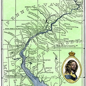
Map of the US in 1792, showing colonial claims on Oregon Territory.
Printed color halftone of a 19th century illustration
North Wind Picture Archives brings history to life with stock images and hand-colored illustrations
Media ID 5877462
© North Wind Picture Archives
1700s 1790s 18th Century British Canada Colonial Colony English Expansion French French Canada Frontier Land Claim Louisiana Louisiana Territory New Spain North West Northwest Territory Old Northwest Oregon Oregon Territory Pacific Northwest Spanish Territory 1792
Jigsaw Puzzle (1014 Pieces)
Discover the rich history of the US with the Media Storehouse Jigsaw Puzzle EXPL2A-00039. This intriguing puzzle features a captivating map of the United States from 1792, showcasing colonial claims on the Oregon Territory. Immerse yourself in this 19th century illustration from North Wind Picture Archives, expertly printed in vibrant color halftone. Challenge yourself or the whole family with this complex jigsaw puzzle that brings history to life in a fun and engaging way. Piece together the past and create a beautiful display for your home or office.
Made in the USA, 1014-piece puzzles measure 20" x 30" (50.8 x 76.2 cm). Every puzzle is meticulously printed on glossy photo paper, which has a strong 1.33 mm thickness. Delivered in a black storage cardboard box, these puzzles are both stylish and practical. (Note: puzzles contain small parts and are not suitable for children under 3 years of age.)
Jigsaw Puzzles are an ideal gift for any occasion
Estimated Product Size is 76cm x 50.8cm (29.9" x 20")
These are individually made so all sizes are approximate
Artwork printed orientated as per the preview above, with landscape (horizontal) orientation to match the source image.
FEATURES IN THESE COLLECTIONS
> Europe
> France
> Canton
> Landes
> Europe
> Spain
> Related Images
> Historic
> Colonial America illustrations
> 18th century America
> Historic
> Colonial America illustrations
> Colonial America
> Historic
> Colonial America illustrations
> Historic
> Colonial history
> Colonial art and artists
> North Wind Picture Archives
> American history
> North Wind Picture Archives
> Maps
EDITORS COMMENTS
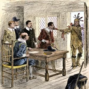
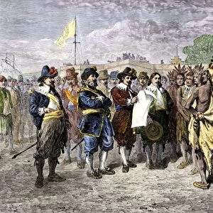
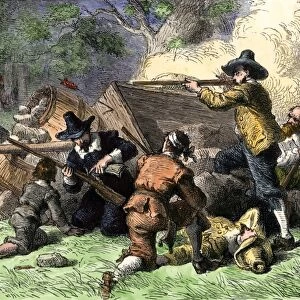
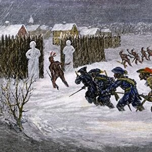
This photo print, titled "EXPL2A-00039" takes us back to the year 1792 when the United States was still in its infancy. The image showcases a meticulously detailed map of the US, specifically highlighting colonial claims on Oregon Territory. With vibrant printed colors and a halftone effect reminiscent of 19th-century illustrations, this vintage piece exudes historical charm. The map offers a glimpse into an era defined by expansion and exploration. It reveals how various European powers such as England, Spain, France, and even Canada had staked their claims on different parts of North America during that time. The intricate details depict borders demarcating territories like Louisiana Territory and New Spain while showcasing British and French influences throughout the continent. As we delve deeper into this artwork's narrative, it becomes evident that this map played a crucial role in shaping American history. It sheds light on the early struggles for control over vast regions like Oregon Territory and serves as a testament to the ambition of those seeking new frontiers. With its rich historical context and artistic flair, this illustration transports us back to an era where land claims were fiercely contested between nations vying for dominance in North America. A true treasure from our past!
MADE IN THE USA
Safe Shipping with 30 Day Money Back Guarantee
FREE PERSONALISATION*
We are proud to offer a range of customisation features including Personalised Captions, Color Filters and Picture Zoom Tools
SECURE PAYMENTS
We happily accept a wide range of payment options so you can pay for the things you need in the way that is most convenient for you
* Options may vary by product and licensing agreement. Zoomed Pictures can be adjusted in the Cart.