Metal Print > Europe > United Kingdom > England > Herefordshire > Ledbury > Charles II
Metal Print : Map of Antietam, Sharpsburg and Vicinity, Maryland, 1862 (1862-1867). Artist: Rae Smith
. Artist: Rae Smith")
![]()
Metal Prints from Heritage Images
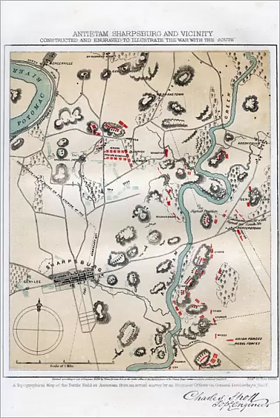
Map of Antietam, Sharpsburg and Vicinity, Maryland, 1862 (1862-1867). Artist: Rae Smith
Map of Antietam, Sharpsburg and Vicinity, Maryland, 1862 (1862-1867) The Battle of Antietam, fought on 17 September 1862, was the first battle of the American Civil War to be fought on Union (northern) soil. It was the bloodiest single day battle in American history, with nearly 23, 000 casualties. An engraving from volume II of The War with the South : a History of the Late Rebellion, by Robert Tomes, Benjamin G Smith, New York, Virtue & Yorston, 3 Volumes, 1862-1867
Heritage Images features heritage image collections
Media ID 14910676
© The Print Collector / Heritage-Images
Battle Of Antietam Cartography Map Making Smith Strategy American Civil War Battlefield Print Collector3
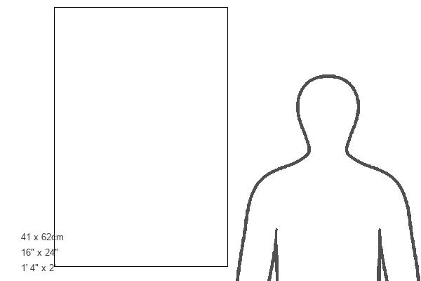
16"x24" (61x41cm) Metal Print
Step back in time with our stunning Metal Print of the Map of Antietam, Sharpsburg and Vicinity, Maryland, 1862. This intricately detailed map, created by artist Rae Smith and originally published by Charles Sholl, offers a captivating glimpse into the historical significance of the Battle of Antietam. Held on September 17, 1862, this was the first major battle of the American Civil War to take place on Union soil. Bring history to life in your home or office with this beautiful and durable Metal Print, featuring vibrant colors and sharp lines that truly bring the map to life. A must-have for history enthusiasts and collectors alike.
Made with durable metal and luxurious printing techniques, our metal photo prints go beyond traditional canvases, adding a cool, modern touch to your space. Wall mount on back. Eco-friendly 100% post-consumer recycled ChromaLuxe aluminum surface. The thickness of the print is 0.045". Featuring a Scratch-resistant surface and Rounded corners. Backing hangers are attached to the back of the print and float the print 1/2-inch off the wall when hung, the choice of hanger may vary depending on size and International orders will come with Float Mount hangers only. Finished with a brilliant white high gloss surface for unsurpassed detail and vibrance. Printed using Dye-Sublimation and for best care we recommend a non-ammonia glass cleaner, water, or isopropyl (rubbing) alcohol to prevent harming the print surface. We recommend using a clean, lint-free cloth to wipe off the print. The ultra-hard surface is scratch-resistant, waterproof and weatherproof. Avoid direct sunlight exposure.
Made with durable metal and luxurious printing techniques, metal prints bring images to life and add a modern touch to any space
Estimated Product Size is 41.2cm x 61.5cm (16.2" x 24.2")
These are individually made so all sizes are approximate
Artwork printed orientated as per the preview above, with portrait (vertical) orientation to match the source image.
FEATURES IN THESE COLLECTIONS
> Arts
> Artists
> Related Images
> Arts
> Artists
> S
> Charles Smith
> Arts
> Artists
> S
> Robert Smith
> Europe
> United Kingdom
> England
> Herefordshire
> Ledbury
> Charles II
> Historic
> Battles
> Related Images
> Maps and Charts
> Related Images
> North America
> United States of America
> Maps
> North America
> United States of America
> Maryland
> Related Images
> North America
> United States of America
> New York
> New York
> Maps
EDITORS COMMENTS
This print showcases a historic map titled "Map of Antietam, Sharpsburg and Vicinity, Maryland, 1862 (1862-1867)" created by the talented artist Rae Smith. The map depicts the location and strategic layout of the Battle of Antietam, which took place on September 17th, 1862. This battle holds significant importance as it was the first major conflict of the American Civil War to occur on Union soil. The image captures the essence of this pivotal moment in American history, with its vibrant colors and intricate details. It is an engraving from volume II of "The War with the South: A History of the Late Rebellion" by Robert Tomes and Benjamin G Smith. Antietam remains etched in memory due to its devastating toll - it stands as one of America's bloodiest single-day battles with nearly 23,000 casualties. The map serves as a visual representation not only for military strategists but also for those interested in cartography and historical geography. Through this remarkable piece, we are transported back to that fateful day when armies clashed on Maryland soil. It reminds us of our nation's turbulent past while honoring those who fought bravely during this tumultuous time in our country's history.
MADE IN THE USA
Safe Shipping with 30 Day Money Back Guarantee
FREE PERSONALISATION*
We are proud to offer a range of customisation features including Personalised Captions, Color Filters and Picture Zoom Tools
SECURE PAYMENTS
We happily accept a wide range of payment options so you can pay for the things you need in the way that is most convenient for you
* Options may vary by product and licensing agreement. Zoomed Pictures can be adjusted in the Cart.