Poster Print > Fine Art Storehouse > Map > Reference Maps
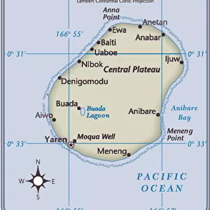
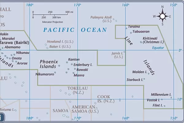
Poster Print : Kiribati country map

Resolution may be reduced at this size (43 DPI)
![]()
Poster Prints from Fine Art Storehouse
Kiribati country map
2011 edition
Unleash your creativity and transform your space into a visual masterpiece!
Media ID 14432439
11x14 inch Poster Print
Poster prints are budget friendly enlarged prints in standard poster paper sizes. Printed on 150 gsm Matte Paper for a natural feel and supplied rolled in a tube. Great for framing and should last many years. To clean wipe with a microfiber, non-abrasive cloth or napkin. Our Archival Quality Photo Prints and Fine Art Paper Prints are printed on higher quality paper and the choice of which largely depends on your budget.
Poster prints are budget friendly enlarged prints in standard poster paper sizes (A0, A1, A2, A3 etc). Whilst poster paper is sometimes thinner and less durable than our other paper types, they are still ok for framing and should last many years. Our Archival Quality Photo Prints and Fine Art Paper Prints are printed on higher quality paper and the choice of which largely depends on your budget.
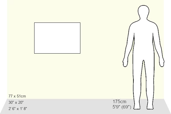
Estimated Product Size is 36.2cm x 28.6cm (14.3" x 11.3")
These are individually made so all sizes are approximate
Artwork printed orientated as per the preview above, with landscape (horizontal) or portrait (vertical) orientation to match the source image.
EDITORS COMMENTS
This print showcases the Kiribati country map, specifically the 2011 edition. The vibrant colors and intricate details of this artwork make it a stunning addition to any space. The map depicts the beautiful archipelago of Kiribati, an island nation located in the central Pacific Ocean. With its turquoise waters and lush greenery, Kiribati is truly a tropical paradise. This print allows you to explore and appreciate the unique geography of this remote destination. From Tarawa Atoll to Kiritimati Island (also known as Christmas Island), every atoll and island is meticulously illustrated on this map. It not only serves as a visual representation but also provides valuable information about major cities, towns, and geographical features within Kiribati. Whether you have a personal connection to this enchanting country or simply admire its natural beauty, this print will transport you straight into its idyllic landscapes. Hang it in your living room or office space for a daily reminder of the world's diverse wonders.
MADE IN THE USA
Safe Shipping with 30 Day Money Back Guarantee
FREE PERSONALISATION*
We are proud to offer a range of customisation features including Personalised Captions, Color Filters and Picture Zoom Tools
SECURE PAYMENTS
We happily accept a wide range of payment options so you can pay for the things you need in the way that is most convenient for you
* Options may vary by product and licensing agreement. Zoomed Pictures can be adjusted in the Cart.