Poster Print > Europe > United Kingdom > England > London > Towns > Welling
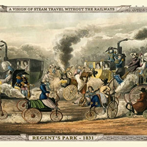
Poster Print : Views on the London to Birmingham Railway - Railway Bridge at Rugby 1839


![]()
Poster Prints from MapSeeker
Views on the London to Birmingham Railway - Railway Bridge at Rugby 1839
A finely detailed facimile remastered in full colour from an antique original map of " Dumbartonshire" featured in A&C Blacks Atlas of 1847. Each Parish is numbered using an index table, colour rendition beautifully differentiating all of the Parishes. As well as principal roads, towns, villages and hamlets, these county maps of Scotland feature key battle sites marked with two crossed swords and the date of the battle. Dumbarton comes from the Scottish Gaelic Dšn Breatainn meaning " fort of the Britons".... Dumbartonshire County Council, set up under the Local Government (Scotland) Act 1889, adopted the spelling " Dunbartonshire" by 1914, a fact recognised by the Local Government (Scotland) Act 1947
Welcome to the Mapseeker Image library and enter an historic gateway to one of the largest on-line collections of Historic Maps, Nostalgic Views, Vista's and Panorama's from a World gone by.
Media ID 20346856
Birmingham To London Railway London To Birmingham Railway Railway View
18x24 inch Poster Print
"Step back in time with Media Storehouse's stunning poster prints featuring the iconic "Views on the London to Birmingham Railway - Railway Bridge at Rugby 1839." This exquisite image is a faithful facsimile, meticulously remastered in full color from an original antique map published in A&C Black's Atlas of 1847. Experience the history and engineering marvel of the early railway era, as you adorn your walls with this finely detailed and captivating piece of cartographic artistry. Perfect for railway enthusiasts, history buffs, and anyone who appreciates the beauty of the past, our high-quality poster prints bring a touch of vintage charm to any space. Order yours today and let the story of the railway bridge at Rugby unfold on your walls."
Poster prints are budget friendly enlarged prints in standard poster paper sizes. Printed on 150 gsm Matte Paper for a natural feel and supplied rolled in a tube. Great for framing and should last many years. To clean wipe with a microfiber, non-abrasive cloth or napkin. Our Archival Quality Photo Prints and Fine Art Paper Prints are printed on higher quality paper and the choice of which largely depends on your budget.
Poster prints are budget friendly enlarged prints in standard poster paper sizes (A0, A1, A2, A3 etc). Whilst poster paper is sometimes thinner and less durable than our other paper types, they are still ok for framing and should last many years. Our Archival Quality Photo Prints and Fine Art Paper Prints are printed on higher quality paper and the choice of which largely depends on your budget.
Estimated Product Size is 61.6cm x 46.3cm (24.3" x 18.2")
These are individually made so all sizes are approximate
Artwork printed orientated as per the preview above, with landscape (horizontal) orientation to match the source image.
FEATURES IN THESE COLLECTIONS
> MapSeeker
> Old Views and Vistas
> 19th & 20th Century Railway Views
> Arts
> Photorealistic artworks
> Detailed art pieces
> Masterful detailing in art
> Europe
> United Kingdom
> England
> London
> Sport
> Rugby
> Europe
> United Kingdom
> England
> London
> Towns
> Welling
> Europe
> United Kingdom
> England
> London
> Transport
> Railway
> Europe
> United Kingdom
> Scotland
> Dumbarton
> Europe
> United Kingdom
> Scotland
> Maps
> Europe
> United Kingdom
> Scotland
> Railways
> Europe
> United Kingdom
> Scotland
> Strathclyde
> Dumbarton
> Historic
> Battles
> Related Images
> Maps and Charts
> Related Images
EDITORS COMMENTS
This beautifully remastered print captures the stunning Railway Bridge at Rugby in 1839, showcasing the remarkable views along the London to Birmingham Railway. The image is a finely detailed facsimile of an antique original map from A&C Blacks Atlas of 1847, specifically featuring Dumbartonshire. The map itself is a true work of art, with each parish numbered and colorfully differentiated, allowing for easy navigation and exploration. Additionally, it highlights principal roads, towns, villages, and hamlets throughout Scotland. Notably, key battle sites are marked by two crossed swords alongside their respective dates. Dumbartonshire holds historical significance as its name originates from the Scottish Gaelic term "Dún Breatainn" meaning "fort of the Britons". Over time, its spelling evolved to "Dunbartonshire" by 1914 under the administration of Dumbartonshire County Council. This change was officially recognized by the Local Government (Scotland) Act 1947. As you admire this print capturing a moment in railway history between London and Birmingham, take note that it does not pertain to any specific company or commercial use. Instead, it serves as a testament to both artistic craftsmanship and historical preservation.
MADE IN THE USA
Safe Shipping with 30 Day Money Back Guarantee
FREE PERSONALISATION*
We are proud to offer a range of customisation features including Personalised Captions, Color Filters and Picture Zoom Tools
SECURE PAYMENTS
We happily accept a wide range of payment options so you can pay for the things you need in the way that is most convenient for you
* Options may vary by product and licensing agreement. Zoomed Pictures can be adjusted in the Cart.