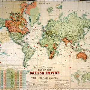
Poster Print > Maps and Charts > World
Poster Print : Europe Map C1918


![]()
Poster Prints from Mary Evans Picture Library
Europe Map C1918
The map of Europe after World War One
Mary Evans Picture Library makes available wonderful images created for people to enjoy over the centuries
Media ID 4315937
© Mary Evans Picture Library 2015 - https://copyrighthub.org/s0/hub1/creation/maryevans/MaryEvansPictureID/10125209
18x24 inch Poster Print
Discover the rich history of Europe after World War One with our stunningly detailed "Europe Map C1918" print from Media Storehouse. This captivating poster, sourced from Mary Evans Prints Online, showcases an intricately designed map that marks the political boundaries of Europe following the Great War. Ideal for history enthusiasts, educators, or anyone seeking to add a touch of vintage charm to their space, this rights-managed print makes a perfect addition to any room. Transport yourself back in time and explore the intriguing changes Europe underwent during this pivotal period in history.
Poster prints are budget friendly enlarged prints in standard poster paper sizes. Printed on 150 gsm Matte Paper for a natural feel and supplied rolled in a tube. Great for framing and should last many years. To clean wipe with a microfiber, non-abrasive cloth or napkin. Our Archival Quality Photo Prints and Fine Art Paper Prints are printed on higher quality paper and the choice of which largely depends on your budget.
Poster prints are budget friendly enlarged prints in standard poster paper sizes (A0, A1, A2, A3 etc). Whilst poster paper is sometimes thinner and less durable than our other paper types, they are still ok for framing and should last many years. Our Archival Quality Photo Prints and Fine Art Paper Prints are printed on higher quality paper and the choice of which largely depends on your budget.
Estimated Product Size is 61.6cm x 46.3cm (24.3" x 18.2")
These are individually made so all sizes are approximate
Artwork printed orientated as per the preview above, with landscape (horizontal) orientation to match the source image.
FEATURES IN THESE COLLECTIONS
> Europe
> Related Images
> Maps and Charts
> Early Maps
> Maps and Charts
> Related Images
> Maps and Charts
> World
EDITORS COMMENTS
This striking print of the Europe Map circa 1918 offers a glimpse into the aftermath of World War One, showcasing the significant changes that took place in the continent during this tumultuous period in history. The map is a visual representation of the great upheaval and shifting borders that occurred as a result of the war, with countries being redrawn and redefined.
The intricate details on this historical map provide a fascinating insight into how Europe looked post-World War One, highlighting the political complexities and territorial adjustments that were made at that time. From new nations emerging to old empires crumbling, this map captures a pivotal moment in European history.
As we study this map closely, we can see how different regions were affected by the war and how power dynamics shifted across the continent. It serves as a reminder of the human cost of conflict and the lasting impact it can have on societies and nations.
Overall, this Europe Map c1918 is not just a geographical representation but also a poignant reminder of our shared history and collective memory. It invites us to reflect on past events while also serving as an educational tool for understanding how wars shape our world.
MADE IN THE USA
Safe Shipping with 30 Day Money Back Guarantee
FREE PERSONALISATION*
We are proud to offer a range of customisation features including Personalised Captions, Color Filters and Picture Zoom Tools
SECURE PAYMENTS
We happily accept a wide range of payment options so you can pay for the things you need in the way that is most convenient for you
* Options may vary by product and licensing agreement. Zoomed Pictures can be adjusted in the Cart.