Poster Print > Maps and Charts > Turkey
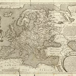
Poster Print : Map / Europe / Balkans 1792


![]()
Poster Prints from Mary Evans Picture Library
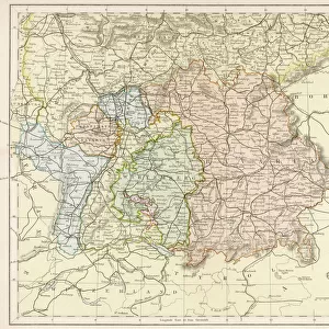
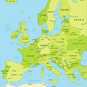
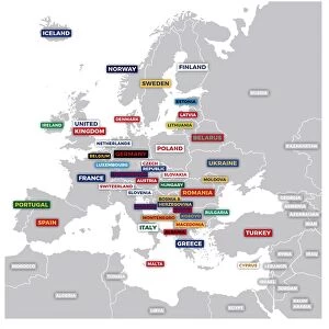
Map / Europe / Balkans 1792
A map showing Turkey in Europe and its neighbouring European states of the Balkans
Mary Evans Picture Library makes available wonderful images created for people to enjoy over the centuries
Media ID 620825
© Mary Evans Picture Library 2015 - https://copyrighthub.org/s0/hub1/creation/maryevans/MaryEvansPictureID/10074527
1792 Balkans Maps Neighbouring
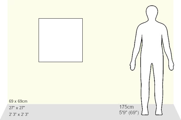
27x27 inch Poster Print
Discover the rich history of Europe's Balkan region with our stunning Map Print from Media Storehouse, in partnership with Mary Evans Prints Online. This captivating 1792 map illustrates the intricate details of Europe during that era, with Turkey prominently displayed as part of Europe and its neighboring Balkan states. Bring history into your home or office with this beautifully detailed and intricately designed poster print, perfect for history enthusiasts, educators, or anyone with a passion for the past. Add a touch of history and culture to your space with this unique and intriguing map print from Media Storehouse.
Poster prints are budget friendly enlarged prints in standard poster paper sizes. Printed on 150 gsm Matte Paper for a natural feel and supplied rolled in a tube. Great for framing and should last many years. To clean wipe with a microfiber, non-abrasive cloth or napkin. Our Archival Quality Photo Prints and Fine Art Paper Prints are printed on higher quality paper and the choice of which largely depends on your budget.
Poster prints are budget friendly enlarged prints in standard poster paper sizes (A0, A1, A2, A3 etc). Whilst poster paper is sometimes thinner and less durable than our other paper types, they are still ok for framing and should last many years. Our Archival Quality Photo Prints and Fine Art Paper Prints are printed on higher quality paper and the choice of which largely depends on your budget.
Estimated Product Size is 69.2cm x 69.2cm (27.2" x 27.2")
These are individually made so all sizes are approximate
Artwork printed orientated as per the preview above, with landscape (horizontal) or portrait (vertical) orientation to match the source image.
FEATURES IN THESE COLLECTIONS
> Asia
> Turkey
> Related Images
> Europe
> Related Images
> Maps and Charts
> Early Maps
> Maps and Charts
> Related Images
EDITORS COMMENTS
This historical map print from 1792 showcases the intricate borders and political landscape of Europe, specifically focusing on the Balkans region and Turkey in Europe. The detailed cartography highlights the neighboring European states surrounding Turkey, providing a glimpse into the complex history and territorial divisions of the time.
The map offers a fascinating insight into the geopolitical dynamics of Europe during this period, with each country clearly delineated and labeled for easy reference. From Hungary to Greece, Serbia to Bulgaria, every nation is represented on this meticulously crafted piece of historical artwork.
As we study this map, we are transported back in time to an era when empires clashed and alliances shifted constantly. The intricate details and fine craftsmanship of the map serve as a testament to the skill and dedication of cartographers from centuries past.
Whether you are a history buff or simply appreciate fine artistry, this vintage map print is sure to captivate your imagination and spark curiosity about the rich tapestry of European history. Display it proudly in your home or office as a conversation piece that will inspire discussion about our shared past and how it has shaped our present-day world.
MADE IN THE USA
Safe Shipping with 30 Day Money Back Guarantee
FREE PERSONALISATION*
We are proud to offer a range of customisation features including Personalised Captions, Color Filters and Picture Zoom Tools
SECURE PAYMENTS
We happily accept a wide range of payment options so you can pay for the things you need in the way that is most convenient for you
* Options may vary by product and licensing agreement. Zoomed Pictures can be adjusted in the Cart.