Premium Framed Print > Europe > United Kingdom > England > London > Boroughs > Newham
Premium Framed Print : Newham E15 3 Map


![]()
Framed Photos from Map Marketing
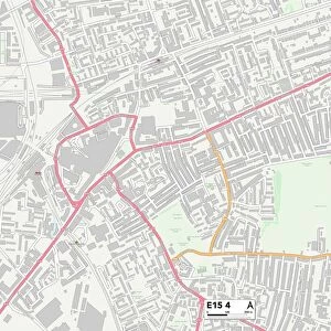
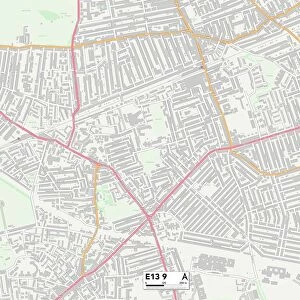
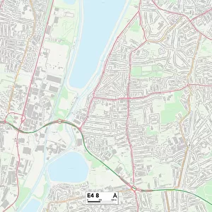
Newham E15 3 Map
Postcode Sector Map of Newham E15 3
Media ID 19969760
Abbey Road Bridge Road Canning Road Celandine Way Chaplin Road Church Street Corporation Street Dell Close Durban Road East Road Eastbourne Road Gainsborough Road Hamilton Road Harcourt Road Holbrook Road Holland Road John Street Kay Street Manor Road Marcus Street Memorial Avenue Milner Road Morley Road Napier Road Newham Park Grove Park Road Pond Road Portway Ranelagh Road Richardson Road Springfield Road Stephens Road Teasel Way West Road Willis Road West Ham
14"x16" Premium Frame
Contemporary style Premium Wooden Frame with 8"x10" Print. Complete with 2" White Mat and 1.25" thick MDF frame. Printed on 260 gsm premium paper. Glazed with shatter proof UV coated acrylic glass. Backing is paper covered backing with rubber bumpers. Supplied ready to hang with a pre-installed sawtooth/wire hanger. Care Instructions: Spot clean with a damp cloth. Securely packaged in a clear plastic bag and envelope in a reinforced cardboard shipper
FSC Real Wood Frame and Double Mounted with White Conservation Mountboard - Professionally Made and Ready to Hang
Estimated Image Size (if not cropped) is 25.4cm x 20.3cm (10" x 8")
Estimated Product Size is 40.6cm x 35.6cm (16" x 14")
These are individually made so all sizes are approximate
Artwork printed orientated as per the preview above, with landscape (horizontal) orientation to match the source image.
FEATURES IN THESE COLLECTIONS
> Map Marketing
> Postcode Sector Maps
> E - London E
> Animals
> Birds
> Passerines
> Crows And Jays
> Related Images
> Arts
> Artists
> K
> John Kay
> Europe
> United Kingdom
> England
> London
> Boroughs
> Newham
> Europe
> United Kingdom
> England
> London
> Sights
> Holland Park
> Europe
> United Kingdom
> Scotland
> Strathclyde
> Hamilton
> Maps and Charts
> Related Images
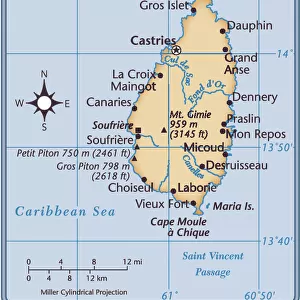
> North America
> Saint Lucia
> Maps
MADE IN THE USA
Safe Shipping with 30 Day Money Back Guarantee
FREE PERSONALISATION*
We are proud to offer a range of customisation features including Personalised Captions, Color Filters and Picture Zoom Tools
SECURE PAYMENTS
We happily accept a wide range of payment options so you can pay for the things you need in the way that is most convenient for you
* Options may vary by product and licensing agreement. Zoomed Pictures can be adjusted in the Cart.