Canvas Print > Arts > Artists > O > Oceanic Oceanic
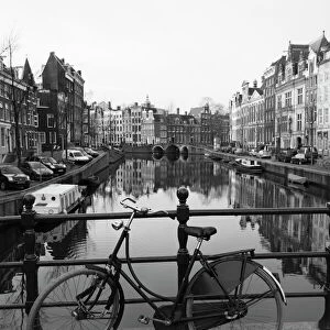
Canvas Print : Map of America. Nova Totius Americae Descriptio by Frederik


![]()
Canvas Prints from Mary Evans Picture Library
Map of America. Nova Totius Americae Descriptio by Frederik
Nova Totius Americae Descriptio. Map of America. By Frederik de Wit (1630-1706). Amsterdam, 1666
Mary Evans Picture Library makes available wonderful images created for people to enjoy over the centuries
Media ID 14330246
© Thaliastock / Mary Evans
1666 Americas Amsterdam Antilles Atlantic Atlas Cartographic Cartography Descriptio Frederic Frederik Holland Netherlands Nova Pacific Totius Witt Americae
20"x16" (51x41cm) Canvas Print
"Discover the captivating allure of history with our exquisite Canvas Prints from the Media Storehouse collection. Featuring the intricately detailed "Map of America. Nova Totius Americae Descriptio" by Frederik de Wit, this masterpiece transports you back in time. Originally published in Amsterdam in 1666, this map showcases the vast and unexplored territories of the American continent as they were known during the 17th century. Each print is meticulously reproduced to preserve the rich textures and intricate lines of the original work. Adorn your walls with a piece of history and add an air of sophistication to your space. Order your Canvas Print of "Map of America. Nova Totius Americae Descriptio" today and let the adventure begin."
Delivered stretched and ready to hang our premium quality canvas prints are made from a polyester/cotton blend canvas and stretched over a 1.25" (32mm) kiln dried knot free wood stretcher bar. Packaged in a plastic bag and secured to a cardboard insert for safe transit.
Canvas Prints add colour, depth and texture to any space. Professionally Stretched Canvas over a hidden Wooden Box Frame and Ready to Hang
Estimated Product Size is 40.6cm x 50.8cm (16" x 20")
These are individually made so all sizes are approximate
Artwork printed orientated as per the preview above, with portrait (vertical) orientation to match the source image.
FEATURES IN THESE COLLECTIONS
> Arts
> Artists
> O
> Oceanic Oceanic
> Europe
> Netherlands
> Amsterdam
> Europe
> Netherlands
> Maps
> Europe
> Netherlands
> Posters
> Europe
> Netherlands
> Related Images
> Maps and Charts
> Early Maps
> Maps and Charts
> Netherlands
> Maps and Charts
> Related Images
Nova Totius Americae Descriptio,
EDITORS COMMENTS
or "A New and Accurate Description of the Whole America," is a remarkable map produced by the renowned Dutch cartographer Frederik de Wit in 1666. This intricately detailed map, published in Amsterdam, offers an unprecedented representation of the Americas during the 17th century. The map is a testament to the advancements in cartography during the modern age, showcasing the latest discoveries and knowledge of the New World. The map covers the entirety of North and South America, including the Caribbean islands, with an exceptional level of detail. The Atlantic and Pacific Oceans frame the map, highlighting the importance of maritime exploration in the discovery and understanding of the American continents. The map includes numerous place names, many of which are still used today, and accurately depicts the coastlines, rivers, and topographical features. Frederik de Wit was a prominent figure in the cartographic world of the Netherlands during the late 17th century. His work was highly regarded for its accuracy and detail, and "Nova Totius Americae Descriptio" is a prime example of his skill. The map was produced during a time when European powers were actively exploring and colonizing the Americas, making it a valuable resource for navigators, explorers, and scholars. This map also reflects the growing interest in the natural history and geography of the New World, which was fueled by the Age of Discovery. The intricate detail and accurate representation of the Americas on this map demonstrate the significant progress that had been made in cartography during this period. Today, "Nova Totius Americae Descriptio" remains an important historical document, providing valuable insights into the exploration and understanding of the Americas during the 17th century.
MADE IN THE USA
Safe Shipping with 30 Day Money Back Guarantee
FREE PERSONALISATION*
We are proud to offer a range of customisation features including Personalised Captions, Color Filters and Picture Zoom Tools
SECURE PAYMENTS
We happily accept a wide range of payment options so you can pay for the things you need in the way that is most convenient for you
* Options may vary by product and licensing agreement. Zoomed Pictures can be adjusted in the Cart.