Canvas Print > Arts > Artists > S > Syrian Syrian
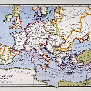
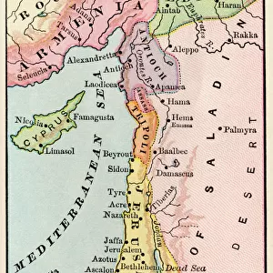
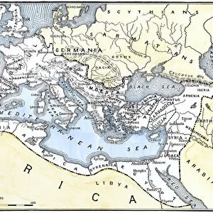
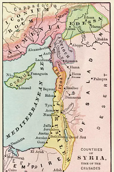
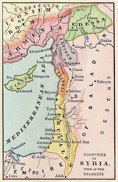
Canvas Print : Mideast map during the Crusades


![]()
Canvas Prints from North Wind
Mideast map during the Crusades
Map of the Middle East at the time of the Crusades.
Printed color lithograph
North Wind Picture Archives brings history to life with stock images and hand-colored illustrations
Media ID 5882427
© North Wind Picture Archives
Asia Minor Crusades Egypt Jerusalem Medieval Mid East Middle Ages Middle East Palestine Syria Antioch Armenia Edessa
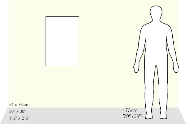
30"x20" (76x51cm) Canvas Print
"Step back in time with our captivating Canvas Print from Media Storehouse, featuring a Mideast map during the Crusades. Meticulously sourced from North Wind Picture Archives, this color lithograph is a vibrant and intriguing depiction of historical geography. The high-quality canvas material adds depth and texture, while the rich colors bring the map to life. Perfect for history enthusiasts, world travelers, or anyone seeking to adorn their walls with a unique and educational piece. Order now and embark on a journey through history with this stunning Crusades-era map."
Delivered stretched and ready to hang our premium quality canvas prints are made from a polyester/cotton blend canvas and stretched over a 1.25" (32mm) kiln dried knot free wood stretcher bar. Packaged in a plastic bag and secured to a cardboard insert for safe transit.
Canvas Prints add colour, depth and texture to any space. Professionally Stretched Canvas over a hidden Wooden Box Frame and Ready to Hang
Estimated Product Size is 50.8cm x 76.2cm (20" x 30")
These are individually made so all sizes are approximate
Artwork printed orientated as per the preview above, with portrait (vertical) orientation to match the source image.
FEATURES IN THESE COLLECTIONS
> Africa
> Egypt
> Related Images
> Arts
> Art Movements
> Medieval Art
> Arts
> Artists
> S
> Syrian Syrian
> Asia
> Armenia
> Related Images
> Asia
> East Timor
> Maps
> Asia
> East Timor
> Related Images
> Asia
> Palestine
> Jerusalem
> North Wind Picture Archives
> Maps
> North Wind Picture Archives
> Mideast history
EDITORS COMMENTS
This vintage print showcases a meticulously detailed map of the Middle East during the tumultuous era of the Crusades. Printed in vibrant colors through lithography, this piece of art takes us back to a time when kingdoms clashed and cultures converged. The map depicts an expansive region, stretching from Egypt to Asia Minor, with Jerusalem at its heart. It offers a glimpse into the historic cities that played pivotal roles during this period, such as Palestine, Syria, Armenia, Antioch, and Edessa. Each city is intricately illustrated with architectural landmarks that transport us to their medieval splendor. As we explore this remarkable artwork, we are reminded of the rich heritage and traditions embedded within these lands. The artist's attention to detail allows us to appreciate not only the geographical layout but also provides insight into historical events that unfolded centuries ago. With every glance at this print, one can't help but be captivated by the layers of history it represents. It serves as a visual testament to both conflict and cultural exchange between East and West during the Middle Ages. Whether you are an enthusiast for ancient civilizations or simply intrigued by historical maps, this stunning lithograph transports viewers on a journey through time – offering glimpses into an era where empires rose and fell amidst religious fervor and political ambition in what was once known as the cradle of civilization - The Middle East.
MADE IN THE USA
Safe Shipping with 30 Day Money Back Guarantee
FREE PERSONALISATION*
We are proud to offer a range of customisation features including Personalised Captions, Color Filters and Picture Zoom Tools
SECURE PAYMENTS
We happily accept a wide range of payment options so you can pay for the things you need in the way that is most convenient for you
* Options may vary by product and licensing agreement. Zoomed Pictures can be adjusted in the Cart.