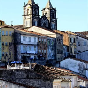
Home > South America > Brazil > Brazil Heritage Sites > Historic Centre of Salvador de Bahia
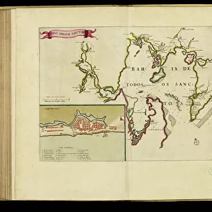
Geography map: view of the bay of C (Sao Salvador da Bahia de Todos os Santos) from an Atlas (probably by Willem Janszoon Blaeu, 1571-1638) 17th century, Biblioteca Angelica, Rome
 from an Atlas (probably by Willem Janszoon Blaeu, 1571-1638) 17th century, Biblioteca Angelica, Rome")
![]()
Wall Art and Photo Gifts from Fine Art Finder
Geography map: view of the bay of C (Sao Salvador da Bahia de Todos os Santos) from an Atlas (probably by Willem Janszoon Blaeu, 1571-1638) 17th century, Biblioteca Angelica, Rome
VEN5030306 Geography map: view of the bay of C (Sao Salvador da Bahia de Todos os Santos) from an Atlas (probably by Willem Janszoon Blaeu, 1571-1638) 17th century, Biblioteca Angelica, Rome; (add.info.: Geography map: view of the bay of C (Sao Salvador da Bahia de Todos os Santos) from an Atlas (probably by Willem Janszoon Blaeu, 1571-1638) 17th century, Biblioteca Angelica, Rome); © Marage Photos
Media ID 38350278
© © Marage Photos / Bridgeman Images
17eme Siecle Amerique (continent) Amerique Du Nord Amerique Du Sud Brasil Brazil Brazil Brasilian Brazil Brazilian Brazilian Brazilians Bresil Bresilien Bresilienne Carte Geographique Etats Unis Geographie Latin America Stockravenna
FEATURES IN THESE COLLECTIONS
> Arts
> Artists
> B
> Willem Blaeu
> Fine Art Finder
> Artists
> Francois Xavier Fabre
> Maps and Charts
> Early Maps
> North America
> El Salvador
> Maps
> North America
> United States of America
> Maps
> South America
> Brazil
> Brazil Heritage Sites
> Historic Centre of Salvador de Bahia
> South America
> Brazil
> Maps
> South America
> Brazil
> Related Images
> South America
> Brazil
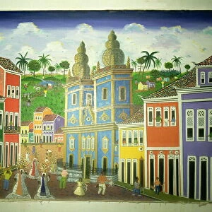
> Salvador
EDITORS COMMENTS
This stunning 17th-century geography map captures the breathtaking view of the bay of C (Sao Salvador da Bahia de Todos os Santos) from an Atlas, most likely created by Willem Janszoon Blaeu. The intricate details and vibrant colors bring to life this historical representation of South America, specifically Brazil.
The Biblioteca Angelica in Rome houses this remarkable piece, showcasing the beauty and complexity of cartography during this period. The map provides a glimpse into the early exploration and understanding of the New World, highlighting the importance of geography in shaping our understanding of different regions.
As we admire this print, we are transported back in time to a world where discovery and curiosity fueled expeditions across oceans and continents. The meticulous engravings on display serve as a testament to human ingenuity and determination to explore unknown territories.
From the lush landscapes to the intricate coastlines, every detail on this map tells a story of adventure and discovery. It serves as a reminder of how far we have come in our understanding of the world around us while also honoring those who paved the way for future generations to continue exploring and learning about our planet.
MADE IN THE USA
Safe Shipping with 30 Day Money Back Guarantee
FREE PERSONALISATION*
We are proud to offer a range of customisation features including Personalised Captions, Color Filters and Picture Zoom Tools
SECURE PAYMENTS
We happily accept a wide range of payment options so you can pay for the things you need in the way that is most convenient for you
* Options may vary by product and licensing agreement. Zoomed Pictures can be adjusted in the Cart.