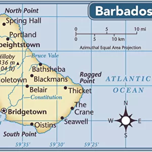
Home > North America > Barbados > Maps
Geography map: representation of Barbados Island (Barbados) from an Atlas by Charles Price, beginning of the 18th century. Biblioteca Angelica, Rome
 from an Atlas by Charles Price, beginning of the 18th century. Biblioteca Angelica, Rome")
![]()
Wall Art and Photo Gifts from Fine Art Finder
Geography map: representation of Barbados Island (Barbados) from an Atlas by Charles Price, beginning of the 18th century. Biblioteca Angelica, Rome
VEN5030270 Geography map: representation of Barbados Island (Barbados) from an Atlas by Charles Price, beginning of the 18th century. Biblioteca Angelica, Rome; (add.info.: Geography map: representation of Barbados Island (Barbados) from an Atlas by Charles Price, beginning of the 18th century. Biblioteca Angelica, Rome); © Marage Photos
Media ID 38484900
© © Marage Photos / Bridgeman Images
Amerique Centrale Amerique Du Nord Carte Geographique Central America Etats Unis Geographie Stockravenna 18eme Siecle Geographical Map
FEATURES IN THESE COLLECTIONS
> Europe
> Italy
> Lazio
> Rome
> Fine Art Finder
> Artists
> Pasquier (workshop of) Grenier
> Maps and Charts
> Early Maps
> Maps and Charts
> Related Images
> North America
> Barbados
> Maps
> North America
> Barbados
> Related Images
> North America
> Related Images
> North America
> United States of America
> Maps
> Popular Themes
> North Island
EDITORS COMMENTS
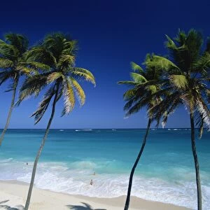
This stunning print of a geography map showcasing the beautiful Barbados Island in the early 18th century is a true masterpiece by Charles Price. The intricate details and accuracy of this representation are truly remarkable, giving us a glimpse into the geographical landscape of this Caribbean gem during that time period.
The Biblioteca Angelica in Rome houses this valuable piece of history, allowing us to appreciate the artistry and precision that went into creating such maps centuries ago. As we study this map, we can imagine sailing through the crystal-clear waters surrounding Barbados and exploring its lush tropical forests and sandy beaches.
Barbados has always been a place of intrigue and fascination, with its rich history and vibrant culture. This map not only serves as a navigational tool but also as a window into the past, showing us how people viewed and understood geography in the 18th century.
Thanks to Bridgeman Images from Fine Art Finder, we are able to admire this historical artifact and appreciate the craftsmanship that went into producing it. Let's take a moment to marvel at the beauty of Barbados Island as depicted by Charles Price all those years ago.
MADE IN THE USA
Safe Shipping with 30 Day Money Back Guarantee
FREE PERSONALISATION*
We are proud to offer a range of customisation features including Personalised Captions, Color Filters and Picture Zoom Tools
SECURE PAYMENTS
We happily accept a wide range of payment options so you can pay for the things you need in the way that is most convenient for you
* Options may vary by product and licensing agreement. Zoomed Pictures can be adjusted in the Cart.