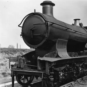
Framed Print > Europe > United Kingdom > England > London > Museums > Science Museum
Framed Print : William Smiths Geological Map


![]()
Framed Photos from Science Photo Library
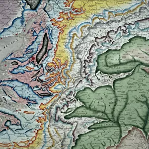
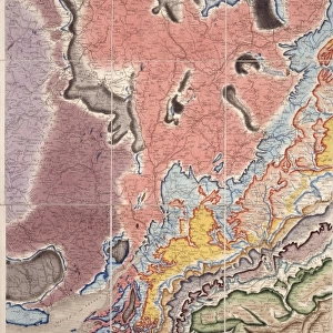
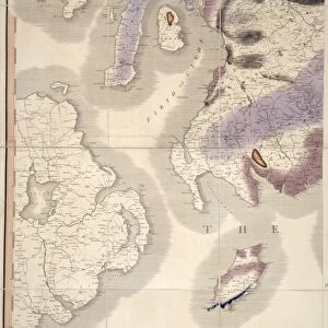
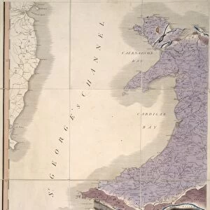
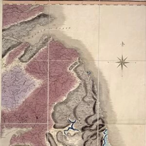
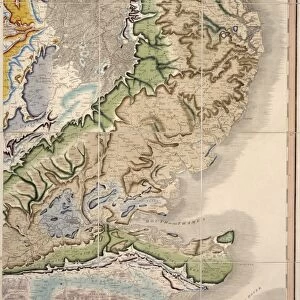
William Smiths Geological Map
William Smiths Geological Map. Fig. 9 from Delineation of Strata of England and Wales (1815) by William Smith
Science Photo Library features Science and Medical images including photos and illustrations
Media ID 9206571
© NATURAL HISTORY MUSEUM, LONDON/SCIENCE PHOTO LIBRARY
Geological Great Britain Rock Smith Strata Stratification Type Wales William Smith 1769 1839 Geological Map
18"x14" Modern Frame
Discover the rich history of geology with our stunningly beautiful Framed Prints from Media Storehouse, featuring the iconic "William Smith's Geological Map" by the Natural History Museum, London/Science Photo Library. This captivating print showcases Fig. 9 from William Smith's groundbreaking work, "Delineation of Strata of England and Wales" (1815). Smith's map is considered a milestone in the field of geology, as it was the first comprehensive attempt to record the stratigraphic relationships among the rocks of England and Wales. Bring this piece of scientific history into your home or office and ignite conversations with its intricate details and timeless design. Each Framed Print is meticulously crafted using high-quality materials to ensure longevity and protection of the print. Order yours today and embark on a fascinating journey through the geological ages.
16x12 Print in an MDF Wooden Frame with 180 gsm Satin Finish Paper. Glazed using shatter proof thin plexiglass. Frame thickness is 1 inch and depth 0.75 inch. Fluted cardboard backing held with clips. Supplied ready to hang with sawtooth hanger and rubber bumpers. Spot clean with a damp cloth. Packaged foam wrapped in a card.
Contemporary Framed and Mounted Prints - Professionally Made and Ready to Hang
Estimated Image Size (if not cropped) is 35.6cm x 40.6cm (14" x 16")
Estimated Product Size is 35.6cm x 45.7cm (14" x 18")
These are individually made so all sizes are approximate
Artwork printed orientated as per the preview above, with portrait (vertical) orientation to match the source image.
FEATURES IN THESE COLLECTIONS
> Europe
> United Kingdom
> England
> London
> Museums
> British Library
> Europe
> United Kingdom
> England
> London
> Museums
> British Museum
> Europe
> United Kingdom
> England
> London
> Museums
> Natural History Museum
> Europe
> United Kingdom
> England
> London
> Museums
> Science Museum
> Europe
> United Kingdom
> England
> London
> Sights
> British Museum
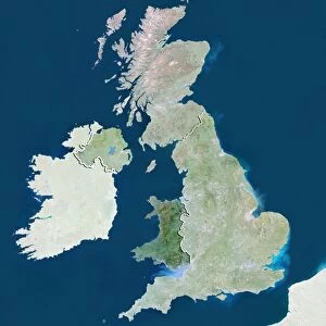
> Europe
> United Kingdom
> England
> Maps
> Europe
> United Kingdom
> Maps
> Europe
> United Kingdom
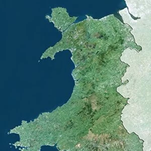
> Wales
> Maps
> Europe
> United Kingdom
> Wales
> Posters
> Maps and Charts
> Geological Map
EDITORS COMMENTS
This print showcases the iconic "William Smiths Geological Map" created by William Smith in 1815. The map, depicted in Figure 9 of his renowned publication "Delineation of Strata of England and Wales" is a groundbreaking representation of the geological formations found throughout Great Britain. The image captures the intricate details and vibrant colors present on this historical map, which has become an invaluable resource for understanding the geology of not only England and Wales but also Europe as a whole. William Smith's meticulous work revolutionized the field of geology by introducing stratification principles that laid the foundation for modern geological mapping. Displayed proudly at the Natural History Museum in London, this print serves as a testament to both Smith's scientific brilliance and artistic skill. Each type of rock and stratum is meticulously illustrated, allowing viewers to appreciate the complexity and diversity within Earth's layers. As we gaze upon this remarkable piece, we are reminded of how one individual's dedication can shape our understanding of our planet's history. This photograph invites us to explore not only the geological wonders captured on this map but also to reflect on how scientific discoveries continue to transform our knowledge about Earth's past.
MADE IN THE USA
Safe Shipping with 30 Day Money Back Guarantee
FREE PERSONALISATION*
We are proud to offer a range of customisation features including Personalised Captions, Color Filters and Picture Zoom Tools
SECURE PAYMENTS
We happily accept a wide range of payment options so you can pay for the things you need in the way that is most convenient for you
* Options may vary by product and licensing agreement. Zoomed Pictures can be adjusted in the Cart.