Strata Collection

"Unveiling Earth's Layers: Exploring the Marvels of Strata" Discovering the Blueprint

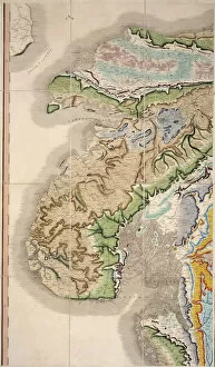
Background imageStrata Collection: William Smith Geological Map

William Smith Geological Map

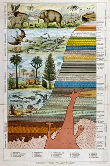
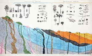
Background imageStrata Collection: Geological Strata 19C

Geological Strata 19C
A schematic representation of geology and palaeontology

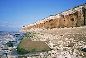
Background imageStrata Collection: Start or end of The Wash, Hunstanton Cliffs, Norfolk, England, United Kingdom, Europe

Start or end of The Wash, Hunstanton Cliffs, Norfolk, England, United Kingdom, Europe

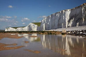
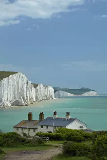
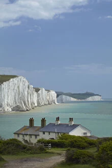
Background imageStrata Collection: Seven Sisters Chalk Cliffs, and coastguard cottages, Cuckmere Haven, near Seaford

Seven Sisters Chalk Cliffs, and coastguard cottages, Cuckmere Haven, near Seaford, East Sussex, England

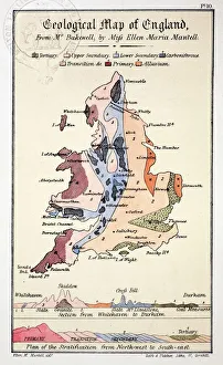
Background imageStrata Collection: 1838 Geological Map of England by Mantell

1838 Geological Map of England by Mantell
From Gideon Mantells " Wonders of Geology" 1839, drawn by his daughter Ellen

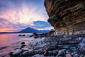
Background imageStrata Collection: Sunset at Honeycomb Rock, Elgol, Isle of Skye, Inner Hebrides, Scotland, United Kingdom

Sunset at Honeycomb Rock, Elgol, Isle of Skye, Inner Hebrides, Scotland, United Kingdom, Europe

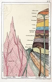
Background imageStrata Collection: 1838 Mantells Geological Strata Section

1838 Mantells Geological Strata Section
An idealised geological section drawn by Gideon Mantell to accompany his book " Wonders of Geology" 1838. It shows the nomenclature in use during the early part of the nineteenth century

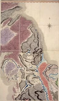
Background imageStrata Collection: First geological map of Britain, 1815 C016 / 5683

First geological map of Britain, 1815 C016 / 5683
First geological map of Britain, detail of the north east coast (figure 8). This map was published in 1815 by British geologist William Smith (1769-1839)

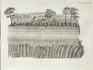
Background imageStrata Collection: Geological unconformity on the river Jed

Geological unconformity on the river Jed. Plate 3 from Theory of the Earth (1795) Vol. 1, by James Hutton

Background imageStrata Collection: 1836 Buckland geology cross-section

1836 Buckland geology cross-section
Detail from a large folding hand coloured copperplate engraving in William Bucklands contribution to the Bridgewater Treatises " Geology

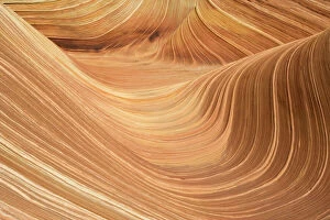
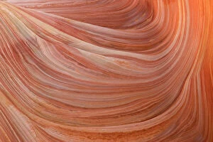
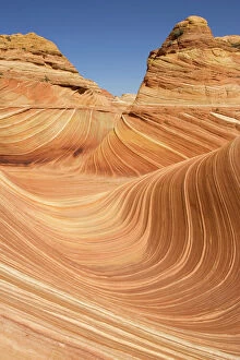
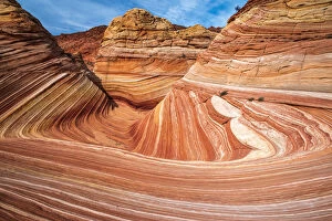
Background imageStrata Collection: USA - The Wave, a breathtaking work of art, naturally carved in beautiful red

USA - The Wave, a breathtaking work of art, naturally carved in beautiful red
TD-1851 The Wave, naturally carved in beautiful red and yellow striated soft Navajo sandstone. North Coyote Buttes, Paria Canyon-Vermilion Cliffs Wilderness, Vermilion Cliffs National Monument

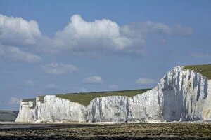
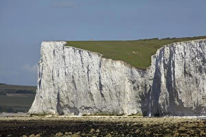
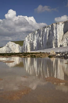
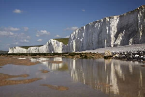
Background imageStrata Collection: Seven Sisters Chalk Cliffs, Birling Gap, East Sussex, England, United Kingdom

Seven Sisters Chalk Cliffs, Birling Gap, East Sussex, England, United Kingdom
Seven Sisters Chalk Cliffs, Birling Gap, East Sussex, England

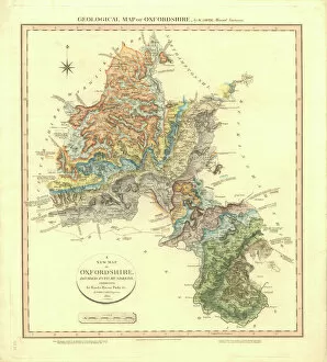
Background imageStrata Collection: Geological Map of Oxfordshire

Geological Map of Oxfordshire
Delineation of Strata of Oxfordshire by William Smith

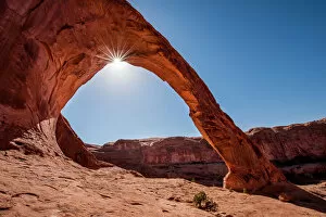
Background imageStrata Collection: Corona Arch, Moab, Utah, United States of America, North America

Corona Arch, Moab, Utah, United States of America, North America

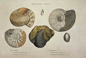
Background imageStrata Collection: Kelloways Stone

Kelloways Stone

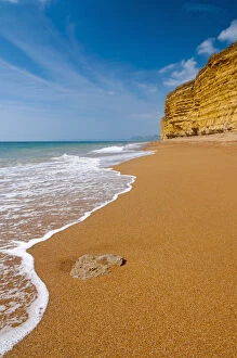
Background imageStrata Collection: UK, Dorset, Jurassic Coast, Burton Bradstock, Hive Beach and Cliffs

UK, Dorset, Jurassic Coast, Burton Bradstock, Hive Beach and Cliffs

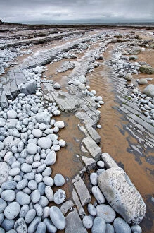
Background imageStrata Collection: Pebbles on Nash Point, Monknash Coast, Vale of Glamorgan, Wales, UK, June 2006

Pebbles on Nash Point, Monknash Coast, Vale of Glamorgan, Wales, UK, June 2006

Background imageStrata Collection: William Smiths Geological Map

William Smiths Geological Map
Fig. 6 from Delineation of Strata of England and Wales (1815) by William Smith

Background imageStrata Collection: USA - Detail of the rock wall at The Wave, a breathtaking work of art

USA - Detail of the rock wall at The Wave, a breathtaking work of art, naturally carved in beautiful red
TD-1847 Detail of the rock wall at The Wave, naturally carved in beautiful red and yellow striated soft Navajo sandstone. North Coyote Buttes, Paria Canyon-Vermilion Cliffs Wilderness

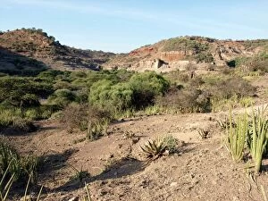
Background imageStrata Collection: Olduvai Gorge landscape, Tanzania C015 / 6429

Olduvai Gorge landscape, Tanzania C015 / 6429
Olduvai Gorge landscape, Tanzania. This gorge (also called Oldupai Gorge) is famous for the fossils discovered here of extinct hominins that form part of the human evolutionary tree

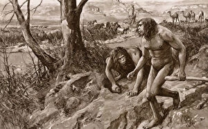
Background imageStrata Collection: Earliest man tracked by tooth, discovery in Pliocene strata

Earliest man tracked by tooth, discovery in Pliocene strata
The earliest man tracked by a tooth: an astounding discovery of human remains in Pliocene strata. An artists vision of Hesperopithecus (the ape-man of the western world) and contemporary animals

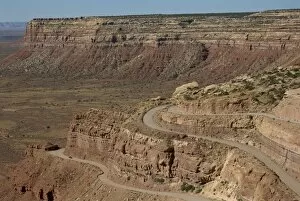
Background imageStrata Collection: The Mokee Dugway road descends from Cedar Mesa

The Mokee Dugway road descends from Cedar Mesa, in the Valley of the Gods, Utah, United States of America, North America

Background imageStrata Collection: USA - The Wave, a breathtaking work of art, naturally carved in beautiful red

USA - The Wave, a breathtaking work of art, naturally carved in beautiful red
TD-1853 The Wave, North Coyote Buttes North Coyote Buttes, Paria Canyon-Vermilion Cliffs Wilderness, Vermilion Cliffs National Monument, Arizona, USA A breathtaking work of art

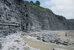
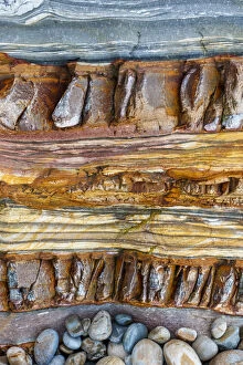
Background imageStrata Collection: Sedimentary rocks, blue lias, shale-limestone sequences, Lyme Regis, Jurassic coast

Sedimentary rocks, blue lias, shale-limestone sequences, Lyme Regis, Jurassic coast, UNESCO World Heritage Site, Dorset, England, United Kingdom, Europe

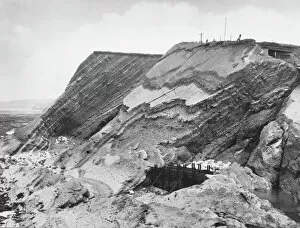
Background imageStrata Collection: Watchet Cliff Strata

Watchet Cliff Strata
The curious cliff strata at Watchet, Somerset, England

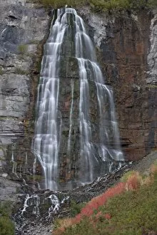
Background imageStrata Collection: Bridal Veil Falls in the fall, Uinta National Forest, Utah, United States of America, North America

Bridal Veil Falls in the fall, Uinta National Forest, Utah, United States of America, North America

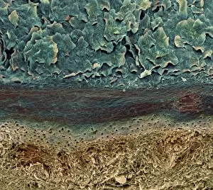
Background imageStrata Collection: Skin layers, SEM

Skin layers, SEM

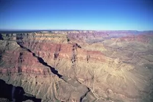
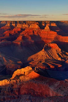
Background imageStrata Collection: Grand Canyon

Grand Canyon, from helicopter, UNESCO World Heritage Site, Arizona, United States of America, North America

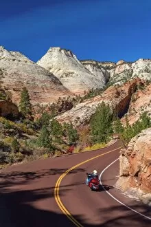
Background imageStrata Collection: USA, Utah, Zion National Park, Highway 9, Zion Park Boulevard

USA, Utah, Zion National Park, Highway 9, Zion Park Boulevard

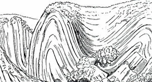
Background imageStrata Collection: Engraving depicting a geological fold, which occurs when one or a stack of originally flat

Engraving depicting a geological fold, which occurs when one or a stack of originally flat and planar surfaces
5309459 Engraving depicting a geological fold, which occurs when one or a stack of originally flat and planar surfaces, such as sedimentary strata

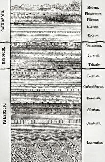
Background imageStrata Collection: A chart of strata, layers of sedimentary rock or soil

A chart of strata, layers of sedimentary rock or soil
5614336 A chart of strata, layers of sedimentary rock or soil; (add.info.: A chart of strata, layers of sedimentary rock or soil)

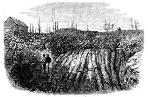
Background imageStrata Collection: Nova Scotian Goldfields: horizontal formation of auriferous quartz at Laidlaw's Farm, 1862

Nova Scotian Goldfields: horizontal formation of auriferous quartz at Laidlaw's Farm, 1862. Creator: Unknown
Nova Scotian Goldfields: horizontal formation of auriferous quartz at Laidlaw's Farm, [Canada], 1862. Engraving of a photograph by Captain W. D. Tompson, of the 17th Regiment

Background imageStrata Collection: The Wave, Coyote Buttes, Paria-Vermilion Cliffs Wilderness, Arizona, USA

The Wave, Coyote Buttes, Paria-Vermilion Cliffs Wilderness, Arizona, USA

Background imageStrata Collection: Picture No. 12480027

Picture No. 12480027
Red rock of the Grand Canyon seen from the South Date:

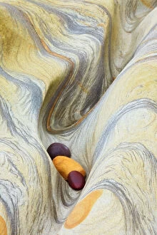
Background imageStrata Collection: Natural Rock Pattern, Northumberland Coast, England

Natural Rock Pattern, Northumberland Coast, England

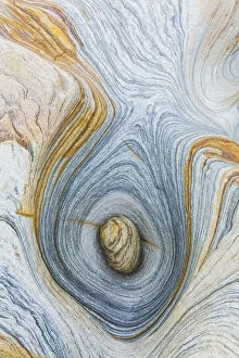
Background imageStrata Collection: Natural Rock Pattern, Northumberland Coast, England

Natural Rock Pattern, Northumberland Coast, England

Background imageStrata Collection: DDE-90182270

DDE-90182270
Seven Sisters Chalk Cliffs, and coastguard cottages, Cuckmere Haven, near Seaford, East Sussex, England Date: 18-05-2010

Background imageStrata Collection: DDE-90035826

DDE-90035826
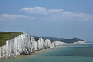
Seven Sisters Chalk Cliffs, seen from Cuckmere Haven, near Seaford, East Sussex, England Date: 19/06/2007

Background imageStrata Collection: DDE-90035825

DDE-90035825
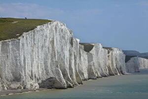
People atop Seven Sisters Chalk Cliffs, seen from Cuckmere Haven, near Seaford, East Sussex, England Date: 19/06/2007

Background imageStrata Collection: DDE-90035823

DDE-90035823
Seven Sisters Chalk Cliffs, Birling Gap, East Sussex, England Date: 19/06/2007

Background imageStrata Collection: DDE-90035822

DDE-90035822
Seven Sisters Chalk Cliffs, Birling Gap, East Sussex, England Date: 19/06/2007

Background imageStrata Collection: DDE-90035819

DDE-90035819
Seven Sisters Chalk Cliffs, Birling Gap, East Sussex, England Date: 19/06/2007

Background imageStrata Collection: DDE-90035818

DDE-90035818
Seven Sisters Chalk Cliffs, Birling Gap, East Sussex, England Date: 19/06/2007

Background imageStrata Collection: DDE-90035817

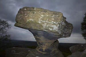
DDE-90035817
Brimham Rocks, near Harrogate, Yorkshire, England Date: 19/06/2007

Background imageStrata Collection: DDE-90034085

DDE-90034085
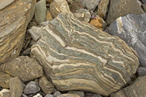
Norway, Svalbard Archipelago, Spitsbergen, St. Johnsfjorden. Intricate geologic rock strata patterns. Date: 14/05/2009

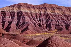
Background imageStrata Collection: Painted Desert, Petrified Forest National Park, Arizona

Painted Desert, Petrified Forest National Park, Arizona

Background imageStrata Collection: 13132652

13132652
Structures at a granite stone at glacier Gullybreen - Svalbard - Norway Date: 27-08-2019

Background imageStrata Collection: Strata of the Earths crust (colour litho)

Strata of the Earths crust (colour litho)
979403 Strata of the Earths crust (colour litho) by English School, (20th century); Private Collection; (add.info.: A pictorial representation of the successive strata of the Earths crust with)

Background imageStrata Collection: Cogmans Kloof, Montagu (Beyond the Tunnel) (b / w photo)

Cogmans Kloof, Montagu (Beyond the Tunnel) (b / w photo)
3092323 Cogmans Kloof, Montagu (Beyond the Tunnel) (b/w photo) by English Photographer, (19th century); Private Collection; (add.info.: Cogmans Kloof, Montagu (Beyond the Tunnel)

Background imageStrata Collection: Quarrying (engraving)

Quarrying (engraving)
STC255662 Quarrying (engraving) by Rostagni, Francesco (18th century); Private Collection; The Stapleton Collection; Italian, out of copyright

Background imageStrata Collection: The Ancient Ruins of the Canyon de Chelle, 1873 (albumen print)

The Ancient Ruins of the Canyon de Chelle, 1873 (albumen print)
STC223383 The Ancient Ruins of the Canyon de Chelle, 1873 (albumen print) by O Sullivan, Timothy (1840-82); Private Collection; (add.info)

Background imageStrata Collection: Geology (colour litho)

Geology (colour litho)
3630380 Geology (colour litho) by German School, (19th century); Private Collection; (add.info.: Geology. Illustration from Meyers Konversations-Lexicon, c1895.); © Look and Learn

Background imageStrata Collection: View from the sea of the promontory, Capo dell Arco in the island of Ventotiene

View from the sea of the promontory, Capo dell Arco in the island of Ventotiene
1275115 View from the sea of the promontory, Capo dell Arco in the island of Ventotiene, Plate XXXI, from Campi Phlegraei: Observations on the Volcanoes of the Two Sicilies

Background imageStrata Collection: Interior view of one of the deepest hollow ways cut by the torrents of the rain water

Interior view of one of the deepest hollow ways cut by the torrents of the rain water
1275118 Interior view of one of the deepest hollow ways cut by the torrents of the rain water on the flanks of Mount Vesuvius, Plate XXXIX

Background imageStrata Collection: Cross-section of the earths crust, frontispiece from L Ecorce Terrestre

Cross-section of the earths crust, frontispiece from L Ecorce Terrestre
CHT236043 Cross-section of the earths crust, frontispiece from L Ecorce Terrestre: Les Mineraux by Emile With, 1874 (colour litho) by French School

Background imageStrata Collection: Steps leading to the Celestial City, copy of an illustration from

Steps leading to the Celestial City, copy of an illustration from
STC202531 Steps leading to the Celestial City, copy of an illustration from Liber de Ascensu by Raymond Lully (c.1232-1315) 1512 used in a History of Magic

Background imageStrata Collection: Remarkable Hills on the Upper Missouri, plate 34 from Volume 2 of

Remarkable Hills on the Upper Missouri, plate 34 from Volume 2 of
STC103853 Remarkable Hills on the Upper Missouri, plate 34 from Volume 2 of Travels in the Interior of North America, engraved by Friedrich Salathe (1793-1858) 1844 (aquatint) by Bodmer

Background imageStrata Collection: Geological section of the artesian well of Grenelle, Paris, France (coloured engraving)

Geological section of the artesian well of Grenelle, Paris, France (coloured engraving)
5233401 Geological section of the artesian well of Grenelle, Paris, France (coloured engraving) by English School, (19th century); Private Collection; (add.info)

Background imageStrata Collection: Section of a Parisian House (engraving)

Section of a Parisian House (engraving)
670568 Section of a Parisian House (engraving) by English School, (19th century); Private Collection; (add.info.: Section of a Parisian House. Illustration for The Boys Own Magazine (Beeton, c 1865)

Background imageStrata Collection: Coloured view of the strata of earth through which the tunnel passes (coloured engraving)

Coloured view of the strata of earth through which the tunnel passes (coloured engraving)
609608 Coloured view of the strata of earth through which the tunnel passes (coloured engraving) by English School, (19th century); Private Collection; (add.info)

Background imageStrata Collection: Ideal cross-section of the earths crust, from a book by Dr. Rengade, c

Ideal cross-section of the earths crust, from a book by Dr. Rengade, c
CHT236042 Ideal cross-section of the earths crust, from a book by Dr. Rengade, c.1880 (coloured engraving) by French School

Background imageStrata Collection: Remarkable Hills on the Upper Missouri, plate 35 from Volume 2 of

Remarkable Hills on the Upper Missouri, plate 35 from Volume 2 of
STC103854 Remarkable Hills on the Upper Missouri, plate 35 from Volume 2 of Travels in the Interior of North America, engraved by Friedrich Salathe (1793-1858) 1844 (aquatint) by Bodmer

Background imageStrata Collection: View of a hollow road leading from the Grotto of Pausilipo to Pianura, Plate XXXX

View of a hollow road leading from the Grotto of Pausilipo to Pianura, Plate XXXX
1275119 View of a hollow road leading from the Grotto of Pausilipo to Pianura, Plate XXXX, from Campi Phlegraei: Observations on the Volcanoes of the Two Sicilies

Background imageStrata Collection: View of a section of a part of the cone of Astruni taken at the entrance of this volcano

View of a section of a part of the cone of Astruni taken at the entrance of this volcano
1275102 View of a section of a part of the cone of Astruni taken at the entrance of this volcano, Plate XIX from Campi Phlegraei: Observations on the Volcanoes of the Two Sicilies

Background imageStrata Collection: Coal-mine at Treuil, St Etienne, France, showing the trunks of fossil trees traversing

Coal-mine at Treuil, St Etienne, France, showing the trunks of fossil trees traversing the overlying strata of
967887 Coal-mine at Treuil, St Etienne, France, showing the trunks of fossil trees traversing the overlying strata of sandstone (engraving) by English School

Background imageStrata Collection: Mining (engraving)

Mining (engraving)
3650047 Mining (engraving) by English School, (19th century); Private Collection; (add.info.: Mining. Illustrations of term relating to coal mining)

Background imageStrata Collection: Petroglyphs at the Mouses Tank, Valley of Fire State Park, Nevada, USA

Petroglyphs at the Mouses Tank, Valley of Fire State Park, Nevada, USA

Background imageStrata Collection: The park road winding through colorful sandstone (hikers visible)

The park road winding through colorful sandstone (hikers visible), Valley of Fire State Park, Nevada, USA

Background imageStrata Collection: Morning light on Elephant Rock, Valley of Fire State Park, Nevada, USA

Morning light on Elephant Rock, Valley of Fire State Park, Nevada, USA

Background imageStrata Collection: The Sweet Water Fountain, 1853-56. Creator: John Dillwyn Llewelyn

The Sweet Water Fountain, 1853-56. Creator: John Dillwyn Llewelyn
The Sweet Water Fountain, 1853-56

Background imageStrata Collection: ROCK STRATA SECTIONS

ROCK STRATA SECTIONS
A diagrammatic section showing the order of succession of rock strata in the earths crust

Background imageStrata Collection: ROCK STRATA DIAGRAM

ROCK STRATA DIAGRAM
A diagram giving a detailed explanation of rock strata groups, their uses and localities

Background imageStrata Collection: CRUIKSHANK - SOCIETY

CRUIKSHANK - SOCIETY
An Outline of Society in Our Own Times Date: 1846

Background imageStrata Collection: PORTLAND QUARRY: STRATA

PORTLAND QUARRY: STRATA
PORTLAND Diagram showing rock strata at the quarries Date: circa 1830s

Background imageStrata Collection: [Rocks in the Auvergne], 1854, printed 1979. Creator: Edouard Baldus

[Rocks in the Auvergne], 1854, printed 1979. Creator: Edouard Baldus
[Rocks in the Auvergne], 1854, printed 1979

Background imageStrata Collection: [Rocky Inlet with Seascape], 1870s. Creator: Francis Bedford

[Rocky Inlet with Seascape], 1870s. Creator: Francis Bedford
[Rocky Inlet with Seascape], 1870s

Background imageStrata Collection: Canada, Alberta, Icefields Parkway

Canada, Alberta, Icefields Parkway, Snow covered mountain escarpment

Background imageStrata Collection: Norway, Svalbard, Pyramiden

Norway, Svalbard, Pyramiden, Russian settlement, Derelict coal-fired power station at abandoned Russian mining settlement Pyramid

Background imageStrata Collection: Norway, Svalbard, Billefjorden

Norway, Svalbard, Billefjorden
Norway, Svalbard Lateral rock strata, scree slopes, band of Gysum near the base at fjordside

Background imageStrata Collection: EyeUbiquitous_20101694

EyeUbiquitous_20101694
England, East Sussex, Birling Gap, looking up at chalk cliff face showing various strata layers

Background imageStrata Collection: EyeUbiquitous_20107870

EyeUbiquitous_20107870
Nepal, Colorful layered mountains and eroded plateau along the route from Ghemi to Lo Manthang

Background imageStrata Collection: EyeUbiquitous_20107049

EyeUbiquitous_20107049
USA, Arizona, Grand Canyon. View across the Grand Canyon

Background imageStrata Collection: EyeUbiquitous_20107047

EyeUbiquitous_20107047
USA, Arizona, Grand Canyon. View across the Grand Canyon

Background imageStrata Collection: EyeUbiquitous_20107045

EyeUbiquitous_20107045
USA, Arizona, Grand Canyon. View across the Grand Canyon


For sale as Licensed Images

Choose your image, Select your licence and Download the media

"Unveiling Earth's Layers: Exploring the Marvels of Strata" Discovering the Blueprint: William Smith Geological Map takes us back to the roots of understanding our planet's strata formations. Time Travel through Rocks: Delving into the 19th-century Geological Strata reveals a fascinating glimpse into Earth's ancient history. England Unearthed: The 1838 Geological Map by Mantell showcases the diverse geological wonders scattered across England, from The Wash to Hunstanton Cliffs. Nature's Artistry in Arizona: Behold The Wave, an awe-inspiring masterpiece carved naturally in vibrant red and yellow Navajo sandstone at Vermilion Cliffs National Monument. A Tale of Continuity and Change: Witness a captivating geological unconformity on the river Jed, where time seems to pause and layers intertwine mysteriously. Pioneering Geology: Step back in time with Britain's first-ever geological map from 1815, offering insights into the nation's rich geological heritage. Oxfordshire Revealed: Explore every nook and cranny as you navigate through the intricate details of the Geological Map of Oxfordshire, uncovering hidden stories beneath our feet. Peering Into Earth’s Depths: Embark on a visual journey through time with Mantell’s detailed 1838 Geological Strata Section, unraveling eons-old secrets layer by layer. Buckland’s Cross-Section Chronicles: Immerse yourself in Buckland’s geology cross-section from 1836, revealing nature’s complex tapestry etched deep within our planet's core. Sunset Serenade at Honeycomb Rock: Bask in nature’s symphony as Elgol’s Honeycomb Rock bids farewell to another day amidst Skye Island's breathtaking Inner Hebrides landscape. Majestic White Guardians - Seven Sisters Chalk Cliffs.

© Copyright Media Storehouse, All Rights Reserved 2003 - 2024
Facebook     Pinterest     Card Payments