
Continental Map Collection

Step back in time and explore the world through these stunning continental maps

Background imageContinental Map Collection: Australia 1851

Australia 1851
A fine facimile artworked from an antique original map of the Continent of Australia, issued as part of the 1851 edition of John Tallis and Companys " The Illustrated Atlas

Background imageContinental Map Collection: Old Map of The Americas 1635 by Willem & Johan Blaue from the Theatrum Orbis Terrarum

Old Map of The Americas 1635 by Willem & Johan Blaue from the Theatrum Orbis Terrarum
This detailed and most attractive reproduction map of The Americas has been carefully art worked from a scan of an antique original

Background imageContinental Map Collection: Europe 1851

Europe 1851
A fine facimile artworked from an antique original map of Europe, issued as part of the 1851 edition of John Tallis and Companys " The Illustrated Atlas and Modern History of the World"

Background imageContinental Map Collection: Old Map of South America 1852 by Henry George Collins

Old Map of South America 1852 by Henry George Collins
This is a finely detailed map of South America remastered from a rare Atlas of the World published in 1852 by Henry George Collins

Background imageContinental Map Collection: Asia Minor 1851

Asia Minor 1851
A fine facimile artworked from an antique original map of Asia Minor, issued as part of the 1851 edition of John Tallis and Companys " The Illustrated Atlas and Modern History of the World"

Background imageContinental Map Collection: Old Map of Africa 1851 by John Tallis

Old Map of Africa 1851 by John Tallis
A fine facimile artworked from an antique original map of the Continent of Africa, issued as part of the 1851 edition of John Tallis and Companys " The Illustrated Atlas

Background imageContinental Map Collection: Old Map of Europe 1852 by Henry George Collins

Old Map of Europe 1852 by Henry George Collins
This is a finely detailed map of Europe remastered from a rare Atlas of the World published in 1852 by Henry George Collins

Background imageContinental Map Collection: Old Map of Australia 1852 by Henry George Collins

Old Map of Australia 1852 by Henry George Collins
This is a finely detailed map of Australia remastered from a rare Atlas of the World published in 1852 by Henry George Collins

Background imageContinental Map Collection: Old Map of Africa 1852 by Henry George Collins

Old Map of Africa 1852 by Henry George Collins
This is a finely detailed map of Africa remastered from a rare Atlas of the World published in 1852 by Henry George Collins

Background imageContinental Map Collection: Old Map of Asia 1852 by Henry George Collins

Old Map of Asia 1852 by Henry George Collins
This is a finely detailed map of Asia remastered from a rare Atlas of the World published in 1852 by Henry George Collins

Background imageContinental Map Collection: Asia 1851

Asia 1851
A fine facimile artworked from an antique original map of the Continent of Asia, issued as part of the 1851 edition of John Tallis and Companys " The Illustrated Atlas

Background imageContinental Map Collection: Old Map of North America 1852 by Henry George Collins

Old Map of North America 1852 by Henry George Collins
This is a finely detailed map of North America remastered from a rare Atlas of the World published in 1852 by Henry George Collins


For sale as Licensed Images

Choose your image, Select your licence and Download the media

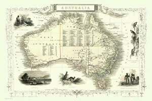
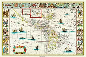
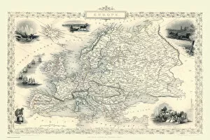
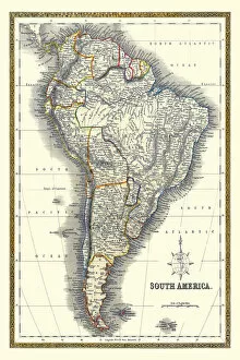
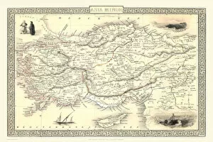
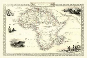
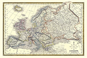
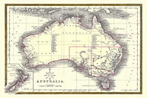
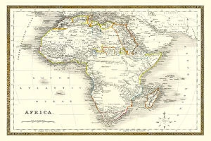
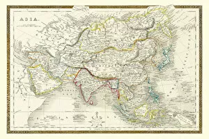
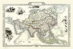
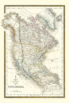
Step back in time and explore the world through these stunning continental maps. 🌍✨ Starting with Australia in 1851, witness the land down under as it was during the gold rush era. Marvel at its vastness and imagine the excitement that filled the air. Traveling across to The Americas, we find ourselves transported to 1635 with an old map by Willem & Johan Blaue from Theatrum Orbis Terrarum. Discover a continent on the brink of exploration, where new frontiers awaited brave adventurers. Next up is Europe in 1851, a time when empires rose and fell. This map captures a continent steeped in history and culture, showcasing its diverse landscapes and rich heritage. Venturing further south, we encounter South America in 1852 through Henry George Collins' meticulous cartography. Explore this vibrant continent teeming with lush rainforests, mighty rivers like the Amazon, and ancient civilizations waiting to be uncovered. Moving eastward towards Asia Minor in 1851, immerse yourself in a region that has witnessed countless empires rise and fall throughout history. Trace their footsteps on this captivating map that reveals both ancient ruins and bustling cities. Continuing our journey across Africa's vast expanse using John Tallis' Old Map from 1851, discover a land of untamed wildernesses juxtaposed against thriving civilizations along its coasts. Experience Africa's diversity as you navigate through its deserts, savannahs, mountains, and fertile plains. Returning to Europe once again but now exploring it through Henry George Collins' lens from 1852 brings forth another perspective altogether. Witness how borders shifted over time while marveling at architectural wonders such as castles dotting picturesque landscapes. Back Down Under we go. With Henry George Collins' Old Map of Australia from 1852 as our guidebook this time around; embark on an adventure into uncharted territories.