Mapping Collection (page 6)

"Exploring the World Through Maps: A Journey of Discovery" Embark on a captivating journey through time and space as we delve into the fascinating world of mapping

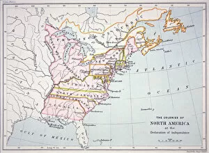
Background imageMapping Collection: Map of the Colonies of North America at the time of the Declaration of Independence

Map of the Colonies of North America at the time of the Declaration of Independence
PNP316579 Map of the Colonies of North America at the time of the Declaration of Independence (colour engraving) by American School; Private Collection; (add.info)

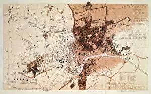
Background imageMapping Collection: Sanitary Map of the Town of Leeds, by Stephen Sly for Her Majestys Stationary Office

Sanitary Map of the Town of Leeds, by Stephen Sly for Her Majestys Stationary Office
XCF291069 Sanitary Map of the Town of Leeds, by Stephen Sly for Her Majestys Stationary Office, 1842 (colour litho) by English School, (19th century); Leeds Library and Information Service, Leeds

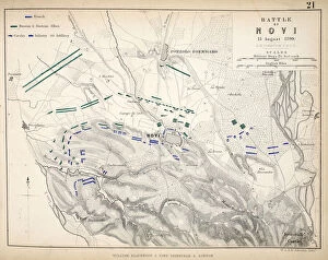
Background imageMapping Collection: Map of the Battle of Novi, published by William Blackwood and Sons, Edinburgh & London

Map of the Battle of Novi, published by William Blackwood and Sons, Edinburgh & London
746923 Map of the Battle of Novi, published by William Blackwood and Sons, Edinburgh & London, 1848 (hand-coloured engraving) by Johnston

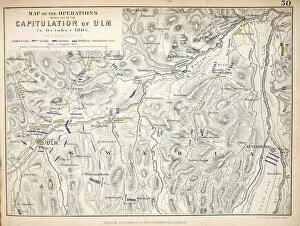
Background imageMapping Collection: Map of the Operations which led to the Capitulation of Ulm

Map of the Operations which led to the Capitulation of Ulm
746914 Map of the Operations which led to the Capitulation of Ulm, published by William Blackwood and Sons, Edinburgh & London, 1848 (hand-coloured engraving) by Johnston

Background imageMapping Collection: Map of the Battle of Aspern or Essling, published by William Blackwood and Sons

Map of the Battle of Aspern or Essling, published by William Blackwood and Sons
746901 Map of the Battle of Aspern or Essling, published by William Blackwood and Sons, Edinburgh & London, 1848 (hand-coloured engraving) by Johnston

Background imageMapping Collection: Map of the Battle of Ocana, published by William Blackwood and Sons, Edinburgh & London

Map of the Battle of Ocana, published by William Blackwood and Sons, Edinburgh & London
746897 Map of the Battle of Ocana, published by William Blackwood and Sons, Edinburgh & London, 1848 (hand-coloured engraving) by Johnston

Background imageMapping Collection: Map of the Siege of St Sebastian, published by William Blackwood and Sons

Map of the Siege of St Sebastian, published by William Blackwood and Sons
746885 Map of the Siege of St Sebastian, published by William Blackwood and Sons, Edinburgh & London, 1848 (hand-coloured engraving) by Johnston

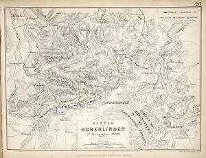
Background imageMapping Collection: Map of the Battle of Hohenlinden, published by William Blackwood and Sons

Map of the Battle of Hohenlinden, published by William Blackwood and Sons
746918 Map of the Battle of Hohenlinden, published by William Blackwood and Sons, Edinburgh & London, 1848 (hand-coloured engraving) by Johnston

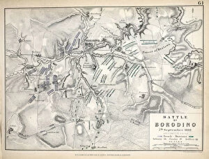
Background imageMapping Collection: Map of the Battle of Borodino, published by William Blackwood and Sons

Map of the Battle of Borodino, published by William Blackwood and Sons
746894 Map of the Battle of Borodino, published by William Blackwood and Sons, Edinburgh & London, 1848 (hand-coloured engraving) by Johnston

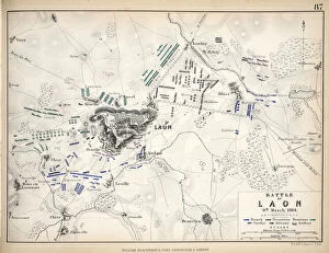
Background imageMapping Collection: Map of the Battle of Laon, published by William Blackwood and Sons, Edinburgh & London

Map of the Battle of Laon, published by William Blackwood and Sons, Edinburgh & London
746879 Map of the Battle of Laon, published by William Blackwood and Sons, Edinburgh & London, 1848 (hand-coloured engraving) by Johnston

Background imageMapping Collection: Map of the Battles of Turcoing & Tournay, published by William Blackwood and Sons

Map of the Battles of Turcoing & Tournay, published by William Blackwood and Sons
746874 Map of the Battles of Turcoing & Tournay, published by William Blackwood and Sons, Edinburgh & London, 1848 (hand-coloured engraving) by Johnston

Background imageMapping Collection: Map of Paris at the Outbreak of the French Revolution, 1789

Map of Paris at the Outbreak of the French Revolution, 1789
746869 Map of Paris at the Outbreak of the French Revolution, 1789, published by William Blackwood and Sons, Edinburgh & London, 1848 (hand-coloured engraving) by Johnston

Background imageMapping Collection: Stephensons map of the Liverpool & Manchester Railway, c. 1824-1830 (colour litho)

Stephensons map of the Liverpool & Manchester Railway, c. 1824-1830 (colour litho)
3697584 Stephensons map of the Liverpool & Manchester Railway, c.1824-1830 (colour litho) by English School, (19th century); Private Collection; (add.info)

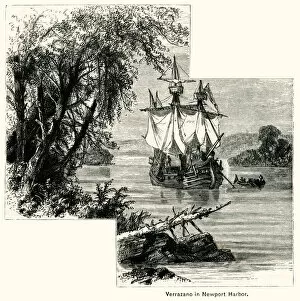
Background imageMapping Collection: Verrazzano at Newport Harbour

Verrazzano at Newport Harbour
Giovanni da Verrazzano, Italian explorer, arriving in 1524 at Newport Harbour, Rhode Island. This was part of his first American expedition mapping and exploring the North American coast for Italy

Background imageMapping Collection: Map of Gulf of Gaeta from Campi Phlegraei: Observations on the Volcanoes of the Two

Map of Gulf of Gaeta from Campi Phlegraei: Observations on the Volcanoes of the Two
1275092 Map of Gulf of Gaeta from Campi Phlegraei: Observations on the Volcanoes of the Two Sicilies, by Sir William Hamilton (1730-1803), published 1776 (hand coloured engraving) by Fabris

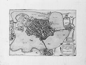
Background imageMapping Collection: Mantua, 1629 (engraving)

Mantua, 1629 (engraving)
696633 Mantua, 1629 (engraving) by Greuter, Matthaus (c.1556-1638); 40.5x54 cm; Private Collection; Photo eChristies Images; French, out of copyright

Background imageMapping Collection: Rare Continental globe cup, North German or Flemish, c. 1600 (silver gilt

Rare Continental globe cup, North German or Flemish, c. 1600 (silver gilt
CH438767 Rare Continental globe cup, North German or Flemish, c.1600 (silver gilt) (see also 438768) by German School; height: 41 cm; Private Collection; Photo eChristies Images; out of copyright

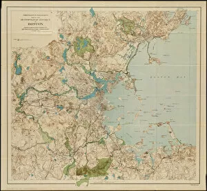
Background imageMapping Collection: Map of the metropolitan district of Boston, Massachusetts

Map of the metropolitan district of Boston, Massachusetts
6256302 Map of the metropolitan district of Boston, Massachusetts : showing local public reservations and holdings of the Metropolitan Park Commission, 1901 (colour litho) by American School

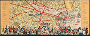
Background imageMapping Collection: Boston is a browsing town : what to see and how to enjoy your visit, c

Boston is a browsing town : what to see and how to enjoy your visit, c
6256290 Boston is a browsing town : what to see and how to enjoy your visit, c.1935-45 (colour litho) by American School, (20th century); 23x46 cm; Boston Public Library, Boston, Massachusetts

Background imageMapping Collection: Map of the coast of New Zealand, illustration from

Map of the coast of New Zealand, illustration from
3610747 Map of the coast of New Zealand, illustration from A journal of a voyage to the South Seas : in His Majestys ship, the Endeavour, 1794 (hand-coloured engraving) by Parkinson

Background imageMapping Collection: Map of the Battle of Arcole, published by William Blackwood and Sons, Edinburgh & London

Map of the Battle of Arcole, published by William Blackwood and Sons, Edinburgh & London
746933 Map of the Battle of Arcole, published by William Blackwood and Sons, Edinburgh & London, 1848 (hand-coloured engraving) by Johnston

Background imageMapping Collection: Map of the Battle of Rivoli, published by William Blackwood and Sons, Edinburgh & London

Map of the Battle of Rivoli, published by William Blackwood and Sons, Edinburgh & London
746932 Map of the Battle of Rivoli, published by William Blackwood and Sons, Edinburgh & London, 1848 (hand-coloured engraving) by Johnston

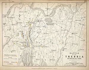
Background imageMapping Collection: Map of the Battle of Trebbia, published by William Blackwood and Sons, Edinburgh & London

Map of the Battle of Trebbia, published by William Blackwood and Sons, Edinburgh & London
746924 Map of the Battle of Trebbia, published by William Blackwood and Sons, Edinburgh & London, 1848 (hand-coloured engraving) by Johnston

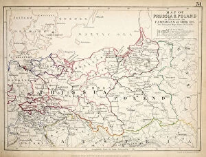
Background imageMapping Collection: Map of Prussia and Poland, published by William Blackwood and Sons, Edinburgh & London

Map of Prussia and Poland, published by William Blackwood and Sons, Edinburgh & London
746910 Map of Prussia and Poland, published by William Blackwood and Sons, Edinburgh & London, 1848 (hand-coloured engraving) by Johnston

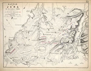
Background imageMapping Collection: Map of the Battle of Jena, published by William Blackwood and Sons, Edinburgh & London

Map of the Battle of Jena, published by William Blackwood and Sons, Edinburgh & London
746909 Map of the Battle of Jena, published by William Blackwood and Sons, Edinburgh & London, 1848 (hand-coloured engraving) by Johnston

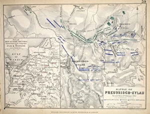
Background imageMapping Collection: Map of the Battle of Preussisch-Eylau, published by William Blackwood and Sons

Map of the Battle of Preussisch-Eylau, published by William Blackwood and Sons
746907 Map of the Battle of Preussisch-Eylau, published by William Blackwood and Sons, Edinburgh & London, 1848 (hand-coloured engraving) by Johnston

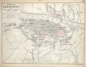
Background imageMapping Collection: Map of the Siege of Saragossa, published by William Blackwood and Sons

Map of the Siege of Saragossa, published by William Blackwood and Sons
746904 Map of the Siege of Saragossa, published by William Blackwood and Sons, Edinburgh & London, 1848 (hand-coloured engraving) by Johnston

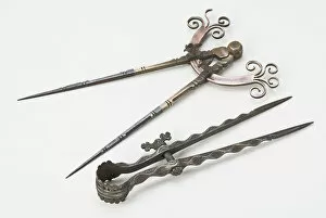
Background imageMapping Collection: Dividers, 18th and 16th centuries (bronze, steel, copper & iron)

Dividers, 18th and 16th centuries (bronze, steel, copper & iron)
701086 Dividers, 18th and 16th centuries (bronze, steel, copper & iron) by European; David Russell Collection; (add.info.: Left: Possibly Dutch, 18th century (bronze, steel, copper & iron), 30.5cm

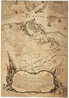
Background imageMapping Collection: Plan of the investment of York and Gloucester (Va. ) [Yorktown], c. February 1782 (litho)

Plan of the investment of York and Gloucester (Va. ) [Yorktown], c. February 1782 (litho)
696020 Plan of the investment of York and Gloucester (Va.) [Yorktown], c.February 1782 (litho) by Bauman, Sebastian (1739-1803); 65x46 cm; Gilder Lehrman Collection, New York

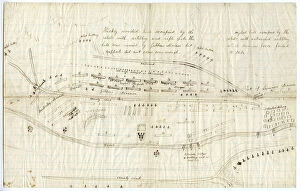
Background imageMapping Collection: Map of Fredericksburg, c. December 1862 (litho)

Map of Fredericksburg, c. December 1862 (litho)
696115 Map of Fredericksburg, c.December 1862 (litho) by Bush, George (fl.1862); 25x39.5 cm; Gilder Lehrman Collection, New York

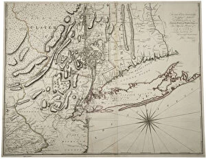
Background imageMapping Collection: Map of Lower New York State and surrounding areas, c. 1775 (litho)

Map of Lower New York State and surrounding areas, c. 1775 (litho)
696111 Map of Lower New York State and surrounding areas, c.1775 (litho) by Montresor, John (1736-99); 76.2x97.8 cm; Gilder Lehrman Collection, New York

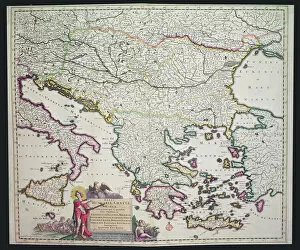
Background imageMapping Collection: Map of Greece, Hungary and their surrounding countries (hand coloured engraving)

Map of Greece, Hungary and their surrounding countries (hand coloured engraving)
XCF306030 Map of Greece, Hungary and their surrounding countries (hand coloured engraving) by Dutch School; Private Collection; Dutch, out of copyright

Background imageMapping Collection: Hand drawn map of the coasts of Portugal and Spain, 1756 (ink on paper)

Hand drawn map of the coasts of Portugal and Spain, 1756 (ink on paper)
XCF307349 Hand drawn map of the coasts of Portugal and Spain, 1756 (ink on paper) by English School, (18th century); Private Collection; English, out of copyright

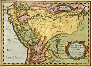
Background imageMapping Collection: Map of the Amazon Basin, 1680 (hand coloured engraving)

Map of the Amazon Basin, 1680 (hand coloured engraving)
STC255196 Map of the Amazon Basin, 1680 (hand coloured engraving) by Sanson D Abbeville, Nicolas (1600-1667) (after); Private Collection; The Stapleton Collection; French, out of copyright

Background imageMapping Collection: Map of Britain and Ireland (colour engraving)

Map of Britain and Ireland (colour engraving)
STC255195 Map of Britain and Ireland (colour engraving) by Valck, Gerard (c.1651-1726); Private Collection; The Stapleton Collection; Dutch, out of copyright

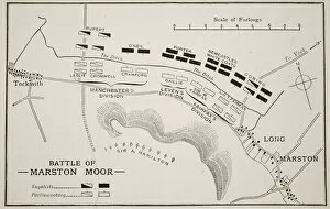
Background imageMapping Collection: Battle of Marston Moor (litho)

Battle of Marston Moor (litho)
STC373406 Battle of Marston Moor (litho) by English School, (19th century); Private Collection; (add.info.: Battle of Marston Moor, 2nd July 1644)

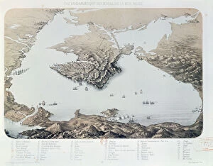
Background imageMapping Collection: Panoramic view and plan of Sevastopol and the Black Sea Coast at the time of the Crimean

Panoramic view and plan of Sevastopol and the Black Sea Coast at the time of the Crimean
CHT365097 Panoramic view and plan of Sevastopol and the Black Sea Coast at the time of the Crimean War, 1855 (litho) by French School, (19th century); Bibliotheque Nationale, Paris

Background imageMapping Collection: Ms 254, f. 1v: Mappa Mundi, from a Bestiary, c. 1200-30 (vellum)

Ms 254, f. 1v: Mappa Mundi, from a Bestiary, c. 1200-30 (vellum)
FIT277706 Ms 254, f.1v: Mappa Mundi, from a Bestiary, c.1200-30 (vellum) by English School, (13th century); 26.7x18 cm; Fitzwilliam Museum, University of Cambridge

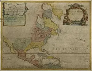
Background imageMapping Collection: Map of Central and North America, published in 1700, Paris (colour engraving)

Map of Central and North America, published in 1700, Paris (colour engraving)
REV345804 Map of Central and North America, published in 1700, Paris (colour engraving) by Delisle, Guillaume (1675-1726) (after); Private Collection; (add.info.: Guillaume de L Isle)

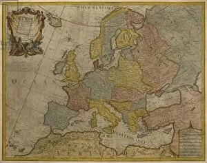
Background imageMapping Collection: Map of Europe, published in 1700, Paris (colour engraving)

Map of Europe, published in 1700, Paris (colour engraving)
REV345801 Map of Europe, published in 1700, Paris (colour engraving) by Delisle, Guillaume (1675-1726) (after); Private Collection; (add.info.: Guillaume de L Isle)

Background imageMapping Collection: Colonial Carolina (lithograph)

Colonial Carolina (lithograph)
PNP351118 Colonial Carolina (lithograph) by Moll, Hermann (fl.1678-1732) (after); Private Collection; (add.info.: Map of Charleston showing early rice fields; based on a map by Herman Moll)

Background imageMapping Collection: New France: The Course of the St Lawrence River as far as Quebec (litho)

New France: The Course of the St Lawrence River as far as Quebec (litho)
PNP351115 New France: The Course of the St Lawrence River as far as Quebec (litho) by English School, (18th century) (after); Private Collection; (add.info.: image from Henry Popples (1743) Atlas

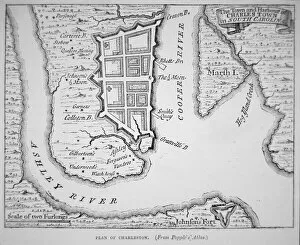
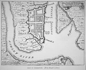
Background imageMapping Collection: Town and Harbour of Charles Town (Charleston), South Carolina (lithograph)

Town and Harbour of Charles Town (Charleston), South Carolina (lithograph)
PNP351113 Town and Harbour of Charles Town (Charleston), South Carolina (lithograph) by English School; Private Collection; (add.info)

Background imageMapping Collection: Pages from The Western Pilot... by Samuel Cummings, published by G

Pages from The Western Pilot... by Samuel Cummings, published by G
NBY332342 Pages from The Western Pilot... by Samuel Cummings, published by G. Conclin, Cincinnati, 1847 (litho) by American School, (19th century); Newberry Library, Chicago, Illinois

Background imageMapping Collection: Map of Kentucke... engraved by Henry D. Pursell, printed by T

Map of Kentucke... engraved by Henry D. Pursell, printed by T
NBY332330 Map of Kentucke... engraved by Henry D. Pursell, printed by T. Rook, Philadelphia, 1784 (coloured engraving) by Filson, John (c.1747-88); 51x46 cm; Newberry Library, Chicago, Illinois

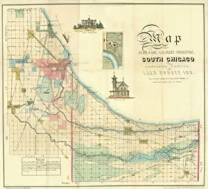
Background imageMapping Collection: Map of South Chicago, 1871 (colour litho)

Map of South Chicago, 1871 (colour litho)
NBY332282 Map of South Chicago, 1871 (colour litho) by American School, (19th century); Newberry Library, Chicago, Illinois, USA; (add.info.: Lake County, Calumet, Thornton)

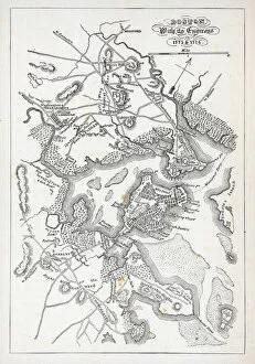
Background imageMapping Collection: Boston and its environs in 1775 and 1776 (litho)

Boston and its environs in 1775 and 1776 (litho)
PNP329795 Boston and its environs in 1775 and 1776 (litho) by American School, (18th century); Private Collection; Peter Newark Pictures; American, out of copyright


For sale as Licensed Images

Choose your image, Select your licence and Download the media

"Exploring the World Through Maps: A Journey of Discovery" Embark on a captivating journey through time and space as we delve into the fascinating world of mapping. From the iconic Wimbledon tennis complex in the UK to the enchanting Theatre of the Empire of Great Britain, these maps offer glimpses into diverse landscapes and historical narratives. Transport yourself back to 1560 Mexico with Alonso de Santa Cruz's Map of Tenochtitlan, where you can trace the ancient streets and waterways that once thrived in this vibrant city. Or marvel at Durer's intricate world map from 1515, which showcases an era when cartography was still in its infancy but held immense potential for exploration. Step foot onto 16th-century Florence with a meticulously detailed plan that captures every nook and cranny of this Renaissance gem. Meanwhile, an Italian map from 1537 unveils Corfu's allure nestled within Greece's Ionian Sea – a testament to both artistic skill and geographical accuracy. As we venture further into history, a stunning 17th-century European map unfolds before our eyes, revealing political boundaries that have since evolved but continue to shape our present-day understanding. Witness Dubrovnik's pre-1667 earthquake charm through an intricately crafted depiction that preserves its architectural grandeur. The allure extends beyond terrestrial realms as well; explore Bermuda’s beauty through a vividly colored engraving or immerse yourself in Roman glory with "A New Map of the Roman Empire. " These maps not only guide us geographically but also provide insights into cultural heritage and societal dynamics. Finally, let us contemplate White Matter Fibres' artwork from 1930 – an abstract representation reminding us that mapping transcends physical borders too. It invites us to explore neural pathways within our own minds while appreciating how cartography has become intertwined with human cognition throughout history. Intricate lines, vibrant colors, and meticulous details come together on these maps, inviting us to embark on a visual and intellectual adventure.