Mapping Collection (page 7)

"Exploring the World Through Maps: A Journey of Discovery" Embark on a captivating journey through time and space as we delve into the fascinating world of mapping

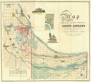
Background imageMapping Collection: Map of South Chicago, 1871 (colour litho)

Map of South Chicago, 1871 (colour litho)
NBY332282 Map of South Chicago, 1871 (colour litho) by American School, (19th century); Newberry Library, Chicago, Illinois, USA; (add.info.: Lake County, Calumet, Thornton)

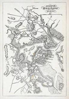
Background imageMapping Collection: Boston and its environs in 1775 and 1776 (litho)

Boston and its environs in 1775 and 1776 (litho)
PNP329795 Boston and its environs in 1775 and 1776 (litho) by American School, (18th century); Private Collection; Peter Newark Pictures; American, out of copyright

Background imageMapping Collection: New York at the Beginning of the Eighteenth Century (litho)

New York at the Beginning of the Eighteenth Century (litho)
PNP329792 New York at the Beginning of the Eighteenth Century (litho) by American School, (18th century); Private Collection; (add.info.: from Mathers Magnalia ; ); Peter Newark Pictures; American

Background imageMapping Collection: Terra Moriath Sive Solymarum Ager Suburbanus (colour engraving)

Terra Moriath Sive Solymarum Ager Suburbanus (colour engraving)
XCF285148 Terra Moriath Sive Solymarum Ager Suburbanus (colour engraving) by English School; Private Collection; (add.info.: biblical Palestine as divided among the tribes; ); English

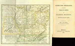
Background imageMapping Collection: A Guide for Emigrants, containing sketches of Illinois

A Guide for Emigrants, containing sketches of Illinois
NBY332354 A Guide for Emigrants, containing sketches of Illinois, Missouri and the adjacent parts, by J.M. Peck, published by Lincoln and Edmands, Boston, 1831 (colour litho) by American School

Background imageMapping Collection: Pages from Travels through the United States of America... 1818 (litho)

Pages from Travels through the United States of America... 1818 (litho)
NBY332351 Pages from Travels through the United States of America... 1818 (litho) by Melish, John (1771-1822); Newberry Library, Chicago, Illinois, USA; (add.info.:in the years 1806 & 1807, and 1809)

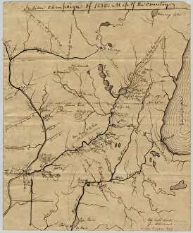
Background imageMapping Collection: Indian campaign of 1832: Map of the country, 1832 (pen & ink on paper)

Indian campaign of 1832: Map of the country, 1832 (pen & ink on paper)
NBY332345 Indian campaign of 1832: Map of the country, 1832 (pen & ink on paper) by Rose, Edwin (fl.1832); Newberry Library, Chicago, Illinois, USA; (add.info.: map from The Black Hawk War)

Background imageMapping Collection: Map of Brighton by Thomas Yeakell and William Gardner, engraved by Whitchurch

Map of Brighton by Thomas Yeakell and William Gardner, engraved by Whitchurch
STC255318 Map of Brighton by Thomas Yeakell and William Gardner, engraved by Whitchurch, 1779 (colour engraving) by English School

Background imageMapping Collection: Map of the Suez Canal, c. 1870 (engraving)

Map of the Suez Canal, c. 1870 (engraving)
CHT290579 Map of the Suez Canal, c.1870 (engraving) by Le Bealle, A. (fl.1870); Private Collection; (add.info.: Carte du Canal de Suez; made soon after the opening of the Canal in 1869;)

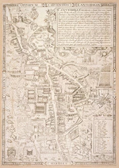
Background imageMapping Collection: Map of Cambridge, from Caius Historia Cantabrigensis Academia, 1574 (engraving)

Map of Cambridge, from Caius Historia Cantabrigensis Academia, 1574 (engraving)
FIT276174 Map of Cambridge, from Caius Historia Cantabrigensis Academia, 1574 (engraving) by Lyne, Richard (fl. c.1570-98); Fitzwilliam Museum, University of Cambridge

Background imageMapping Collection: Wolfes plan for the siege of Quebec in 1759, 1780 (litho)

Wolfes plan for the siege of Quebec in 1759, 1780 (litho)
PNP375476 Wolfes plan for the siege of Quebec in 1759, 1780 (litho) by English School, (18th century); Private Collection; (add.info)

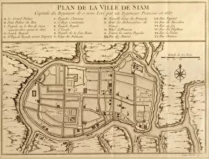
Background imageMapping Collection: Map of the city of Siam, capital of the kingdom of that name after a survey done by a

Map of the city of Siam, capital of the kingdom of that name after a survey done by a
LIT389753 Map of the city of Siam, capital of the kingdom of that name after a survey done by a French engineer in 1687, published in the 1751 edition of Histoire Generale des Voyages by Antoine

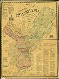
Background imageMapping Collection: Scotts Map of the Consolidated City of Philadelphia, 1856 (hand-coloured engraving)

Scotts Map of the Consolidated City of Philadelphia, 1856 (hand-coloured engraving)
486274 Scotts Map of the Consolidated City of Philadelphia, 1856 (hand-coloured engraving) by Scott, James (19th century); 108x81 cm; Free Library of Philadelphia; eFree Library of Philadelphia; Map

Background imageMapping Collection: Map of the County of Philadelphia From Actual Survey, 1843 (hand-coloured engraving)

Map of the County of Philadelphia From Actual Survey, 1843 (hand-coloured engraving)
486269 Map of the County of Philadelphia From Actual Survey, 1843 (hand-coloured engraving) by Ellet, Charles Jr. (1810-62)

Background imageMapping Collection: Panoramic view of Canterbury in the sixteenth century, illustration from

Panoramic view of Canterbury in the sixteenth century, illustration from
STC393378 Panoramic view of Canterbury in the sixteenth century, illustration from The Church of England: A History for the People by H.D.M. Spence-Jones, pub

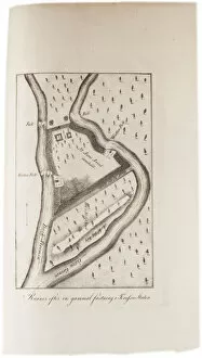
Background imageMapping Collection: Ruins of an old fort in Tennessee, from an Atlas of the United States, 1824 (engraving)

Ruins of an old fort in Tennessee, from an Atlas of the United States, 1824 (engraving)
497560 Ruins of an old fort in Tennessee, from an Atlas of the United States, 1824 (engraving) by KlinckowstrAom, Axel Leonhard (1775-1837); 56x44 cm; Gilder Lehrman Collection, New York

Background imageMapping Collection: Assembled map of the planet Mars, from observations made during six oppositions in

Assembled map of the planet Mars, from observations made during six oppositions in
CHT176314 Assembled map of the planet Mars, from observations made during six oppositions in 1877-88 by Schiaparelli, Giovanni (c.1835-1910) (after); Observatoire Camille Flammarion, Juvisy

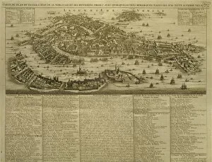
Background imageMapping Collection: Map of Venice, published by H. Chatelain in Amsterdam, 1728 (engraving)

Map of Venice, published by H. Chatelain in Amsterdam, 1728 (engraving)
REV345836 Map of Venice, published by H. Chatelain in Amsterdam, 1728 (engraving) by French School, (18th century); Private Collection; (add.info.: Carte du plan de Venise)

Background imageMapping Collection: Map of Trento, from Les Villes de Venetie, 1704

Map of Trento, from Les Villes de Venetie, 1704
REV345812 Map of Trento, from Les Villes de Venetie, 1704, published by Pierre Mortier in Amsterdam (engraving) by Mortier

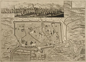
Background imageMapping Collection: Map of Treviso, from Les Villes de Venetie, 1704

Map of Treviso, from Les Villes de Venetie, 1704
REV345807 Map of Treviso, from Les Villes de Venetie, 1704, published by Pierre Mortier in Amsterdam (engraving) by Mortier

Background imageMapping Collection: Map of Asia, published in 1700, Paris (colour engraving)

Map of Asia, published in 1700, Paris (colour engraving)
REV345802 Map of Asia, published in 1700, Paris (colour engraving) by Delisle, Guillaume (1675-1726) (after); Private Collection; (add.info.: Guillaume de L Isle)

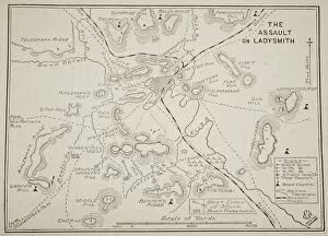
Background imageMapping Collection: Plan of the Assault on Ladysmith (litho)

Plan of the Assault on Ladysmith (litho)
STC373407 Plan of the Assault on Ladysmith (litho) by English School, (19th century); Private Collection; (add.info.: Siege of Ladysmith, 30th October 1899 to 28th February 1900)

Background imageMapping Collection: Battle of Newbury, 20th September 1643 (litho)

Battle of Newbury, 20th September 1643 (litho)
STC373364 Battle of Newbury, 20th September 1643 (litho) by English School, (19th century); Private Collection; The Stapleton Collection; English, out of copyright

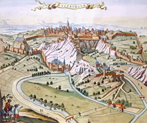
Background imageMapping Collection: Luxembourg, the capital of the Duchy, 1649 (hand-coloured engraving)

Luxembourg, the capital of the Duchy, 1649 (hand-coloured engraving)
STC420678 Luxembourg, the capital of the Duchy, 1649 (hand-coloured engraving) by Blaeu, Joan (1596-1673); Private Collection; The Stapleton Collection; Dutch, out of copyright

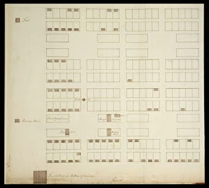
Background imageMapping Collection: Town Plan of Savannah, c. 1733 (pen & ink on paper)

Town Plan of Savannah, c. 1733 (pen & ink on paper)
3964034 Town Plan of Savannah, c.1733 (pen & ink on paper) by American School, (18th century); 35.2x39.5 cm; By kind permission of the Earl of Leicester and the Trustees of the Holkham Estate;

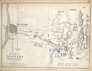
Background imageMapping Collection: Map of the Battle of Talavera, published by William Blackwood and Sons

Map of the Battle of Talavera, published by William Blackwood and Sons
746898 Map of the Battle of Talavera, published by William Blackwood and Sons, Edinburgh & London, 1848 (hand-coloured engraving) by Johnston

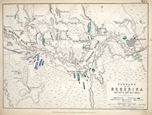
Background imageMapping Collection: Map of the Passage of the Beresina, published by William Blackwood and Sons

Map of the Passage of the Beresina, published by William Blackwood and Sons
746891 Map of the Passage of the Beresina, published by William Blackwood and Sons, Edinburgh & London, 1848 (hand-coloured engraving) by Johnston

Background imageMapping Collection: Map of the Battle of Lutzen, published by William Blackwood and Sons, Edinburgh & London

Map of the Battle of Lutzen, published by William Blackwood and Sons, Edinburgh & London
746890 Map of the Battle of Lutzen, published by William Blackwood and Sons, Edinburgh & London, 1848 (hand-coloured engraving) by Johnston

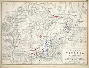
Background imageMapping Collection: Map of the Battle of Vitoria, published by William Blackwood and Sons, Edinburgh & London

Map of the Battle of Vitoria, published by William Blackwood and Sons, Edinburgh & London
746888 Map of the Battle of Vitoria, published by William Blackwood and Sons, Edinburgh & London, 1848 (hand-coloured engraving) by Johnston

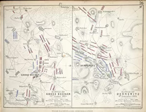
Background imageMapping Collection: Maps of the Battle of Gross Beeren and Battle of Dennewitz

Maps of the Battle of Gross Beeren and Battle of Dennewitz
746886 Maps of the Battle of Gross Beeren and Battle of Dennewitz, published by William Blackwood and Sons, Edinburgh & London, 1848 (hand-coloured engraving) by Johnston

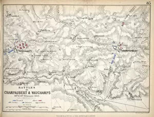
Background imageMapping Collection: Map of the Battles of Champaubert and Vauchamps, published by William Blackwood and Sons

Map of the Battles of Champaubert and Vauchamps, published by William Blackwood and Sons
746881 Map of the Battles of Champaubert and Vauchamps, published by William Blackwood and Sons, Edinburgh & London, 1848 (hand-coloured engraving) by Johnston

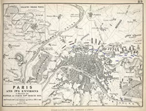
Background imageMapping Collection: Map of Paris and Its Environs, published by William Blackwood and Sons

Map of Paris and Its Environs, published by William Blackwood and Sons
746877 Map of Paris and Its Environs, published by William Blackwood and Sons, Edinburgh & London, 1848 (hand-coloured engraving) by Johnston

Background imageMapping Collection: Two exceptional terrestrial and celestial globes, supported by Hercules and Atlas

Two exceptional terrestrial and celestial globes, supported by Hercules and Atlas
3482925 Two exceptional terrestrial and celestial globes, supported by Hercules and Atlas, Augsburg, 1697-99 (silver & silver-gilt) by Drentwett

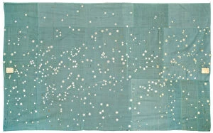
Background imageMapping Collection: Celestial manuscript map, 1863 (cloth, embroidery & pen and ink on paper)

Celestial manuscript map, 1863 (cloth, embroidery & pen and ink on paper)
3482905 Celestial manuscript map, 1863 (cloth, embroidery & pen and ink on paper) by Rogers, Hattie E. (fl.1863-78); 143.5x239 cm; Private Collection; (add.info.: CELESTIAL MANUSCRIPT MAP -- ROGERS)

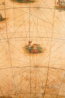
Background imageMapping Collection: Detail of a sea monster from a terrestrial globe, 1645 / 48 (plaster

Detail of a sea monster from a terrestrial globe, 1645 / 48 (plaster
3482879 Detail of a sea monster from a terrestrial globe, 1645/48 (plaster, wood & engraved paper) by Blaeu, Willem (1571-1638); height: 99 cm; Private Collection; (add.info)

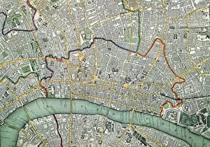
Background imageMapping Collection: Map of London, 1852 (litho)

Map of London, 1852 (litho)
GHL7823 Map of London, 1852 (litho) by Knight, Charles (fl. 1850s); London Metropolitan Archives, City of London; eLondon Metropolitan Archives; British, out of copyright

Background imageMapping Collection: Page 4 View of Porto Santo extending from NNW to WBW distant 5 miles

Page 4 View of Porto Santo extending from NNW to WBW distant 5 miles
5670255 Page 4 View of Porto Santo extending from NNW to WBW distant 5 miles, 1768-75 (pen & ink and wash) by Hodges, William (1744-97); Mitchell Library

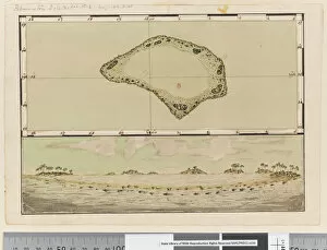
Background imageMapping Collection: Page 25b / a Map and profile of Palmerston Island, 1768-75 (pen & ink and w / c)

Page 25b / a Map and profile of Palmerston Island, 1768-75 (pen & ink and w / c)
5670283 Page 25b/a Map and profile of Palmerston Island, 1768-75 (pen & ink and w/c) by Hodges, William (1744-97); Mitchell Library, State Library of New South Wales; (add.info.: Original Sketches)

Background imageMapping Collection: Philadelphia, 1848 (engraving)

Philadelphia, 1848 (engraving)
5913395 Philadelphia, 1848 (engraving) by American School, (19th century); 19x21 cm; Free Library of Philadelphia; eFree Library of Philadelphia; Map Collection

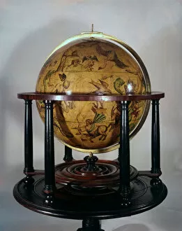
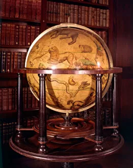
Background imageMapping Collection: Celestial globe with depictions of animals and other creatures representing signs of the zodiac

Celestial globe with depictions of animals and other creatures representing signs of the zodiac
3849532 Celestial globe with depictions of animals and other creatures representing signs of the zodiac by English School, (16th-17th century); Middle Temple, London, UK; Photo © Derek Bayes

Background imageMapping Collection: Celestial globe with depictions of animals and other creatures representing signs of the zodiac

Celestial globe with depictions of animals and other creatures representing signs of the zodiac
3849530 Celestial globe with depictions of animals and other creatures representing signs of the zodiac by English School, (16th-17th century); Middle Temple, London, UK; Photo © Derek Bayes

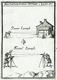
Background imageMapping Collection: Illustration from 'La Geometrie Pratique'1702, (engraving)

Illustration from "La Geometrie Pratique"1702, (engraving)
937189 Illustration from " La Geometrie Pratique" 1702, (engraving) by Mallet, Alain Manesson (1630-1706); Private Collection; (add.info)

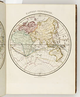
Background imageMapping Collection: Map of the eastern hemisphere, illustration from A journal of a voyage to the South

Map of the eastern hemisphere, illustration from A journal of a voyage to the South
3610754 Map of the eastern hemisphere, illustration from A journal of a voyage to the South Seas : in His Majestys ship, the Endeavour, 1794 (hand-coloured engraving) by Parkinson

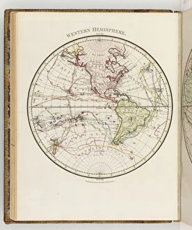
Background imageMapping Collection: Map of the western hemisphere, illustration from A journal of a voyage to the South

Map of the western hemisphere, illustration from A journal of a voyage to the South
3610752 Map of the western hemisphere, illustration from A journal of a voyage to the South Seas : in His Majestys ship, the Endeavour, 1794 (hand-coloured engraving) by Parkinson


For sale as Licensed Images

Choose your image, Select your licence and Download the media

"Exploring the World Through Maps: A Journey of Discovery" Embark on a captivating journey through time and space as we delve into the fascinating world of mapping. From the iconic Wimbledon tennis complex in the UK to the enchanting Theatre of the Empire of Great Britain, these maps offer glimpses into diverse landscapes and historical narratives. Transport yourself back to 1560 Mexico with Alonso de Santa Cruz's Map of Tenochtitlan, where you can trace the ancient streets and waterways that once thrived in this vibrant city. Or marvel at Durer's intricate world map from 1515, which showcases an era when cartography was still in its infancy but held immense potential for exploration. Step foot onto 16th-century Florence with a meticulously detailed plan that captures every nook and cranny of this Renaissance gem. Meanwhile, an Italian map from 1537 unveils Corfu's allure nestled within Greece's Ionian Sea – a testament to both artistic skill and geographical accuracy. As we venture further into history, a stunning 17th-century European map unfolds before our eyes, revealing political boundaries that have since evolved but continue to shape our present-day understanding. Witness Dubrovnik's pre-1667 earthquake charm through an intricately crafted depiction that preserves its architectural grandeur. The allure extends beyond terrestrial realms as well; explore Bermuda’s beauty through a vividly colored engraving or immerse yourself in Roman glory with "A New Map of the Roman Empire. " These maps not only guide us geographically but also provide insights into cultural heritage and societal dynamics. Finally, let us contemplate White Matter Fibres' artwork from 1930 – an abstract representation reminding us that mapping transcends physical borders too. It invites us to explore neural pathways within our own minds while appreciating how cartography has become intertwined with human cognition throughout history. Intricate lines, vibrant colors, and meticulous details come together on these maps, inviting us to embark on a visual and intellectual adventure.