Surveying Collection (page 3)

"Surveying: Unveiling the Past, Charting the Future" Step into a journey of discovery as we delve into the fascinating world of surveying

Background imageSurveying Collection: King George VI amd Queen Elizabeth, together with Winston Churchill, surveying bomb damage

King George VI amd Queen Elizabeth, together with Winston Churchill, surveying bomb damage
6030257 King George VI amd Queen Elizabeth, together with Winston Churchill, surveying bomb damage, presumably to Buckingham Palace (b/w photo) by English Photographer

Background imageSurveying Collection: Surveying (engraving)

Surveying (engraving)
5207125 Surveying (engraving) by American School, (19th century); Private Collection; (add.info.: Surveying. Illustration for Farrows Military Encyclopedia by Edwards Farrow (Published by the Author)

Background imageSurveying Collection: The Manner in which to Reduce any sort of Ground to the Surveying Square

The Manner in which to Reduce any sort of Ground to the Surveying Square
498437 The Manner in which to Reduce any sort of Ground to the Surveying Square, illustration from L Agriculture et Maison Rustique by Charles Estienne

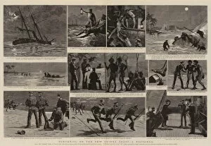
Background imageSurveying Collection: Surveying on the New Guinea Coast, a Nocturne (engraving)

Surveying on the New Guinea Coast, a Nocturne (engraving)
1046889 Surveying on the New Guinea Coast, a Nocturne (engraving) by Nash, Joseph (d.1922); Private Collection; (add.info.: Surveying on the New Guinea Coast, a Nocturne)

Background imageSurveying Collection: Soldiers on horseback surveying Nicopolis (colour litho)

Soldiers on horseback surveying Nicopolis (colour litho)
960181 Soldiers on horseback surveying Nicopolis (colour litho) by Myrbach-Rheinfeld, Felicien baron de (b.1853) (after); Private Collection; (add.info.: Soldiers on horseback surveying Nicopolis)

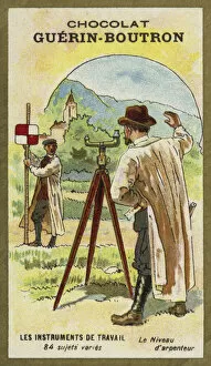
Background imageSurveying Collection: Surveyors level (chromolitho)

Surveyors level (chromolitho)
977696 Surveyors level (chromolitho) by French School, (19th century); Private Collection; (add.info.: Surveyors level. French educational card, late 19th/early 20th century.); © Look and Learn

Background imageSurveying Collection: Napoleon Bonaparte surveying his fleet as they depart from Boulogne (colour litho)

Napoleon Bonaparte surveying his fleet as they depart from Boulogne (colour litho)
725711 Napoleon Bonaparte surveying his fleet as they depart from Boulogne (colour litho) by Job, pseudonym for Onfray de Breville

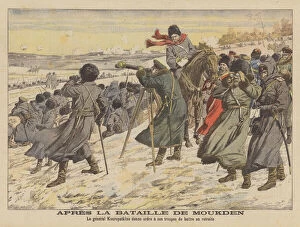
Background imageSurveying Collection: After the Battle of Mukden, Russo-Japanese War (colour litho)

After the Battle of Mukden, Russo-Japanese War (colour litho)
2795925 After the Battle of Mukden, Russo-Japanese War (colour litho) by French School, (20th century); Private Collection; (add.info.: After the Battle of Mukden, Russo-Japanese War)

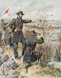
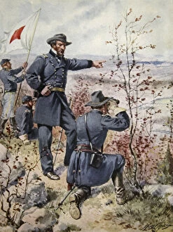
Background imageSurveying Collection: General Sherman at Kenesaw Mountain during the Battle of Allatoona Pass, 4th October

General Sherman at Kenesaw Mountain during the Battle of Allatoona Pass, 4th October
KW271371 General Sherman at Kenesaw Mountain during the Battle of Allatoona Pass, 4th October, 1864 (colour lithograph) by Ogden

Background imageSurveying Collection: Architects and surveyors tools, a trompe l oeuil (engraving)

Architects and surveyors tools, a trompe l oeuil (engraving)
STC255693 Architects and surveyors tools, a trompe l oeuil (engraving) by Gucht, Michael van der (1660-1725); Private Collection; (add.info)

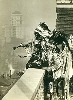
Background imageSurveying Collection: Blackfoot indians on the roof of the McAlpin Hotel, refusing to sleep in their rooms

Blackfoot indians on the roof of the McAlpin Hotel, refusing to sleep in their rooms
NBY259401 Blackfoot indians on the roof of the McAlpin Hotel, refusing to sleep in their rooms, New York City (b/w photo) by American Photographer, (20th century); Newberry Library, Chicago

Background imageSurveying Collection: General Sherman at Kenesaw Mountain during the Battle of Allatoona Pass, 4th October

General Sherman at Kenesaw Mountain during the Battle of Allatoona Pass, 4th October
STC354318 General Sherman at Kenesaw Mountain during the Battle of Allatoona Pass, 4th October, 1864 (colour litho) by Ogden

Background imageSurveying Collection: Ms 327 fol. 218r Measuring a field, from Traite d Arpentage

Ms 327 fol. 218r Measuring a field, from Traite d Arpentage
XIR205402 Ms 327 fol.218r Measuring a field, from Traite d Arpentage by Arnaud de Villeneuve (1240-1312) (vellum) by Boysset, Bertrand (1355-1415); Bibliotheque Inguimbertine, Carpentras

Background imageSurveying Collection: Remnant of a cadastre (stone)

Remnant of a cadastre (stone)
XIR170468 Remnant of a cadastre (stone) by Gallo-Roman, (2nd century AD); Location Unknown; (add.info.: land information system defining roads)

Background imageSurveying Collection: Portrait of Charles Lee, Rector of Wootton, full length, with a dog, in Wootton Park

Portrait of Charles Lee, Rector of Wootton, full length, with a dog, in Wootton Park
CH451401 Portrait of Charles Lee, Rector of Wootton, full length, with a dog, in Wootton Park, Oxfordshire, 1861 (pencil, pen & ink and w/c on paper) by English School

Background imageSurveying Collection: Nehemiah surveying the ruins of Jerusalem, Nehemiah II, ver 12 (engraving)

Nehemiah surveying the ruins of Jerusalem, Nehemiah II, ver 12 (engraving)
6021696 Nehemiah surveying the ruins of Jerusalem, Nehemiah II, ver 12 (engraving) by English School, (19th century); Private Collection; (add.info.: Nehemiah surveying the ruins of Jerusalem)

Background imageSurveying Collection: Agricultural Education in Victoria, Dookie and Longerenong (b / w photo)

Agricultural Education in Victoria, Dookie and Longerenong (b / w photo)
5988457 Agricultural Education in Victoria, Dookie and Longerenong (b/w photo) by Australian Photographer (20th century); Private Collection; (add.info.: Agricultural Education in Victoria)

Background imageSurveying Collection: Page 37a A Sketch of Block Island, latitude of the South Head 41: 9 N

Page 37a A Sketch of Block Island, latitude of the South Head 41: 9 N
5670302 Page 37a A Sketch of Block Island, latitude of the South Head 41: 9 N, 1768-75 (pen & ink) by Hodges, William (1744-97); Mitchell Library

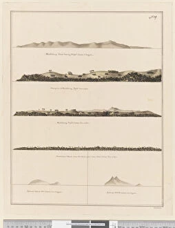
Background imageSurveying Collection: Page 19 (a) Middleburg Island bearing W bys distant 3 leagues (b

Page 19 (a) Middleburg Island bearing W bys distant 3 leagues (b
5670271 Page 19 (a) Middleburg Island bearing W bys distant 3 leagues (b) West point of Middleburg N by W four miles (c) Middleburg E bys distant five miles (d)

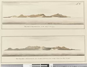
Background imageSurveying Collection: Page 6 Island of Bonavista: 2 Profiles. Titled: Island of Bonavista S. W

Page 6 Island of Bonavista: 2 Profiles. Titled: Island of Bonavista S. W
5670257 Page 6 Island of Bonavista: 2 Profiles. Titled: Island of Bonavista S.W. distant 5 leagues and The Island of Bonavista when the hill A, off which lies a ledge of rocks bears west 2 leagues

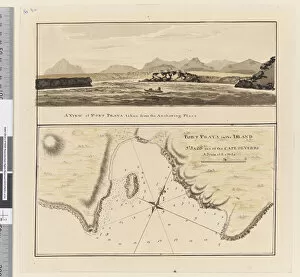
Background imageSurveying Collection: Page 3a Chart of Port Praya in the Island of St Jago, Cape Verde Islands

Page 3a Chart of Port Praya in the Island of St Jago, Cape Verde Islands
5670253 Page 3a Chart of Port Praya in the Island of St Jago, Cape Verde Islands. Titled Port Praya in the Island St Jago one of the Cape de Verds sic A scale of 2 to 1/2 a mile / A View of Port

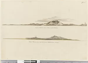
Background imageSurveying Collection: Page 1 (a) Profile of the coast of the Isle of Mayo, Cape Verde Islands

Page 1 (a) Profile of the coast of the Isle of Mayo, Cape Verde Islands
5670251 Page 1 (a) Profile of the coast of the Isle of Mayo, Cape Verde Islands. (b) Profile of the coast of Isle of Mayo Cape Verde Islands, looking north west, 1768-75 (pencil)

Background imageSurveying Collection: iii. Sketches of the islands Lagoon, Thrum-Cap, Bow-Island, the Two Groups

iii. Sketches of the islands Lagoon, Thrum-Cap, Bow-Island, the Two Groups
5670248 iii. Sketches of the islands Lagoon, Thrum-Cap, Bow-Island, the Two Groups, Bird Island and Chain Island, lying in the South, Sea

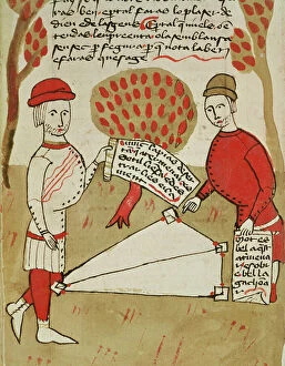
Background imageSurveying Collection: Ms 327 fol. 201v A Surveyor with his Workers, from Traite d Arpentage

Ms 327 fol. 201v A Surveyor with his Workers, from Traite d Arpentage
XIR204983 Ms 327 fol.201v A Surveyor with his Workers, from Traite d Arpentage by Arnaud de Villeneuve (1240-1315) (vellum) by Boysset, Bertrand (1355-1415); Bibliotheque Inguimbertine, Carpentras

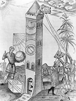
Background imageSurveying Collection: An Illustration from Sebastian Munsters Rudimenta Mathematica

An Illustration from Sebastian Munsters Rudimenta Mathematica
XJF412210 An Illustration from Sebastian Munsters Rudimenta Mathematica, 1551 (engraving) by Swiss School, (16th century); Private Collection; (add.info)

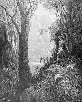
Background imageSurveying Collection: Satan in Paradise, from Book IV of Paradise Lost

Satan in Paradise, from Book IV of Paradise Lost
OTB182316 Satan in Paradise, from Book IV of Paradise Lost by John Milton (1608-74) engraved by Charles Laplante (d.1903) c.1868 (engraving) by Dore

Background imageSurveying Collection: Ms 327 fol. 226v Demarcation of land, from Traite d Arpentage

Ms 327 fol. 226v Demarcation of land, from Traite d Arpentage
XIR205403 Ms 327 fol.226v Demarcation of land, from Traite d Arpentage by Arnaud de Villeneuve (1240-1312) (vellum) by Boysset, Bertrand (1355-1415); Bibliotheque Inguimbertine, Carpentras

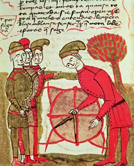
Background imageSurveying Collection: Ms 327 fol. 216v Surveyors working with a plan and compasses

Ms 327 fol. 216v Surveyors working with a plan and compasses
XIR205401 Ms 327 fol.216v Surveyors working with a plan and compasses, from Traite d Arpentage by Arnaud de Villeneuve (1240-1312) (vellum) by Boysset

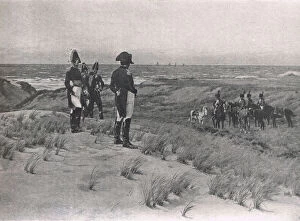
Background imageSurveying Collection: Napoleon Surveys the English Channel, illustration from

Napoleon Surveys the English Channel, illustration from
IL323209 Napoleon Surveys the English Channel, illustration from British Battles on Land and Sea, published by Cassell, London, c.1910 (litho) by Wollen

Background imageSurveying Collection: Frontispiece from La Science de l Arpenteur by Dupain de Montesson (c

Frontispiece from La Science de l Arpenteur by Dupain de Montesson (c
CHT237212 Frontispiece from La Science de l Arpenteur by Dupain de Montesson (c.1720-90) published in Paris, 1766 (engraving) (b/w photo) by French School

Background imageSurveying Collection: Measuring the land using rope, from the Tomb Chapel of Menna

Measuring the land using rope, from the Tomb Chapel of Menna
XIR184029 Measuring the land using rope, from the Tomb Chapel of Menna, New Kingdom (wall painting) (see also 251666) by Egyptian 18th Dynasty (c.1567-1320 BC); Valley of the Nobles, Thebes

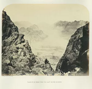
Background imageSurveying Collection: Plain of Er Rahah from the Cleft on Ras Sufsafeh, 1867 (b / w photo)

Plain of Er Rahah from the Cleft on Ras Sufsafeh, 1867 (b / w photo)
809223 Plain of Er Rahah from the Cleft on Ras Sufsafeh, 1867 (b/w photo) by English Photographer, (19th century); Palestine Exploration Fund, London, UK; ePalestine Exploration Fund; English

Background imageSurveying Collection: Stephensons map of the Liverpool & Manchester Railway, c. 1824-1830 (colour litho)

Stephensons map of the Liverpool & Manchester Railway, c. 1824-1830 (colour litho)
3697584 Stephensons map of the Liverpool & Manchester Railway, c.1824-1830 (colour litho) by English School, (19th century); Private Collection; (add.info)

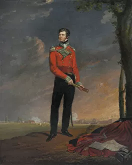
Background imageSurveying Collection: Major Sir Neil Campbell, 1819 (oil on canvas)

Major Sir Neil Campbell, 1819 (oil on canvas)
1268460 Major Sir Neil Campbell, 1819 (oil on canvas) by Pingret, Edouard (1788-1875); National Army Museum, London; (add.info.: Known as The man who let Boney go)

Background imageSurveying Collection: The Theodolite and other Surveryors Instruments (engraving)

The Theodolite and other Surveryors Instruments (engraving)
2603402 The Theodolite and other Surveryors Instruments (engraving) by Unknown artist, (18th century); Private Collection; out of copyright

Background imageSurveying Collection: The Land of the Golden Nugget, Hampton Plains (engraving)

The Land of the Golden Nugget, Hampton Plains (engraving)
1100428 The Land of the Golden Nugget, Hampton Plains (engraving) by Price, Julius Mandes (1857-1924); Private Collection; (add.info.: The Land of the Golden Nugget, Hampton Plains)

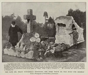
Background imageSurveying Collection: The Late Mr Tracy Turnerelli surveying the Tomb which he had built for himself (b / w photo)

The Late Mr Tracy Turnerelli surveying the Tomb which he had built for himself (b / w photo)
1041921 The Late Mr Tracy Turnerelli surveying the Tomb which he had built for himself (b/w photo) by English photographer

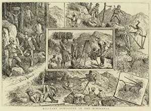
Background imageSurveying Collection: Military surveying in the Himalayas (engraving)

Military surveying in the Himalayas (engraving)
1037897 Military surveying in the Himalayas (engraving) by English School, (19th century); Private Collection; (add.info.: Military surveying in the Himalayas)

Background imageSurveying Collection: Notre Dame, or Double Peak Mountain, Straits of Magellan (engraving)

Notre Dame, or Double Peak Mountain, Straits of Magellan (engraving)
1045336 Notre Dame, or Double Peak Mountain, Straits of Magellan (engraving) by English School, (19th century); Private Collection; (add.info.: Notre Dame, or Double Peak Mountain)

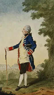
Background imageSurveying Collection: The Baron de Bombelles in the Tuileries, 1765 (black lead, red chalk

The Baron de Bombelles in the Tuileries, 1765 (black lead, red chalk
659249 The Baron de Bombelles in the Tuileries, 1765 (black lead, red chalk, watercolour heightened with white) by Carmontelle

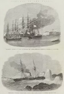
Background imageSurveying Collection: Sketches in the Baltic (engraving)

Sketches in the Baltic (engraving)
1608180 Sketches in the Baltic (engraving) by Carmichael, John Wilson (1800-68); Private Collection; (add.info.: Sketches in the Baltic)

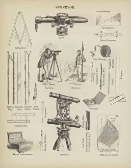
Background imageSurveying Collection: Surveyor (engraving)

Surveyor (engraving)
2802005 Surveyor (engraving) by English School, (19th century); Private Collection; (add.info.: Surveyor. Illustration for An Illustrated Vocabulary For The Use Of The Deaf And Dumb (SPCK)

Background imageSurveying Collection: Mine surveying (chromolitho)

Mine surveying (chromolitho)
3631093 Mine surveying (chromolitho) by English School, (20th century); Private Collection; (add.info.: Mine surveying. Illustration for one of a series of cigarette cards on the subject of mining)

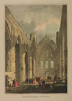
Background imageSurveying Collection: Palace of Westminster, 1834 (colour litho)

Palace of Westminster, 1834 (colour litho)
3102562 Palace of Westminster, 1834 (colour litho) by English School, (19th century); London Metropolitan Archives, City of London; (add.info.: The Palace of Westminster)

Background imageSurveying Collection: Battle of Chillianwala on the 13th of January, 1849 (colour litho)

Battle of Chillianwala on the 13th of January, 1849 (colour litho)
NAM254168 Battle of Chillianwala on the 13th of January, 1849 (colour litho) by Young, Charles Becher (1816-92) (after); National Army Museum

Background imageSurveying Collection: The investment of Port Arthur during the Russo-Japanese War (litho)

The investment of Port Arthur during the Russo-Japanese War (litho)
IL283020 The investment of Port Arthur during the Russo-Japanese War (litho) by Prater, Ernest (fl.1885-1937); Private Collection; (add.info)

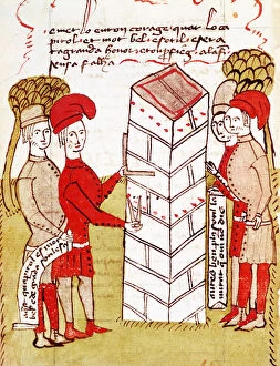
Background imageSurveying Collection: Ms 327 (2) fol. 214v Stonemasons, from Traite d Arpentage

Ms 327 (2) fol. 214v Stonemasons, from Traite d Arpentage
XIR203306 Ms 327 (2) fol.214v Stonemasons, from Traite d Arpentage by Arnaud de Villeneuve (vellum) by Boysset, Bertrand (1355-1415); Bibliotheque Inguimbertine, Carpentras, France; French

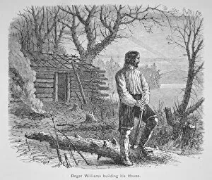
Background imageSurveying Collection: Roger Williams builds a cabin on the Seekonk River (litho)

Roger Williams builds a cabin on the Seekonk River (litho)
PNP377447 Roger Williams builds a cabin on the Seekonk River (litho) by American School; Private Collection; (add.info.: English Protestant theologian Roger Williams (c.1603-83)


For sale as Licensed Images

Choose your image, Select your licence and Download the media

"Surveying: Unveiling the Past, Charting the Future" Step into a journey of discovery as we delve into the fascinating world of surveying. From historic battles to breathtaking landscapes, this captivating practice has shaped our understanding of the world around us. In 1982, during the Falklands War, surveyors played a crucial role in mapping out strategic locations and guiding troops through treacherous terrains. Similarly, in Lord Chelmsford's retreat from Isandhlwana during The Zulu War, surveying knowledge proved vital for navigating challenging landscapes. Travel back to 1872 with Gustave Doré's masterpiece "The New Zealander, " where surveyors meticulously measured and mapped uncharted territories. Their dedication paved the way for exploration and development. Closer to home, Larkswood Lido stands as a testament to meticulous planning by skilled surveyors who ensured every inch was perfectly aligned. Meanwhile, atop Wild Boar Fell in the north Pennines UK stands a trig point—a symbol of precision measurement that aids navigation across vast expanses. Venturing underground reveals surface buildings from Basset Mines in Illogan, Cornwall circa 1906. Surveyors painstakingly documented these structures that once thrived with activity—now preserved as historical landmarks. Alfred Stephenson on Anchorage Island showcases how technology evolved over time. Armed with his trusty theodolite—an instrument used for measuring angles—he captured precise data that contributed to scientific advancements. From ancient times to modern-day practices like PSCI2A-00073, young Washington's career as a surveyor laid foundations for his future leadership role. His experiences honed skills necessary for shaping nations and making history. Beyond measurements lie moments of collaboration; miniature depictions show surveyors sitting in circles during meetings—exchanging ideas and expertise—a tradition carried forward today within this vibrant community. Maps have always been invaluable tools; one such masterpiece is the 1891 color lithograph depicting Africa's treaty boundaries.