Surveying Collection (page 4)

"Surveying: Unveiling the Past, Charting the Future" Step into a journey of discovery as we delve into the fascinating world of surveying

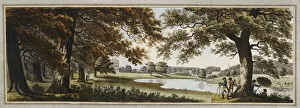
Background imageSurveying Collection: Sketches and Hints on Landscape Gardening, 1794 (aquatint)

Sketches and Hints on Landscape Gardening, 1794 (aquatint)
CH378521 Sketches and Hints on Landscape Gardening, 1794 (aquatint) by Repton, Humphry (1752-1818); 25.9x36 cm; Private Collection; (add.info.: from REPTON, Humphry)

Background imageSurveying Collection: Emperor Hirohito reviewing his troops (b / w photo)

Emperor Hirohito reviewing his troops (b / w photo)
PNP364521 Emperor Hirohito reviewing his troops (b/w photo) by Japanese Photographer (20th century); Private Collection; (add.info.: Hirohito, or Emperor Showa (1901-89)

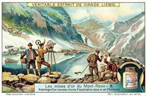
Background imageSurveying Collection: Survey of a new mining site (chromolitho)

Survey of a new mining site (chromolitho)
2788900 Survey of a new mining site (chromolitho) by European School, (19th century); Private Collection; (add.info.: Survey of a new mining site)

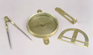
Background imageSurveying Collection: Surveyors Tools (brass)

Surveyors Tools (brass)
AKM210020 Surveyors Tools (brass) by American School, (17th century); Philadelphia History Museum at the Atwater Kent; (add.info)

Background imageSurveying Collection: Page 4 View of Porto Santo extending from NNW to WBW distant 5 miles

Page 4 View of Porto Santo extending from NNW to WBW distant 5 miles
5670255 Page 4 View of Porto Santo extending from NNW to WBW distant 5 miles, 1768-75 (pen & ink and wash) by Hodges, William (1744-97); Mitchell Library

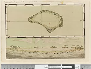
Background imageSurveying Collection: Page 25b / a Map and profile of Palmerston Island, 1768-75 (pen & ink and w / c)

Page 25b / a Map and profile of Palmerston Island, 1768-75 (pen & ink and w / c)
5670283 Page 25b/a Map and profile of Palmerston Island, 1768-75 (pen & ink and w/c) by Hodges, William (1744-97); Mitchell Library, State Library of New South Wales; (add.info.: Original Sketches)

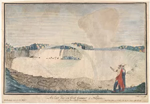
Background imageSurveying Collection: An East View of the Great Cataract of Niagara, 1762 (w / c)

An East View of the Great Cataract of Niagara, 1762 (w / c)
5926986 A An East View of the Great Cataract of NiagaraA, 1762 (w/c) by Davies, Thomas (c.1737-1812); National Army Museum, London; (add.info.: A An East View of the Great Cataract of NiagaraA, 1762)

Background imageSurveying Collection: Passing the Rubicon, c. 1853 (lithograph printed in colours)

Passing the Rubicon, c. 1853 (lithograph printed in colours)
828375 Passing the Rubicon, c.1853 (lithograph printed in colours) by Heine, Peter Bernhard Wilhelm (1827-85); 69.8x97.1 cm; Private Collection; (add.info.: Passing the Rubicon. Lieut. S)

Background imageSurveying Collection: Among the many new applications that lie ahead for airplanes in peacetime... (colour litho)

Among the many new applications that lie ahead for airplanes in peacetime... (colour litho)
2808832 Among the many new applications that lie ahead for airplanes in peacetime... (colour litho) by Beltrame, Achille (1871-1945); Private Collection; (add.info)

Background imageSurveying Collection: The Obelisk from the Circus of Sallustius, 1833 (etching with brown wash)

The Obelisk from the Circus of Sallustius, 1833 (etching with brown wash)
STC384857 The Obelisk from the Circus of Sallustius, 1833 (etching with brown wash) by Tofanelli, Agostino (1770-1834); Private Collection; (add.info)

Background imageSurveying Collection: The Arch of Janus: Excavation of the Forum Boarium, 1833 (etching with brown wash)

The Arch of Janus: Excavation of the Forum Boarium, 1833 (etching with brown wash)
STC384850 The Arch of Janus: Excavation of the Forum Boarium, 1833 (etching with brown wash) by Tofanelli, Agostino (1770-1834); Private Collection; (add.info.: Arc de Janus. Forum Boarium)

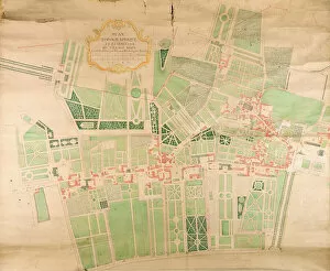
Background imageSurveying Collection: N / 11 / Seine / 87 Topographical Map and Survey of the Village of Issy, 1740 (pen

N / 11 / Seine / 87 Topographical Map and Survey of the Village of Issy, 1740 (pen
ARH418421 N/11/Seine/87 Topographical Map and Survey of the Village of Issy, 1740 (pen, ink & w/c on paper) by Borde, Bernard (fl.1740); 198 x 184 cm; Centre Historique des Archives Nationales

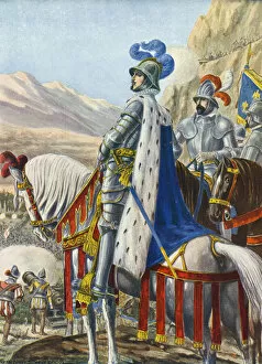
Background imageSurveying Collection: King Francis I of France surveying the Alps on 15 August 1515

King Francis I of France surveying the Alps on 15 August 1515
LLM461661 King Francis I of France surveying the Alps on 15 August 1515 by Scarpelli, Tancredi (1866-1937); Private Collection; (add.info)

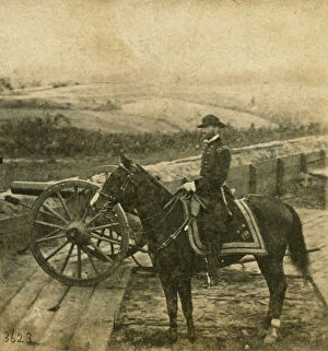
Background imageSurveying Collection: Major General W. T. Sherman and horse, 1864 (b / w photo)

Major General W. T. Sherman and horse, 1864 (b / w photo)
NYH258389 Major General W.T. Sherman and horse, 1864 (b/w photo) by Brady, Mathew (1823-96); Collection of the New-York Historical Society

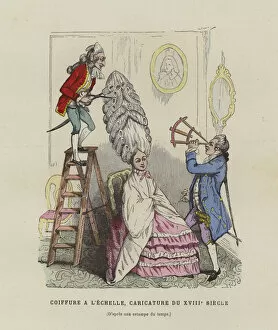
Background imageSurveying Collection: Caricature on French womens hairstyles of the 18th Century (coloured engraving)

Caricature on French womens hairstyles of the 18th Century (coloured engraving)
977737 Caricature on French womens hairstyles of the 18th Century (coloured engraving) by French School, (19th century); Private Collection; (add.info)

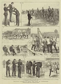
Background imageSurveying Collection: Military Career of HRH the Duke of Connaught (engraving)

Military Career of HRH the Duke of Connaught (engraving)
1058784 Military Career of HRH the Duke of Connaught (engraving) by Corbould, Alfred Chantrey (1852-1920); Private Collection; (add.info.: Military Career of HRH the Duke of Connaught)

Background imageSurveying Collection: Cadet Life at Woolwich, surveying (engraving)

Cadet Life at Woolwich, surveying (engraving)
1058957 Cadet Life at Woolwich, surveying (engraving) by English School, (19th century); Private Collection; (add.info.: Cadet Life at Woolwich, surveying)

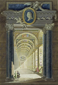
Background imageSurveying Collection: Frontispiece with a medallion portrait of Raphael (1483-1520)

Frontispiece with a medallion portrait of Raphael (1483-1520)
STC176448 Frontispiece with a medallion portrait of Raphael (1483-1520), from Delle Loggie di Rafaele nel Vaticano, engraved by Giovanni Volpato (1735-1803)

Background imageSurveying Collection: Page 25b / c Profile of unidentified island, 1768-75 (pen & ink and wash)

Page 25b / c Profile of unidentified island, 1768-75 (pen & ink and wash)
5670285 Page 25b/c Profile of unidentified island, 1768-75 (pen & ink and wash) by Hodges, William (1744-97); Mitchell Library, State Library of New South Wales; (add.info.: Original Sketches)

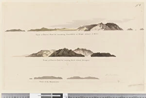
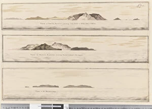
Background imageSurveying Collection: Page 8 (a) View of Porto Santo extending from NNW to WBN distant 5 miles (b

Page 8 (a) View of Porto Santo extending from NNW to WBN distant 5 miles (b
5670259 Page 8 (a) View of Porto Santo extending from NNW to WBN distant 5 miles (b) View of Porto Santo bearing north distant 2 leagues and (c) View of The Deserters, 1768-75 by Hodges

Background imageSurveying Collection: ii. (a) Four profiles of the coast of Terra del Fuego (b

ii. (a) Four profiles of the coast of Terra del Fuego (b
5670247 ii. (a) Four profiles of the coast of Terra del Fuego (b) A plan of Success Bay in Strait le Maire (c) A chart of the S.E. part of Terra del Fuego, engraved by T. Borven and J

Background imageSurveying Collection: The Hop Bitters Worlds Regatta (engraving)

The Hop Bitters Worlds Regatta (engraving)
1616205 The Hop Bitters Worlds Regatta (engraving) by English School, (19th century); Private Collection; (add.info.: The Hop Bitters Worlds Regatta)

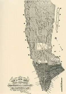
Background imageSurveying Collection: Commissioners Map of Manhattan, 1811 (b / w engraving)

Commissioners Map of Manhattan, 1811 (b / w engraving)
3034969 Commissioners Map of Manhattan, 1811 (b/w engraving) by American School, (19th century); (add.info.: The Commissioners Map of Manhattan)

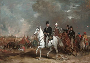
Background imageSurveying Collection: The Viscount Hardinge, Governor-general of India, accompanied by his two sons

The Viscount Hardinge, Governor-general of India, accompanied by his two sons
CH433416 The Viscount Hardinge, Governor-general of India, accompanied by his two sons and Colonel Wood, on the battlefield of Ferozeshah (oil on canvas) by Grant

Background imageSurveying Collection: Plumb bobs (ivory & silver) (see also 701108)

Plumb bobs (ivory & silver) (see also 701108)
701087 Plumb bobs (ivory & silver) (see also 701108) by European School, (19th century); David Russell Collection; (add.info.: These bobs with unmarked silver points are adorned with piquework)

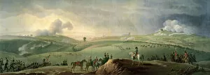
Background imageSurveying Collection: Napoleon I (1769-1821) Observing the Battle of Austerlitz

Napoleon I (1769-1821) Observing the Battle of Austerlitz
PLT208484 Napoleon I (1769-1821) Observing the Battle of Austerlitz, 2nd December 1805 (oil on canvas) by Swebach, Jacques Francois Joseph (1769-1823); Musee de l Armee, Brussels

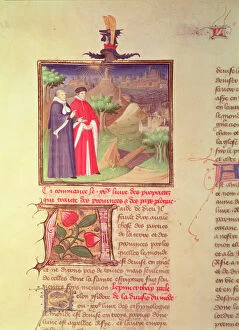
Background imageSurveying Collection: Ms Fr 9141 fol. 217v Scholar and Nobleman, from Livre des Proprietes des Choses

Ms Fr 9141 fol. 217v Scholar and Nobleman, from Livre des Proprietes des Choses
PHD30929 Ms Fr 9141 fol.217v Scholar and Nobleman, from Livre des Proprietes des Choses by Barthelemy l Anglais, c.1405 (vellum) by Boucicaut Master

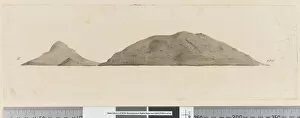
Background imageSurveying Collection: Page 25b / d Profile of unidentified island, 1768-75 (pen & ink and wash)

Page 25b / d Profile of unidentified island, 1768-75 (pen & ink and wash)
5670286 Page 25b/d Profile of unidentified island, 1768-75 (pen & ink and wash) by Hodges, William (1744-97); Mitchell Library, State Library of New South Wales; (add.info.: Original Sketches)

Background imageSurveying Collection: Page 7 (a) View of Porto Santo. Titled in ink along lower edge

Page 7 (a) View of Porto Santo. Titled in ink along lower edge
5670258 Page 7 (a) View of Porto Santo. Titled in ink along lower edge View of Porto Santo extending from NNW to WBW distant 5 miles (b) View of Porto Santo bearing north

Background imageSurveying Collection: Page 5 View of Porto Santo bearing North distant 2 Leagues, 1768-75 (pen & ink and wash)

Page 5 View of Porto Santo bearing North distant 2 Leagues, 1768-75 (pen & ink and wash)
5670256 Page 5 View of Porto Santo bearing North distant 2 Leagues, 1768-75 (pen & ink and wash) by Hodges, William (1744-97); Mitchell Library

Background imageSurveying Collection: ia. A Plan of the Harbour of St Johns in Newfoundland, 1760s (pen & ink and wash)

ia. A Plan of the Harbour of St Johns in Newfoundland, 1760s (pen & ink and wash)
5670245 ia. A Plan of the Harbour of St Johns in Newfoundland, 1760s (pen & ink and wash) by Cook, James (1728-79); Mitchell Library, State Library of New South Wales; (add.info.: Original Sketches)

Background imageSurveying Collection: Page 38b The Track of His Majestys ship Perseverance between Rutland

Page 38b The Track of His Majestys ship Perseverance between Rutland
5670306 Page 38b The Track of His Majestys ship Perseverance between Rutland and the Cinque Islands (pen & ink) by Unknown artist, (18th century); Mitchell Library

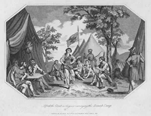
Background imageSurveying Collection: Alfred the Great in disguise surveying the Danish Camp (engraving)

Alfred the Great in disguise surveying the Danish Camp (engraving)
5220760 Alfred the Great in disguise surveying the Danish Camp (engraving) by English School, (19th century); Private Collection; (add.info.: Alfred the Great in disguise surveying the Danish Camp)

Background imageSurveying Collection: Nehemiah (engraving)

Nehemiah (engraving)
816494 Nehemiah (engraving) by French School, (19th century); Private Collection; (add.info.: Nehemiah Surveying the Ruins of Jerusalem)

Background imageSurveying Collection: Members of the Sinai Survey Expedition, 1868 (b / w photo)

Members of the Sinai Survey Expedition, 1868 (b / w photo)
809222 Members of the Sinai Survey Expedition, 1868 (b/w photo) by English Photographer, (19th century); Palestine Exploration Fund, London, UK; (add.info.: left to right: Lance Corporal J)

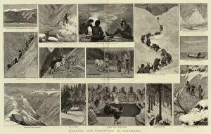
Background imageSurveying Collection: Hunting and Surveying in Cashmere (engraving)

Hunting and Surveying in Cashmere (engraving)
1038183 Hunting and Surveying in Cashmere (engraving) by English School, (19th century); Private Collection; (add.info.: Hunting and Surveying in Cashmere)

Background imageSurveying Collection: Surveying in Upper Burma (engraving)

Surveying in Upper Burma (engraving)
1050321 Surveying in Upper Burma (engraving) by Ralston, William (1848-1911) (after); Private Collection; (add.info.: Surveying in Upper Burma)

Background imageSurveying Collection: The Afghan War (engraving)

The Afghan War (engraving)
1058762 The Afghan War (engraving) by English School, (19th century); Private Collection; (add.info.: The Afghan War. Illustration for The Graphic)

Background imageSurveying Collection: A Right-of-Way dispute at Whitby, the Reverend Haydn Williams surveying the Scene after

A Right-of-Way dispute at Whitby, the Reverend Haydn Williams surveying the Scene after the Demolition of the Railings
1047973 A Right-of-Way dispute at Whitby, the Reverend Haydn Williams surveying the Scene after the Demolition of the Railings (litho) by English School

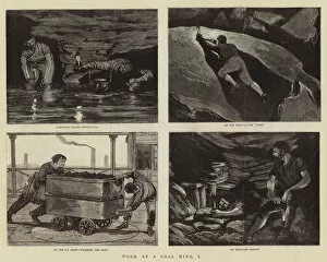
Background imageSurveying Collection: Work at a Coal Mine, I (engraving)

Work at a Coal Mine, I (engraving)
1059871 Work at a Coal Mine, I (engraving) by Nash, Joseph (d.1922); Private Collection; (add.info.: Work at a Coal Mine, I)

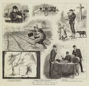
Background imageSurveying Collection: The Annual Field Sketch (engraving)

The Annual Field Sketch (engraving)
1061960 The Annual Field Sketch (engraving) by English School, (19th century); Private Collection; (add.info.: The Annual Field Sketch)

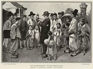
Background imageSurveying Collection: With a Survey Party in Korea (litho)

With a Survey Party in Korea (litho)
1040750 With a Survey Party in Korea (litho) by Browne, Gordon Frederick (1858-1932) (after); Private Collection; (add.info.: With a Survey Party in Korea)

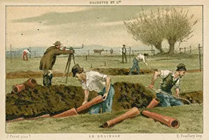
Background imageSurveying Collection: Drainage (colour litho)

Drainage (colour litho)
982609 Drainage (colour litho) by French School, (19th century); Private Collection; (add.info.: Drainage.); Look and Learn / Valerie Jackson Harris Collection

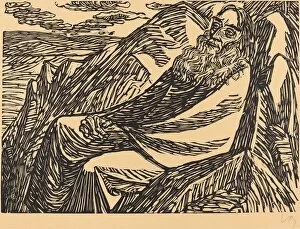
Background imageSurveying Collection: The Seventh Day, 1920. Creator: Ernst Barlach

The Seventh Day, 1920. Creator: Ernst Barlach
The Seventh Day, 1920

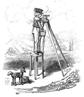
Background imageSurveying Collection: Boy using surveying instrument, 1845. Creator: Alfred Crowquill

Boy using surveying instrument, 1845. Creator: Alfred Crowquill
Boy using surveying instrument, 1845. Illustration to Railway Mania, a story by Alfred Crowquill, a satire on the obsession with the railways

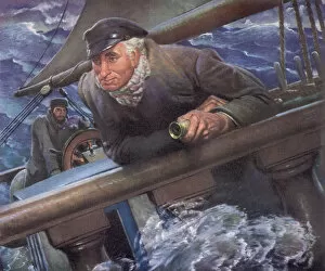
Background imageSurveying Collection: Calm Captain in Storm Date: 1947

Calm Captain in Storm Date: 1947

Background imageSurveying Collection: Elderly Couple on Christmas Morn

Elderly Couple on Christmas Morn

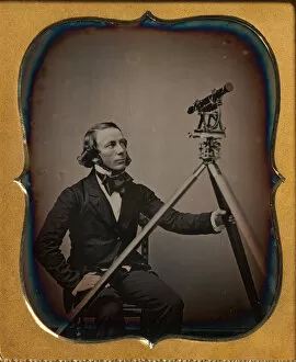
Background imageSurveying Collection: Surveyor, ca. 1854. Creator: Unknown

Surveyor, ca. 1854. Creator: Unknown
Surveyor, ca. 1854


For sale as Licensed Images

Choose your image, Select your licence and Download the media

"Surveying: Unveiling the Past, Charting the Future" Step into a journey of discovery as we delve into the fascinating world of surveying. From historic battles to breathtaking landscapes, this captivating practice has shaped our understanding of the world around us. In 1982, during the Falklands War, surveyors played a crucial role in mapping out strategic locations and guiding troops through treacherous terrains. Similarly, in Lord Chelmsford's retreat from Isandhlwana during The Zulu War, surveying knowledge proved vital for navigating challenging landscapes. Travel back to 1872 with Gustave Doré's masterpiece "The New Zealander, " where surveyors meticulously measured and mapped uncharted territories. Their dedication paved the way for exploration and development. Closer to home, Larkswood Lido stands as a testament to meticulous planning by skilled surveyors who ensured every inch was perfectly aligned. Meanwhile, atop Wild Boar Fell in the north Pennines UK stands a trig point—a symbol of precision measurement that aids navigation across vast expanses. Venturing underground reveals surface buildings from Basset Mines in Illogan, Cornwall circa 1906. Surveyors painstakingly documented these structures that once thrived with activity—now preserved as historical landmarks. Alfred Stephenson on Anchorage Island showcases how technology evolved over time. Armed with his trusty theodolite—an instrument used for measuring angles—he captured precise data that contributed to scientific advancements. From ancient times to modern-day practices like PSCI2A-00073, young Washington's career as a surveyor laid foundations for his future leadership role. His experiences honed skills necessary for shaping nations and making history. Beyond measurements lie moments of collaboration; miniature depictions show surveyors sitting in circles during meetings—exchanging ideas and expertise—a tradition carried forward today within this vibrant community. Maps have always been invaluable tools; one such masterpiece is the 1891 color lithograph depicting Africa's treaty boundaries.