Surveying Collection (page 9)

"Surveying: Unveiling the Past, Charting the Future" Step into a journey of discovery as we delve into the fascinating world of surveying

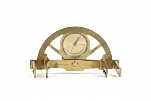
Background imageSurveying Collection: 19th Century graphometer

19th Century graphometer. A graphometer is a surveying instrument used for angle measurements. Made in 1850

Background imageSurveying Collection: Julius Hilgard, German-US surveyor

Julius Hilgard, German-US surveyor
Julius Erasmus Hilgard (1825-1890), German-US surveyor. Hilgard and his family settled in rural Illinois in 1835. After studying engineering

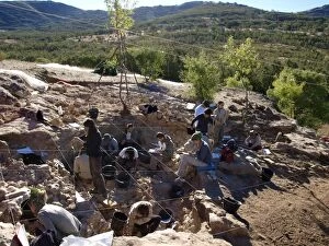
Background imageSurveying Collection: Neanderthal excavation, Pinilla del Valle C015 / 6589

Neanderthal excavation, Pinilla del Valle C015 / 6589
Neanderthal excavation. Researchers carrying out excavations for prehistoric human fossils at the Pinilla del Valle site, in the Lozoya Valley, near Madrid, Spain

Background imageSurveying Collection: Von Neumann probe at planet, artwork C015 / 0805

Von Neumann probe at planet, artwork C015 / 0805
Von Neumann probe at planet. Artwork of a self-replicating spacecraft (upper left) exploring a distant alien world. This type of self-replicating spacecraft

Background imageSurveying Collection: Extrasolar planetary probe, artwork C015 / 0791

Extrasolar planetary probe, artwork C015 / 0791
Extrasolar planetary probe. Artwork of a spacecraft probe orbiting a dead extrasolar planet. In the future, deep space probes may be launched on interstellar missions to explore planets found around

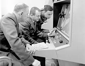
Background imageSurveying Collection: Cuban Missile Crisis of 1962, analysis C016 / 4236

Cuban Missile Crisis of 1962, analysis C016 / 4236
Cuban Missile Crisis. Strategic Air Command (SAC) photo interpreters using a magnifying and mapping machine to examine aerial reconnaissance images of Cuba, obtained in 1962

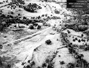
Background imageSurveying Collection: Cuban Missile Crisis of 1962, aerial view C016 / 4235

Cuban Missile Crisis of 1962, aerial view C016 / 4235
Cuban Missile Crisis. Aerial photograph of one of the nuclear missile sites (San Cristobal launch site 2), constructed in Cuba by Soviet forces, that precipitated the Cuban Missile Crisis of 1962

Background imageSurveying Collection: Abandoned British trench, World War I C016 / 2542

Abandoned British trench, World War I C016 / 2542
Abandoned British trench, World War I. Remains of an abandoned British trench being inspected by German staff officers on horseback

Background imageSurveying Collection: Gold detector, 1893

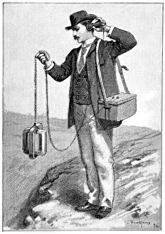
Gold detector, 1893
Gold detector, 19th-century artwork. Artwork from the 11th volume (first period of 1893) of the French popular science weekly La Science Illustree

Background imageSurveying Collection: Spy books, conceptual artwork

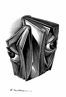
Spy books, conceptual artwork
Spy books. Conceptual artwork of eyes peering out of books. This can represent subjects such as espionage, state surveillance, and invasion of privacy

Background imageSurveying Collection: Fuegians going to trade with Patagonians in Zapallos

Fuegians going to trade with Patagonians in Zapallos

Background imageSurveying Collection: Practical Geometry by Allain Manesson Mallet

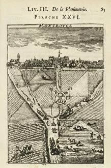
Practical Geometry by Allain Manesson Mallet
" Practical Geometry" by Allain Manesson Mallet. Fol. 85 depicting the surveying of fields (1702). Engraving. FRANCE. Paris. National Library."

Background imageSurveying Collection: Arnaldus de Villa Nova (1240 - 1312); BOYSSET

Arnaldus de Villa Nova (1240 - 1312); BOYSSET, Bertrand (1355-1415). Surveying treaty. 1250 - 1312. Surveying and demarcation of land. Illustration of Boysset. Ms 327 fol.28r. Gothic art

Background imageSurveying Collection: View of San Francisco, California: taken from Telegraph Hill

View of San Francisco, California: taken from Telegraph Hill, April 1850, by Wm. B. McMurtrie, draughtsman of the U.S. Surveying Expedition. Date c1851

Background imageSurveying Collection: Defending Law and Order

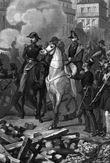
Defending Law and Order
Generals Cavaignac and Lamoriciere ride through the streets of Paris, surveying the damage and debating how to deal with the insurrection. Date: 22 June 1848

Background imageSurveying Collection: World War Two Bomb Damage

World War Two Bomb Damage
A couple survey the damage caused by a bomb dropped on the UK during World War Two. Date: circa 1942

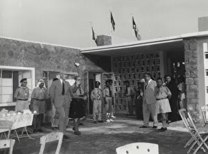
Background imageSurveying Collection: Sir Richard Turnbull inspecting Scout quadrangle

Sir Richard Turnbull inspecting Scout quadrangle
Sir Richard Turnbull, G.C.M.G. Chief Scout for Scouts Arabia, inspects the quadrangle of the new Headquarters of the South Arabian Boy Scouts Association in Aden. circa 1966

Background imageSurveying Collection: Officials inspecting Scout headquarters

Officials inspecting Scout headquarters
Sir Richard Turnbull, G.C.M.G. Chief Scout of Aden, led by the Chief Commissioner, Mr J.J. Greene O.B.E. inspecting the new Headquarters of the South Arabian Boy Scouts Association. circa 1966

Background imageSurveying Collection: Surveying in Afghanistan

Surveying in Afghanistan
A mile-measuring machine (perambulator) being used by the Afghan Boundary Commission. Date: circa 1884

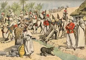
Background imageSurveying Collection: French Survey Algeria

French Survey Algeria
The French whilst surveying the Sahara, stop for refreshment at an oasis Date: 1906

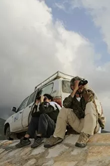
Background imageSurveying Collection: Ornithologists with binoculars, surveying birds along road, Socotra, Yemen, december

Ornithologists with binoculars, surveying birds along road, Socotra, Yemen, december

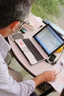
Background imageSurveying Collection: Researcher plotting survey data on GIS software, Socotra, Yemen, december

Researcher plotting survey data on GIS software, Socotra, Yemen, december

Background imageSurveying Collection: Conservation workers netting river during survey, River Wensum, Norfolk, England, september

Conservation workers netting river during survey, River Wensum, Norfolk, England, september

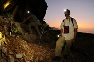
Background imageSurveying Collection: Researchers exploring desert during night survey, Socotra, Yemen, march

Researchers exploring desert during night survey, Socotra, Yemen, march

Background imageSurveying Collection: Researchers explaining to local people purpose of survey on island, Abd el-Kuri Island, Socotra

Researchers explaining to local people purpose of survey on island, Abd el-Kuri Island, Socotra, Yemen, april

Background imageSurveying Collection: Ornithologists with binoculars, surveying birds in wadi along road, Socotra, Yemen, december

Ornithologists with binoculars, surveying birds in wadi along road, Socotra, Yemen, december

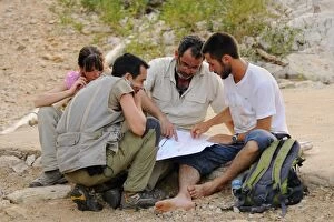
Background imageSurveying Collection: Researchers looking at map in desert, Socotra, Yemen, march

Researchers looking at map in desert, Socotra, Yemen, march

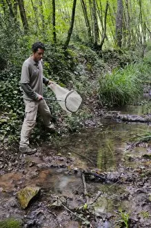
Background imageSurveying Collection: Enthomologist catching insects with net along stream during survey, Italy, june

Enthomologist catching insects with net along stream during survey, Italy, june

Background imageSurveying Collection: Surveillance cameras, computer artwork

Surveillance cameras, computer artwork. Closed-circuit television (CCTV) cameras can record images, which are relayed to surveillance monitors in a central security control room

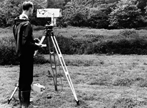
Background imageSurveying Collection: Mekometre surveying, 1967

Mekometre surveying, 1967
Mekometre surveying. Surveyor using a mekometre, an instrument used to measure long distances at extremely high resolution

Background imageSurveying Collection: Waste water outfalls

Waste water outfalls
Waste water flowing from an outlet pipe. Rigorous tests are conducted on this waste water by the refinery, to ensure that it is clean enough to join unpolluted water sources

Background imageSurveying Collection: Climbing a ladder

Climbing a ladder. Worker using a ladder to reach the roof of a building. Rooftop workers include surveyors, construction workers and building inspectors

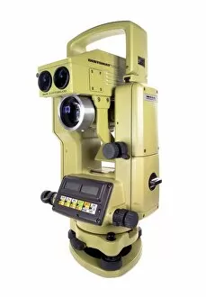
Background imageSurveying Collection: Theodolite

Theodolite. A theodolite is an engineering instrument used for measuring both horizontal and vertical angles

Background imageSurveying Collection: Brain scanning, conceptual artwork

Brain scanning, conceptual artwork. This may represent the brain being scanned by a CT (computed tomography) or MRI (magnetic resonance imaging) scanner

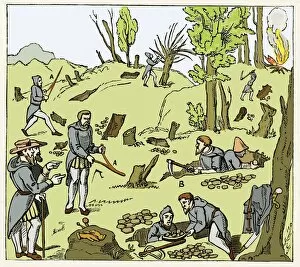
Background imageSurveying Collection: Diviners finding minerals

Diviners finding minerals. Artwork of divining rods being used to search for underground minerals during the 16th century. Diviners are using forked, wooden rods at centre left and upper left

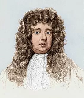
Background imageSurveying Collection: Sir William Petty, English physician

Sir William Petty, English physician
Sir William Petty (1623-1687), English physician, surveyor and ship designer. Born in Hampshire, England, Petty travelled to France to study at the age of 13

Background imageSurveying Collection: Map wheel

Map wheel. This device is used to measure out distances on a map. The route is traced using the wheel, which moves the pointer (top centre). The distance traced is read out from the dial

Background imageSurveying Collection: Dredging New York, 19th century

Dredging New York, 19th century
Dredging New York harbour. The steamboat at left is using an apparatus suspended below it to survey the harbour floor and take soundings to determine which areas need dredging

Background imageSurveying Collection: Naval observation balloon, 19th century

Naval observation balloon, 19th century artwork. The balloon (upper right) is tethered to the ship below, and is being used to survey the movement of enemy ships and forces

Background imageSurveying Collection: Iron distribution map, Barringer Crater

Iron distribution map, Barringer Crater
Iron distribution map for Barringer Crater, Arizona, USA, also known as Meteor Crater. A six-mile (9.65-kilometre) radius circle, centred on the crater

Background imageSurveying Collection: Woodcut of a cosmolabe

Woodcut of a cosmolabe
Cosmolabe. 16th century woodcut illustration showing a cosmolabe. A cosmolabe is an instrument similar to an astrolabe used to measure angles between celestial objects

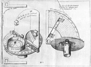
Background imageSurveying Collection: Pantometer, 16th Century

Pantometer, 16th Century
Pantometer. 16th century engraving showing the design of a pantometer. This is used to determine the bearing and elevation to a given point

Background imageSurveying Collection: Surveyor at work with a theodolite

Surveyor at work with a theodolite
A surveyor at work with a theodolite level

Background imageSurveying Collection: Policemen on a stake-out

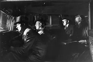
Policemen on a stake-out
Non-uniformed police officers and detectives on a stake-out sit in a large unmarked car, watching and waiting

Background imageSurveying Collection: Cavaignac in Paris

Cavaignac in Paris
Cavaignac, in charge of maintaining order in Paris, tours the city with Lamartine, Pierre Napoleon (son of Lucien) and their entourage, surveying the damage

Background imageSurveying Collection: The Civil war in America; aftermath of the battle at Fort Wa

The Civil war in America; aftermath of the battle at Fort Wa
Confederate soldiers surveying the damage after the battle at Fort Wagner, South Carolina. The Black regiment of the 54th Massachusetts lost 40% of their men here on the 18th July 1863. Date: 1863

Background imageSurveying Collection: Zulu war sketches by our special artist. Interior of the old

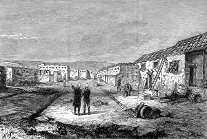
Zulu war sketches by our special artist. Interior of the old
British soldiers surveying the damage to the old fort at Rorkes Drift, where 137 British soldiers held out against 3, 000 zulus at the beginning of the Zulu wars

Background imageSurveying Collection: Gold at Monte Rosa 2

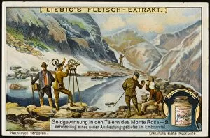
Gold at Monte Rosa 2
Surveying the valleys


For sale as Licensed Images

Choose your image, Select your licence and Download the media

"Surveying: Unveiling the Past, Charting the Future" Step into a journey of discovery as we delve into the fascinating world of surveying. From historic battles to breathtaking landscapes, this captivating practice has shaped our understanding of the world around us. In 1982, during the Falklands War, surveyors played a crucial role in mapping out strategic locations and guiding troops through treacherous terrains. Similarly, in Lord Chelmsford's retreat from Isandhlwana during The Zulu War, surveying knowledge proved vital for navigating challenging landscapes. Travel back to 1872 with Gustave Doré's masterpiece "The New Zealander, " where surveyors meticulously measured and mapped uncharted territories. Their dedication paved the way for exploration and development. Closer to home, Larkswood Lido stands as a testament to meticulous planning by skilled surveyors who ensured every inch was perfectly aligned. Meanwhile, atop Wild Boar Fell in the north Pennines UK stands a trig point—a symbol of precision measurement that aids navigation across vast expanses. Venturing underground reveals surface buildings from Basset Mines in Illogan, Cornwall circa 1906. Surveyors painstakingly documented these structures that once thrived with activity—now preserved as historical landmarks. Alfred Stephenson on Anchorage Island showcases how technology evolved over time. Armed with his trusty theodolite—an instrument used for measuring angles—he captured precise data that contributed to scientific advancements. From ancient times to modern-day practices like PSCI2A-00073, young Washington's career as a surveyor laid foundations for his future leadership role. His experiences honed skills necessary for shaping nations and making history. Beyond measurements lie moments of collaboration; miniature depictions show surveyors sitting in circles during meetings—exchanging ideas and expertise—a tradition carried forward today within this vibrant community. Maps have always been invaluable tools; one such masterpiece is the 1891 color lithograph depicting Africa's treaty boundaries.