Surveying Collection (page 5)

"Surveying: Unveiling the Past, Charting the Future" Step into a journey of discovery as we delve into the fascinating world of surveying

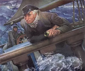
Background imageSurveying Collection: Calm Captain in Storm Date: 1947

Calm Captain in Storm Date: 1947

Background imageSurveying Collection: Elderly Couple on Christmas Morn

Elderly Couple on Christmas Morn

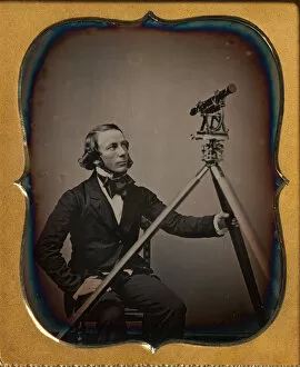
Background imageSurveying Collection: Surveyor, ca. 1854. Creator: Unknown

Surveyor, ca. 1854. Creator: Unknown
Surveyor, ca. 1854

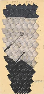
Background imageSurveying Collection: Day 322, Survey U, Sectors 15 and 16, 1967. Creators: NASA

Day 322, Survey U, Sectors 15 and 16, 1967. Creators: NASA
Day 322, Survey U, Sectors 15 and 16, 1967

Background imageSurveying Collection: Return of Commander Selfridge and his Reconnaissance Party from an Expedition in the

Return of Commander Selfridge and his Reconnaissance Party from an Expedition in the Interior of Darien, 1870

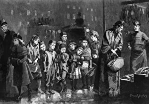
Background imageSurveying Collection: Whats left?, woman and children waiting for leftovers

Whats left?, woman and children waiting for leftovers
A woman and a group of children wait for leftovers at a fishmonger and poulterers shop. A well-to-do mother and daughter are seen leaving the shop

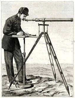
Background imageSurveying Collection: SURVEYING / TELEMETROGRAPH

SURVEYING / TELEMETROGRAPH
TELEMETROGRAPH Date: 1885

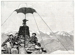
Background imageSurveying Collection: TUNNEL SURVEY / 1906

TUNNEL SURVEY / 1906
Tunnel surveying with a theodolite atop Mount Leone by three intrepid surveyors! Date: 1906

Background imageSurveying Collection: Andreossi Surveys Egypt

Andreossi Surveys Egypt
Comte Andreossi surveys antique sites for Napoleon. Date: 1788

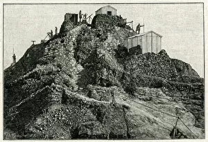
Background imageSurveying Collection: TRIGONOMETRIC SURVEY

TRIGONOMETRIC SURVEY
A Trigonometric survey in North America. Date: circa 1900

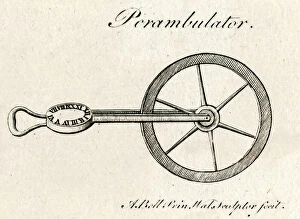
Background imageSurveying Collection: PEDOMETER / PERAMBULATOR

PEDOMETER / PERAMBULATOR
A Perambulator or pedometer. Date: 1797

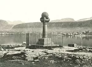
Background imageSurveying Collection: The Meridian Column, Hammerfest, Norway, 1895. Creator: Unknown

The Meridian Column, Hammerfest, Norway, 1895. Creator: Unknown
The Meridian Column, Hammerfest, Norway, 1895. Monument marking the northernmost station of the Struve Geodetic Arc, a chain of survey triangulations

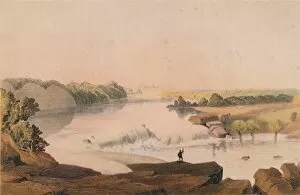
Background imageSurveying Collection: Falls of the Rio Salado, 1857-1859. Creator: Sarony, Major and Knapp

Falls of the Rio Salado, 1857-1859. Creator: Sarony, Major and Knapp
Falls of the Rio Salado, 1857-1859. View of falls on the Rio Salado, a tributary of the Rio Grande, in New Mexico, United States of America

Background imageSurveying Collection: The Obelisk in St. Georges Circus, (c1878). Creator: Unknown

The Obelisk in St. Georges Circus, (c1878). Creator: Unknown
The Obelisk in St. Georges Circus, (c1878). St Georges Circus in Southwark, south London with the obelisk designed by Robert Mylne in his role as surveyor and architect of Blackfriars Bridge

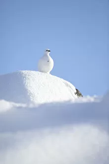
Background imageSurveying Collection: RF- Rock ptarmigan (Lagopus mutus) standing on boulder, camouflaged against snow in winter plumage

RF- Rock ptarmigan (Lagopus mutus) standing on boulder, camouflaged against snow in winter plumage. Cairngorms National Park, Highlands, Scotland, UK, February

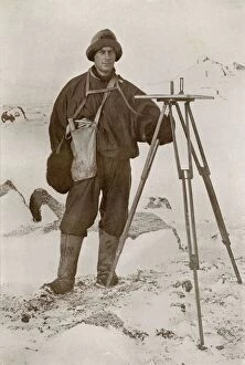
Background imageSurveying Collection: F. Debenham, 9 September 1911, (1913). Artist: Herbert Ponting

F. Debenham, 9 September 1911, (1913). Artist: Herbert Ponting
F. Debenham, 9 September 1911, (1913). Geologist Frank Debenham (1883-1965) with a plane table, used in surveying to provide a solid and level surface on which to make field drawings

Background imageSurveying Collection: The Lower Koettlitz Glacier, 1911, (1913). Artist: Frank Debenham

The Lower Koettlitz Glacier, 1911, (1913). Artist: Frank Debenham
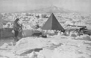
The Lower Koettlitz Glacier, 1911, (1913). Camp in pinnacled ice at mouth of Koettlitz Glacier, geologist Raymond Priestley takes a reading from a piece of scientific equipment on a tripod

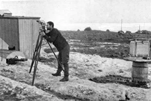
Background imageSurveying Collection: Lieut. E. R. G. R. Evans Surveying With The Four-Inch Theodolite, October 1911, (1913)

Lieut. E. R. G. R. Evans Surveying With The Four-Inch Theodolite, October 1911, (1913)
Lieut. E. R. G. R. Evans Surveying With The Four-Inch Theodolite Which Was Used To Locate The South Pole, October 1911, (1913)

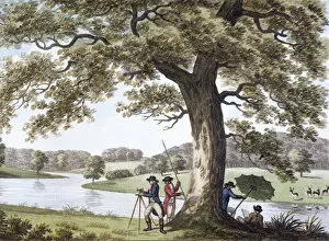
Background imageSurveying Collection: Humphry Repton surveying with a theodolite, late 18th-early19th century

Humphry Repton surveying with a theodolite, late 18th-early19th century. Repton (1752-1818) succeeded Capability Brown as the garden designer of choice for the landed gentry of England

Background imageSurveying Collection: Lieutenant Evans surveying in the Antarctic, 1911-1912. Artist: Herbert Ponting

Lieutenant Evans surveying in the Antarctic, 1911-1912. Artist: Herbert Ponting
Lieutenant Evans surveying in the Antarctic, 1911-1912. Evans using the 4 inch theodolite used to locate the South Pole on Captain Scotts Antarctic expedition of 1910-1913

Background imageSurveying Collection: James Brindley, 18th century English civil engineer and canal builder, (1836). Artist: JT Wedgwood

James Brindley, 18th century English civil engineer and canal builder, (1836). Artist: JT Wedgwood
James Brindley, 18th century English civil engineer and canal builder, (1836). Brindley (1716-1772) rests a hand on a theodolite

Background imageSurveying Collection: Sir Christopher Wren, 1711. Artist: Sir Godfrey Kneller

Sir Christopher Wren, 1711. Artist: Sir Godfrey Kneller
Sir Christopher Wren, 1711. Wren (1632-1723) is best remembered for his rebuilding of St Pauls Cathedral and numerous other churches destroyed in the Great Fire of London (1666)

Background imageSurveying Collection: Albert Borlase Armitage, Scottish polar explorer, c1894-c1897 (1899)

Albert Borlase Armitage, Scottish polar explorer, c1894-c1897 (1899). Artist: Frederick George Jackson
Albert Borlase Armitage, Scottish polar explorer, c1894-c1897 (1899). Armitage (1864-1943) using a sextant while on the Jackson-Harmsworth Expedition to Franz-Josef Land in the Arctic

Background imageSurveying Collection: Crugers azimuth quadrant, 1673 (1956). Artist: A Steck

Crugers azimuth quadrant, 1673 (1956). Artist: A Steck
Crugers azimuth quadrant, 1673 (1956). Peter Cruger (1580-1639) was a German mathematician, astronomer and polymath. He taught the Polish astronomer Johannes Hevelius

Background imageSurveying Collection: Five inch theodolite, 1866

Five inch theodolite, 1866. A print from Cyclopaedia of Useful Arts, Mechanical and Chemical, Manufactures, Mining, and Engineering, edited by Charles Tomlinson, Volume II, Virtue and Co, London, 1866

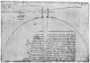
Background imageSurveying Collection: Method of measuring the surface of the Earth, late 15th or early 16th century (1954)

Method of measuring the surface of the Earth, late 15th or early 16th century (1954). Artist: Leonardo da Vinci
Method of measuring the surface of the Earth, late 15th or early 16th century (1954). Codex Atlanticus, 269v-a. A print from Leonardo da Vinci by Ludwig H Heydenreich. (London, 1954)

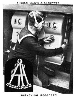
Background imageSurveying Collection: Surveying Recorder, 1937. Artist: WA & AC Churchman

Surveying Recorder, 1937. Artist: WA & AC Churchman
Surveying Recorder, 1937. Churchmans Cigarette Series, The Navy At Work

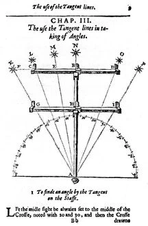
Background imageSurveying Collection: Method of measuring angles with a cross-staff, 1636

Method of measuring angles with a cross-staff, 1636. Edmund Gunter (1581-1626) was an English mathematician and astronomer who invented many measuring instruments which bear his name; Gunters Chain

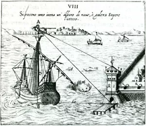
Background imageSurveying Collection: Measuring the distance from ship to shore, using a quadrant marked with shadow-scales, 1598

Measuring the distance from ship to shore, using a quadrant marked with shadow-scales, 1598. From L usa della squadra mobile by Ottavius Fabri. (Venice, 1598)

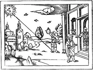
Background imageSurveying Collection: Measuring the altitude of the Sun, 1539

Measuring the altitude of the Sun, 1539. From Cosmographia by Peter Apian. (Antwerp, 1539)

Background imageSurveying Collection: Title page of The Description and Use of the Sector by Edmund Gunter, 1636

Title page of The Description and Use of the Sector by Edmund Gunter, 1636. It shows mariners holding various navigational instruments, including a sector and a cross-staff at the top

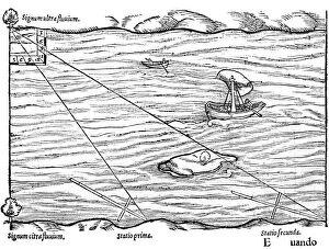
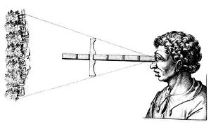
Background imageSurveying Collection: Cross-staffs used for surveying, 1551

Cross-staffs used for surveying, 1551. In this case they are being used to measure the width of a river by triangulation. From Rudimenta Mathematica by Sebastian Munster. (Basel, 1551)

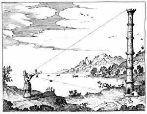
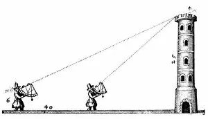
Background imageSurveying Collection: Using a cross-staff to measure the height of a tower, 1617-1619

Using a cross-staff to measure the height of a tower, 1617-1619. From Utriusque cosmi...historia by Robert Fludd. (Oppenheim, 1617-1619)

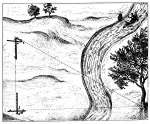
Background imageSurveying Collection: Measuring the distance of an inaccessible object by triangulation using a hinged staff, 1617-1619

Measuring the distance of an inaccessible object by triangulation using a hinged staff, 1617-1619. From Utriusque cosmi...historia by Robert Fludd. (Oppenheim, 1617-1619)

Background imageSurveying Collection: Planimeter used in conjunction with a set square for surveying, 1605

Planimeter used in conjunction with a set square for surveying, 1605. From Instrumentorum Mechanicorum by Levinus Hulsius. (Frankfurt-am-Main, 1605)

Background imageSurveying Collection: A surveyors level, 1547

A surveyors level, 1547. From Architechtur...Mathematischen...Kunst by Gaultherus Rivius. (Nuremberg, 1547)

Background imageSurveying Collection: Forms of astrolabe in use for surveying, 1650

Forms of astrolabe in use for surveying, 1650. Vignette from a multiplication table

Background imageSurveying Collection: Surveying, from Levinus Hulsius Instrumentorum Mechanicorum, Frankfurt-am-Main, 1605

Surveying, from Levinus Hulsius Instrumentorum Mechanicorum, Frankfurt-am-Main, 1605. Artist: Levinus Hulsius
Surveying, from Levinus Hulsius Instrumentorum Mechanicorum, Frankfurt-am-Main, 1605. Top; measuring angles using a quadrant. Bottom; obtaining levels and altitudes using Hulsiuss planimeter

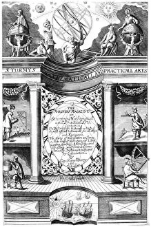
Background imageSurveying Collection: Title page of Samuel Sturmy, Mariners Magazine, London, 1669. Artist: Samuel Sturmy

Title page of Samuel Sturmy, Mariners Magazine, London, 1669. Artist: Samuel Sturmy
Title page of Samuel Sturmy Mariners Magazine, London, 1669. Sturmy (1633-1669) was a sea captain and sailed to the West Indies and Virginia

Background imageSurveying Collection: Surveyors using quadrants to measure the height of a tower, c1617-c1619. Artist: Robert Fludd

Surveyors using quadrants to measure the height of a tower, c1617-c1619. Artist: Robert Fludd
Surveyors using quadrants to measure the height of a tower, 1617-c1619. Quadrants fitted with plumb bobs and marked with shadow scales to measure the height of a tower

Background imageSurveying Collection: Finding the angular distance between two edges of a wood using a cross-staff, 1617-1619

Finding the angular distance between two edges of a wood using a cross-staff, 1617-1619. From Utriusque cosmi...historia by Robert Fludd. (Oppenheim, 1617-1619)

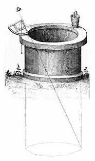
Background imageSurveying Collection: Surveying, early 17th century

Surveying, early 17th century. Method of using a quadrant fitted with a plumb line and marked with shadow scales to measure the depth of a well. From Utriusque cosmi... historia by Robert Fludd

Background imageSurveying Collection: Surveying and timekeeping, 1551

Surveying and timekeeping, 1551. On the left are various different kinds of sundial and a clock with a single arm. On the right a survey is being made of the height of the tower, using quadrants

Background imageSurveying Collection: Surveying, 1551

Surveying, 1551. Obtaining the height of a building by the use of a cross-staff. From Rudimenta Mathematica by Sebastian Munster. (Basel, 1551)

Background imageSurveying Collection: Use of the magnetic compass in map making, 1643

Use of the magnetic compass in map making, 1643. Diagram of the use of the compass by cartographers and surveyors. Bor (Borealis) is north and Aust (Australis) is south

Background imageSurveying Collection: James Rennell, British geographer, 1802

James Rennell, British geographer, 1802. Rennell (1742-1839) was appointed the first surveyor-general of Bengal in 1764. He carried out a survey of Bengal 1765-1771. From The European Magazine

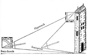
Background imageSurveying Collection: Using a quadrant with a plumb bob to calculate the height of a tower by triangulation, 1551

Using a quadrant with a plumb bob to calculate the height of a tower by triangulation, 1551. From Rudimenta Mathematica by Sebastian Munster. (Basel, 1551)

Background imageSurveying Collection: James Brindley, English civil engineer and canal builder, c1770 (1835)

James Brindley, English civil engineer and canal builder, c1770 (1835). Brindley (1716-1772) rests a hand on a theodolite and points to the aqueduct over the Irwell on the Worsley to Manchester


For sale as Licensed Images

Choose your image, Select your licence and Download the media

"Surveying: Unveiling the Past, Charting the Future" Step into a journey of discovery as we delve into the fascinating world of surveying. From historic battles to breathtaking landscapes, this captivating practice has shaped our understanding of the world around us. In 1982, during the Falklands War, surveyors played a crucial role in mapping out strategic locations and guiding troops through treacherous terrains. Similarly, in Lord Chelmsford's retreat from Isandhlwana during The Zulu War, surveying knowledge proved vital for navigating challenging landscapes. Travel back to 1872 with Gustave Doré's masterpiece "The New Zealander, " where surveyors meticulously measured and mapped uncharted territories. Their dedication paved the way for exploration and development. Closer to home, Larkswood Lido stands as a testament to meticulous planning by skilled surveyors who ensured every inch was perfectly aligned. Meanwhile, atop Wild Boar Fell in the north Pennines UK stands a trig point—a symbol of precision measurement that aids navigation across vast expanses. Venturing underground reveals surface buildings from Basset Mines in Illogan, Cornwall circa 1906. Surveyors painstakingly documented these structures that once thrived with activity—now preserved as historical landmarks. Alfred Stephenson on Anchorage Island showcases how technology evolved over time. Armed with his trusty theodolite—an instrument used for measuring angles—he captured precise data that contributed to scientific advancements. From ancient times to modern-day practices like PSCI2A-00073, young Washington's career as a surveyor laid foundations for his future leadership role. His experiences honed skills necessary for shaping nations and making history. Beyond measurements lie moments of collaboration; miniature depictions show surveyors sitting in circles during meetings—exchanging ideas and expertise—a tradition carried forward today within this vibrant community. Maps have always been invaluable tools; one such masterpiece is the 1891 color lithograph depicting Africa's treaty boundaries.