Metal Print > Africa > Egypt > Maps
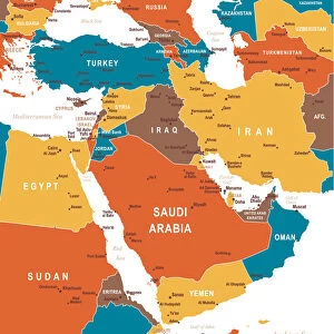
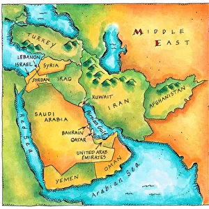
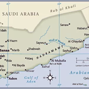
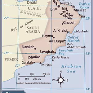
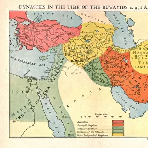
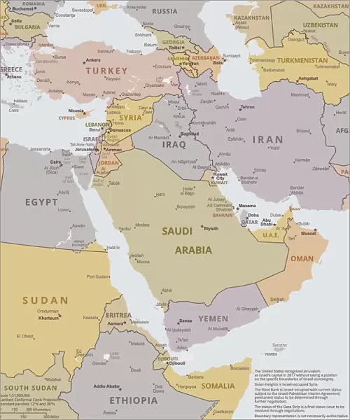
Metal Print : Political map of The Middle East

Resolution may be poor at this size (104 DPI)
![]()
Metal Prints from Fine Art Storehouse
Political map of The Middle East
Vector illustration of the policital map of The Middle East
Reference map was created by the US Central Intelligence Agency and is available as a public domain map at the University of Texas Libraries website.
https:/cia.gov/library/publications/resources/the-world-factbook/graphics/ref_maps/political/pdf/middle_east.pdf
Unleash your creativity and transform your space into a visual masterpiece!
calvindexter
Media ID 15192884
Adventure Backgrounds Business Concepts Creativity Data Design Element Division Egypt Exploration Global Communications Government Icon Ideas Infographic International Border Iran Iraq Island Israel Jordan Journey Land Lebanon Middle East Newspaper Oman Outline Politics Saudi Arabia Sign Silhouette Symbol Technology Topography Trip Turkey Unity Vector World Map Yemen Palestina Political Map Social Media
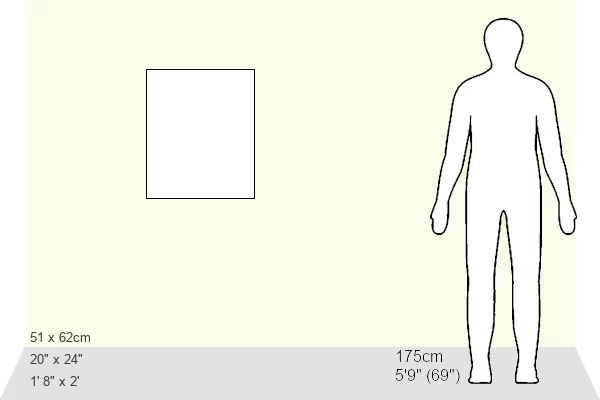
20"x24" (61x51cm) Metal Print
Bring the intricacies of Middle Eastern politics to life with our stunning Metal Prints from Media Storehouse. Featuring a captivating vector illustration of the political map of The Middle East by Calvindexter from Fine Art Storehouse, this print is a must-have for anyone with an interest in geopolitics or world affairs. With the US Central Intelligence Agency's reference map as its basis, this print offers an accurate and visually engaging representation of the region's complex political landscape. Each Metal Print is meticulously crafted using high-quality materials and state-of-the-art printing techniques to ensure a vibrant, long-lasting display. Add this unique and thought-provoking piece to your home or office decor today.
Made with durable metal and luxurious printing techniques, our metal photo prints go beyond traditional canvases, adding a cool, modern touch to your space. Wall mount on back. Eco-friendly 100% post-consumer recycled ChromaLuxe aluminum surface. The thickness of the print is 0.045". Featuring a Scratch-resistant surface and Rounded corners. Backing hangers are attached to the back of the print and float the print 1/2-inch off the wall when hung, the choice of hanger may vary depending on size and International orders will come with Float Mount hangers only. Finished with a brilliant white high gloss surface for unsurpassed detail and vibrance. Printed using Dye-Sublimation and for best care we recommend a non-ammonia glass cleaner, water, or isopropyl (rubbing) alcohol to prevent harming the print surface. We recommend using a clean, lint-free cloth to wipe off the print. The ultra-hard surface is scratch-resistant, waterproof and weatherproof. Avoid direct sunlight exposure.
Made with durable metal and luxurious printing techniques, metal prints bring images to life and add a modern touch to any space
Estimated Image Size (if not cropped) is 50.8cm x 60.9cm (20" x 24")
Estimated Product Size is 51.4cm x 61.5cm (20.2" x 24.2")
These are individually made so all sizes are approximate
Artwork printed orientated as per the preview above, with portrait (vertical) orientation to match the source image.
FEATURES IN THESE COLLECTIONS
> Fine Art Storehouse
> Map
> Reference Maps
> Africa
> Egypt
> Related Images
> Asia
> Iran
> Related Images
> Asia
> Iraq
> Related Images
> Asia
> Israel
> Related Images
EDITORS COMMENTS
This print showcases a meticulously crafted political map of the Middle East, brought to life through stunning vector illustration. Created by the US Central Intelligence Agency and made available as a public domain map at the University of Texas Libraries website, this artwork is both informative and visually striking. The intricate details of this map capture every aspect of the region's geography, from coastlines and islands to land borders and topography. It serves as a powerful symbol representing government, politics, unity, division, and global communications. With its vibrant colors and precise design elements, this piece sparks creativity while providing essential information about each country within the Middle East. Whether you're an avid traveler planning your next journey or simply fascinated by cartography, this print invites you on an exploration into the rich history and diverse cultures that define this part of our world. Perfect for any background or setting - be it in business offices or educational institutions - it seamlessly blends technology with tradition. Its presence adds depth to any space while serving as a reminder of how interconnected our world truly is. Discover Turkey's unique blend of Eastern traditions with Western influences; marvel at Iran's ancient heritage; explore Egypt's iconic landmarks; witness Saudi Arabia's modern developments; immerse yourself in Oman's breathtaking landscapes; experience Yemen's cultural tapestry; delve into Iraq's complex history; appreciate Israel’s historical significance alongside Palestine’s struggle for recognition; admire Jordan’s archaeological wonders; savor Lebanon’s culinary delights – all encapsulated within one extraordinary artwork. Let this remarkable print
MADE IN THE USA
Safe Shipping with 30 Day Money Back Guarantee
FREE PERSONALISATION*
We are proud to offer a range of customisation features including Personalised Captions, Color Filters and Picture Zoom Tools
SECURE PAYMENTS
We happily accept a wide range of payment options so you can pay for the things you need in the way that is most convenient for you
* Options may vary by product and licensing agreement. Zoomed Pictures can be adjusted in the Cart.