Poster Print > North America > Cuba > Cuba Heritage Sites > Old Havana and its Fortification System
Poster Print : Geography Atlas: representation of the Detroit of Bahamas and the island of Cuba. Map printed in "London Magazine", 1763. Biblioteca Jose Marti, Havana, Cuba


![]()
Poster Prints from Fine Art Finder
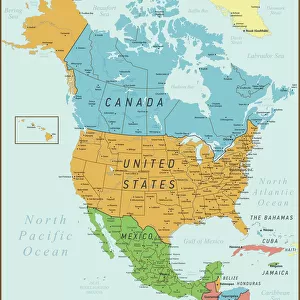
Geography Atlas: representation of the Detroit of Bahamas and the island of Cuba. Map printed in "London Magazine", 1763. Biblioteca Jose Marti, Havana, Cuba
VEN5029617 Geography Atlas: representation of the Detroit of Bahamas and the island of Cuba. Map printed in "London Magazine", 1763. Biblioteca Jose Marti, Havana, Cuba.; (add.info.: Geography Atlas: representation of the Detroit of Bahamas and the island of Cuba. Map printed in "London Magazine", 1763. Biblioteca Jose Marti, Havana, Cuba.); © Marage Photos
Media ID 38425704
© © Marage Photos / Bridgeman Images
Amerique Centrale Amerique Du Nord Carte Geographique Central America Cuba Cuba Cubain Cubaine Cubains Cubaines Cuban Etats Unis Geographie Stockravenna 18eme Siecle Geographical Map
18x24 inch Poster Print
Step into history with our Media Storehouse Poster Prints! This stunning piece, 'Geography Atlas: Representation of the Detroit of Bahamas and the Island of Cuba' by Bridgeman Images from Fine Art Finder, takes you back to a moment in time. Printed on high-quality paper, this vintage map shows a detailed representation of the Detroit Strait between Bahamian waters and Cuban shores as it appeared in 'London Magazine', 1763. A unique addition to any room's decor, perfect for history buffs and those who appreciate the beauty of bygone eras.
Poster prints are budget friendly enlarged prints in standard poster paper sizes. Printed on 150 gsm Matte Paper for a natural feel and supplied rolled in a tube. Great for framing and should last many years. To clean wipe with a microfiber, non-abrasive cloth or napkin. Our Archival Quality Photo Prints and Fine Art Paper Prints are printed on higher quality paper and the choice of which largely depends on your budget.
Poster prints are budget friendly enlarged prints in standard poster paper sizes (A0, A1, A2, A3 etc). Whilst poster paper is sometimes thinner and less durable than our other paper types, they are still ok for framing and should last many years. Our Archival Quality Photo Prints and Fine Art Paper Prints are printed on higher quality paper and the choice of which largely depends on your budget.
Estimated Product Size is 61.6cm x 46.3cm (24.3" x 18.2")
These are individually made so all sizes are approximate
Artwork printed orientated as per the preview above, with landscape (horizontal) orientation to match the source image.
FEATURES IN THESE COLLECTIONS
> Fine Art Finder
> Artists
> Pasquier (workshop of) Grenier
> Arts
> Literature
> Magazines
> Maps and Charts
> Early Maps
> Maps and Charts
> Related Images
> North America
> The Bahamas
> Maps
> North America
> The Bahamas
> Related Images
> North America
> Cuba
> Cuba Heritage Sites
> Old Havana and its Fortification System
> North America
> Cuba
> Havana
> North America
> Cuba
> Maps
> North America
> Cuba
> Related Images
EDITORS COMMENTS
This stunning print showcases a Geography Atlas representation of the Detroit of Bahamas and the island of Cuba, originally printed in the "London Magazine" in 1763. The intricate details and historical significance captured in this map offer a glimpse into the past, highlighting the geographical features of these regions during the 18th century.
Located at Biblioteca Jose Marti in Havana, Cuba, this piece serves as a valuable resource for understanding the evolution of cartography and exploration in Central America and beyond. The engraving beautifully illustrates the coastlines, rivers, and topographical elements that were essential for navigation and trade during this time period.
As we study this map, we are transported back to an era when discovery and colonization shaped the landscape of North America. The inclusion of Cuba adds another layer of complexity to our understanding of early American history, showcasing its strategic importance as an island nation.
Overall, this Geography Atlas print is not just a visual representation but also a window into how people viewed their world centuries ago. It reminds us of the interconnectedness between geography, culture, and politics that continues to influence our global perspectives today.
MADE IN THE USA
Safe Shipping with 30 Day Money Back Guarantee
FREE PERSONALISATION*
We are proud to offer a range of customisation features including Personalised Captions, Color Filters and Picture Zoom Tools
SECURE PAYMENTS
We happily accept a wide range of payment options so you can pay for the things you need in the way that is most convenient for you
* Options may vary by product and licensing agreement. Zoomed Pictures can be adjusted in the Cart.