Fine Art Print > Europe > Italy > Emilia-Romagna > Ravenna
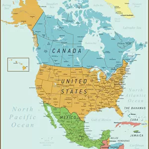
Fine Art Print : Geography map: representation of the island of Cuba in the Caribbean, made by Dutch cartographer Gerard van Keulen (1678-1726) 1709-1713. Biblioteca Angelica, Rome
 1709-1713. Biblioteca Angelica, Rome")


![]()
Fine Art Prints from Fine Art Finder
Geography map: representation of the island of Cuba in the Caribbean, made by Dutch cartographer Gerard van Keulen (1678-1726) 1709-1713. Biblioteca Angelica, Rome
VEN5030107 Geography map: representation of the island of Cuba in the Caribbean, made by Dutch cartographer Gerard van Keulen (1678-1726) 1709-1713. Biblioteca Angelica, Rome; (add.info.: Geography map: representation of the island of Cuba in the Caribbean, made by Dutch cartographer Gerard van Keulen (1678-1726) 1709-1713. Biblioteca Angelica, Rome); Photo © Marco Ravenna
Media ID 38274418
© © Marco Ravenna / Bridgeman Images
Amerique Centrale Amerique Du Nord Caraïbes Caribbean Caribbean Island Carribean Carte Geographique Central America Cuba Cuba Cubain Cubaine Cubains Cubaines Cuban Etats Unis Geographie Stockravenna 18eme Siecle Geographical Map
21"x14" (+3" Border) Fine Art Print
Explore the rich history and intricate details of Cuba with this stunning Fine Art Print from Media Storehouse. Captured by Dutch cartographer Gerard van Keulen in the early 18th century, this map offers a fascinating glimpse into the island's geography. Perfect for adding a touch of sophistication to any space.
21x14 image printed on 27x20 Fine Art Rag Paper with 3" (76mm) white border. Our Fine Art Prints are printed on 300gsm 100% acid free, PH neutral paper with archival properties. This printing method is used by museums and art collections to exhibit photographs and art reproductions.
Our fine art prints are high-quality prints made using a paper called Photo Rag. This 100% cotton rag fibre paper is known for its exceptional image sharpness, rich colors, and high level of detail, making it a popular choice for professional photographers and artists. Photo rag paper is our clear recommendation for a fine art paper print. If you can afford to spend more on a higher quality paper, then Photo Rag is our clear recommendation for a fine art paper print.
Estimated Image Size (if not cropped) is 53.3cm x 35.5cm (21" x 14")
Estimated Product Size is 68.6cm x 50.8cm (27" x 20")
These are individually made so all sizes are approximate
Artwork printed orientated as per the preview above, with landscape (horizontal) orientation to match the source image.
FEATURES IN THESE COLLECTIONS
> Fine Art Finder
> Artists
> Marcantonio Bassetti
> Europe
> Italy
> Emilia-Romagna
> Ravenna
> Europe
> Italy
> Lazio
> Rome
> Maps and Charts
> Early Maps
> Maps and Charts
> Related Images
> North America
> Cuba
> Maps
> North America
> Cuba
> Related Images
> North America
> United States of America
> Maps
> Popular Themes
> North Island
EDITORS COMMENTS
This stunning print showcases a detailed representation of the island of Cuba in the Caribbean, created by Dutch cartographer Gerard van Keulen between 1709 and 1713. The intricate engraving captures the beauty and complexity of this important geographical location during the early 18th century.
The map, housed in the Biblioteca Angelica in Rome, is a testament to van Keulen's skill and precision as a cartographer. Every detail of the island is meticulously rendered, from its coastline to its interior topography. This piece serves as both a historical document and a work of art, offering viewers a glimpse into how Cuba was perceived and understood centuries ago.
As we study this map, we are transported back in time to an era when exploration and discovery were at the forefront of human endeavor. The map not only provides valuable geographic information but also reflects cultural attitudes towards colonial territories like Cuba.
Through Marco Ravenna's expert photography, we are able to appreciate this rare piece of cartographic history with clarity and depth. It is a reminder of how maps have shaped our understanding of the world around us and continue to hold significance as both scientific tools and works of art.
MADE IN THE USA
Safe Shipping with 30 Day Money Back Guarantee
FREE PERSONALISATION*
We are proud to offer a range of customisation features including Personalised Captions, Color Filters and Picture Zoom Tools
SECURE PAYMENTS
We happily accept a wide range of payment options so you can pay for the things you need in the way that is most convenient for you
* Options may vary by product and licensing agreement. Zoomed Pictures can be adjusted in the Cart.