
Caraïbes Collection

The captivating beauty of the Caribbean is truly unparalleled

Background imageCaraïbes Collection: Geography: map showing the Gulf of Mexico, the Caribbean Islands, Central America (Honduras)

Geography: map showing the Gulf of Mexico, the Caribbean Islands, Central America (Honduras, Costarica)
VEN5031255 Geography: map showing the Gulf of Mexico, the Caribbean Islands, Central America (Honduras, Costarica), northern South America (Venezuela) and southern United States

Background imageCaraïbes Collection: Geography: representation of the Gulf of Mexico with the coasts of Mexico, Yucatan

Geography: representation of the Gulf of Mexico with the coasts of Mexico, Yucatan, Florida and Cuba (Antilles)
VEN5031179 Geography: representation of the Gulf of Mexico with the coasts of Mexico, Yucatan, Florida and Cuba (Antilles)

Background imageCaraïbes Collection: Geography map: representation of the Atlantic Ocean (or North Sea) with the coasts of the Americas

Geography map: representation of the Atlantic Ocean (or North Sea) with the coasts of the Americas
VEN5030386 Geography map: representation of the Atlantic Ocean (or North Sea) with the coasts of the Americas (South and United States), the Caribbean Sea and the Caribbean

Background imageCaraïbes Collection: Geography map: representation of the coasts of Cuba and Havana Bay in the West Indies

Geography map: representation of the coasts of Cuba and Havana Bay in the West Indies
VEN5030185 Geography map: representation of the coasts of Cuba and Havana Bay in the West Indies, made by Dutch cartographer Gerard van Keulen (1678-1726) 1709-1713

Background imageCaraïbes Collection: Geography Atlas: representation of the Bahamas islands, northern Hispaniola (Santo Domingo)

Geography Atlas: representation of the Bahamas islands, northern Hispaniola (Santo Domingo)
VEN5031335 Geography Atlas: representation of the Bahamas islands, northern Hispaniola (Santo Domingo) and the Leewind Passage between Cuba and Hispaniola in the West Indies

Background imageCaraïbes Collection: Geography: Map of Puerto Rico Island, Beata Island, Hispaniola coasts in the West Indies

Geography: Map of Puerto Rico Island, Beata Island, Hispaniola coasts in the West Indies
VEN5031327 Geography: Map of Puerto Rico Island, Beata Island, Hispaniola coasts in the West Indies. Map from an Atlas of Maritime Geography of 1767

Background imageCaraïbes Collection: Geography Atlas: representation of the Caribbean Sea region, the Caribbean (Cuba, Jamaica)

Geography Atlas: representation of the Caribbean Sea region, the Caribbean (Cuba, Jamaica, Hispaniola, Jamaica)
VEN5030043 Geography Atlas: representation of the Caribbean Sea region, the Caribbean (Cuba, Jamaica, Hispaniola, Jamaica), the Bahamas Islands, the Lesser Antilles

Background imageCaraïbes Collection: Geography Atlas: description of the Caribbean Sea, Caribbean Sea (Cuba, Jamaica, Hispaniola)

Geography Atlas: description of the Caribbean Sea, Caribbean Sea (Cuba, Jamaica, Hispaniola, Jamaica)
VEN5030036 Geography Atlas: description of the Caribbean Sea, Caribbean Sea (Cuba, Jamaica, Hispaniola, Jamaica), the Bahamas Islands and the Lesser Antilles with map

Background imageCaraïbes Collection: Geography Atlas: representation of the island of Antigua in the Caribbean

Geography Atlas: representation of the island of Antigua in the Caribbean
VEN5030006 Geography Atlas: representation of the island of Antigua in the Caribbean. Map taken from "The west indian atlas or general description of west indies" by Thomas Jefferys

Background imageCaraïbes Collection: Geography Atlas: representation of Tobago Island in the Lesser Antilles

Geography Atlas: representation of Tobago Island in the Lesser Antilles. Map taken from "The west indian atlas or
VEN5029619 Geography Atlas: representation of Tobago Island in the Lesser Antilles. Map taken from "The west indian atlas or general description of west indies" by Thomas Jefferys

Background imageCaraïbes Collection: Caribbean spider-lily, Hymenocallis caribaea (Pancratium declinatum)

Caribbean spider-lily, Hymenocallis caribaea (Pancratium declinatum). Handcoloured copperplate engraving by George
FLO4665856 Caribbean spider-lily, Hymenocallis caribaea (Pancratium declinatum). Handcoloured copperplate engraving by George Cooke from Conrad Loddiges Botanical Cabinet, Hackney, London

Background imageCaraïbes Collection: Metisse de Martinique - Mixed-race woman of Martinique, 1865

Metisse de Martinique - Mixed-race woman of Martinique, 1865. Handcoloured steel engraving by Polydor Pauquet from
FLO4686696 Metisse de Martinique - Mixed-race woman of Martinique, 1865. Handcoloured steel engraving by Polydor Pauquet from the Pauquet Brothers " Modes et Costumes Etrangers Anciens et

Background imageCaraïbes Collection: Aristoloche pipe of Harlequin (Aristolochia anguicida). Lithograph from 'Afbeelding der

Aristoloche pipe of Harlequin (Aristolochia anguicida). Lithograph from "Afbeelding der Artseny-Gewassen" by
FLO4733101 Aristoloche pipe of Harlequin (Aristolochia anguicida). Lithograph from "Afbeelding der Artseny-Gewassen" by Johannes Zorn (1739-1799), Netherlands, 1796

Background imageCaraïbes Collection: Clamshell orchid, Epidendrum cochleatum, native to central and south America and the Caribbean

Clamshell orchid, Epidendrum cochleatum, native to central and south America and the Caribbean
FLO4569696 Clamshell orchid, Epidendrum cochleatum, native to central and south America and the Caribbean. Handcoloured stipple engraving on copper by Barrois from a botanical illustration by

Background imageCaraïbes Collection: Marica has small white flower and spear-shaped leaf, bright green stripes

Marica has small white flower and spear-shaped leaf, bright green stripes. Origin Cayenne, Jamaican and Caribbean
FLO4585684 Marica has small white flower and spear-shaped leaf, bright green stripes. Origin Cayenne, Jamaican and Caribbean

Background imageCaraïbes Collection: Ribband fish, unknown species. Illustration copied from George Edwards from a specimen sent

Ribband fish, unknown species. Illustration copied from George Edwards from a specimen sent from the Caribbean islands
FLO4640575 Ribband fish, unknown species. Illustration copied from George Edwards from a specimen sent from the Caribbean islands

Background imageCaraïbes Collection: Ornaments of the Island Carib or Kalinago people, West Indies, including garters

Ornaments of the Island Carib or Kalinago people, West Indies, including garters
FLO4621591 Ornaments of the Island Carib or Kalinago people, West Indies, including garters and body paint of roucou or achiote dye

Background imageCaraïbes Collection: Caribbean pygmymelon, Psiguria pedata (Anguria pedata). Handcoloured copperplate engraving after

Caribbean pygmymelon, Psiguria pedata (Anguria pedata). Handcoloured copperplate engraving after an illustration by
FLO4618390 Caribbean pygmymelon, Psiguria pedata (Anguria pedata). Handcoloured copperplate engraving after an illustration by Richard Duppa from his The Clours

Background imageCaraïbes Collection: Idols and axe or buton of the Island Carib or Kalinago people

Idols and axe or buton of the Island Carib or Kalinago people. Handcoloured copperplate engraving from Giulio
FLO4621613 Idols and axe or buton of the Island Carib or Kalinago people. Handcoloured copperplate engraving from Giulio Ferrario's Costumes Antique and Modern of All Peoples

Background imageCaraïbes Collection: Hammock, rattan basketball, cassava beer-fermenting net, and other utensils made by the Island

Hammock, rattan basketball, cassava beer-fermenting net, and other utensils made by the Island Carib or Kalinago
FLO4621597 Hammock, rattan basketball, cassava beer-fermenting net, and other utensils made by the Island Carib or Kalinago people, West Indies

Background imageCaraïbes Collection: Crantzia tigrina (Heintzia tigrina). Native to Caracas, Venezuela

Crantzia tigrina (Heintzia tigrina). Native to Caracas, Venezuela. Handcoloured lithograph from Louis van Houtte
FLO4628584 Crantzia tigrina (Heintzia tigrina). Native to Caracas, Venezuela. Handcoloured lithograph from Louis van Houtte and Charles Lemaire's Flowers of the Gardens and Hothouses of Europe

Background imageCaraïbes Collection: Cupid's bower, Achimenes erecta, native of the Caribbean. Handcoloured stipple engraving on copper

Cupid's bower, Achimenes erecta, native of the Caribbean. Handcoloured stipple engraving on copper by Barrois
FLO4569567 Cupid's bower, Achimenes erecta, native of the Caribbean. Handcoloured stipple engraving on copper by Barrois from a botanical illustration by Pancrace Bessa from Mordant de

Background imageCaraïbes Collection: Singapore holly, Malpighia coccigera, native to the Caribbean

Singapore holly, Malpighia coccigera, native to the Caribbean. Handcoloured stipple engraving on copper by Barrois
FLO4569557 Singapore holly, Malpighia coccigera, native to the Caribbean. Handcoloured stipple engraving on copper by Barrois from a botanical illustration by Pancrace Bessa from Mordant de

Background imageCaraïbes Collection: Giant cabuya - choca vert or cadere - Furcraea foetida (Fourcroya gigantea), flower A

Giant cabuya - choca vert or cadere - Furcraea foetida (Fourcroya gigantea), flower A, native to the Caribbean
FLO4576753 Giant cabuya - choca vert or cadere - Furcraea foetida (Fourcroya gigantea), flower A, native to the Caribbean

Background imageCaraïbes Collection: Common smoothhand, Mustelus mustelus, Vulnerable 1, angler fish, Lophius piscatorius 2, burrfish

Common smoothhand, Mustelus mustelus, Vulnerable 1, angler fish, Lophius piscatorius 2, burrfish
FLO4652692 Common smoothhand, Mustelus mustelus, Vulnerable 1, angler fish, Lophius piscatorius 2, burrfish, Chilomycterus schoepfi 3, and bill of a sawfish, Pristis pectinata

Background imageCaraïbes Collection: Geography map: representation of the southern island of Cuba and the island of Hispaniola

Geography map: representation of the southern island of Cuba and the island of Hispaniola and the small Caribbean
VEN5030180 Geography map: representation of the southern island of Cuba and the island of Hispaniola and the small Caribbean, made by the Dutch cartographer Gerard van Keulen (1678-1726) 1709-1713

Background imageCaraïbes Collection: Geography Atlas: representation of the island of Hispaniola (which includes Santo Domingo and Haiti)

Geography Atlas: representation of the island of Hispaniola (which includes Santo Domingo and Haiti)
VEN5031366 Geography Atlas: representation of the island of Hispaniola (which includes Santo Domingo and Haiti) in the Caribbean archipelago. Map by the Knight Lapie, 1819

Background imageCaraïbes Collection: Geography Atlas: representation of the island of Santo Domingo

Geography Atlas: representation of the island of Santo Domingo, the Bahamas of Puerto Rico to the West Indies
VEN5031345 Geography Atlas: representation of the island of Santo Domingo, the Bahamas of Puerto Rico to the West Indies. Map from an atlas of 1867

Background imageCaraïbes Collection: Geography: map showing the Gulf of Mexico and the Caribbean Sea islands (Caribbean)

Geography: map showing the Gulf of Mexico and the Caribbean Sea islands (Caribbean)
VEN5031257 Geography: map showing the Gulf of Mexico and the Caribbean Sea islands (Caribbean). Plate taken from an Atlas by Philippe Buache (1700-1773) 1780

Background imageCaraïbes Collection: Geography Atlas: description of the Caribbean Sea, Caribbean Sea (Cuba, Jamaica, Hispaniola)

Geography Atlas: description of the Caribbean Sea, Caribbean Sea (Cuba, Jamaica, Hispaniola, Jamaica)
VEN5031247 Geography Atlas: description of the Caribbean Sea, Caribbean Sea (Cuba, Jamaica, Hispaniola, Jamaica), the Bahamas Islands and the Lesser Antilles with map

Background imageCaraïbes Collection: Geography: map showing Central America (Mexico, Honduras, Yucatan)

Geography: map showing Central America (Mexico, Honduras, Yucatan) and the Caribbean Sea Islands (Antilles)
VEN5031211 Geography: map showing Central America (Mexico, Honduras, Yucatan) and the Caribbean Sea Islands (Antilles). Plate from a British Atlas of 1737

Background imageCaraïbes Collection: Geography: map of the islands of Central America (Antilles), the Detroit of Panama

Geography: map of the islands of Central America (Antilles), the Detroit of Panama and representation of Mexico City
VEN5031188 Geography: map of the islands of Central America (Antilles), the Detroit of Panama and representation of Mexico City

Background imageCaraïbes Collection: Geography: representation of the island of Hispaniola with the east coast of the island of Cuba in

Geography: representation of the island of Hispaniola with the east coast of the island of Cuba in the Caribbean Sea
VEN5031183 Geography: representation of the island of Hispaniola with the east coast of the island of Cuba in the Caribbean Sea

Background imageCaraïbes Collection: Geography Atlas: representation of the region of the Caribbean Sea, the Greater Antilles (Cuba)

Geography Atlas: representation of the region of the Caribbean Sea, the Greater Antilles (Cuba, Jamaica)
VEN5030081 Geography Atlas: representation of the region of the Caribbean Sea, the Greater Antilles (Cuba, Jamaica, Hispaniola) and the small Antilles with colours indicating membership to France

Background imageCaraïbes Collection: Geography Atlas: representation of North America and the Caribbean Sea region, Caribbean (Cuba)

Geography Atlas: representation of North America and the Caribbean Sea region, Caribbean (Cuba, Jamaica, Hispaniola)
VEN5030064 Geography Atlas: representation of North America and the Caribbean Sea region, Caribbean (Cuba, Jamaica, Hispaniola, Jamaica). Map from an Atlas by Adrien Hubert Brue (1786-1832), 1821

Background imageCaraïbes Collection: Geography Atlas: representation of the Caribbean archipelago (Cuba, Hispaniola, Puerto Rico)

Geography Atlas: representation of the Caribbean archipelago (Cuba, Hispaniola, Puerto Rico), the Bahamas Islands
VEN5030034 Geography Atlas: representation of the Caribbean archipelago (Cuba, Hispaniola, Puerto Rico), the Bahamas Islands. Map from a Spanish Atlas of 1825

Background imageCaraïbes Collection: Geography Atlas: representation of the island of Hispaniola (which includes Santo Domingo and Haiti)

Geography Atlas: representation of the island of Hispaniola (which includes Santo Domingo and Haiti)
VEN5030030 Geography Atlas: representation of the island of Hispaniola (which includes Santo Domingo and Haiti) in the Caribbean archipelago

Background imageCaraïbes Collection: Geography Atlas: representation of the island of Saint Lucia (Antilles)

Geography Atlas: representation of the island of Saint Lucia (Antilles). Map taken from "The west indian atlas or
VEN5030018 Geography Atlas: representation of the island of Saint Lucia (Antilles). Map taken from "The west indian atlas or general description of west indies" by Thomas Jefferys

Background imageCaraïbes Collection: Geography Atlas: representation of the island of Jamaica (Antilles)

Geography Atlas: representation of the island of Jamaica (Antilles). Map taken from "The west indian atlas or
VEN5030010 Geography Atlas: representation of the island of Jamaica (Antilles). Map taken from "The west indian atlas or general description of west indies" by Thomas Jefferys

Background imageCaraïbes Collection: Harvesting of tree's resin called chibou, cachibou or gomartis or gum or mastic

Harvesting of tree's resin called chibou, cachibou or gomartis or gum or mastic on the gumbo-limbo, copperwood
ELD4919328 Harvesting of tree's resin called chibou, cachibou or gomartis or gum or mastic on the gumbo-limbo, copperwood, chaca

Background imageCaraïbes Collection: Eruption of Mount Pelee in Martinique, 1902 (illustration)

Eruption of Mount Pelee in Martinique, 1902 (illustration)
2093143 Eruption of Mount Pelee in Martinique, 1902 (illustration); (add.info.: France. Eruption de la montagne Pelee le 7/05/1902. Illustration in: Le Petit Parisien, France, 08/06/1902. Coll. Part)

Background imageCaraïbes Collection: Crantzia tigrina (Heintzia tigrina). Handcoloured lithograph from Louis van Houtte

Crantzia tigrina (Heintzia tigrina). Handcoloured lithograph from Louis van Houtte
FLO4629832 Crantzia tigrina (Heintzia tigrina). Handcoloured lithograph from Louis van Houtte and Charles Lemaire's Flowers of the Gardens and Hothouses of Europe

Background imageCaraïbes Collection: Geography: Map of Saint Kitts and Nevis Island in the West Indies

Geography: Map of Saint Kitts and Nevis Island in the West Indies. Map from an Atlas by Bryan Edwards (1743-1800)
VEN5031320 Geography: Map of Saint Kitts and Nevis Island in the West Indies. Map from an Atlas by Bryan Edwards (1743-1800) from 1791

Background imageCaraïbes Collection: Geography: map showing the Gulf of Mexico, the Caribbean Islands, Central America (Mexico)

Geography: map showing the Gulf of Mexico, the Caribbean Islands, Central America (Mexico, Yucatan, Salvador, Honduras)
VEN5031242 Geography: map showing the Gulf of Mexico, the Caribbean Islands, Central America (Mexico, Yucatan, Salvador, Honduras, Nicaragua, Costarica) and northern South America (Venezuela)

Background imageCaraïbes Collection: Geography map: representation of the islands of the Greater Antilles (Cuba, Hispaniola)

Geography map: representation of the islands of the Greater Antilles (Cuba, Hispaniola)
VEN5030434 Geography map: representation of the islands of the Greater Antilles (Cuba, Hispaniola, Jamaica and Puerto Rico) and the Lesser Antilles in the Caribbean Sea

Background imageCaraïbes Collection: Geography map: representation of the main British islands of the Caribbean Sea (Antigua, Barbados)

Geography map: representation of the main British islands of the Caribbean Sea (Antigua, Barbados, Jamaican, Bermuda)
VEN5030269 Geography map: representation of the main British islands of the Caribbean Sea (Antigua, Barbados, Jamaican, Bermuda, St. Christopher Island or St)

Background imageCaraïbes Collection: Geography map: representation of the island of Martinique in the small Antilles

Geography map: representation of the island of Martinique in the small Antilles
VEN5030213 Geography map: representation of the island of Martinique in the small Antilles, made by Dutch cartographer Gerard van Keulen (1678-1726) 1709-1713

Background imageCaraïbes Collection: Geography map: representation of part of the archipelago of the small Antilles

Geography map: representation of part of the archipelago of the small Antilles (island of Saint Lucia, Martinique)
VEN5030211 Geography map: representation of part of the archipelago of the small Antilles (island of Saint Lucia, Martinique, Dominica, Ile des Saintes, Guadeloupe, Montserrat, Antigua, Barbuda)


For sale as Licensed Images

Choose your image, Select your licence and Download the media

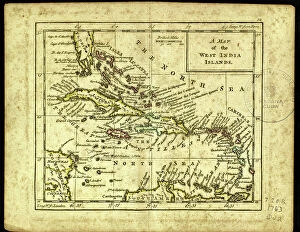
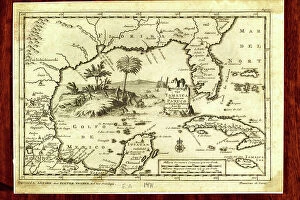
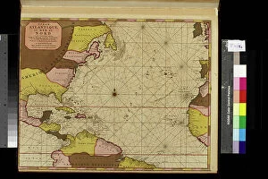
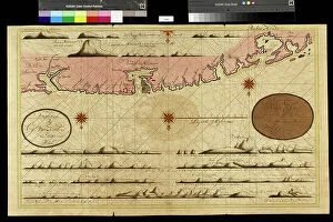
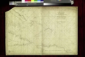
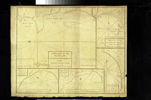
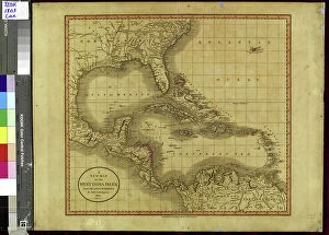
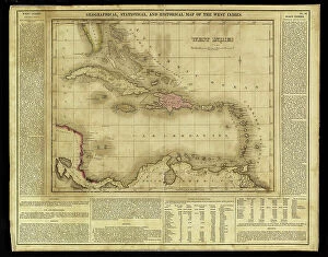
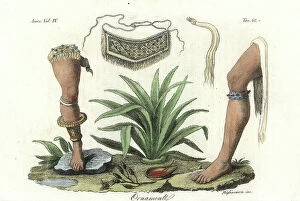
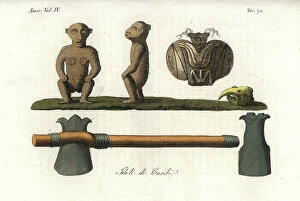
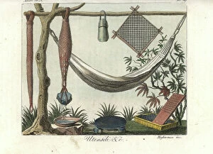
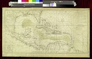
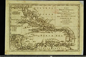
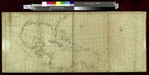
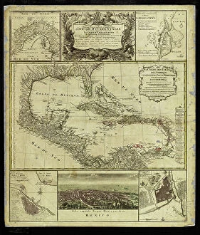
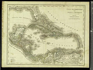
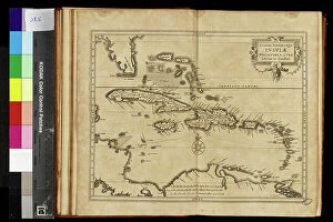
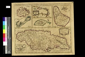
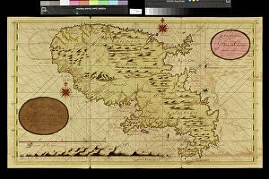
The captivating beauty of the Caribbean is truly unparalleled. From the mesmerizing Stingray City in the Cayman Islands to the rich history and culture depicted in engravings from 1880, this region never fails to leave a lasting impression. One cannot help but be enchanted by the vibrant agriculture scene, such as witnessing sugar making at a traditional sugar cane plantation in Cuba. The process itself is an art form, passed down through generations, showcasing both skill and dedication. Speaking of history, portraits like that of Francois Dominique Toussaint L'Ouverture remind us of the remarkable individuals who shaped these islands. Their courage and resilience continue to inspire generations even today. Education too has played a significant role in shaping these lands. The small seminary or college Saint Martin in Port-au-Prince stands as a testament to knowledge-seeking minds striving for excellence, and is heartwarming to witness firefighters diligently performing their rescue exercises nearby, ensuring safety for all. Leadership also holds great importance within this region's narrative. Nissage Saget, Haiti's eighth president, left an indelible mark on his country during his tenure from 1870-1880. His portrait serves as a reminder of his contributions towards building a stronger nation. Even centuries ago, explorers like Johannes Leriis were captivated by the indigenous people known as Caraibe Indians. Their fascinating way of life was documented meticulously in accounts that still intrigue historians till date. The Caribbean embodies diversity - from its breathtaking landscapes and cultural heritage to its resilient people who have overcome countless challenges throughout history. This enchanting paradise continues to beckon travelers with open arms and promises unforgettable experiences at every turn.