Age Of Discovery Collection (#11)

The Age of Discovery, a remarkable era in history, was characterized by the exploration and mapping of new territories

Background imageAge Of Discovery Collection: Jacques Cartier, French explorer

Jacques Cartier, French explorer

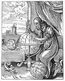
Background imageAge Of Discovery Collection: Medieval geographer

Medieval geographer. Artwork of a 15th century geographer using a pair of dividers to measure distances on a terrestrial globe showing the known regions of the Earth

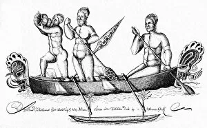
Background imageAge Of Discovery Collection: Natives of New Guinea, 1643

Natives of New Guinea, 1643
Natives of New Guinea. 17th century artwork of three men from the Bismarck Archipelago, New Guinea, paddling an outrigger canoe

Background imageAge Of Discovery Collection: Exploration of Tonga, 18th century

Exploration of Tonga, 18th century
Exploration of Tonga. 18th century artwork showing a European explorer (lower centre) being welcomed by Tongans in a canopied area on a chieftains sailing vessel

Background imageAge Of Discovery Collection: Third Barents Arctic Expedition, 1596

Third Barents Arctic Expedition, 1596
Third Barents Arctic Expedition of 1596, artwork. After their ship was trapped in the ice, the expedition crew of 16 spent the winter in this shelter (Het Behouden Huys)

Background imageAge Of Discovery Collection: Tasmans visit to Fiji, 1643

Tasmans visit to Fiji, 1643
Tasmans visit to Fiji. 17th century artwork showing the visit of the Dutch navigator and explorer Abel Tasman (1603-1659) to the Fiji Islands in 1643

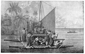
Background imageAge Of Discovery Collection: Tahitian sailing vessels, 18th century

Tahitian sailing vessels, 18th century
Tahitian sailing vessels. 18th century artwork of Tahitians in sailing vessels in a bay in Tahiti. A raft is being paddled at lower right, and fishing is taking place at lower left

Background imageAge Of Discovery Collection: Cartiers visit to Hochelaga, 1535

Cartiers visit to Hochelaga, 1535
Cartiers visit to Hochelaga. 16th century artwork of the visit by the French explorer Jacques Cartier (1491-1557) to the Native American fortified village of Hochelaga (beaver lake) in October 1535

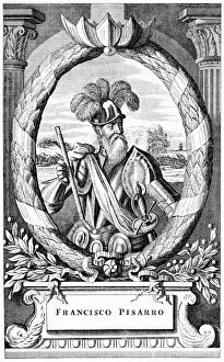
Background imageAge Of Discovery Collection: Francisco Pizarro, Spanish explorer

Francisco Pizarro, Spanish explorer
Francisco Pizarro (c.1471-1541), Spanish explorer and conquistador. Pizarro accompanied Vasco Nunez de Balboa on his 1513 expedition to cross the Isthmus of Panama

Background imageAge Of Discovery Collection: Vespucius off the Americas coast, artwork

Vespucius off the Americas coast, artwork
Vespucius off the Americas coast. Artwork of the Italian explorer Americus Vespucius (1454-1512) on his ship, off the coast of South America

Background imageAge Of Discovery Collection: Americus Vespucius, Italian explorer

Americus Vespucius, Italian explorer
Americus Vespucius (1454-1512), Italian explorer. In 1499, Vespucius followed Columbuss tracks to the New World, where he explored the coast of South America

Background imageAge Of Discovery Collection: Vasco da Gama in India

Vasco da Gama in India. Portuguese explorer Vasco de Gama (1460-1524) being received by the Zamorin (ruler) of Calicut, Kerala, India, in 1498

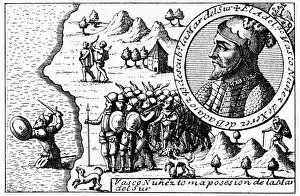
Background imageAge Of Discovery Collection: Balboa claiming the South Sea for Spain

Balboa claiming the South Sea for Spain. Artwork of the Spanish conquistador and explorer Vasco Nunez de Balboa (1475-1519)

Background imageAge Of Discovery Collection: Cartier claiming Canada for France

Cartier claiming Canada for France, artwork. French navigator and explorer Jacques Cartier (1491-1557) claiming Canada for France at Gaspe Bay, in 1534

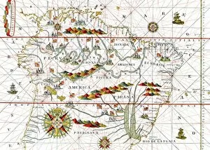
Background imageAge Of Discovery Collection: South America, 16th century map

South America, 16th century map
South America. 16th century map of South America. From " Atlas" by Juan Martinez (Madrid, 1582)

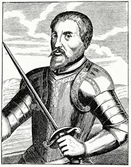
Background imageAge Of Discovery Collection: Hernando de Soto, Spanish explorer

Hernando de Soto, Spanish explorer
Hernando de Soto (c.1496-1542), Spanish explorer and conquistador. Soto left Spain in 1914 to travel to the Indies and find a passage through to China

Background imageAge Of Discovery Collection: Ferdinand Magellan, Portuguese explorer

Ferdinand Magellan, Portuguese explorer
Ferdinand Magellan (c.1480-1521), Portuguese navigator and explorer. Magellan is most famous for heading the first expedition to eventually circumnavigate the world

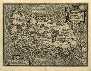
Background imageAge Of Discovery Collection: Orteliuss map of Ireland, 1598

Orteliuss map of Ireland, 1598
Orteliuss map of Ireland, from an atlas of 1598. North is at right. This map is titled: Hiberniae, Britannicae Insulae Nova Descriptio (A new depiction of Ireland, a British Isle)

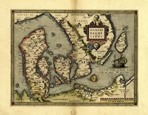
Background imageAge Of Discovery Collection: Orteliuss map of Denmark, 1570

Orteliuss map of Denmark, 1570
Orteliuss map of Denmark. This map is from the 1570 first edition of Theatrum orbis terrarum ( Theatre of the World ). Drawn by the Flemish mapmaker Abraham Ortelius (1527-1598)

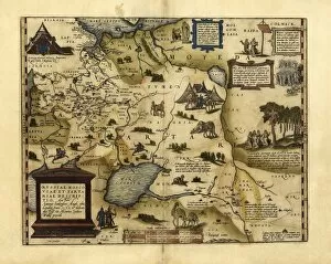
Background imageAge Of Discovery Collection: Orteliuss map of European Russia, 1570

Orteliuss map of European Russia, 1570
Orteliuss map of European Russia. This map is from the 1570 first edition of Theatrum orbis terrarum ( Theatre of the World )

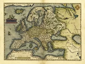
Background imageAge Of Discovery Collection: Orteliuss map of Europe, 1570

Orteliuss map of Europe, 1570. This map is from the 1570 first edition of Theatrum orbis terrarum ( Theatre of the World )

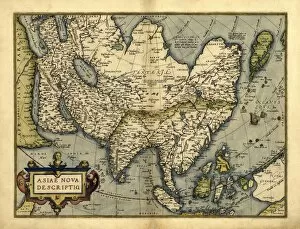
Background imageAge Of Discovery Collection: Orteliuss map of Asia, 1570

Orteliuss map of Asia, 1570
Orteliuss map of Asia. This map is from the 1570 first edition of Theatrum orbis terrarum ( Theatre of the World ). Drawn by the Flemish mapmaker Abraham Ortelius (1527-1598)

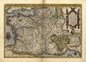
Background imageAge Of Discovery Collection: Orteliuss map of France, 1570

Orteliuss map of France, 1570
Orteliuss map of France. This map is from the 1570 first edition of Theatrum orbis terrarum ( Theatre of the World ). Drawn by the Flemish mapmaker Abraham Ortelius (1527-1598)
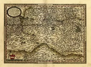
Background imageAge Of Discovery Collection: Orteliuss map of Austria, 1570

Orteliuss map of Austria, 1570
Orteliuss map of Austria. This map is from the 1570 first edition of Theatrum orbis terrarum ( Theatre of the World ). Drawn by the Flemish mapmaker Abraham Ortelius (1527-1598)

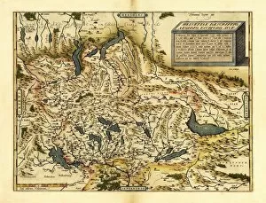
Background imageAge Of Discovery Collection: Orteliuss map of Switzerland, 1570

Orteliuss map of Switzerland, 1570
Orteliuss map of Switzerland. This map is from the 1570 first edition of Theatrum orbis terrarum ( Theatre of the World )

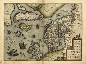
Background imageAge Of Discovery Collection: Orteliuss map of Northern Europe, 1570

Orteliuss map of Northern Europe, 1570
Orteliuss map of Northern Europe. This map is from the 1570 first edition of Theatrum orbis terrarum ( Theatre of the World )

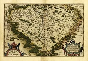
Background imageAge Of Discovery Collection: Orteliuss map of Bohemia, 1570

Orteliuss map of Bohemia, 1570
Orteliuss map of Bohemia. This map is from the 1570 first edition of Theatrum orbis terrarum ( Theatre of the World ). Drawn by the Flemish mapmaker Abraham Ortelius (1527-1598)

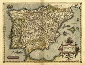
Background imageAge Of Discovery Collection: Orteliuss map of Iberian Peninsula, 1570

Orteliuss map of Iberian Peninsula, 1570
Orteliuss map of Iberian Peninsula. This map is from the 1570 first edition of Theatrum orbis terrarum ( Theatre of the World )

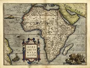
Background imageAge Of Discovery Collection: Orteliuss map of Africa, 1570

Orteliuss map of Africa, 1570
Orteliuss map of Africa. This map is from the 1570 first edition of Theatrum orbis terrarum ( Theatre of the World ). Drawn by the Flemish mapmaker Abraham Ortelius (1527-1598)

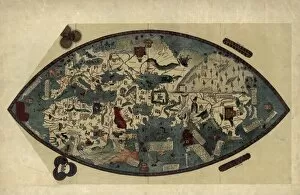
Background imageAge Of Discovery Collection: Genoese world map, 1450

Genoese world map, 1450
Genoese world map. This world map was drawn in around 1450, possibly by the Italian mathematician, astronomer, and geographer Paolo dal Pozzo Toscanelli (1397-1482)

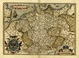
Background imageAge Of Discovery Collection: Orteliuss map of Germany, 1570

Orteliuss map of Germany, 1570
Orteliuss map of Germany. This map is from the 1570 first edition of Theatrum orbis terrarum ( Theatre of the World ). Drawn by the Flemish mapmaker Abraham Ortelius (1527-1598)

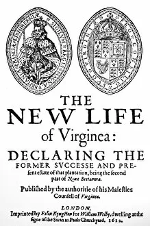
Background imageAge Of Discovery Collection: VIRGINIA TRACT, 1612. Title-page of Robert Johnsons The New Life of Virginea, London, 1612

VIRGINIA TRACT, 1612. Title-page of Robert Johnsons The New Life of Virginea, London, 1612, a tract encouraging settlement in the new colony

Background imageAge Of Discovery Collection: COLUMBUS: NEW WORLD, 1492. The Landing of Columbus in the New World, 1492. Painting by William J

COLUMBUS: NEW WORLD, 1492. The Landing of Columbus in the New World, 1492. Painting by William J. Aylward (b. 1875)
COLUMBUS: NEW WORLD, 1492. The Landing of Columbus in the New World, 1492. Painting by William J. Aylward (b.1875)

Background imageAge Of Discovery Collection: BRAZIL: MAP AND NATIVE INDIANS. Map of Brazil from the Vallard Atlas, c1547; the map

BRAZIL: MAP AND NATIVE INDIANS. Map of Brazil from the Vallard Atlas, c1547; the map, drawn " upside-down" as if viewed from North America

Background imageAge Of Discovery Collection: Sea of Darkness

Sea of Darkness
Terrors in the Sea of Darkness. Hand-colored woodcut of a 19th-century illustration

Background imageAge Of Discovery Collection: India coast, 1459

India coast, 1459
The Malabar coast of India, from Fra Mauros map, 1459 (south is at the top). Digitally colored woodcut reproduction

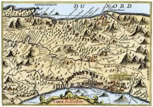
Background imageAge Of Discovery Collection: Isthmus of Panama, 1744

Isthmus of Panama, 1744
Map from Oexmelins Histoire of the Isthmus of Panama, 1744. Hand-colored woodcut

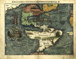
Background imageAge Of Discovery Collection: Map of the Americas, 1550

Map of the Americas, 1550
16th century map of the Americas. Published in 1550, this German map shows a rudimentary geography of the newly-discovered Americas


For sale as Licensed Images

Choose your image, Select your licence and Download the media

The Age of Discovery, a remarkable era in history, was characterized by the exploration and mapping of new territories. Maps from this period provide glimpses into the vast knowledge gained during these expeditions. Ortelius's map of the Ottoman Empire in 1570 showcases the intricate details and boundaries of this powerful empire, and is a testament to the expanding horizons and growing curiosity of explorers during this time. Captain John Smith's map of Virginia in 1612 offers insights into early English colonization efforts in North America. This detailed depiction highlights the challenges faced by settlers as they navigated unfamiliar lands. Abraham Ortelius' engraved Azores map from around 1584 provides an intriguing glimpse into one of Europe's most important maritime regions. The accuracy and precision displayed on this map demonstrate advancements made in cartography during this age. Oronce Fine's world map from 1531 presents a fascinating perspective on global geography at that time. Its inclusion of newly discovered lands reflects how explorers were continuously pushing boundaries and uncovering previously unknown territories. Juan Vespucci's world map from 1526, based on his uncle Amerigo Vespucci's voyages, contributes to our understanding of early European exploration across continents. This significant document sheds light on how discoveries were being disseminated throughout Europe. The Cantino World Map from 1502 reveals Western half geographical knowledge at that time, showcasing Portuguese discoveries along with other European nations' contributions to expanding geographic understanding. A seventeenth-century New World map illustrates how Europeans gradually began comprehending the vastness and diversity present within these uncharted lands. It serves as a reminder that every voyage brought forth new information about these mysterious territories. A Map of Europe dating back to 1700 captures political borders amidst shifting alliances during an era marked by territorial disputes among European powers. Such maps played crucial roles in shaping diplomatic negotiations and military strategies alike.