Age Of Discovery Collection (#9)

The Age of Discovery, a remarkable era in history, was characterized by the exploration and mapping of new territories

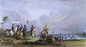
Background imageAge Of Discovery Collection: DE SOTO (c1496-1542). Hernando De Soto. Spanish explorer in America

DE SOTO (c1496-1542). Hernando De Soto. Spanish explorer in America. De Soto at Tampa Bay, Florida, 1539. Steel engraving, American, 1853, after a drawing by Seth Eastman

Background imageAge Of Discovery Collection: DE SOTO: FLORIDA, 1539. Spanish explorer Hernando De Soto at Tampa Bay, Florida, in 1539

DE SOTO: FLORIDA, 1539. Spanish explorer Hernando De Soto at Tampa Bay, Florida, in 1539. Steel engraving, American, 1853, after a drawing by Seth Eastman

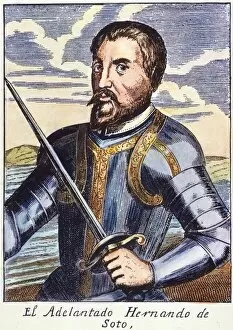
Background imageAge Of Discovery Collection: HERNANDO de SOTO (1500-1542). Colored Spanish engraving, 1728

HERNANDO de SOTO (1500-1542). Colored Spanish engraving, 1728

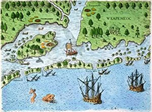
Background imageAge Of Discovery Collection: ROANOKE LANDING, 1585. The landing of the English at Roanoke Island in 1585

ROANOKE LANDING, 1585. The landing of the English at Roanoke Island in 1585. Contrary to the engraved legend, Sir Walter Raleigh, though the promoter of the expedition, remained home in England

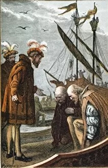
Background imageAge Of Discovery Collection: VASCO DA GAMA taking leave from King Manuel of Portugal at his departure from Lisbon for India

VASCO DA GAMA taking leave from King Manuel of Portugal at his departure from Lisbon for India on July 8, 1497. Colored engraving, 19th century

Background imageAge Of Discovery Collection: SEVILLE: DEPARTURE, 1594. Departure for the New World from Sanlucar de Barrameda

SEVILLE: DEPARTURE, 1594. Departure for the New World from Sanlucar de Barrameda, the port of Seville, Spain. Line engraving, 1594, by Theodor de Bry

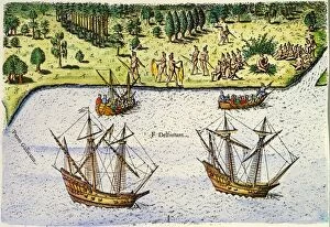
Background imageAge Of Discovery Collection: JEAN RIBAULT: FLORIDA, 1562. The French, under the command of Jean Ribault

JEAN RIBAULT: FLORIDA, 1562. The French, under the command of Jean Ribault, arriving in Florida in 1562. Colored engraving, 1591, by Theodor de Bry after Jacques Le Moyne de Morgues

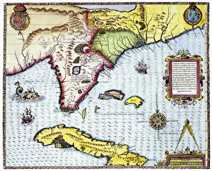
Background imageAge Of Discovery Collection: FLORIDA: MAP, 1591. Engraving by Theodor de Bry after a now lost drawing by Jacques Le Moyne de

FLORIDA: MAP, 1591. Engraving by Theodor de Bry after a now lost drawing by Jacques Le Moyne de Morgues

Background imageAge Of Discovery Collection: SHIP OF DISCOVERY, 1592. Flying fish, attempting to escape predators

SHIP OF DISCOVERY, 1592. Flying fish, attempting to escape predators, fall on board a Portuguese ship of discovery in West Indian waters. Engraving, 1592, by Theodore de Bry

Background imageAge Of Discovery Collection: FRANCISCO PIZARRO (1470?-1541). Spanish conqueror of Peru. Line engraving, Dutch, 1673

FRANCISCO PIZARRO (1470?-1541). Spanish conqueror of Peru. Line engraving, Dutch, 1673

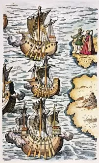
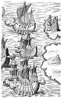
Background imageAge Of Discovery Collection: COLUMBUS: CARAVELS, 1492. Ferdinand and Isabella bidding a symbolic farewell to the caravels of

COLUMBUS: CARAVELS, 1492. Ferdinand and Isabella bidding a symbolic farewell to the caravels of Columbus setting sail from Palos, Spain on 3 August 1492: detail of an engraving from Nova Typis

Background imageAge Of Discovery Collection: HERNANDO de SOTO (1500-1542). Spanish colored engraving, 18th century

HERNANDO de SOTO (1500-1542). Spanish colored engraving, 18th century

Background imageAge Of Discovery Collection: BEHEADING OF PIZARRO, 1548. The beheading of Gonzalo Pizarro (c1502-1548), Spanish conquistador

BEHEADING OF PIZARRO, 1548. The beheading of Gonzalo Pizarro (c1502-1548), Spanish conquistador, in Cuzco, Peru. Color engraving, English, 18th century

Background imageAge Of Discovery Collection: COLUMBUS: SAN SALVADOR. The landing of Columbus at San Salvador (Guanahani) in the Bahamas

COLUMBUS: SAN SALVADOR. The landing of Columbus at San Salvador (Guanahani) in the Bahamas, 12 October 1492. Steel engraving, 19th century, after the painting by John Vanderlyn

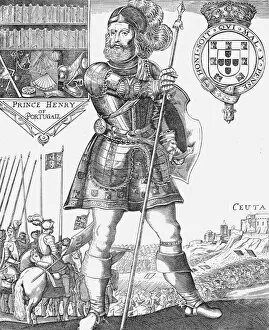
Background imageAge Of Discovery Collection: PRINCE HENRY THE NAVIGATOR at the conquest of Ceuta in 1415: colored engraving, 16th century

PRINCE HENRY THE NAVIGATOR at the conquest of Ceuta in 1415: colored engraving, 16th century

Background imageAge Of Discovery Collection: VASCO da GAMA (c1469-1524). Portuguese navigator. Gama received by the Samorin at Calicut, India

VASCO da GAMA (c1469-1524). Portuguese navigator. Gama received by the Samorin at Calicut, India, in 1498. Line engraving, 1747

Background imageAge Of Discovery Collection: COLUMBUS: LA RABIDA. The convent of La Rabida at Huelva, Spain, where Christopher Columbus

COLUMBUS: LA RABIDA. The convent of La Rabida at Huelva, Spain, where Christopher Columbus and his son Diego sought lodging shortly before Columbus sailed for the New World in 1492

Background imageAge Of Discovery Collection: COLUMBUS: NEW WORLD, 1492. The landing of Christopher Columbus in the New World: engraving

COLUMBUS: NEW WORLD, 1492. The landing of Christopher Columbus in the New World: engraving, early 19th century

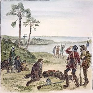
Background imageAge Of Discovery Collection: CABEZA de VACA (c1490-c1557). The arrival of Alvar Nu├▒ez Cabeza de Vaca and his companions

CABEZA de VACA (c1490-c1557). The arrival of Alvar Nu├▒ez Cabeza de Vaca and his companions, the sole survivors of Panfilo de Narvaezs 1528 Florida expedition

Background imageAge Of Discovery Collection: FLORIDA: NATIVE AMERICANS, 1591. Florida Native Americans holding a triumphant

FLORIDA: NATIVE AMERICANS, 1591. Florida Native Americans holding a triumphant and solemn ritual in celebration of the defeat of an enemy

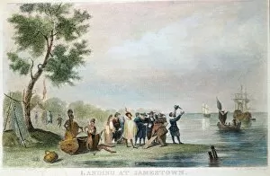
Background imageAge Of Discovery Collection: LANDING IN JAMESTOWN, 1607. American color engraving, 19th century

LANDING IN JAMESTOWN, 1607. American color engraving, 19th century

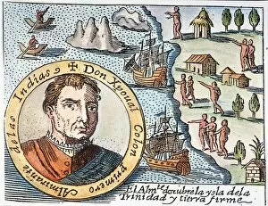
Background imageAge Of Discovery Collection: COLUMBUS: TRINIDAD, 1498. Christopher Columbus and his men discovering the three-peaked island of

COLUMBUS: TRINIDAD, 1498. Christopher Columbus and his men discovering the three-peaked island of Trinidad (top left) in 1498: Spanish engraving, 1730

Background imageAge Of Discovery Collection: COLUMBUS: ARREST, 1500. The arrest of Christopher Columbus at Santo Domingo in 1500 by Francis de

COLUMBUS: ARREST, 1500. The arrest of Christopher Columbus at Santo Domingo in 1500 by Francis de Bobadillo. Engraving, c1590, by Theodor de Bry

Background imageAge Of Discovery Collection: COLUMBUS: TRIBUTE, 1621. Allegorical tribute to Christopher Columbus

COLUMBUS: TRIBUTE, 1621. Allegorical tribute to Christopher Columbus and his discovery of the New World, including America and Spagniolla as shown on the accompanying map: German engraving, 1621

Background imageAge Of Discovery Collection: HERNANDO CORTES (1485-1547). Spanish conqueror of Mexico. Color engraving, 19th century

HERNANDO CORTES (1485-1547). Spanish conqueror of Mexico. Color engraving, 19th century, after an illustration from Antonio de Solis y Ribadeneiras Historia de la Conquista de Mejico, 1684

Background imageAge Of Discovery Collection: COLUMBUS: NATIVE AMERICANS The First Interview of Christopher Columbus with the Natives of America

COLUMBUS: NATIVE AMERICANS The First Interview of Christopher Columbus with the Natives of America (1492): English engraving, 18th century

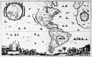
Background imageAge Of Discovery Collection: NEW WORLD MAP, c1650. Line engraving, Amsterdam, Netherlands, c1650

NEW WORLD MAP, c1650. Line engraving, Amsterdam, Netherlands, c1650

Background imageAge Of Discovery Collection: COLUMBUS CARAVELS, 1492. Chrisopher Columbus caravels setting sail from Spain, 3 August 1492

COLUMBUS CARAVELS, 1492. Chrisopher Columbus caravels setting sail from Spain, 3 August 1492. Detail of an engraving from Honorius Philoponus Nova typis transacta navigato novi orbis Indiae

Background imageAge Of Discovery Collection: MAGELLANs VITTORIA, 1522. The Vittoria, the only one of Ferdinand Magellans five ships that

MAGELLANs VITTORIA, 1522. The Vittoria, the only one of Ferdinand Magellans five ships that survived to complete the first circumnavigation of the globe, 1522. Line engraving, 16th century

Background imageAge Of Discovery Collection: HENRY THE NAVIGATOR (1394-1460). Prince of Portugal. Line engraving, 16th century

HENRY THE NAVIGATOR (1394-1460). Prince of Portugal. Line engraving, 16th century

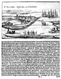
Background imageAge Of Discovery Collection: NEW AMSTERDAM, 1620s. The Hartgers View, the earliest known view of New Amsterdam as it appeared

NEW AMSTERDAM, 1620s. The Hartgers View, the earliest known view of New Amsterdam as it appeared c1626-28. Line engraving, Dutch, 1651

Background imageAge Of Discovery Collection: FERDINAND MAGELLAN (1480-1521). Portuguese navigator. Line engraving, 16th century

FERDINAND MAGELLAN (1480-1521). Portuguese navigator. Line engraving, 16th century

Background imageAge Of Discovery Collection: LANDING OF COLUMBUS, 1492. Wood engraving, American, c1835

LANDING OF COLUMBUS, 1492. Wood engraving, American, c1835

Background imageAge Of Discovery Collection: COLUMBUS: SAN SALVADOR. The landing of Christopher Columbus at San Salvador (Guanahani)

COLUMBUS: SAN SALVADOR. The landing of Christopher Columbus at San Salvador (Guanahani) in the Bahamas, 12 October 1492. Steel engraving, 19th century, after the painting by John Vanderlyn

Background imageAge Of Discovery Collection: ALONSO de OJEDA (1465?-1515). Spanish explorer. Ojeda with a cacique of natives during one of his

ALONSO de OJEDA (1465?-1515). Spanish explorer. Ojeda with a cacique of natives during one of his many expeditions in the West Indies. Wood engraving, American, 19th century

Background imageAge Of Discovery Collection: MAGELLANs FLEET, 1519. Ferdinand Magellans fleet of five ships after their departure from Spain

MAGELLANs FLEET, 1519. Ferdinand Magellans fleet of five ships after their departure from Spain on 20 September 1519; only one, the Vittoria, completed the circumnavigation of the earth in 1522

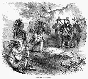
Background imageAge Of Discovery Collection: DUTCH-NATIVE AMERICAN FUR TRADE. Dutch colonists trading with Native Americans along the Hudson

DUTCH-NATIVE AMERICAN FUR TRADE. Dutch colonists trading with Native Americans along the Hudson River. Wood engraving, American, 19th century

Background imageAge Of Discovery Collection: LANDING OF COLUMBUS, 1492. The landing of Christopher Columbus in the New World, 12 October 1492

LANDING OF COLUMBUS, 1492. The landing of Christopher Columbus in the New World, 12 October 1492. Steel engraving, American, 1858, after a painting by Alonzo Chappel

Background imageAge Of Discovery Collection: MAP OF NEW FRANCE, 1555. From Guillaume le Testus Cosmographie Universelle

MAP OF NEW FRANCE, 1555. From Guillaume le Testus Cosmographie Universelle, 1555

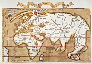
Background imageAge Of Discovery Collection: WALDSEEMULLER: WORLD MAP. Map of the world by Martin Waldseemuller and Laurens Fries

WALDSEEMULLER: WORLD MAP. Map of the world by Martin Waldseemuller and Laurens Fries, printed at Strassburg in 1535, showing only a hint of the New World at left

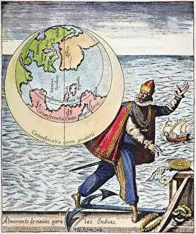
Background imageAge Of Discovery Collection: W. HEMISPHERE MAP, 1596. Theodore de Brys map of the western hemisphere

W. HEMISPHERE MAP, 1596. Theodore de Brys map of the western hemisphere, 1596, surrounded by the explorers (clockwise from top left) Columbus, Vespucci, Pizarro, and Magellan

Background imageAge Of Discovery Collection: COLUMBUS: WEST INDIES MAP. Map, 1892, illustrating presumed route of the first voyage of Columbus in

COLUMBUS: WEST INDIES MAP. Map, 1892, illustrating presumed route of the first voyage of Columbus in the West Indies

Background imageAge Of Discovery Collection: NEW WORLD MAP, 1616. English map of the western hemisphere published by John Speed in 1616

NEW WORLD MAP, 1616. English map of the western hemisphere published by John Speed in 1616. California appears as a huge island and the views along both sides are of natives in fanciful costumes

Background imageAge Of Discovery Collection: MAP: PORTOLAN ATLAS, c1545. Portolan Atlas showing the Caribbean, Central America

MAP: PORTOLAN ATLAS, c1545. Portolan Atlas showing the Caribbean, Central America, and North and South America, by Pierre Desceliers, c1545

Background imageAge Of Discovery Collection: MAP: ATLANTIC VOYAGES. Map showing the routes of the major European voyages of discovery

MAP: ATLANTIC VOYAGES. Map showing the routes of the major European voyages of discovery, from Leif Ericsson (1001) to Henry Hudson (1610)

Background imageAge Of Discovery Collection: NEW WORLD MAP, 1570. A New Description of America, or the New World

NEW WORLD MAP, 1570. A New Description of America, or the New World. Map from Abraham Ortelius Theatrum Orbis Terrarum, 1570

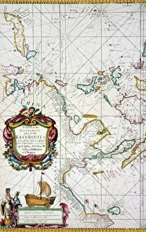
Background imageAge Of Discovery Collection: EAST INDIES MAP, 1670. Detail of a chart of the East Indies (oriented with north at the left)

EAST INDIES MAP, 1670. Detail of a chart of the East Indies (oriented with north at the left) by John Seller, 1670

Background imageAge Of Discovery Collection: MAP: EAST INDIES, 1670. Chart of the East Indies (oriented with north at the left) by John Seller

MAP: EAST INDIES, 1670. Chart of the East Indies (oriented with north at the left) by John Seller, 1670


For sale as Licensed Images

Choose your image, Select your licence and Download the media

The Age of Discovery, a remarkable era in history, was characterized by the exploration and mapping of new territories. Maps from this period provide glimpses into the vast knowledge gained during these expeditions. Ortelius's map of the Ottoman Empire in 1570 showcases the intricate details and boundaries of this powerful empire, and is a testament to the expanding horizons and growing curiosity of explorers during this time. Captain John Smith's map of Virginia in 1612 offers insights into early English colonization efforts in North America. This detailed depiction highlights the challenges faced by settlers as they navigated unfamiliar lands. Abraham Ortelius' engraved Azores map from around 1584 provides an intriguing glimpse into one of Europe's most important maritime regions. The accuracy and precision displayed on this map demonstrate advancements made in cartography during this age. Oronce Fine's world map from 1531 presents a fascinating perspective on global geography at that time. Its inclusion of newly discovered lands reflects how explorers were continuously pushing boundaries and uncovering previously unknown territories. Juan Vespucci's world map from 1526, based on his uncle Amerigo Vespucci's voyages, contributes to our understanding of early European exploration across continents. This significant document sheds light on how discoveries were being disseminated throughout Europe. The Cantino World Map from 1502 reveals Western half geographical knowledge at that time, showcasing Portuguese discoveries along with other European nations' contributions to expanding geographic understanding. A seventeenth-century New World map illustrates how Europeans gradually began comprehending the vastness and diversity present within these uncharted lands. It serves as a reminder that every voyage brought forth new information about these mysterious territories. A Map of Europe dating back to 1700 captures political borders amidst shifting alliances during an era marked by territorial disputes among European powers. Such maps played crucial roles in shaping diplomatic negotiations and military strategies alike.