Age Of Discovery Collection (#6)

The Age of Discovery, a remarkable era in history, was characterized by the exploration and mapping of new territories

Background imageAge Of Discovery Collection: THE LADRONE ISLANDS. French drawing after Pigafettas account of Magellans voyage

THE LADRONE ISLANDS. French drawing after Pigafettas account of Magellans voyage

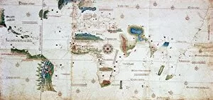
Background imageAge Of Discovery Collection: CANTINO WORLD MAP, 1502. The Cantino chart of 1502, the earliest Portugese manuscript

CANTINO WORLD MAP, 1502. The Cantino chart of 1502, the earliest Portugese manuscript showing New World discoveries

Background imageAge Of Discovery Collection: MAP OF THE NEW WORLD, 1544. Woodcut from Sebastian Munsters Cosmographia, 1544

MAP OF THE NEW WORLD, 1544. Woodcut from Sebastian Munsters Cosmographia, 1544

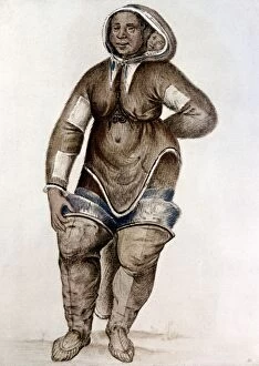
Background imageAge Of Discovery Collection: ESKIMO WOMAN AND BABY Native American of southern Baffin Island probably captured

ESKIMO WOMAN AND BABY Native American of southern Baffin Island probably captured by Frobisher on his second voyage to the North-West in 1577

Background imageAge Of Discovery Collection: PERU: INCAN COURT. Spanish explorers in the court of Incan king Atahualpa at Cajamarca

PERU: INCAN COURT. Spanish explorers in the court of Incan king Atahualpa at Cajamarca, Peru

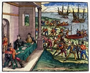
Background imageAge Of Discovery Collection: SPANISH DEFEAT, 1515. The Defeat of D Ayllon by the Chicoreans

SPANISH DEFEAT, 1515. The Defeat of D Ayllon by the Chicoreans. Spanish troops led by Vasquez de Ayllon driven away by Native Americans in southeastern America, 1515. Engraving, American, 1853

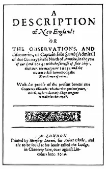
Background imageAge Of Discovery Collection: JOHN SMITH: TITLE PAGE. Title-page of the first edition of John Smiths A Description

JOHN SMITH: TITLE PAGE. Title-page of the first edition of John Smiths A Description of New England, London, England, 1616

Background imageAge Of Discovery Collection: VIRGINIA REPORT, 1590. Title-page of Thomas Hariots Briefe and tru report of

VIRGINIA REPORT, 1590. Title-page of Thomas Hariots Briefe and tru report of the new found land of Virginia, published by Theodor de Bry at Frankfurt, Germany, 1590

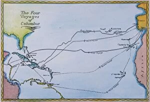
Background imageAge Of Discovery Collection: COLUMBUS: MAP, 15th CENTURY. Map of the four voyages made by Christopher Columbus

COLUMBUS: MAP, 15th CENTURY. Map of the four voyages made by Christopher Columbus from Spain to the New World

Background imageAge Of Discovery Collection: COLUMBUS: MAP, 1492. Track of Christopher Columbus movements during his first voyage

COLUMBUS: MAP, 1492. Track of Christopher Columbus movements during his first voyage, 1492, after the landfall until he started on the return voyage

Background imageAge Of Discovery Collection: VIRGINIA PAMPHLET, 1588. Title-page of Thomas Harriots Report of the new found land of Virginia

VIRGINIA PAMPHLET, 1588. Title-page of Thomas Harriots Report of the new found land of Virginia, London, 1588, which promoted share buying

Background imageAge Of Discovery Collection: COLUMBUS: NEW WORLD, 1492. The First Sight of the New World (Christopher Columbus

COLUMBUS: NEW WORLD, 1492. The First Sight of the New World (Christopher Columbus discovering America). American lithograph, 1892, after a painting of 1846 by Christian Ruben

Background imageAge Of Discovery Collection: MANHATTAN PURCHASE, 1626. Dutch colonial official Peter Minuits purchase of Manhattan

MANHATTAN PURCHASE, 1626. Dutch colonial official Peter Minuits purchase of Manhattan Island from the Wappinger Indians, 1626. Line drawing, 1891

Background imageAge Of Discovery Collection: CHRISTOPHER COLUMBUS. Native Americans flee in fear of Columbus

CHRISTOPHER COLUMBUS. Native Americans flee in fear of Columbus. Colored woodcut from Giuliano Datis Isole Trovate Nuovamente Per El Re di Spagna, Florence, 1493

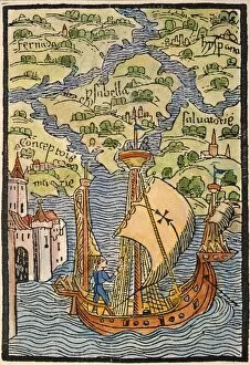
Background imageAge Of Discovery Collection: COLUMBUS: WEST INDIES, 1492. The West Indian Isles discovered by Christopher Columbus

COLUMBUS: WEST INDIES, 1492. The West Indian Isles discovered by Christopher Columbus. Colored woodcut from the illustrated edition of the Columbus letter to Sanchez, 1493

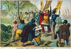
Background imageAge Of Discovery Collection: COLUMBUS: NEW WORLD, 1492. Columbus taking possession of the New World. American lithograph

COLUMBUS: NEW WORLD, 1492. Columbus taking possession of the New World. American lithograph, 1892

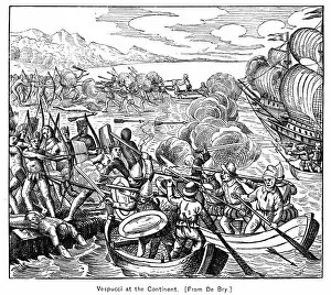
Background imageAge Of Discovery Collection: Italian navigator. Vespucci and his crew beset by native Indians as they arrive on the coast of

Italian navigator. Vespucci and his crew beset by native Indians as they arrive on the coast of what is now Guiana
AMERIGO VESPUCCI (1454-1512). Italian navigator. Vespucci and his crew beset by native Indians as they arrive on the coast of what is now Guiana during their voyage of 1499-1500

Background imageAge Of Discovery Collection: Natives of Hispaniola aid Christopher Columbus crew in salvaging supplies from the Santa Maria

Natives of Hispaniola aid Christopher Columbus crew in salvaging supplies from the Santa Maria
SANTA MARIA: WRECK, 1492. Natives of Hispaniola aid Christopher Columbus crew in salvaging supplies from the Santa Maria, wrecked on a coral reef on Christmas Day 1492

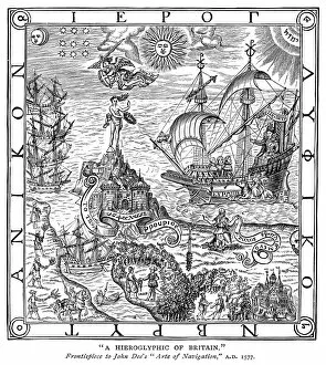
Background imageAge Of Discovery Collection: A Hieroglyphic of Britain. Allegorical depiction of the nation of Great Britain

A Hieroglyphic of Britain. Allegorical depiction of the nation of Great Britain
GREAT BRITAIN: ALLEGORY. A Hieroglyphic of Britain. Allegorical depiction of the nation of Great Britain. Frontispiece to John Dees Arte of Navigation, 1577

Background imageAge Of Discovery Collection: Plan of the Spanish fort of San Mateo (formerly the French Fort Caroline, until 1565)

Plan of the Spanish fort of San Mateo (formerly the French Fort Caroline, until 1565). Drawing, c1590
FLORIDA: SPANISH FORT. Plan of the Spanish fort of San Mateo (formerly the French Fort Caroline, until 1565). Drawing, c1590

Background imageAge Of Discovery Collection: The second French expedition to Florida, under Rene de Laudonniere

The second French expedition to Florida, under Rene de Laudonniere, begin the construction of Fort Caroline on an
FORT CAROLINE, 1564. The second French expedition to Florida, under Rene de Laudonniere, begin the construction of Fort Caroline on an island in the St. Johns River in 1564

Background imageAge Of Discovery Collection: The taking of St. Augustine, Florida, by Sir Francis Drake on 7 June 1586

The taking of St. Augustine, Florida, by Sir Francis Drake on 7 June 1586
TAKING OF ST. AUGUSTINE. The taking of St. Augustine, Florida, by Sir Francis Drake on 7 June 1586. Colored engraving, 1588, the earliest engraved view of a U.S. city

Background imageAge Of Discovery Collection: Plan of Fort Caroline on the St. Johns River, built by the second French expedition to Florida in

Plan of Fort Caroline on the St. Johns River, built by the second French expedition to Florida in 1564
FORT CAROLINE, 1564. Plan of Fort Caroline on the St. Johns River, built by the second French expedition to Florida in 1564

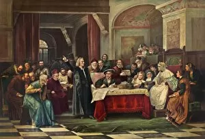
Background imageAge Of Discovery Collection: (1451-1509). Italian navigator. Columbus explaining his planned voyage in search of a sea route to

(1451-1509). Italian navigator. Columbus explaining his planned voyage in search of a sea route to Asia while staying
CHRISTOPHER COLUMBUS (1451-1509). Italian navigator. Columbus explaining his planned voyage in search of a sea route to Asia while staying at the monastery of La Rabida, 1490

Background imageAge Of Discovery Collection: Francis Drakes Golden Hind, 16th century

Francis Drakes Golden Hind, 16th century
Francis Drakes Golden Hind. Cutaway artwork of the English galleon the Golden Hind that is most famous for circumnavigating the globe

Background imageAge Of Discovery Collection: Christopher Columbus, Italian explorer C015 / 5790

Christopher Columbus, Italian explorer C015 / 5790
Christopher Columbus, Italian explorer

Background imageAge Of Discovery Collection: Dutch Northeast Arctic expedition, 1596-7 C017 / 8047

Dutch Northeast Arctic expedition, 1596-7 C017 / 8047
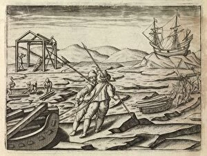
Dutch Northeast Arctic expedition. Artwork of a scene from the Dutch expedition of 1596-7 that attempted to find a Northeast passage through the Arctic from Europe to the East Indies

Background imageAge Of Discovery Collection: Columbus returns to Spain, February 1493 C016 / 4495

Columbus returns to Spain, February 1493 C016 / 4495
Columbus returns to Spain. 19th-century artwork of the Italian explorer Christopher Columbus (1451-1506, centre) at the court of Barcelona in February 1493 following his return from the New World

Background imageAge Of Discovery Collection: Columbus departs Spain, August 1492 C016 / 4493

Columbus departs Spain, August 1492 C016 / 4493
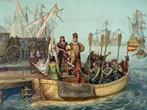
Columbus departs Spain. 19th-century artwork of the Italian explorer Christopher Columbus (1451-1506) kissing the hand of Queen Isabella I of Castile on 3 August 1492

Background imageAge Of Discovery Collection: Columbus at Spains royal court, May 1486

Columbus at Spains royal court, May 1486
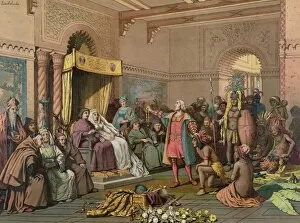
Columbus at Spains royal court. 19th-century artwork of the Italian explorer Christopher Columbus (1451-1506, centre left)

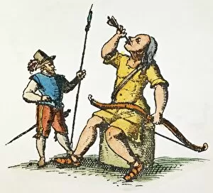
Background imageAge Of Discovery Collection: A European watches a Patagonian giant swallowing an arrow to cure his stomach ache

A European watches a Patagonian giant swallowing an arrow to cure his stomach ache. Line engraving, 1602
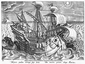
PATAGONIAN GIANT, 1602. A European watches a Patagonian giant swallowing an arrow to cure his stomach ache. Line engraving, 1602

Background imageAge Of Discovery Collection: Last Inca king of Peru. Illustration from a Spanish album

Last Inca king of Peru. Illustration from a Spanish album
ATAHUALPA (c1500-1533). Last Inca king of Peru. Illustration from a Spanish album

Background imageAge Of Discovery Collection: PATAGONIAN GIANT, 1602. A European watches a Patagonian giant swallowing an arrow to cure his

PATAGONIAN GIANT, 1602. A European watches a Patagonian giant swallowing an arrow to cure his stomach ache. Line engraving, 1602

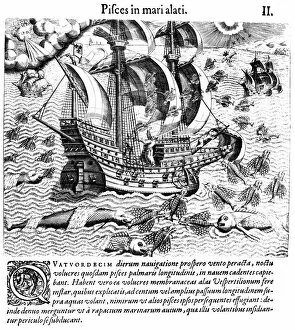
Background imageAge Of Discovery Collection: FLYING FISH, 1594. Flying fish, attempting to escape predators

FLYING FISH, 1594. Flying fish, attempting to escape predators, fall on the deck of Italian explorer Girolamo Benzonis ship in West Indian waters, 1541. Engraving, 1594, by Theodor de Bry

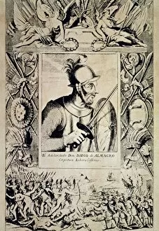
Background imageAge Of Discovery Collection: DIEGO DE ALMAGRO (c1475-1538). Spanish soldier. Spanish line engraving, 17th century

DIEGO DE ALMAGRO (c1475-1538). Spanish soldier. Spanish line engraving, 17th century

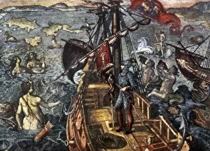
Background imageAge Of Discovery Collection: EXPLORER & MERMAIDS, c1591. A European explorer being visited by mermaids and other sea creatures

EXPLORER & MERMAIDS, c1591. A European explorer being visited by mermaids and other sea creatures. Color copper engraving by Theodore de Bry, c1591

Background imageAge Of Discovery Collection: CONQUISTADOR SHIP. A heavily armed ship, probably Spanish, bearing the Jesuit monogram IHS on a sail

CONQUISTADOR SHIP. A heavily armed ship, probably Spanish, bearing the Jesuit monogram IHS on a sail. Line engraving by Theodor Galle (1571-1633)

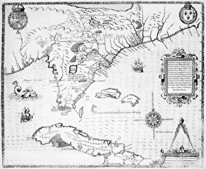
Background imageAge Of Discovery Collection: MAP: CARIBBEAN, c1591. Map of Florida and the Caribbean. Color copper engraving by Theodore de

MAP: CARIBBEAN, c1591. Map of Florida and the Caribbean. Color copper engraving by Theodore de Bry, c1591

Background imageAge Of Discovery Collection: INCA EMPIRE: CONQUEST. Inca natives of Peru collecting a ransom of gold

INCA EMPIRE: CONQUEST. Inca natives of Peru collecting a ransom of gold and silver to be given to the Spanish conquistadors under Francisco Pizarro, in exchange for the release of King Atahualpa

Background imageAge Of Discovery Collection: DE BRY: FRONTISPIECE. Frontispiece for a book about the discovery of the New World

DE BRY: FRONTISPIECE. Frontispiece for a book about the discovery of the New World. Color line engraving by Theodor de Bry, 16th century

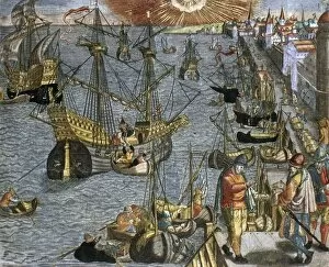
Background imageAge Of Discovery Collection: NEW WORLD: VOYAGE, 1592. The departure of an exploratory voyage to the New World from Lisbon

NEW WORLD: VOYAGE, 1592. The departure of an exploratory voyage to the New World from Lisbon. Colored engraving, 1592, by Theodor de Bry

Background imageAge Of Discovery Collection: NEW WORLD: SPANISH, 1590. Departure of a Spanish voyage to the New World

NEW WORLD: SPANISH, 1590. Departure of a Spanish voyage to the New World. Engraving by Theodor de Bry, 1590

Background imageAge Of Discovery Collection: VERRAZZANO: MAP, 1542. Giovanni da Verrazzanos map of North America, entitled

VERRAZZANO: MAP, 1542. Giovanni da Verrazzanos map of North America, entitled, Regiones orbis terrar, issued in 1542

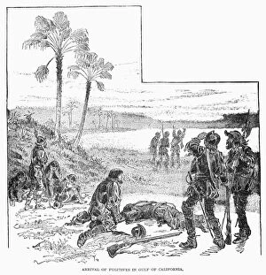
Background imageAge Of Discovery Collection: CABEZA de VACA (c1490-c1557). Alvar Nu├▒ez Cabeza de Vaca. Spanish explorer

CABEZA de VACA (c1490-c1557). Alvar Nu├▒ez Cabeza de Vaca. Spanish explorer. The arrival of Cabeza de Vaca and his companions

Background imageAge Of Discovery Collection: RIBAULT EXPEDITION, 1562. A French expedition under the command of Jean Ribault arrives at Port

RIBAULT EXPEDITION, 1562. A French expedition under the command of Jean Ribault arrives at Port Royal (present-day Beaufort), South Carolina, 1562

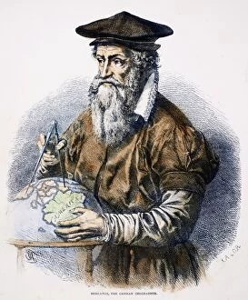
Background imageAge Of Discovery Collection: GERHARDUS MERCATOR (1512-1594). Flemish geographer. Wood engraving, 19th century

GERHARDUS MERCATOR (1512-1594). Flemish geographer. Wood engraving, 19th century

Background imageAge Of Discovery Collection: FLORIDA: MAP, 1591. Engraved map of Florida by Jacques Le Moyne de Morgues published by Theodor de

FLORIDA: MAP, 1591. Engraved map of Florida by Jacques Le Moyne de Morgues published by Theodor de Bry at Frankfort, 1591

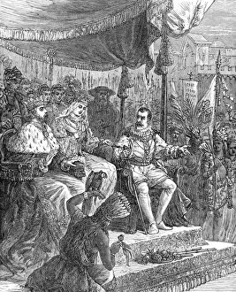
Background imageAge Of Discovery Collection: COLUMBUS AT BARCELONA. Christopher Columbus at the court of Barcelona, Spain

COLUMBUS AT BARCELONA. Christopher Columbus at the court of Barcelona, Spain, following his return from the New World, 1493. Wood engraving, American, 19th century


For sale as Licensed Images

Choose your image, Select your licence and Download the media

The Age of Discovery, a remarkable era in history, was characterized by the exploration and mapping of new territories. Maps from this period provide glimpses into the vast knowledge gained during these expeditions. Ortelius's map of the Ottoman Empire in 1570 showcases the intricate details and boundaries of this powerful empire, and is a testament to the expanding horizons and growing curiosity of explorers during this time. Captain John Smith's map of Virginia in 1612 offers insights into early English colonization efforts in North America. This detailed depiction highlights the challenges faced by settlers as they navigated unfamiliar lands. Abraham Ortelius' engraved Azores map from around 1584 provides an intriguing glimpse into one of Europe's most important maritime regions. The accuracy and precision displayed on this map demonstrate advancements made in cartography during this age. Oronce Fine's world map from 1531 presents a fascinating perspective on global geography at that time. Its inclusion of newly discovered lands reflects how explorers were continuously pushing boundaries and uncovering previously unknown territories. Juan Vespucci's world map from 1526, based on his uncle Amerigo Vespucci's voyages, contributes to our understanding of early European exploration across continents. This significant document sheds light on how discoveries were being disseminated throughout Europe. The Cantino World Map from 1502 reveals Western half geographical knowledge at that time, showcasing Portuguese discoveries along with other European nations' contributions to expanding geographic understanding. A seventeenth-century New World map illustrates how Europeans gradually began comprehending the vastness and diversity present within these uncharted lands. It serves as a reminder that every voyage brought forth new information about these mysterious territories. A Map of Europe dating back to 1700 captures political borders amidst shifting alliances during an era marked by territorial disputes among European powers. Such maps played crucial roles in shaping diplomatic negotiations and military strategies alike.