Age Of Discovery Collection (#5)

The Age of Discovery, a remarkable era in history, was characterized by the exploration and mapping of new territories

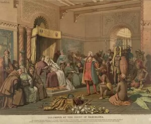
Background imageAge Of Discovery Collection: COLUMBUS AT BARCELONA. Christopher Columbus at the court of Barcelona, Spain, following

COLUMBUS AT BARCELONA. Christopher Columbus at the court of Barcelona, Spain, following his return from the New World, 1493

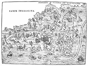
Background imageAge Of Discovery Collection: JACQUES CARTIER MAP, 1566. Map showing Jacques Cartiers discoveries in the new

JACQUES CARTIER MAP, 1566. Map showing Jacques Cartiers discoveries in the new World from Giovanni Battista Ramusios Raccolta, Venice, Italy, 1566

Background imageAge Of Discovery Collection: COLUMBUS: SANTA MARIA. A modern replica of Christopher Columbus caravel, Santa Maria

COLUMBUS: SANTA MARIA. A modern replica of Christopher Columbus caravel, Santa Maria, made for a motion picture

Background imageAge Of Discovery Collection: JACQUES CARTIER (1491-1557). French explorer in North America. Cartier ascending the St

JACQUES CARTIER (1491-1557). French explorer in North America. Cartier ascending the St. Lawrence River. Color lithograph

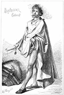
Background imageAge Of Discovery Collection: BARTHOLOMEW COLUMBUS (c1445-c1514). Italian sea captain in Spanish service

BARTHOLOMEW COLUMBUS (c1445-c1514). Italian sea captain in Spanish service and brother of Christopher Columbus. Etching, French, 19th century

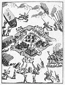
Background imageAge Of Discovery Collection: DE SOTO: ALABAMA NATIVE AMERICANS. The expedition of Hernando de Soto besieges

DE SOTO: ALABAMA NATIVE AMERICANS. The expedition of Hernando de Soto besieges the encampment of the Alabama Native Americans at Mauvila (or Mabila), 1540

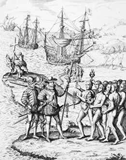
Background imageAge Of Discovery Collection: COLUMBUS IN NEW WORLD. The earliest depiction of Christopher Columbus landing in

COLUMBUS IN NEW WORLD. The earliest depiction of Christopher Columbus landing in the New World in 1492. Woodcut from Giuliano Datis Narrative of Columbus, Florence, Italy, 1493

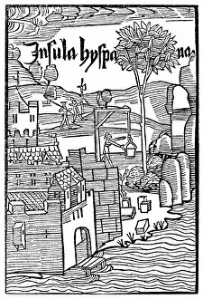
Background imageAge Of Discovery Collection: FORT AT NAVIDAD, 1493. The fort at Navidad on Hispaniola, built largely from the

FORT AT NAVIDAD, 1493. The fort at Navidad on Hispaniola, built largely from the timbers of the Santa Maria by members of Christopher Columbus crew

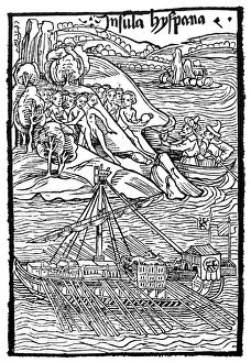
Background imageAge Of Discovery Collection: LANDING OF COLUMBUS, 1492. The West Indian islands discovered by Christopher Columbus

LANDING OF COLUMBUS, 1492. The West Indian islands discovered by Christopher Columbus. Woodcut from the illustrated edition of the Columbus letter to Gabriel Sanchez, 1493

Background imageAge Of Discovery Collection: JOHN CABOT (1450-1498). Italian navigator and explorer

JOHN CABOT (1450-1498). Italian navigator and explorer. Cabot and his ship Mathew off the coast of Newfoundland in 1497. pen and ink drawing by Charles W. Jefferys

Background imageAge Of Discovery Collection: CHRISTOPHER COLUMBUS (1451-1506). Italian navigator. Columbus landing on the island of Hispaniola

CHRISTOPHER COLUMBUS (1451-1506). Italian navigator. Columbus landing on the island of Hispaniola, 1492. Etching, Spanish, 1728

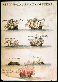
Background imageAge Of Discovery Collection: CABRAL: FLEET, 1500. Seven of the 13 Portuguese ships in Pedro Alvares Cabral s

CABRAL: FLEET, 1500. Seven of the 13 Portuguese ships in Pedro Alvares Cabral s
CABRAL: FLEET, 1500. Seven of the 13 Portuguese ships in Pedro Alvares Cabrals expedition to India in 1500, which resulted in the discoveries of Brazil and Madagascar

Background imageAge Of Discovery Collection: PEDRO de ALVARADO (1495?-1541). Spanish soldier in America. Lithograph, Spanish

PEDRO de ALVARADO (1495?-1541). Spanish soldier in America. Lithograph, Spanish, 19th century

Background imageAge Of Discovery Collection: COLUMBUS: HISPANIOLA, 1492. Christopher Columbus trading with the native Indians

COLUMBUS: HISPANIOLA, 1492. Christopher Columbus trading with the native Indians of Hispaniola on his first voyage to the New World, 1492

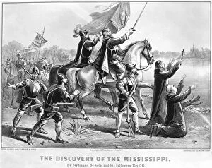
Background imageAge Of Discovery Collection: HERNANDO DE SOTO (c1500-1542). Spanish explorer in America

HERNANDO DE SOTO (c1500-1542). Spanish explorer in America. Lithograph, 1876, by Currier & Ives

Background imageAge Of Discovery Collection: CORTES LETTER, 1522. Title-page of the first edition of Cortes Second Letter

CORTES LETTER, 1522. Title-page of the first edition of Cortes Second Letter, entitled Carta de Relacion. Printed at Seville in 1522

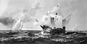
Background imageAge Of Discovery Collection: COLUMBUS: CARAVELS. The fleet of Christopher Columbus off the Canary Islands during

COLUMBUS: CARAVELS. The fleet of Christopher Columbus off the Canary Islands during their voyage across the Atlantic, 1492. Oil on canvas by Fred Pansing

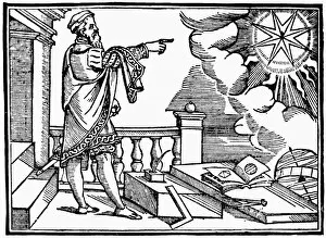
Background imageAge Of Discovery Collection: ASTRONOMER, 1568. An astronomer and cosmographer. Woodcut, 1568, by Jost Amman

ASTRONOMER, 1568. An astronomer and cosmographer. Woodcut, 1568, by Jost Amman

Background imageAge Of Discovery Collection: SPANISH CARAVEL, c1587. A Spanish caravel flying the red cross of Santiago

SPANISH CARAVEL, c1587. A Spanish caravel flying the red cross of Santiago. Detail from the Atlas Portulano, by Juan Martinez, c1587

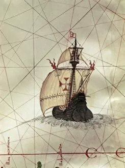
Background imageAge Of Discovery Collection: PORTUGUESE CARAVEL. A Portuguese caravel ship. Detail of a map, 15th-17th century

PORTUGUESE CARAVEL. A Portuguese caravel ship. Detail of a map, 15th-17th century

Background imageAge Of Discovery Collection: SHIP: VENICE, 1486. The building of a ship in Venice

SHIP: VENICE, 1486. The building of a ship in Venice. German woodcut, 1486, from Bernhard von Breydenbachs Sanctae Peregrinationes
Background imageAge Of Discovery Collection: NAVIGATION STUDENT, 1556. The Student of Navigation
NAVIGATION STUDENT, 1556. The Student of Navigation. Woodcut from Martin Cortes Breve Compendio de la Sphera, Seville, 1556

Background imageAge Of Discovery Collection: NAVIGATOR, 1523. Woodcut, 1523, from the title-page of a book about the voyages

NAVIGATOR, 1523. Woodcut, 1523, from the title-page of a book about the voyages of Ludouico de Verthema, published at Milan

Background imageAge Of Discovery Collection: MAGELLANs VITTORIA. The Vittoria, the last surviving ship of Ferdinand Magellans command

MAGELLANs VITTORIA. The Vittoria, the last surviving ship of Ferdinand Magellans command and the first one to circumnavigate the globe. After a 16th century woodcut

Background imageAge Of Discovery Collection: SAGRES, 1587. Some of the installations on the capes of Sagres and St Vincent in

SAGRES, 1587. Some of the installations on the capes of Sagres and St Vincent in southern Portugal where, according to tradition, Prince Henry the Navigator sponsored many innovations in navigation

Background imageAge Of Discovery Collection: MAP: JOHN WHITE, c1585. The camp of Englishmen on St

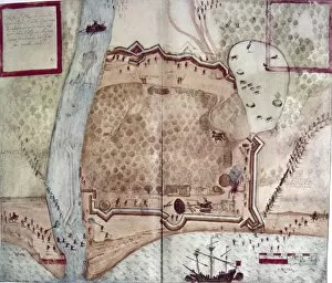
MAP: JOHN WHITE, c1585. The camp of Englishmen on St. Johns Island at Sir Walter Raleighs Virginia. Drawing by John White, c1585

Background imageAge Of Discovery Collection: FIRST PRINTED MAP, 1472. The first printed map, 1472, with accompanying printed text from St

FIRST PRINTED MAP, 1472. The first printed map, 1472, with accompanying printed text from St. Isidore of Sevilles explanation of the world, originally written in the late 6th century

Background imageAge Of Discovery Collection: MAP: MAGELLANs VOYAGE. Gore-map showing Ferdinand Magellans circumnavigation of the globe

MAP: MAGELLANs VOYAGE. Gore-map showing Ferdinand Magellans circumnavigation of the globe, 1519-1522

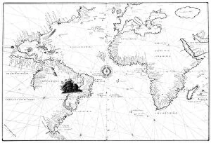
Background imageAge Of Discovery Collection: MAP: ATLANTIC OCEAN, 1554. Map of Europe and North and South America. Produced in Venice

MAP: ATLANTIC OCEAN, 1554. Map of Europe and North and South America. Produced in Venice, 1554

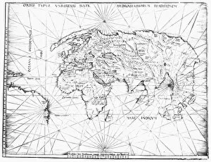
Background imageAge Of Discovery Collection: WORLD MAP, c1492. World map showing only the Eastern Hemisphere

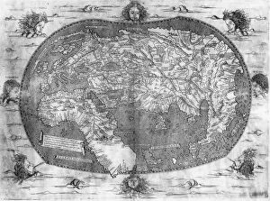
WORLD MAP, c1492. World map showing only the Eastern Hemisphere. One of the first maps to depict the Cape of Good Hope, Madagascar and Zanzibar

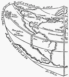
Background imageAge Of Discovery Collection: NEW WORLD MAP, 1556. Map of Giovanni Battista Ramusios depiction of North and South America

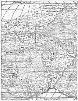
NEW WORLD MAP, 1556. Map of Giovanni Battista Ramusios depiction of North and South America. Woodcut, 1556

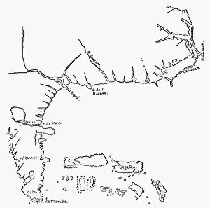
Background imageAge Of Discovery Collection: STRAITS OF MAGELLAN, 1598. Patagonia and the Straits of Magellan as depicted in Olivier

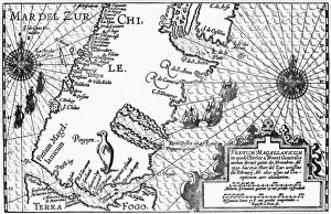
STRAITS OF MAGELLAN, 1598. Patagonia and the Straits of Magellan as depicted in Olivier du Noorts Description du penible Voyage, published, 1602, in Amsterdam

Background imageAge Of Discovery Collection: WESTERN HEMISPHERE, 1576. Map of the Western Hemisphere from Sir Humphrey Gilbert s

WESTERN HEMISPHERE, 1576. Map of the Western Hemisphere from Sir Humphrey Gilbert s
WESTERN HEMISPHERE, 1576. Map of the Western Hemisphere from Sir Humphrey Gilberts Discourse of a Discoverie for a new passage to Cataia, 1576

Background imageAge Of Discovery Collection: MAP OF NORTH AMERICA, 1585. John Whites map of Americas eastern coast from Chesapeake

MAP OF NORTH AMERICA, 1585. John Whites map of Americas eastern coast from Chesapeake to Florida, 1585

Background imageAge Of Discovery Collection: VIRGINIA COMPANY MAP, c1607. Map of the world featuring North America by the Virginia

VIRGINIA COMPANY MAP, c1607. Map of the world featuring North America by the Virginia Company of London

Background imageAge Of Discovery Collection: WORLD MAP, 16th CENTURY. Map of the world from Battista Agneses Atlas, c1542-52

WORLD MAP, 16th CENTURY. Map of the world from Battista Agneses Atlas, c1542-52

Background imageAge Of Discovery Collection: WORLD MAP, c1513. World map by Martin Waldseemuller, thought by some to have been

WORLD MAP, c1513. World map by Martin Waldseemuller, thought by some to have been compiled with the assistance of Christopher Columbus and so referred to as the Admirals Map, c1513

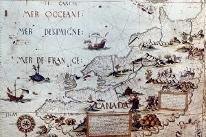
Background imageAge Of Discovery Collection: NORTH AMERICA: MAP, 1550. French planisphere of North America

NORTH AMERICA: MAP, 1550. French planisphere of North America

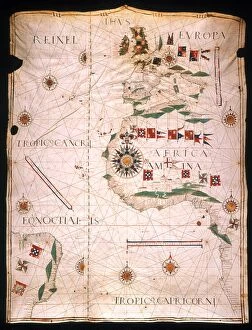
Background imageAge Of Discovery Collection: MAP OF THE ATLANTIC, 1534. Manuscript map on parchment by Jorge Reinel

MAP OF THE ATLANTIC, 1534. Manuscript map on parchment by Jorge Reinel

Background imageAge Of Discovery Collection: RELACAM VERDADEIRA, 1577. Title page of the first printed account of Hernando de Sotos discovery

RELACAM VERDADEIRA, 1577. Title page of the first printed account of Hernando de Sotos discovery and exploration of Florida, the Relacam Verdadeira. Printed at Evora, Portugal, in 1577

Background imageAge Of Discovery Collection: THE LADRONE ISLANDS. French drawing after Pigafettas account of Magellans voyage

THE LADRONE ISLANDS. French drawing after Pigafettas account of Magellans voyage

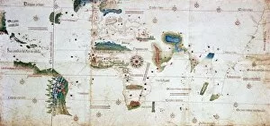
Background imageAge Of Discovery Collection: CANTINO WORLD MAP, 1502. The Cantino chart of 1502, the earliest Portugese manuscript

CANTINO WORLD MAP, 1502. The Cantino chart of 1502, the earliest Portugese manuscript showing New World discoveries

Background imageAge Of Discovery Collection: MAP OF THE NEW WORLD, 1544. Woodcut from Sebastian Munsters Cosmographia, 1544

MAP OF THE NEW WORLD, 1544. Woodcut from Sebastian Munsters Cosmographia, 1544

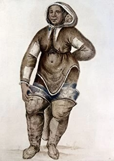
Background imageAge Of Discovery Collection: ESKIMO WOMAN AND BABY Native American of southern Baffin Island probably captured

ESKIMO WOMAN AND BABY Native American of southern Baffin Island probably captured by Frobisher on his second voyage to the North-West in 1577

Background imageAge Of Discovery Collection: PERU: INCAN COURT. Spanish explorers in the court of Incan king Atahualpa at Cajamarca

PERU: INCAN COURT. Spanish explorers in the court of Incan king Atahualpa at Cajamarca, Peru

Background imageAge Of Discovery Collection: SPANISH DEFEAT, 1515. The Defeat of D Ayllon by the Chicoreans

SPANISH DEFEAT, 1515. The Defeat of D Ayllon by the Chicoreans. Spanish troops led by Vasquez de Ayllon driven away by Native Americans in southeastern America, 1515. Engraving, American, 1853

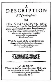
Background imageAge Of Discovery Collection: JOHN SMITH: TITLE PAGE. Title-page of the first edition of John Smiths A Description

JOHN SMITH: TITLE PAGE. Title-page of the first edition of John Smiths A Description of New England, London, England, 1616

Background imageAge Of Discovery Collection: VIRGINIA REPORT, 1590. Title-page of Thomas Hariots Briefe and tru report of

VIRGINIA REPORT, 1590. Title-page of Thomas Hariots Briefe and tru report of the new found land of Virginia, published by Theodor de Bry at Frankfurt, Germany, 1590


For sale as Licensed Images

Choose your image, Select your licence and Download the media

The Age of Discovery, a remarkable era in history, was characterized by the exploration and mapping of new territories. Maps from this period provide glimpses into the vast knowledge gained during these expeditions. Ortelius's map of the Ottoman Empire in 1570 showcases the intricate details and boundaries of this powerful empire, and is a testament to the expanding horizons and growing curiosity of explorers during this time. Captain John Smith's map of Virginia in 1612 offers insights into early English colonization efforts in North America. This detailed depiction highlights the challenges faced by settlers as they navigated unfamiliar lands. Abraham Ortelius' engraved Azores map from around 1584 provides an intriguing glimpse into one of Europe's most important maritime regions. The accuracy and precision displayed on this map demonstrate advancements made in cartography during this age. Oronce Fine's world map from 1531 presents a fascinating perspective on global geography at that time. Its inclusion of newly discovered lands reflects how explorers were continuously pushing boundaries and uncovering previously unknown territories. Juan Vespucci's world map from 1526, based on his uncle Amerigo Vespucci's voyages, contributes to our understanding of early European exploration across continents. This significant document sheds light on how discoveries were being disseminated throughout Europe. The Cantino World Map from 1502 reveals Western half geographical knowledge at that time, showcasing Portuguese discoveries along with other European nations' contributions to expanding geographic understanding. A seventeenth-century New World map illustrates how Europeans gradually began comprehending the vastness and diversity present within these uncharted lands. It serves as a reminder that every voyage brought forth new information about these mysterious territories. A Map of Europe dating back to 1700 captures political borders amidst shifting alliances during an era marked by territorial disputes among European powers. Such maps played crucial roles in shaping diplomatic negotiations and military strategies alike.