Age Of Discovery Collection (#3)

The Age of Discovery, a remarkable era in history, was characterized by the exploration and mapping of new territories

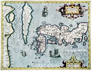
Background imageAge Of Discovery Collection: 17th century map of Japan

17th century map of Japan
Japan, 17th century Dutch map. These lands had not yet been accurately mapped by Europeans, and the islands of Japan (centre to centre right) are much distorted

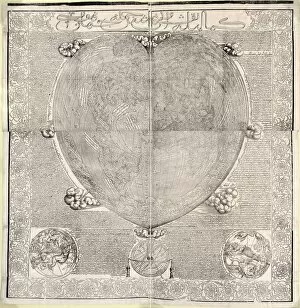
Background imageAge Of Discovery Collection: Haci Ahmeds world map, 1560

Haci Ahmeds world map, 1560
Haci Ahmeds world map. This map, based on Oronce Fines cordiform (heart-shaped) map of 1534, was translated into Turkish in the Islamic year 967 (October 1559 to September 1560)

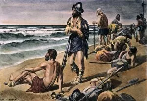
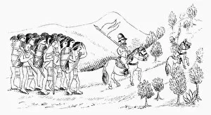
Background imageAge Of Discovery Collection: CABEZA de VACA EXPEDITION. Alvar Nunez Cabeza de Vaca and his men during their eight-year trek

CABEZA de VACA EXPEDITION. Alvar Nunez Cabeza de Vaca and his men during their eight-year trek between the Gulf of Mexico and Mexico City, 1528-36. Illustration by Alfred Russell

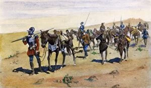
Background imageAge Of Discovery Collection: CORONADOs MARCH, 1540. Francisco Vasquez de Coronado explores southwestern America

CORONADOs MARCH, 1540. Francisco Vasquez de Coronado explores southwestern America. After the illustration, 1898, by Frederic Remington

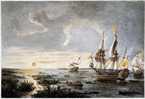
Background imageAge Of Discovery Collection: HERNANDO de SOTO (1496?-42). Spanish explorer. De Soto putting into Tampa Bay, Florida, in 1539

HERNANDO de SOTO (1496?-42). Spanish explorer. De Soto putting into Tampa Bay, Florida, in 1539. Color etching, 19th century

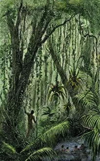
Background imageAge Of Discovery Collection: New World natives in a rain forest

New World natives in a rain forest
Natives in a tropical rain forest in the New World. Hand-colored woodcut of a 19th-century illustration

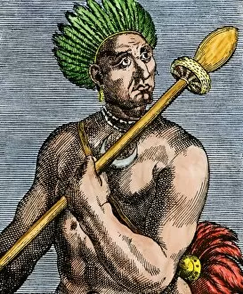
Background imageAge Of Discovery Collection: Patagonian as described by early explorers, 1500s

Patagonian as described by early explorers, 1500s
Quoniambec, a Patagonia native described as a giant by explorers. Hand-colored woodcut reproduction of a 16th-century illustration

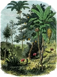
Background imageAge Of Discovery Collection: A view of the tropical New World

A view of the tropical New World
Tropical forest of the " Spanish Main" of Central America or the Caribbean. Hand-colored woodcut of a 19th-century illustration

Background imageAge Of Discovery Collection: Magellan sails around South America to circumnavigate the earth

Magellan sails around South America to circumnavigate the earth
Magellan passing through his Strait to sail around South America on his circumnavigation of the earth, 1519-1522. Hand-colored woodcut reproduction

Background imageAge Of Discovery Collection: Sailing unknown seas in the Age of Discovery

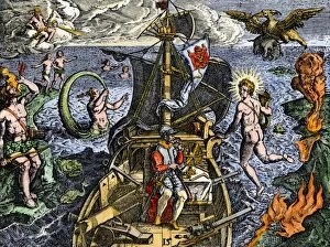
Sailing unknown seas in the Age of Discovery
Navigating the Sea of Darkness. Hand-colored woodcut reproduction

Background imageAge Of Discovery Collection: Early depiction of Brazil in the Age of Discovery

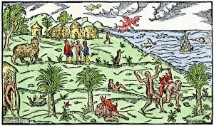
Early depiction of Brazil in the Age of Discovery
Brazil coast, natives, and New World flora and fauna as known in 1586. Hand-colored woodcut from De Lery

Background imageAge Of Discovery Collection: Early map of the New World, 1513

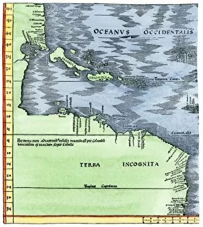
Early map of the New World, 1513
Tabula Terre Nove 1513: the Admirals Map of the Caribbean and Terra Incognita (unknown lands). Hand-colored woodcut reproduction

Background imageAge Of Discovery Collection: Portuguese map of the tip of South America, 1571

Portuguese map of the tip of South America, 1571
Map of South America printed in Lisbon, 1571. Printed color halftone reproduction

Background imageAge Of Discovery Collection: Cape of Good Hope mapped at its correct latitude, 1508

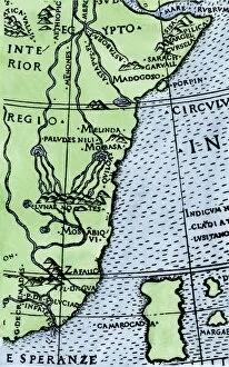
Cape of Good Hope mapped at its correct latitude, 1508
First map showing Africas southern point at the correct latitude, from Ruysch 1508. Hand-colored woodcut reproduction of a 16th-century illustration

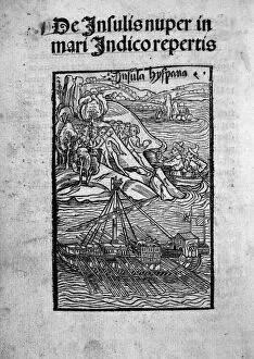
Background imageAge Of Discovery Collection: COLUMBUS: SHIP, c1494. The ship of Christopher Columbus off the coast of the New World

COLUMBUS: SHIP, c1494. The ship of Christopher Columbus off the coast of the New World. Woodcut from In Lauden Serenissimi Ferdinandi, Hispania[rum] Regis

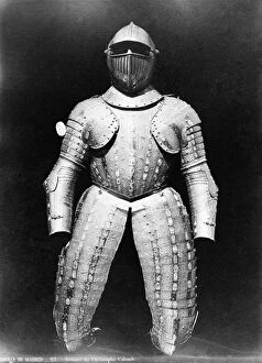
Background imageAge Of Discovery Collection: COLUMBUS: ARMOR. Armor belonging to Christopher Columbus. Photograph, c1870

COLUMBUS: ARMOR. Armor belonging to Christopher Columbus. Photograph, c1870

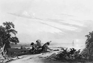
Background imageAge Of Discovery Collection: ARRIVAL OF COLUMBUS. The arrival of Christopher Columbus in the New World

ARRIVAL OF COLUMBUS. The arrival of Christopher Columbus in the New World. Engraving by John Sartain after a painting by Joshua Shaw, 19th century

Background imageAge Of Discovery Collection: CHRISTOPHER COLUMBUS (1451-1506). Italian navigator. Lithograph by Currier and Ives

CHRISTOPHER COLUMBUS (1451-1506). Italian navigator. Lithograph by Currier and Ives, 1892

Background imageAge Of Discovery Collection: CHRISTOPHER COLUMBUS (1541-1506). Italian navigator. Columbus returning to Cadiz

CHRISTOPHER COLUMBUS (1541-1506). Italian navigator. Columbus returning to Cadiz, Spain, in chains, after his arrest on Hispaniola in 1500

Background imageAge Of Discovery Collection: JOHANNES SCHONER (1477-1547). German astonomer and geographer. Woodcut, 16th century

JOHANNES SCHONER (1477-1547). German astonomer and geographer. Woodcut, 16th century

Background imageAge Of Discovery Collection: ROANOKE LANDING, 1585. The landing of the English at Roanoke Island in 1585

ROANOKE LANDING, 1585. The landing of the English at Roanoke Island in 1585. Contrary to the engraved legend, Sir Walter Raleigh, though the promoter of the expedition, remained home in England

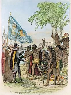
Background imageAge Of Discovery Collection: COLUMBUS: CUBA, 1492. A native Indian cacique of Cuba greeting Christopher Columbus in 1492

COLUMBUS: CUBA, 1492. A native Indian cacique of Cuba greeting Christopher Columbus in 1492. Engraving, 1800s

Background imageAge Of Discovery Collection: SHIP: VENICE, 1486. The building of a ship in Venice

SHIP: VENICE, 1486. The building of a ship in Venice. German woodcut, 1486, from Bernhard von Breydenbachs Sanctae Peregrinationes

Background imageAge Of Discovery Collection: FERDINAND MAGELLAN (c1480-1521). Portuguese navigator. Spanish lithograph, c1850

FERDINAND MAGELLAN (c1480-1521). Portuguese navigator. Spanish lithograph, c1850

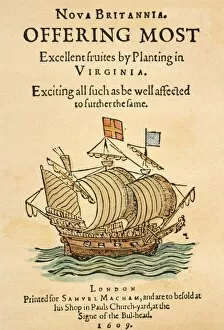
Background imageAge Of Discovery Collection: NOVA BRITANNIA, 1609. Title-page of Nova Britannia, the pamphlet issued in 1609

NOVA BRITANNIA, 1609. Title-page of Nova Britannia, the pamphlet issued in 1609 by the Virginia Company in London to win support for their enterprise in America

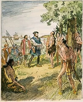
Background imageAge Of Discovery Collection: JACQUES CARTIER (1491-1557). French sailor and explorer

JACQUES CARTIER (1491-1557). French sailor and explorer. Cartier with his men meeting with the Hurons and Iroquois of the St. Lawrence River in 1535. Illustration by C.W. Jefferys

Background imageAge Of Discovery Collection: COLUMBUS: SAN SALVADOR, 1492. American depiction of the landing of Columbus at San Salvador

COLUMBUS: SAN SALVADOR, 1492. American depiction of the landing of Columbus at San Salvador (Guanahani) in the Bahamas, 12 October 1492. Lithograph, 1893

Background imageAge Of Discovery Collection: FERDINAND & ISABELLA, 1493. Columbus at the court of Ferdinand and Isabella

FERDINAND & ISABELLA, 1493. Columbus at the court of Ferdinand and Isabella on his return from the New World in 1493. Engraving after Victor A. Searles, 1893

Background imageAge Of Discovery Collection: VASCO NUNEZ de BALBOA (1475-1519). Spanish explorer

VASCO NUNEZ de BALBOA (1475-1519). Spanish explorer. Balboa taking possession of the Pacific Ocean for Spain on September 29, 1513. Color lithograph, 19th century

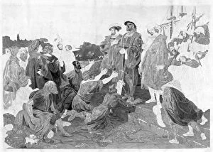
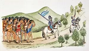
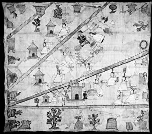
Background imageAge Of Discovery Collection: HERNANDO CORTES, 1519. Cortes (center), his conquistador Bernal Diaz, and a band

HERNANDO CORTES, 1519. Cortes (center), his conquistador Bernal Diaz, and a band of Tlaxcaltecs marching to Tenochtitlan (present-day Mexico City) in 1519. From the Lienzo de Tlaxcala canvas

Background imageAge Of Discovery Collection: SPANISH CONQUEST, c1519. The arrival in Mexico of a Spanish ship from Cuba, c1519

SPANISH CONQUEST, c1519. The arrival in Mexico of a Spanish ship from Cuba, c1519. Aztec drawing

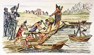
Background imageAge Of Discovery Collection: HERNANDO CORTES and a Tlaxcaltec chief supervise native Indians building boats for Cortes

HERNANDO CORTES and a Tlaxcaltec chief supervise native Indians building boats for Cortes and his men to sail against Tenochtitlan, 1521. Aztec drawing

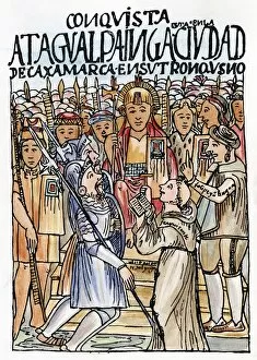
Background imageAge Of Discovery Collection: PERU: ATAHUALPA & PIZZARO. The first meeting, in 1532, of Francisco Pizarro and Atahualpa

PERU: ATAHUALPA & PIZZARO. The first meeting, in 1532, of Francisco Pizarro and Atahualpa, the last Inca king of Peru. Drawing from El primer nueva cronica y buen gobierno

Background imageAge Of Discovery Collection: Map of the Moluccas, 1522 (manuscript on vellum)

Map of the Moluccas, 1522 (manuscript on vellum)
XCF701482 Map of the Moluccas, 1522 (manuscript on vellum) by Toreno, Nuno Garcia de (16th century); Biblioteca Reale, Turin

Background imageAge Of Discovery Collection: Monument of the Discoveries, Lisbon, Portugal, Europe

Monument of the Discoveries, Lisbon, Portugal, Europe

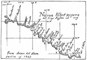
Background imageAge Of Discovery Collection: CALIFORNIA: NEW ALBION MAP. Map of the California coastline near the port of New Albion

CALIFORNIA: NEW ALBION MAP. Map of the California coastline near the port of New Albion, based on the explorations of Sir Francis Drake in 1579

Background imageAge Of Discovery Collection: FLORIDA: SPANISH FORT. Plan of the Spanish Fort of Santa Elena in Florida. Drawing

FLORIDA: SPANISH FORT. Plan of the Spanish Fort of Santa Elena in Florida. Drawing, 1595

Background imageAge Of Discovery Collection: BRAZIL EXPLORATION, 1509. Account of a Spanish expedition to Brazil under Juan Diaz de Solis

BRAZIL EXPLORATION, 1509. Account of a Spanish expedition to Brazil under Juan Diaz de Solis and Vicente Yanez Pinzon from a compilation by Antonio de Herrera, published at Leyden, 1509

Background imageAge Of Discovery Collection: HERNANDO CORTES (1485-1547). Spanish conqueror of Mexico

HERNANDO CORTES (1485-1547). Spanish conqueror of Mexico. Drawing from the Trachtenbuch of medallist Christoph Weiditz, 1529, believed to be the only authentic portrait of Cortes

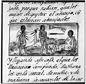
Background imageAge Of Discovery Collection: MEXICO: AZTEC DAILY LIFE. A scene of Aztec life. Illumination from the Codex Florentino

MEXICO: AZTEC DAILY LIFE. A scene of Aztec life. Illumination from the Codex Florentino, c1540, compiled by Bernardino de Sahagun (1499-1590)

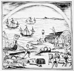
Background imageAge Of Discovery Collection: SPANISH CONQUEST, 1519. Hernando Cortes ships arriving in harbor in Veracruz, Mexico

SPANISH CONQUEST, 1519. Hernando Cortes ships arriving in harbor in Veracruz, Mexico. Illumination from the Codex Florentino, c1540, compiled by Bernardino de Sahagun (1499-1590)

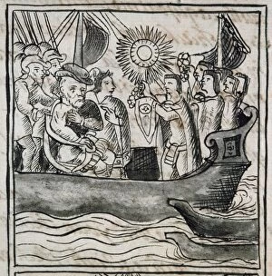
Background imageAge Of Discovery Collection: CORTEZ AT VERACRUZ, 1519. Hernando Cortes receiving tribute in his boat at the

CORTEZ AT VERACRUZ, 1519. Hernando Cortes receiving tribute in his boat at the time of his arrival in Veracruz in 1519. Illumination from the Codex Florentino, c1540

Background imageAge Of Discovery Collection: CORTES AT VERACRUZ, 1519. Hernando Cortes at Veracruz, Mexico, at the beginning

CORTES AT VERACRUZ, 1519. Hernando Cortes at Veracruz, Mexico, at the beginning of the Spanish conquest, 1519. Drawing from a Mexican codex

Background imageAge Of Discovery Collection: PERU: CONQUISTADOR. A Spanish conquistador trampling an Incan man

PERU: CONQUISTADOR. A Spanish conquistador trampling an Incan man. Pen and ink drawing from El primer nueva cronica y buen gobierno (The first new chronicle and good government), 1583-1615

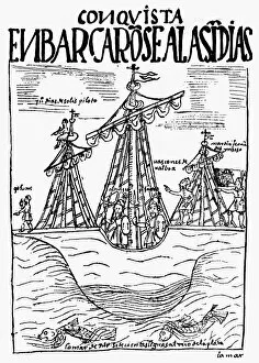
Background imageAge Of Discovery Collection: PERU: SPANISH CONQUEST. Spanish ships sailing to Peru during the reign of Incan emperors Huascar

PERU: SPANISH CONQUEST. Spanish ships sailing to Peru during the reign of Incan emperors Huascar and Atahualpa, c1527. Pen and ink drawing from El primer nueva cronica y buen gobierno

Background imageAge Of Discovery Collection: SPANISH CONQUEST, c1519. The arrival in Mexico of a Spanish ship from Cuba, c1519

SPANISH CONQUEST, c1519. The arrival in Mexico of a Spanish ship from Cuba, c1519. Aztec drawing

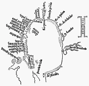
Background imageAge Of Discovery Collection: SPANISH CONQUEST, 1524. Contemporary map of the discoveries in the Gulf of Mexico

SPANISH CONQUEST, 1524. Contemporary map of the discoveries in the Gulf of Mexico, from the Latin version of Hernando Cortes Second Letter, printed at Nuremburg, Germany, in 1524

Background imageAge Of Discovery Collection: SPANISH CONQUEST, 1519. Hernando Cortes (center), his conquistador Bernal Diaz

SPANISH CONQUEST, 1519. Hernando Cortes (center), his conquistador Bernal Diaz, and a band of Tlaxcaltecs marching to Tenochtitlan (present-day Mexico City) in 1519


For sale as Licensed Images

Choose your image, Select your licence and Download the media

The Age of Discovery, a remarkable era in history, was characterized by the exploration and mapping of new territories. Maps from this period provide glimpses into the vast knowledge gained during these expeditions. Ortelius's map of the Ottoman Empire in 1570 showcases the intricate details and boundaries of this powerful empire, and is a testament to the expanding horizons and growing curiosity of explorers during this time. Captain John Smith's map of Virginia in 1612 offers insights into early English colonization efforts in North America. This detailed depiction highlights the challenges faced by settlers as they navigated unfamiliar lands. Abraham Ortelius' engraved Azores map from around 1584 provides an intriguing glimpse into one of Europe's most important maritime regions. The accuracy and precision displayed on this map demonstrate advancements made in cartography during this age. Oronce Fine's world map from 1531 presents a fascinating perspective on global geography at that time. Its inclusion of newly discovered lands reflects how explorers were continuously pushing boundaries and uncovering previously unknown territories. Juan Vespucci's world map from 1526, based on his uncle Amerigo Vespucci's voyages, contributes to our understanding of early European exploration across continents. This significant document sheds light on how discoveries were being disseminated throughout Europe. The Cantino World Map from 1502 reveals Western half geographical knowledge at that time, showcasing Portuguese discoveries along with other European nations' contributions to expanding geographic understanding. A seventeenth-century New World map illustrates how Europeans gradually began comprehending the vastness and diversity present within these uncharted lands. It serves as a reminder that every voyage brought forth new information about these mysterious territories. A Map of Europe dating back to 1700 captures political borders amidst shifting alliances during an era marked by territorial disputes among European powers. Such maps played crucial roles in shaping diplomatic negotiations and military strategies alike.