Age Of Discovery Collection (#2)

The Age of Discovery, a remarkable era in history, was characterized by the exploration and mapping of new territories

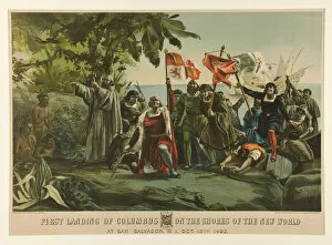
Background imageAge Of Discovery Collection: First Landing of Columbus on the Shores of the New World, 1892 (colour lithograph)

First Landing of Columbus on the Shores of the New World, 1892 (colour lithograph)
3704176 First Landing of Columbus on the Shores of the New World, 1892 (colour lithograph) by Currier, N. (1813-88) and Ives, J.M

Background imageAge Of Discovery Collection: The Virgin of the Navigators, 1505-36 (oil on panel)

The Virgin of the Navigators, 1505-36 (oil on panel)
JLJ4660069 The Virgin of the Navigators, 1505-36 (oil on panel) by Fernandez, Alejo (1475-1543); Alcazar, Segovia, Spain; (add.info)

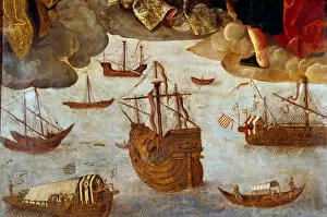
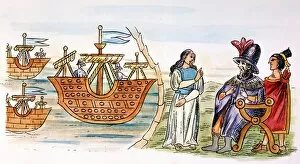
Background imageAge Of Discovery Collection: Spanish Caravel (detail from Virgin of the Navigators), 1531-36 (oil on panel)

Spanish Caravel (detail from Virgin of the Navigators), 1531-36 (oil on panel)
JLJ4660058 Spanish Caravel (detail from Virgin of the Navigators), 1531-36 (oil on panel) by Fernandez, Alejo (1475-1543); Alcazar, Segovia

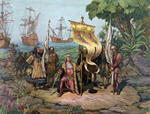
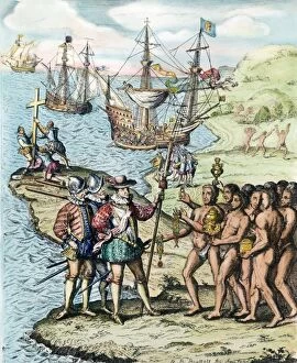
Background imageAge Of Discovery Collection: Columbus taking possession of the New Country, pub. 1893 (coloured litho)

Columbus taking possession of the New Country, pub. 1893 (coloured litho)
3526878 Columbus taking possession of the New Country, pub.1893 (coloured litho) by American School, (19th century); (add.info.: Christopher Columbus (1451-1506); The Stapleton Collection; American

Background imageAge Of Discovery Collection: MAGELLAN COMPASS. An early 16th century compass depicted in Antonio Pigafetta s

MAGELLAN COMPASS. An early 16th century compass depicted in Antonio Pigafetta s
MAGELLAN COMPASS. An early 16th century compass depicted in Antonio Pigafettas published account of Magellans circumnavigation of the earth

Background imageAge Of Discovery Collection: BARTOLOMEU DIAS (c1450-1500). Portuguese explorer who discovered the Cape of Good Hope

BARTOLOMEU DIAS (c1450-1500). Portuguese explorer who discovered the Cape of Good Hope. Undated portrait
Background imageAge Of Discovery Collection: CHRISTOPHER COLUMBUS landing on San Salvador (Guanahani) in the Bahamas on Oct

CHRISTOPHER COLUMBUS landing on San Salvador (Guanahani) in the Bahamas on Oct. 12, 1492: lithograph, 19th century
Background imageAge Of Discovery Collection: Brazilian cannibalism, 1500s

Brazilian cannibalism, 1500s
Natives eating and cooking human flesh, northern Brazil, circa 1500. Hand-colored woodcut reproduction of a 16th-century illustration

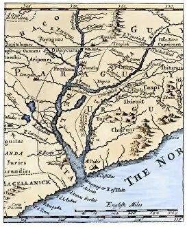
Background imageAge Of Discovery Collection: Rio de la Plata, 1698

Rio de la Plata, 1698
Mouth of the Rio de la Plata in South America, in a map of 1698. Hand-colored woodcut of a 19th-century illustration

Background imageAge Of Discovery Collection: Columbus landing in the New World, 1492

Columbus landing in the New World, 1492
First landing of Columbus in the New World, 1492. Hand-colored woodcut of a 19th-century illustration

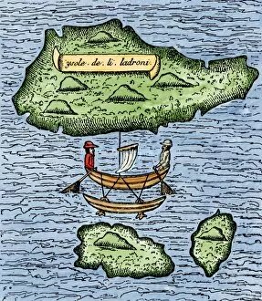
Background imageAge Of Discovery Collection: Mariana Islands in the Pacific discovered by Magellan, 1521

Mariana Islands in the Pacific discovered by Magellan, 1521
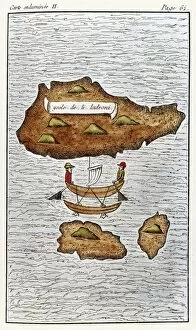
The Ladrones, later called the Marianas, and a native outrigger drawn by Pigafetta on the Magellan expedition, 1521. Hand-colored woodcut reproduction of a 16th-century illustration

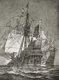
Background imageAge Of Discovery Collection: EDITORIAL The Spanish galleon Nuestra Senora de la Concepcion aka Cacafuego

EDITORIAL The Spanish galleon Nuestra Senora de la Concepcion aka Cacafuego, captured by Sir Francis Drake aboard The Golden Hind, 1579. From The Book of Ships, published c.1920

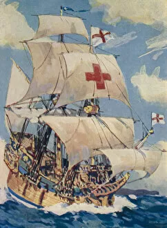
Background imageAge Of Discovery Collection: EDITORIAL Sir Francis Drakes ship The Golden Hind. From The Book of Ships, published c. 1920

EDITORIAL Sir Francis Drakes ship The Golden Hind. From The Book of Ships, published c. 1920
EDITORIAL Sir Francis Drakes ship The Golden Hind. From The Book of Ships, published c.1920

Background imageAge Of Discovery Collection: 'Westward Ho!'A voyage of discovery. A 15th century English sailing ship

"Westward Ho!"A voyage of discovery. A 15th century English sailing ship
" Westward Ho!" A voyage of discovery. A 15th century English sailing ship. Frontispiece from The Book of Ships, published c.1920

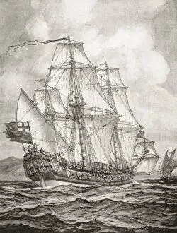
Background imageAge Of Discovery Collection: William Dampier aboard the HMS Roebuck surveys the New Guinea coast during the Roebuck Expedition

William Dampier aboard the HMS Roebuck surveys the New Guinea coast during the Roebuck Expedition of 1699. From The Book of Ships, published c.1920

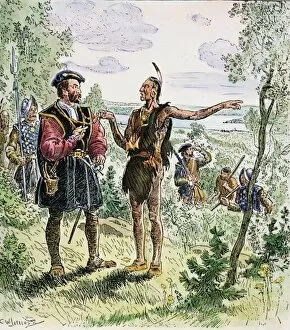
Background imageAge Of Discovery Collection: JACQUES CARTIER at the Huron-Iroquois village of Hochelaga (at present-day Montreal) in 1535

JACQUES CARTIER at the Huron-Iroquois village of Hochelaga (at present-day Montreal) in 1535, where he learned from the Native Americans that silver and gold could be found nearby

Background imageAge Of Discovery Collection: CHRISTOPHER COLUMBUS (1451-1506). Italian navigator. Landing on the island of Hispaniola, 1492

CHRISTOPHER COLUMBUS (1451-1506). Italian navigator. Landing on the island of Hispaniola, 1492. Etching, 1728

Background imageAge Of Discovery Collection: MEXICO: HERNANDO CORTES welcomed with gifts by Tlaxcaltec natives who believed

MEXICO: HERNANDO CORTES welcomed with gifts by Tlaxcaltec natives who believed him to be the god Quetzalcoatl incarnate, 1519. From the Lienzo de Tlaxcala canvas

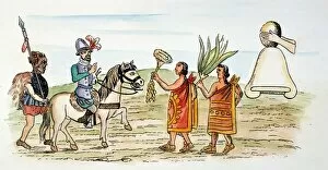
Background imageAge Of Discovery Collection: SPANISH CONQUEST. Dona Marina (left) interpreting during the meeting between Hernando Cortes

SPANISH CONQUEST. Dona Marina (left) interpreting during the meeting between Hernando Cortes and an envoy of Montezuma II, shortly after Cortes arrival, November 8, 1519, in Tenochtitlan; his fleet

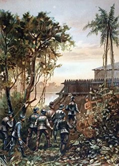
Background imageAge Of Discovery Collection: FLORIDA: FORT CAROLINE. French attack led by Dominique de Gourgues on the Spanish

FLORIDA: FORT CAROLINE. French attack led by Dominique de Gourgues on the Spanish Fort of San Mateo (formerly the French Fort Caroline), near the present-day site of Jacksonville, Florida

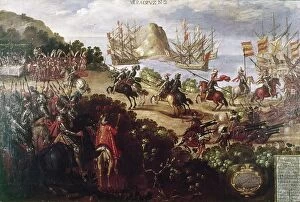
Background imageAge Of Discovery Collection: CORTEZ LANDING, 1519. Hernando Cortes landing at Veracruz, spring 1519. Mexican painting

CORTEZ LANDING, 1519. Hernando Cortes landing at Veracruz, spring 1519. Mexican painting, 19th century

Background imageAge Of Discovery Collection: MEXICO: AZTEC WEDDING. Aztec wedding ceremony, during which the clothes of the bride

MEXICO: AZTEC WEDDING. Aztec wedding ceremony, during which the clothes of the bride and groom are tied. The bride is then carried home by the matchmaker. Page from the Codex Mendoza, Aztec, c1540

Background imageAge Of Discovery Collection: STRAITS OF MAGELLAN, 1598. The Straits of Magellan as reproduced in John Wolfes Linschoten

STRAITS OF MAGELLAN, 1598. The Straits of Magellan as reproduced in John Wolfes Linschoten, published 1598, London, England

Background imageAge Of Discovery Collection: MARTELLUS: WORLD MAP, 1489. World map, c1489, of Henricus Martellus, copies of

MARTELLUS: WORLD MAP, 1489. World map, c1489, of Henricus Martellus, copies of which are believed to have reached Christopher Columbus in Spain and Martin Behaim in Nuremberg where, in 1492

Background imageAge Of Discovery Collection: FERDINAND & ISABELLA, 1493. King Ferdinand of Aragon and Queen Isabella of Castile

FERDINAND & ISABELLA, 1493. King Ferdinand of Aragon and Queen Isabella of Castile welcome Columbus on his return from the New World, 1493. Engraving, c1892

Background imageAge Of Discovery Collection: Codex diagram of Aztec cosmology, with the four directions depicted with a corresponding day sign

Codex diagram of Aztec cosmology, with the four directions depicted with a corresponding day sign
MEXICO: AZTEC COSMOLOGY. Codex diagram of Aztec cosmology, with the four directions depicted with a corresponding day sign. East is oriented at the top of the page. Probably 16th century

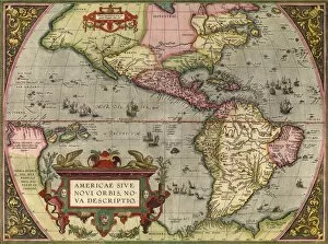
Background imageAge Of Discovery Collection: Orteliuss map of The New World, 1603

Orteliuss map of The New World, 1603
Orteliuss map of The New World. This map of the Americas is from the 1603 edition of Theatrum orbis terrarum (Theatre of the World)

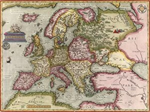
Background imageAge Of Discovery Collection: Orteliuss map of Europe, 1603

Orteliuss map of Europe, 1603
Orteliuss map of Europe. This map of Europe is from the 1603 edition of Theatrum orbis terrarum (Theatre of the World). First published in 1570 by Flemish mapmaker Abraham Ortelius (1527-1598)

Background imageAge Of Discovery Collection: Columbus arrives in the Americas, 1492 C016 / 4494

Columbus arrives in the Americas, 1492 C016 / 4494
Columbus arrives in the Americas. 19th-century artwork of the Italian explorer Christopher Columbus (1451-1506, kneeling) taking possession of the new country he had discovered on 12 October 1492

Background imageAge Of Discovery Collection: THE LADRONE ISLANDS. Engraving of Antonio Pigafettas map of the Ladrone Islands discovered by

THE LADRONE ISLANDS. Engraving of Antonio Pigafettas map of the Ladrone Islands discovered by Ferdinand Magellan and his crew in 1521

Background imageAge Of Discovery Collection: SCH├ûNER GLOBE, 1515. Johannes Sch├Âners globe of 1515 depicting America and Asia

SCH├ûNER GLOBE, 1515. Johannes Sch├Âners globe of 1515 depicting America and Asia, from Historia da Colonizacao do Brasil. Woodcut

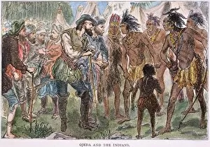
Background imageAge Of Discovery Collection: ALONSO de OJEDA (1465?-1515) with an native Indian cacique on one of his expeditions to the West

ALONSO de OJEDA (1465?-1515) with an native Indian cacique on one of his expeditions to the West Indies. American engraving, 19th century

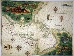
Background imageAge Of Discovery Collection: NEW WORLD MAP, 1547. Map of the West Indies and Central American from the Vallard Atlas

NEW WORLD MAP, 1547. Map of the West Indies and Central American from the Vallard Atlas, c. 1547; the map, drawn " upside-down" as if viewed from Europe

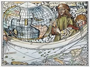
Background imageAge Of Discovery Collection: AMERIGO VESPUCCI (1454-1512). Detail from map of the world and account of Vespuccis voyage

AMERIGO VESPUCCI (1454-1512). Detail from map of the world and account of Vespuccis voyage, 1507, by Martin Waldseemuller, who suggested that the New World be named " America."

Background imageAge Of Discovery Collection: Vasco da Gama, Portuguese explorer

Vasco da Gama, Portuguese explorer
Vasco da Gama (1460-1524), Portuguese explorer. In 1497, Da Gama was sent by Prince Manuel of Portugal to find a trade route to India

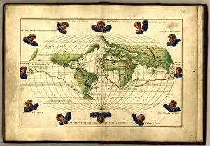
Background imageAge Of Discovery Collection: Magellans route, 16th century map

Magellans route, 16th century map
Magellans route around the world, in a 1544 copy of the Agnese Atlas. Magellans route is shown as a dark line. Ferdinand Magellan (c.1480-1521) set sail from Seville, Spain

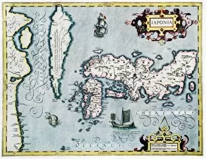
Background imageAge Of Discovery Collection: 17th century map of Japan

17th century map of Japan
Japan, 17th century Dutch map. These lands had not yet been accurately mapped by Europeans, and the islands of Japan (centre to centre right) are much distorted

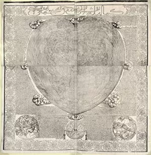
Background imageAge Of Discovery Collection: Haci Ahmeds world map, 1560

Haci Ahmeds world map, 1560
Haci Ahmeds world map. This map, based on Oronce Fines cordiform (heart-shaped) map of 1534, was translated into Turkish in the Islamic year 967 (October 1559 to September 1560)

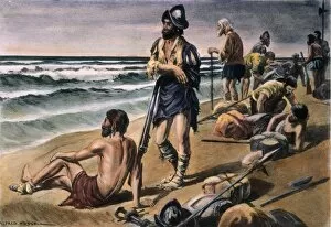
Background imageAge Of Discovery Collection: CABEZA de VACA EXPEDITION. Alvar Nunez Cabeza de Vaca and his men during their eight-year trek

CABEZA de VACA EXPEDITION. Alvar Nunez Cabeza de Vaca and his men during their eight-year trek between the Gulf of Mexico and Mexico City, 1528-36. Illustration by Alfred Russell

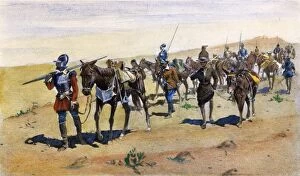
Background imageAge Of Discovery Collection: CORONADOs MARCH, 1540. Francisco Vasquez de Coronado explores southwestern America

CORONADOs MARCH, 1540. Francisco Vasquez de Coronado explores southwestern America. After the illustration, 1898, by Frederic Remington

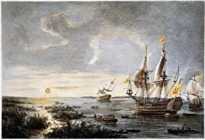
Background imageAge Of Discovery Collection: HERNANDO de SOTO (1496?-42). Spanish explorer. De Soto putting into Tampa Bay, Florida, in 1539

HERNANDO de SOTO (1496?-42). Spanish explorer. De Soto putting into Tampa Bay, Florida, in 1539. Color etching, 19th century

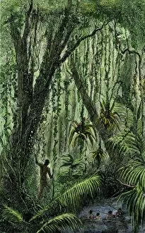
Background imageAge Of Discovery Collection: New World natives in a rain forest

New World natives in a rain forest
Natives in a tropical rain forest in the New World. Hand-colored woodcut of a 19th-century illustration

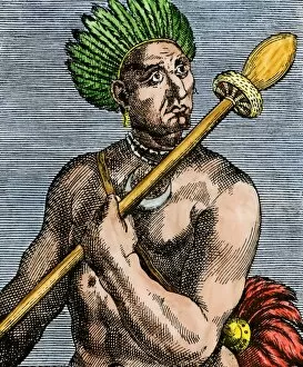
Background imageAge Of Discovery Collection: Patagonian as described by early explorers, 1500s

Patagonian as described by early explorers, 1500s
Quoniambec, a Patagonia native described as a giant by explorers. Hand-colored woodcut reproduction of a 16th-century illustration

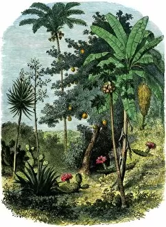
Background imageAge Of Discovery Collection: A view of the tropical New World

A view of the tropical New World
Tropical forest of the " Spanish Main" of Central America or the Caribbean. Hand-colored woodcut of a 19th-century illustration


For sale as Licensed Images

Choose your image, Select your licence and Download the media

The Age of Discovery, a remarkable era in history, was characterized by the exploration and mapping of new territories. Maps from this period provide glimpses into the vast knowledge gained during these expeditions. Ortelius's map of the Ottoman Empire in 1570 showcases the intricate details and boundaries of this powerful empire, and is a testament to the expanding horizons and growing curiosity of explorers during this time. Captain John Smith's map of Virginia in 1612 offers insights into early English colonization efforts in North America. This detailed depiction highlights the challenges faced by settlers as they navigated unfamiliar lands. Abraham Ortelius' engraved Azores map from around 1584 provides an intriguing glimpse into one of Europe's most important maritime regions. The accuracy and precision displayed on this map demonstrate advancements made in cartography during this age. Oronce Fine's world map from 1531 presents a fascinating perspective on global geography at that time. Its inclusion of newly discovered lands reflects how explorers were continuously pushing boundaries and uncovering previously unknown territories. Juan Vespucci's world map from 1526, based on his uncle Amerigo Vespucci's voyages, contributes to our understanding of early European exploration across continents. This significant document sheds light on how discoveries were being disseminated throughout Europe. The Cantino World Map from 1502 reveals Western half geographical knowledge at that time, showcasing Portuguese discoveries along with other European nations' contributions to expanding geographic understanding. A seventeenth-century New World map illustrates how Europeans gradually began comprehending the vastness and diversity present within these uncharted lands. It serves as a reminder that every voyage brought forth new information about these mysterious territories. A Map of Europe dating back to 1700 captures political borders amidst shifting alliances during an era marked by territorial disputes among European powers. Such maps played crucial roles in shaping diplomatic negotiations and military strategies alike.