Boundary Collection (#4)

"Exploring Boundaries

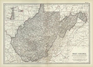
Background imageBoundary Collection: Map of West Virginia, c.1900 (engraving)

Map of West Virginia, c.1900 (engraving)
533127 Map of West Virginia, c.1900 (engraving); (add.info.: Map of West Virginia, United States, circa 1902, from the 10th edition of Encyclopaedia Britannica.); Encyclopaedia Britannica/UIG

Background imageBoundary Collection: Map of Virginia, c.1900 (engraving)

Map of Virginia, c.1900 (engraving)
533124 Map of Virginia, c.1900 (engraving); (add.info.: Map showing historical boundaries of Virginia, with inset maps of Richmond and Norfolk, circa 1902)

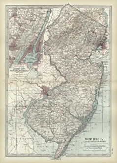
Background imageBoundary Collection: Map of New Jersey, c.1900 (engraving)

Map of New Jersey, c.1900 (engraving)
533112 Map of New Jersey, c.1900 (engraving); (add.info.: Map of New Jersey with inset map of Jersey City, Newark and Paterson, circa 1902)

Background imageBoundary Collection: Map of Massachusetts, c.1900 (engraving)

Map of Massachusetts, c.1900 (engraving)
533096 Map of Massachusetts, c.1900 (engraving); (add.info.: State map of Massachusetts, United States, with inset map of Boston, circa 1902)

Background imageBoundary Collection: Map of Gibraltar, c.1900 (engraving)

Map of Gibraltar, c.1900 (engraving)
532764 Map of Gibraltar, c.1900 (engraving); (add.info.: Map of Gibraltar, circa 1900, from the 10th edition of Encyclopaedia Britannica.); Encyclopaedia Britannica/UIG

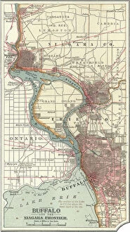
Background imageBoundary Collection: Map of Buffalo and the Niagara Frontier, c.1900 (engraving)

Map of Buffalo and the Niagara Frontier, c.1900 (engraving)
532728 Map of Buffalo and the Niagara Frontier, c.1900 (engraving); (add.info.: Map of Buffalo, New York, and the Niagara Frontier, circa 1900)

Background imageBoundary Collection: Burning of the Evans-Gordon train, at Wounded Knee Creek, near the north boundary of Nebraska

Burning of the Evans-Gordon train, at Wounded Knee Creek, near the north boundary of Nebraska
529830 Burning of the Evans-Gordon train, at Wounded Knee Creek, near the north boundary of Nebraska, 325 miles west of Sioux City. M. B. Brubacher (Artist) 1875; Universal History Archive/UIG

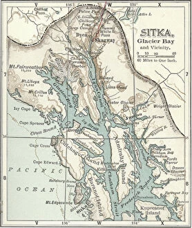
Background imageBoundary Collection: Map of Sitka and Glacier Bay, Alaska, c.1900 (engraving)

Map of Sitka and Glacier Bay, Alaska, c.1900 (engraving)
533464 Map of Sitka and Glacier Bay, Alaska, c.1900 (engraving); (add.info.: Map of Sitka and Glacier Bay, Alaska, circa 1902)

Background imageBoundary Collection: Map of the Hudson River, New York, c.1900 (engraving)

Map of the Hudson River, New York, c.1900 (engraving)
533427 Map of the Hudson River, New York, c.1900 (engraving); (add.info.: Map of Hudson River, New York, from Yonkers to Kingston, circa 1902)

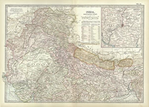
Background imageBoundary Collection: Map of northern India with Calcutta, c.1900 (engraving)

Map of northern India with Calcutta, c.1900 (engraving)
533016 Map of northern India with Calcutta, c.1900 (engraving); (add.info.: Map showing the historical boundaries of the northern part of India with an inset map of Calcutta (now Kolkata)

Background imageBoundary Collection: Map of the German Empire with Berlin and Hamburg, c.1900 (engraving)

Map of the German Empire with Berlin and Hamburg, c.1900 (engraving)
532964 Map of the German Empire with Berlin and Hamburg, c.1900 (engraving); (add.info.: Map showing the eastern part of the German Empire, with inset maps of Berlin and Hamburg, circa 1902)

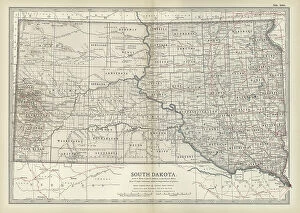
Background imageBoundary Collection: Map of South Dakota, c.1900 (engraving)

Map of South Dakota, c.1900 (engraving)
533193 Map of South Dakota, c.1900 (engraving); (add.info.: State map of South Dakota, United States, circa 1902, from the 10th edition of Encyclopaedia Britannica.); Encyclopaedia Britannica/UIG

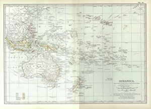
Background imageBoundary Collection: Map of Oceania, c.1900 (engraving)

Map of Oceania, c.1900 (engraving)
533039 Map of Oceania, c.1900 (engraving); (add.info.: Map of Oceanica (Oceania): Australia, New Zealand, Polynesia, Melanesia, and Hawaiian Islands, circa 1902

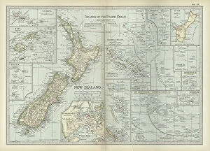
Background imageBoundary Collection: Map of Pacific Ocean Islands, c.1900 (engraving)

Map of Pacific Ocean Islands, c.1900 (engraving)
533048 Map of Pacific Ocean Islands, c.1900 (engraving); (add.info.: Map of Pacific Ocean Islands: New Zealand, Samoa, Fiji, Tonga, Guam, Marshall Islands, Solomon Islands, Mariana Islands)

Background imageBoundary Collection: A Japanese Tattooed Man, c.1880 (hand coloured photograph)

A Japanese Tattooed Man, c.1880 (hand coloured photograph)
1766822 A Japanese Tattooed Man, c.1880 (hand coloured photograph); Private Collection; (add.info.: A Japanese Tattooed Man. Anonymous)

Background imageBoundary Collection: Map of Greece with Crete and Samos, c.1900 (engraving)

Map of Greece with Crete and Samos, c.1900 (engraving)
533001 Map of Greece with Crete and Samos, c.1900 (engraving); (add.info.: Map showing detail of Greece with Crete and Samos, with insets of Crete and Athens, circa 1902)

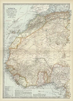
Background imageBoundary Collection: Map of northwestern Africa, c.1900 (engraving)

Map of northwestern Africa, c.1900 (engraving)
533056 Map of northwestern Africa, c.1900 (engraving); (add.info.: Map of northwest Africa with Morocco, Algeria, Tunis, Sahara, Senegal, Portuguese Guinea, circa 1902)

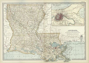
Background imageBoundary Collection: Map of Louisiana, c.1900 (engraving)

Map of Louisiana, c.1900 (engraving)
533158 Map of Louisiana, c.1900 (engraving); (add.info.: Map of Louisiana, United States, with inset map of New Orleans and Vicinity, circa 1902)

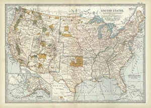
Background imageBoundary Collection: Map of the United States with inset of Alaska, c.1900 (engraving)

Map of the United States with inset of Alaska, c.1900 (engraving)
533086 Map of the United States with inset of Alaska, c.1900 (engraving); (add.info.: Map of United States with inset of Alaska, circa 1902)

Background imageBoundary Collection: Map of Manitoba and British Columbia, c.1900 (engraving)

Map of Manitoba and British Columbia, c.1900 (engraving)
533074 Map of Manitoba and British Columbia, c.1900 (engraving); (add.info.: Map of Manitoba, British Columbia, and the Northwest Territories, Canada, circa 1902)

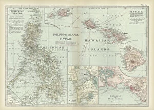
Background imageBoundary Collection: Map of Philippine Islands with Hawaii, c.1900 (engraving)

Map of Philippine Islands with Hawaii, c.1900 (engraving)
533033 Map of Philippine Islands with Hawaii, c.1900 (engraving); (add.info.: Map of Philippine Islands and Hawaii, with inset maps of Manila, Honolulu, and Pearl Harbor, circa 1902)

Background imageBoundary Collection: Map of colonial Africa with Madagascar, c.1900 (engraving)

Map of colonial Africa with Madagascar, c.1900 (engraving)
533062 Map of colonial Africa with Madagascar, c.1900 (engraving); (add.info.: Map of southern colonial Africa, with an inset of Madagascar, circa 1902)

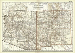
Background imageBoundary Collection: Map of Arizona and New Mexico, c.1900 (engraving)

Map of Arizona and New Mexico, c.1900 (engraving)
533218 Map of Arizona and New Mexico, c.1900 (engraving); (add.info.: Map of Arizona and New Mexico, circa 1902, from the 10th edition of Encyclopaedia Britannica.); Encyclopaedia Britannica/UIG

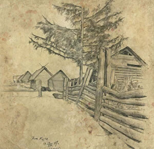
Background imageBoundary Collection: Kotets, Selkups, 1920. Creator: A. G. Vargin

Kotets, Selkups, 1920. Creator: A. G. Vargin
Kotets, Selkups, 1920. V. I. Surikov Museum of Art in Krasnoiarsk

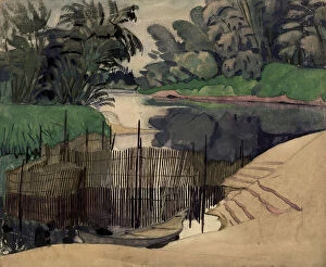
Background imageBoundary Collection: Kur'ia Settlement, Ket River, 1927. Creator: Dmitrii Innokent'evich Karatanov

Kur'ia Settlement, Ket River, 1927. Creator: Dmitrii Innokent'evich Karatanov
Kur'ia Settlement, Ket River, 1927. Novosibirsk State Museum of Regional History and Folklife

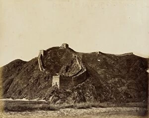
Background imageBoundary Collection: Portion of the Great Wall, 1860. Creator: Felice Beato

Portion of the Great Wall, 1860. Creator: Felice Beato
Portion of the Great Wall, 1860

Background imageBoundary Collection: Cactus fence in Salamanca, Salamanca, Mexico, between 1880 and 1900. Creator: Unknown

Cactus fence in Salamanca, Salamanca, Mexico, between 1880 and 1900. Creator: Unknown
Cactus fence in Salamanca, Salamanca, Mexico, between 1880 and 1900

Background imageBoundary Collection: Horsepond near a Boundary Stone, c.1651-c.1654. Creator: Philips Wouwerman

Horsepond near a Boundary Stone, c.1651-c.1654. Creator: Philips Wouwerman
Horsepond near a Boundary Stone, c.1651-c.1654

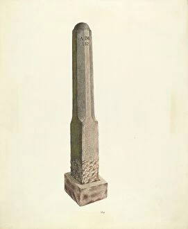
Background imageBoundary Collection: Plantation Boundary Marker, c. 1938. Creator: Joseph L. Boyd

Plantation Boundary Marker, c. 1938. Creator: Joseph L. Boyd
Plantation Boundary Marker, c. 1938

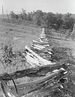
Background imageBoundary Collection: Split-log fence, north central Arkansas, along U.S. 62, 1938. Creator: Dorothea Lange

Split-log fence, north central Arkansas, along U.S. 62, 1938. Creator: Dorothea Lange
North central Arkansas, along U.S. 62. Split-log fence

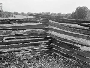
Background imageBoundary Collection: Split-log fence, North central Arkansas, along U.S. 62, 1938. Creator: Dorothea Lange

Split-log fence, North central Arkansas, along U.S. 62, 1938. Creator: Dorothea Lange
North central Arkansas, along U.S. 62. Split-log fence

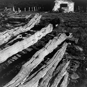
Background imageBoundary Collection: Split-log fence, North Central Arkansas along U.S. 62, 1938. Creator: Dorothea Lange

Split-log fence, North Central Arkansas along U.S. 62, 1938. Creator: Dorothea Lange
North Central Arkansas along U.S. 62. Split-log fence

Background imageBoundary Collection: Split-log fence, North central Arkansas, along U.S. 62, 1938. Creator: Dorothea Lange

Split-log fence, North central Arkansas, along U.S. 62, 1938. Creator: Dorothea Lange
North central Arkansas, along U.S. 62. Split-log fence

Background imageBoundary Collection: Split-log fence, North central Arkansas, along U.S. 62, 1938. Creator: Dorothea Lange

Split-log fence, North central Arkansas, along U.S. 62, 1938. Creator: Dorothea Lange
North central Arkansas, along U.S. 62. Split-log fence

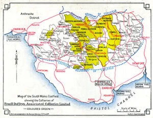
Background imageBoundary Collection: Map, South Wales coalfield

Map, South Wales coalfield. 1939

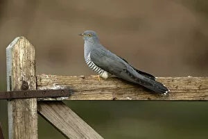
Background imageBoundary Collection: Common Cuckoo (Cuculus canorus) perched on gate Surrey, England, UK. April

Common Cuckoo (Cuculus canorus) perched on gate Surrey, England, UK. April

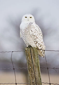
Background imageBoundary Collection: Snowy Owl (Nyctea scandiaca) female perched, Amherst Island, Ontario, Canada, January

Snowy Owl (Nyctea scandiaca) female perched, Amherst Island, Ontario, Canada, January

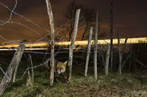
Background imageBoundary Collection: Red fox (Vulpes vulpes) adult with train in background, Kent, UK

Red fox (Vulpes vulpes) adult with train in background, Kent, UK. March. Highly commended in the Nature Photographer of the Year Awards 2018. Taken with remote camera

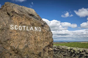
Background imageBoundary Collection: England / Scotland boundary stone on the A68, Jedburgh, Scotish Borders, Scotland

England / Scotland boundary stone on the A68, Jedburgh, Scotish Borders, Scotland, Great Britain

Background imageBoundary Collection: Wansdyke and Eald Burh 29625_035

Wansdyke and Eald Burh 29625_035
The Wansdyke and Eald Burh, Wiltshire, 2015. A later prehistoric or Roman settlement, a boundary earthwork, an enclosure earthwork and possibly a post-medieval square dewpond

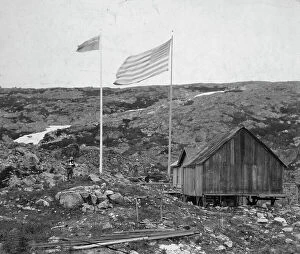
Background imageBoundary Collection: Alaska - Yukon boundary, between c1900 and 1923. Creator: Unknown

Alaska - Yukon boundary, between c1900 and 1923. Creator: Unknown
Alaska - Yukon boundary, between c1900 and 1923. Alaska-Canada border with American and Canadian flags, a building, and people standing on either side

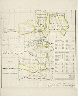
Background imageBoundary Collection: Map showing the lands assigned to emigrant Indians west of Arkansas and Missouri, 1836

Map showing the lands assigned to emigrant Indians west of Arkansas and Missouri, 1836. Creator: Topographical Bureau
Map showing the lands assigned to emigrant Indians west of Arkansas and Missouri, 1836. Following passage of the Indian Removal Act in 1830

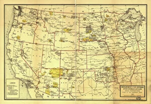
Background imageBoundary Collection: Indian Reservations west of the Mississippi River, 1923. Creator: Office of Indian Affairs

Indian Reservations west of the Mississippi River, 1923. Creator: Office of Indian Affairs
Indian Reservations west of the Mississippi River, 1923. This map, created by the Office of Indian Affairs in 1923, shows the location of Indian reservations west of the Mississippi River

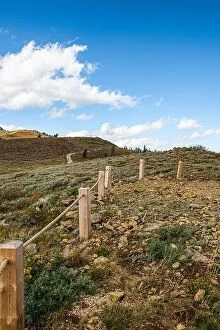
Background imageBoundary Collection: Park City, Utah, USA scenic landscapes in autumn

Park City, Utah, USA scenic landscapes in autumn

Background imageBoundary Collection: Clouds drift over the Columbia River which runs between Oregon and Washington

Clouds drift over the Columbia River which runs between Oregon and Washington. The scenic Columbia River Gorge runs for over 80 miles

Background imageBoundary Collection: A waterfall flows over a cliff into the Columbia River Gorge in Oregon. This canyon

A waterfall flows over a cliff into the Columbia River Gorge in Oregon. This canyon, with the Columbia River flowing through it, is 80 miles long

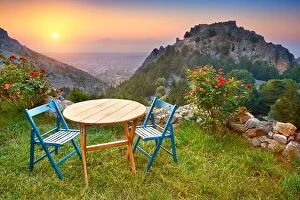
Background imageBoundary Collection: Kos Island, Greece, sunset landscape view from Old Pili village tavern

Kos Island, Greece, sunset landscape view from Old Pili village tavern

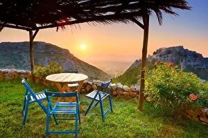
Background imageBoundary Collection: Kos - Dodecanese Islands, Greece, sunset from Old Pili village tavern

Kos - Dodecanese Islands, Greece, sunset from Old Pili village tavern


For sale as Licensed Images

Choose your image, Select your licence and Download the media

"Exploring Boundaries: From Ancient Empires to Modern Territories" This captivating collection of images highlights the significance and diversity of boundaries across various realms. Starting with Boundary Park Art in Oldham Athletic, we witness how art can transcend physical limits and connect communities. Moving on to Scotland, UK, a satellite image showcases the intricate lines that define national borders. Delving into history, we encounter the Map of the Macedonian Empire after Alexander the Great's conquests. This map symbolizes both territorial expansion and cultural exchange during one of history's most influential periods. Shifting our focus to geology, a Map of the World reveals lines marking tectonic plate boundaries—a reminder of Earth's ever-changing nature. In contrast, two majestic lions patrolling their territorial boundary remind us that animals too have distinct territories they fiercely protect. As we explore further, maps depicting The Apostle Paul's travels and ancient-modern Jerusalem offer glimpses into religious boundaries shaped by faith and historical events. Meanwhile, an Africa Political Map emphasizes geopolitical divisions shaping nations' identities today. Closer to home in London, arms and seals represent local authority while highlighting administrative boundaries within this bustling metropolis. Additionally, Earth’s tectonic plates illustrate how invisible forces shape our planet beneath its surface. Lastly, we reflect on U. S territory gained from Mexico—a testament to political negotiations defining international borders throughout history. Concluding with LCC-LFB Plumstead fire station in SE London signifies how even emergency services are organized based on geographical boundaries for efficient response times. In this diverse array of images lies a common thread—the concept of "boundary. " Whether physical or abstract; natural or man-made.