Boundary Collection (#3)

"Exploring Boundaries

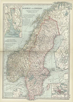
Background imageBoundary Collection: Map of Norway and Sweden, c.1900 (engraving)

Map of Norway and Sweden, c.1900 (engraving)
532971 Map of Norway and Sweden, c.1900 (engraving); (add.info.: Map of Norway, Sweden, with insets of Kristianiafjord and Stockholm, circa 1902)

Background imageBoundary Collection: Map of northern Illinois, c.1900 (engraving)

Map of northern Illinois, c.1900 (engraving)
533173 Map of northern Illinois, c.1900 (engraving); (add.info.: Map of the northern part of Illinois, United States, circa 1902)

Background imageBoundary Collection: Map of South Carolina with inset of Charleston, c.1900 (engraving)

Map of South Carolina with inset of Charleston, c.1900 (engraving)
533136 Map of South Carolina with inset of Charleston, c.1900 (engraving); (add.info.: Map showing the historical boundaries of South Carolina, United States, with an inset map of Charleston)

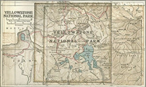
Background imageBoundary Collection: Map of Yellowstone National Park, c.1900 (engraving)

Map of Yellowstone National Park, c.1900 (engraving)
532887 Map of Yellowstone National Park, c.1900 (engraving); (add.info.: Map of Yellowstone National Park, highlighting major mountain ranges and other features, circa 1900)

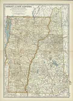
Background imageBoundary Collection: Map of Vermont and New Hampshire, c.1900 (engraving)

Map of Vermont and New Hampshire, c.1900 (engraving)
533091 Map of Vermont and New Hampshire, c.1900 (engraving); (add.info.: Map showing the historical boundaries of Vermont and New Hampshire, United States, circa 1902)

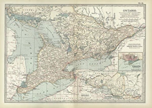
Background imageBoundary Collection: Map of Ontario, Canada, c.1900 (engraving)

Map of Ontario, Canada, c.1900 (engraving)
533076 Map of Ontario, Canada, c.1900 (engraving); (add.info.: Map of Ontario, Canada, with an inset of Toronto, circa 1902)

Background imageBoundary Collection: Map of St. Marys River and Sault Ste. Marie, MI, c.1900 (engraving)

Map of St. Marys River and Sault Ste. Marie, MI, c.1900 (engraving)
533450 Map of St. Marys River and Sault Ste. Marie, MI, c.1900 (engraving); (add.info.: Map of St. Marys River and Sault Ste)

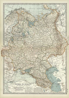
Background imageBoundary Collection: Map of Russia showing historical boundaries of Russia in Europe with Poland and Finland, circa 1902

Map of Russia showing historical boundaries of Russia in Europe with Poland and Finland, circa 1902
532992 Map of Russia showing historical boundaries of Russia in Europe with Poland and Finland, circa 1902; (add.info.: Map showing historical boundaries of Russia in Europe with Poland and Finland)

Background imageBoundary Collection: Map of Italy with Sicily and Naples, c.1900 (engraving)

Map of Italy with Sicily and Naples, c.1900 (engraving)
532989 Map of Italy with Sicily and Naples, c.1900 (engraving); (add.info.: Map of central and southern Italy with insets map of Sicily and Naples, circa 1902)

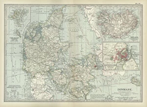
Background imageBoundary Collection: Map of Denmark, c.1900 (engraving)

Map of Denmark, c.1900 (engraving)
532967 Map of Denmark, c.1900 (engraving); (add.info.: Map of Denmark, with insets of Iceland, Copenhagen, and the Faeroe Islands, circa 1902)

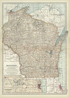
Background imageBoundary Collection: Map of Wisconsin, c.1900 (engraving)

Map of Wisconsin, c.1900 (engraving)
533185 Map of Wisconsin, c.1900 (engraving); (add.info.: Map of Wisconsin, United States, with an inset map of Milwaukee and the Waukesha Lake Region, circa 1902)

Background imageBoundary Collection: Map of the northern part of Michigan, c.1900 (engraving)

Map of the northern part of Michigan, c.1900 (engraving)
533181 Map of the northern part of Michigan, c.1900 (engraving); (add.info.: Map of the northern part of Michigan, United States, with inset maps of St)

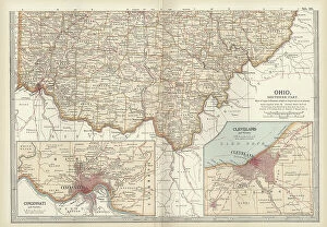
Background imageBoundary Collection: Map of southern Ohio, c.1900 (engraving)

Map of southern Ohio, c.1900 (engraving)
533168 Map of southern Ohio, c.1900 (engraving); (add.info.: Map of the southern part of Ohio, United States, with inset maps of Cincinnati and Cleveland, circa 1902)

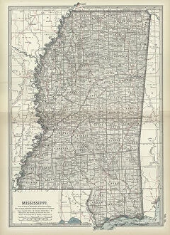
Background imageBoundary Collection: Map of Mississippi, c.1900 (engraving)

Map of Mississippi, c.1900 (engraving)
533154 Map of Mississippi, c.1900 (engraving); (add.info.: Map of Mississippi, United States, circa 1902, from the 10th edition of Encyclopaedia Britannica.); Encyclopaedia Britannica/UIG

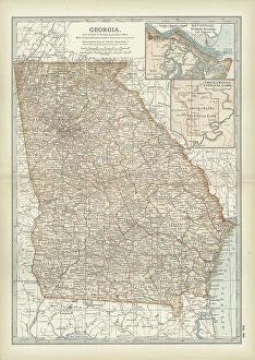
Background imageBoundary Collection: Map of Georgia, c.1900 (engraving)

Map of Georgia, c.1900 (engraving)
533139 Map of Georgia, c.1900 (engraving); (add.info.: Map of Georgia, United States, with inset maps of Savannah and Chickamauga National Park, circa 1902)

Background imageBoundary Collection: Map of Yosemite National Park, c.1900 (engraving)

Map of Yosemite National Park, c.1900 (engraving)
532890 Map of Yosemite National Park, c.1900 (engraving); (add.info.: Map of Yosemite National Park, highlighting major parks and other features, circa 1900)

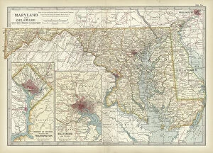
Background imageBoundary Collection: Map of Maryland and Delaware, c.1900 (engraving)

Map of Maryland and Delaware, c.1900 (engraving)
533120 Map of Maryland and Delaware, c.1900 (engraving); (add.info.: Map of Maryland and Delaware, inset maps of District of Columbia and Baltimore, circa 1902)

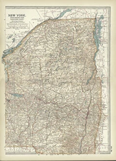
Background imageBoundary Collection: Map of New York State, c.1900 (engraving)

Map of New York State, c.1900 (engraving)
533105 Map of New York State, c.1900 (engraving); (add.info.: Map of north and eastern New York State, United States, circa 1902)

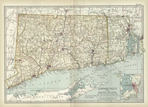
Background imageBoundary Collection: Map of Connecticut and Rhode Island, c.1900 (engraving)

Map of Connecticut and Rhode Island, c.1900 (engraving)
533101 Map of Connecticut and Rhode Island, c.1900 (engraving); (add.info.: Map of Connecticut and Rhode Island, United States, with an inset of Newport, circa 1902)

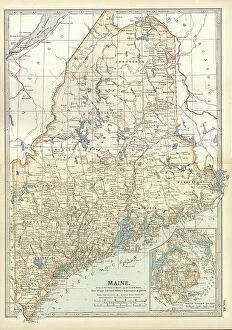
Background imageBoundary Collection: Map of Maine, c.1900 (engraving)

Map of Maine, c.1900 (engraving)
533088 Map of Maine, c.1900 (engraving); (add.info.: Map of Maine, United States, with inset map of Mount Desert Island, circa 1902)

Background imageBoundary Collection: Map of Hamburg, c.1900 (engraving)

Map of Hamburg, c.1900 (engraving)
532767 Map of Hamburg, c.1900 (engraving); (add.info.: Map of Hamburg, circa 1900, from the 10th edition of Encyclopaedia Britannica.); Encyclopaedia Britannica/UIG

Background imageBoundary Collection: Map of Dardanelles, c.1900 (engraving)

Map of Dardanelles, c.1900 (engraving)
532751 Map of Dardanelles, c.1900 (engraving); (add.info.: Map of Dardanelles, circa 1900, from the 10th edition of Encyclopaedia Britannica.); Encyclopaedia Britannica/UIG

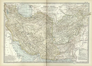
Background imageBoundary Collection: Map of Persia with Afghanistan and Baluchistan, c.1900 (engraving)

Map of Persia with Afghanistan and Baluchistan, c.1900 (engraving)
533013 Map of Persia with Afghanistan and Baluchistan, c.1900 (engraving); (add.info.: Map showing the historical boundaries of Persia (now Iran), Afghanistan, and Baluchistan, circa 1902

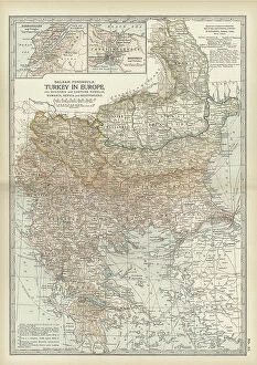
Background imageBoundary Collection: Map of Turkey, c.1900 (engraving)

Map of Turkey, c.1900 (engraving)
532998 Map of Turkey, c.1900 (engraving); (add.info.: Map showing historical boundaries of the European portion of Turkey, circa 1902)

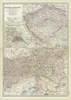
Background imageBoundary Collection: Map of Austria with Vienna, c.1900 (engraving)

Map of Austria with Vienna, c.1900 (engraving)
532980 Map of Austria with Vienna, c.1900 (engraving); (add.info.: Map showing Austria-Hungary, with an inset of Vienna, circa 1902)

Background imageBoundary Collection: Map of southern Illinois, c.1900 (engraving)

Map of southern Illinois, c.1900 (engraving)
533175 Map of southern Illinois, c.1900 (engraving); (add.info.: Map of the southern part of Illinois, United States, with an inset map of Chicago and Vicinity, circa 1902)

Background imageBoundary Collection: Map of Indiana, c.1900 (engraving)

Map of Indiana, c.1900 (engraving)
533170 Map of Indiana, c.1900 (engraving); (add.info.: Map of Indiana, United States, circa 1902, from the 10th edition of Encyclopaedia Britannica.); Encyclopaedia Britannica/UIG

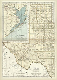
Background imageBoundary Collection: Map of western Texas with Galveston, c.1900 (engraving)

Map of western Texas with Galveston, c.1900 (engraving)
533163 Map of western Texas with Galveston, c.1900 (engraving); (add.info.: Map of the western part of Texas with inset map of Galveston Bay, Galveston, Houston and Vicinity, circa 1902)

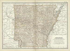
Background imageBoundary Collection: Map of Arkansas, c.1900 (engraving)

Map of Arkansas, c.1900 (engraving)
533157 Map of Arkansas, c.1900 (engraving); (add.info.: Map of Arkansas, United States, circa 1902, from the 10th edition of Encyclopaedia Britannica.); Encyclopaedia Britannica/UIG

Background imageBoundary Collection: Map of southeast Australia, c.1900 (engraving)

Map of southeast Australia, c.1900 (engraving)
533045 Map of southeast Australia, c.1900 (engraving); (add.info.: Map of southeast Australia with Victoria, New South Wales, and parts of South Australia and Queensland, circa 1902)

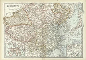
Background imageBoundary Collection: Map of the Chinese Empire, c.1900 (engraving)

Map of the Chinese Empire, c.1900 (engraving)
533025 Map of the Chinese Empire, c.1900 (engraving); (add.info.: Map showing the historical boundaries of the Chinese Empire, with insets of Hong Kong, Peking (now Beijing), and Tientsin

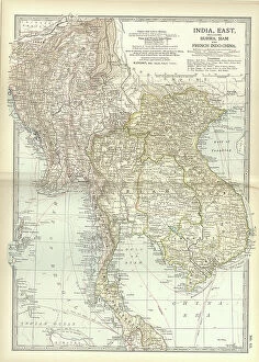
Background imageBoundary Collection: Map of Eastern India, c.1900 (engraving)

Map of Eastern India, c.1900 (engraving)
533022 Map of Eastern India, c.1900 (engraving); (add.info.: Map showing historical boundaries of eastern India, Burma, Siam and French Indo-China, circa 1902)

Background imageBoundary Collection: Map of Asia with Siberia and Central Asia, c.1900 (engraving)

Map of Asia with Siberia and Central Asia, c.1900 (engraving)
533003 Map of Asia with Siberia and Central Asia, c.1900 (engraving); (add.info.: Map of Asia, circa 1902, from the 10th edition of Encyclopaedia Britannica.); Encyclopaedia Britannica/UIG

Background imageBoundary Collection: Map of the southern part of California, c.1900 (engraving)

Map of the southern part of California, c.1900 (engraving)
533233 Map of the southern part of California, c.1900 (engraving); (add.info.: Map of the southern part of California, United States, with inset maps of Los Angeles, San Diego)

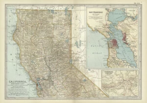
Background imageBoundary Collection: Map of the northern part of California, c.1900 (engraving)

Map of the northern part of California, c.1900 (engraving)
533231 Map of the northern part of California, c.1900 (engraving); (add.info.: Map of the northern part of California, United States, with inset maps of San Francisco and Yosemite Valley, circa 1902)

Background imageBoundary Collection: Map of Oregon, c.1900 (engraving)

Map of Oregon, c.1900 (engraving)
533223 Map of Oregon, c.1900 (engraving); (add.info.: Map of Oregon, United States, circa 1902, from the 10th edition of Encyclopaedia Britannica.); Encyclopaedia Britannica/UIG

Background imageBoundary Collection: Map of Kansas, c.1900 (engraving)

Map of Kansas, c.1900 (engraving)
533205 Map of Kansas, c.1900 (engraving); (add.info.: Map of Kansas, United States, circa 1902, from the 10th edition of Encyclopaedia Britannica.); Encyclopaedia Britannica/UIG

Background imageBoundary Collection: Map of the southern part of Missouri, c.1900 (engraving)

Map of the southern part of Missouri, c.1900 (engraving)
533203 Map of the southern part of Missouri, c.1900 (engraving); (add.info.: Map of the southern part of Missouri, United States, circa 1902)

Background imageBoundary Collection: Map of France, c.1900 (engraving)

Map of France, c.1900 (engraving)
532946 Map of France, c.1900 (engraving); (add.info.: Map of France with inset map of Vicinity of Marseille and the Mediterranean Coast of France, and Corsica, circa 1902)

Background imageBoundary Collection: Map of Florida with insets of cities, c.1900 (engraving)

Map of Florida with insets of cities, c.1900 (engraving)
533142 Map of Florida with insets of cities, c.1900 (engraving); (add.info.: Map of Florida, United States, with inset maps of Jacksonville, Tampa, St)

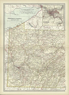
Background imageBoundary Collection: Map of Pennsylvania, with inset map of Pittsburg, c.1900 (engraving)

Map of Pennsylvania, with inset map of Pittsburg, c.1900 (engraving)
533118 Map of Pennsylvania, with inset map of Pittsburg, c.1900 (engraving); (add.info.: Map of Pennsylvania, with inset map of Pittsburg, circa 1902)

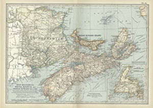
Background imageBoundary Collection: New Brunswick, Nova Scotia & Prince Edward Island, c.1900 (engraving)

New Brunswick, Nova Scotia & Prince Edward Island, c.1900 (engraving)
533083 New Brunswick, Nova Scotia & Prince Edward Island, c.1900 (engraving); (add.info.: Map of New Brunswick, Nova Scotia, and Prince Edward Island, Canada, with an inset of Newfoundland)

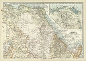
Background imageBoundary Collection: Map of northeastern Africa, c.1900 (engraving)

Map of northeastern Africa, c.1900 (engraving)
533059 Map of northeastern Africa, c.1900 (engraving); (add.info.: Map of northeast Africa, with insets of the Nile Delta and Suez Canal, circa 1902)

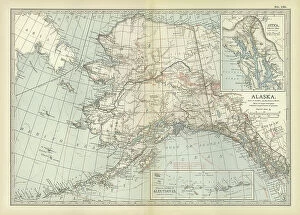
Background imageBoundary Collection: Map of Alaska, c.1900 (engraving)

Map of Alaska, c.1900 (engraving)
533237 Map of Alaska, c.1900 (engraving); (add.info.: Map of Alaska, United States, with inset maps of Sitka and the Aleutian Islands, circa 1902)

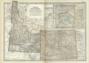
Background imageBoundary Collection: Map of Idaho and Wyoming, c.1900 (engraving)

Map of Idaho and Wyoming, c.1900 (engraving)
533214 Map of Idaho and Wyoming, c.1900 (engraving); (add.info.: Map of Idaho and Wyoming, United States, with an inset map of Yellowstone National Park, circa 1902)

Background imageBoundary Collection: Map of France, c.1900 (engraving)

Map of France, c.1900 (engraving)
532949 Map of France, c.1900 (engraving); (add.info.: Map of north central France, in the vicinity of Paris, circa 1902, from the 10th edition of Encyclopaedia Britannica)

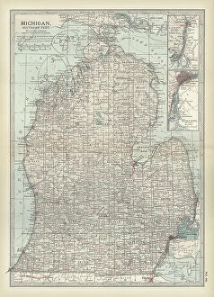
Background imageBoundary Collection: Map of the southern part of Michigan, c.1900 (engraving)

Map of the southern part of Michigan, c.1900 (engraving)
533184 Map of the southern part of Michigan, c.1900 (engraving); (add.info.: Map of the southern part of Michigan, United States, with inset maps of Detroit and the St)

Background imageBoundary Collection: Map of western Tennessee, c.1900 (engraving)

Map of western Tennessee, c.1900 (engraving)
533148 Map of western Tennessee, c.1900 (engraving); (add.info.: Map of the western part of Tennessee, circa 1902, from the 10th edition of Encyclopaedia Britannica.); Encyclopaedia Britannica/UIG


For sale as Licensed Images

Choose your image, Select your licence and Download the media

"Exploring Boundaries: From Ancient Empires to Modern Territories" This captivating collection of images highlights the significance and diversity of boundaries across various realms. Starting with Boundary Park Art in Oldham Athletic, we witness how art can transcend physical limits and connect communities. Moving on to Scotland, UK, a satellite image showcases the intricate lines that define national borders. Delving into history, we encounter the Map of the Macedonian Empire after Alexander the Great's conquests. This map symbolizes both territorial expansion and cultural exchange during one of history's most influential periods. Shifting our focus to geology, a Map of the World reveals lines marking tectonic plate boundaries—a reminder of Earth's ever-changing nature. In contrast, two majestic lions patrolling their territorial boundary remind us that animals too have distinct territories they fiercely protect. As we explore further, maps depicting The Apostle Paul's travels and ancient-modern Jerusalem offer glimpses into religious boundaries shaped by faith and historical events. Meanwhile, an Africa Political Map emphasizes geopolitical divisions shaping nations' identities today. Closer to home in London, arms and seals represent local authority while highlighting administrative boundaries within this bustling metropolis. Additionally, Earth’s tectonic plates illustrate how invisible forces shape our planet beneath its surface. Lastly, we reflect on U. S territory gained from Mexico—a testament to political negotiations defining international borders throughout history. Concluding with LCC-LFB Plumstead fire station in SE London signifies how even emergency services are organized based on geographical boundaries for efficient response times. In this diverse array of images lies a common thread—the concept of "boundary. " Whether physical or abstract; natural or man-made.