Boundary Collection (#2)

"Exploring Boundaries

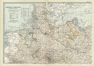
Background imageBoundary Collection: Map of the northern part of the German Empire, c.1900 (engraving)

Map of the northern part of the German Empire, c.1900 (engraving)
532959 Map of the northern part of the German Empire, c.1900 (engraving); (add.info.: Map of the northern part of the German empire, circa 1902)

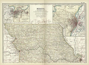
Background imageBoundary Collection: Map of the northern part of Missouri, c.1900 (engraving)

Map of the northern part of Missouri, c.1900 (engraving)
533200 Map of the northern part of Missouri, c.1900 (engraving); (add.info.: Map of the northern part of Missouri with inset maps of Kansas City and St)

Background imageBoundary Collection: Map of Nebraska with inset of Omaha, c.1900 (engraving)

Map of Nebraska with inset of Omaha, c.1900 (engraving)
533197 Map of Nebraska with inset of Omaha, c.1900 (engraving); (add.info.: Map of Nebraska, United States, with an inset map of Omaha, circa 1902)

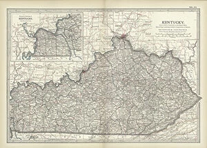
Background imageBoundary Collection: Map of Kentucky, c.1900 (engraving)

Map of Kentucky, c.1900 (engraving)
533143 Map of Kentucky, c.1900 (engraving); (add.info.: Map of Kentucky, United States, circa 1902, from the 10th edition of Encyclopaedia Britannica.); Encyclopaedia Britannica/UIG

Background imageBoundary Collection: Map of Pennsylvania with inset map of Philadelphia, c.1900 (engraving)

Map of Pennsylvania with inset map of Philadelphia, c.1900 (engraving)
533115 Map of Pennsylvania with inset map of Philadelphia, c.1900 (engraving); (add.info.: Map of eastern Pennsylvania with inset map of Philadelphia, circa 1902)

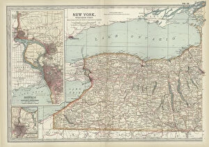
Background imageBoundary Collection: Map of New York State, c.1900 (engraving)

Map of New York State, c.1900 (engraving)
533109 Map of New York State, c.1900 (engraving); (add.info.: Map of western New York State, with inset map of Buffalo, Niagara Frontier, and Rochester, circa 1902)

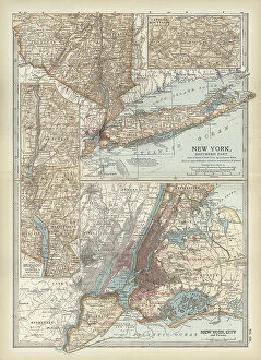
Background imageBoundary Collection: Map of New York State, c.1900 (engraving)

Map of New York State, c.1900 (engraving)
533104 Map of New York State, c.1900 (engraving); (add.info.: Map of southern New York State, United States, insets map of New York City, the Hudson River, and the Catskill Mountains, circa 1902)

Background imageBoundary Collection: Map of North America and Central America, c.1900 (engraving)

Map of North America and Central America, c.1900 (engraving)
533069 Map of North America and Central America, c.1900 (engraving); (add.info.: Map of North America and Central America, circa 1902)

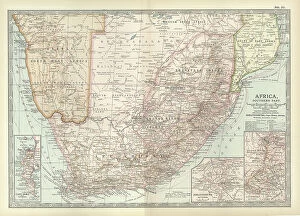
Background imageBoundary Collection: Map of Southern Africa, c.1900 (engraving)

Map of Southern Africa, c.1900 (engraving)
533065 Map of Southern Africa, c.1900 (engraving); (add.info.: Map of colonial southern Africa, with insets of Cape Town, Johannesburg, and Ladysmith, circa 1902)

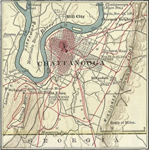
Background imageBoundary Collection: Map of Chattanooga, c.1900 (engraving)

Map of Chattanooga, c.1900 (engraving)
532737 Map of Chattanooga, c.1900 (engraving); (add.info.: Map of Chattanooga, Tennessee, circa 1900, from the 10th edition of Encyclopaedia Britannica.); Encyclopaedia Britannica/UIG

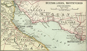
Background imageBoundary Collection: Map of Buenos Aires and Montevideo, c.1900 (engraving)

Map of Buenos Aires and Montevideo, c.1900 (engraving)
533500 Map of Buenos Aires and Montevideo, c.1900 (engraving); (add.info.: Inset map of Buenos Aires (Argentina) and Montevideo (Uruguay), circa 1902

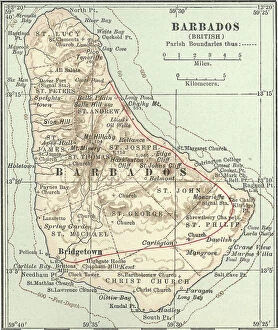
Background imageBoundary Collection: Map of Barbados, c.1900 (engraving)

Map of Barbados, c.1900 (engraving)
533469 Map of Barbados, c.1900 (engraving); (add.info.: Map showing the parish boundaries of Barbados, circa 1902, from the 10th edition of Encyclopaedia Britannica.); Encyclopaedia Britannica/UIG

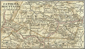
Background imageBoundary Collection: Map of the Catskill Mountains, New York, c.1900 (engraving)

Map of the Catskill Mountains, New York, c.1900 (engraving)
533423 Map of the Catskill Mountains, New York, c.1900 (engraving); (add.info.: Map of Catskill Mountains, New York, circa 1902)

Background imageBoundary Collection: Map of East India Islands with New Guinea, c.1900 (engraving)

Map of East India Islands with New Guinea, c.1900 (engraving)
533036 Map of East India Islands with New Guinea, c.1900 (engraving); (add.info.: Map of East India Islands, with an inset of New Guinea, circa 1902)

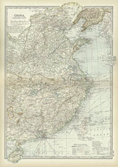
Background imageBoundary Collection: Map of China, c.1900 (engraving)

Map of China, c.1900 (engraving)
533028 Map of China, c.1900 (engraving); (add.info.: Map of China, circa 1902, from the 10th edition of Encyclopaedia Britannica.); Encyclopaedia Britannica/UIG

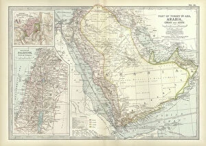
Background imageBoundary Collection: Map of Arabia with part of Turkey and Oman, c.1900 (engraving)

Map of Arabia with part of Turkey and Oman, c.1900 (engraving)
533009 Map of Arabia with part of Turkey and Oman, c.1900 (engraving); (add.info.: Map of Arabia, Turkey, Oman, Aden, with insets map of Jerusalem and Palestine, circa 1902)

Background imageBoundary Collection: Map of Turkey, c.1900 (engraving)

Map of Turkey, c.1900 (engraving)
533006 Map of Turkey, c.1900 (engraving); (add.info.: Map showing the historical boundaries of Turkey in Asia, circa 1902)

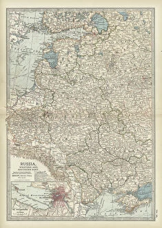
Background imageBoundary Collection: Map of Russia with inset of St. Petersburg, c.1900 (engraving)

Map of Russia with inset of St. Petersburg, c.1900 (engraving)
532995 Map of Russia with inset of St. Petersburg, c.1900 (engraving); (add.info.: Map of Russia, with an inset of St. Petersburg, circa 1902)

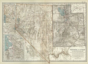
Background imageBoundary Collection: Map of Nevada and Utah, c.1900 (engraving)

Map of Nevada and Utah, c.1900 (engraving)
533228 Map of Nevada and Utah, c.1900 (engraving); (add.info.: Map of Nevada and Utah, United States, with an inset map of Salt Lake City, circa 1902)

Background imageBoundary Collection: Map of Colorado, c.1900 (engraving)

Map of Colorado, c.1900 (engraving)
533216 Map of Colorado, c.1900 (engraving); (add.info.: Map of Colorado, United States, circa 1902, from the 10th edition of Encyclopaedia Britannica.); Encyclopaedia Britannica/UIG

Background imageBoundary Collection: Map of Montana, c.1900 (engraving)

Map of Montana, c.1900 (engraving)
533209 Map of Montana, c.1900 (engraving); (add.info.: Map of Montana, United States, circa 1902, from the 10th edition of Encyclopaedia Britannica.); Encyclopaedia Britannica/UIG

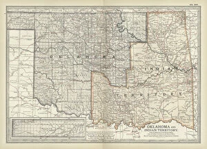
Background imageBoundary Collection: Map of Oklahoma and the Indian Territory, c.1900 (engraving)

Map of Oklahoma and the Indian Territory, c.1900 (engraving)
533207 Map of Oklahoma and the Indian Territory, c.1900 (engraving); (add.info.: Map of Oklahoma and the Indian Territory, United States, circa 1902)

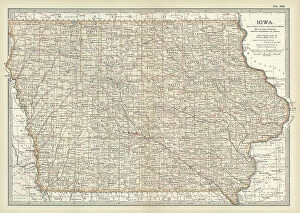
Background imageBoundary Collection: Map of Iowa, c.1900 (engraving)

Map of Iowa, c.1900 (engraving)
533195 Map of Iowa, c.1900 (engraving); (add.info.: Map of Iowa, United States, circa 1902, from the 10th edition of Encyclopaedia Britannica.); Encyclopaedia Britannica/UIG

Background imageBoundary Collection: Map of northern Ohio, c.1900 (engraving)

Map of northern Ohio, c.1900 (engraving)
533164 Map of northern Ohio, c.1900 (engraving); (add.info.: Map of the northern part of Ohio, United States, circa 1902, from the 10th edition of Encyclopaedia Britannica)

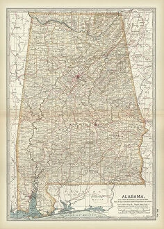
Background imageBoundary Collection: Map of Alabama, c.1900 (engraving)

Map of Alabama, c.1900 (engraving)
533151 Map of Alabama, c.1900 (engraving); (add.info.: Map of Alabama, United States, circa 1902, from the 10th edition of Encyclopaedia Britannica.); Encyclopaedia Britannica/UIG

Background imageBoundary Collection: Map of Quebec, Canada, c.1900 (engraving)

Map of Quebec, Canada, c.1900 (engraving)
533080 Map of Quebec, Canada, c.1900 (engraving); (add.info.: Map of Quebec, Canada, with insets of Quebec City and Montreal, circa 1902)

Background imageBoundary Collection: Anne Hathaway's Cottage, 1945 (oil on canvas laid down on board)

Anne Hathaway's Cottage, 1945 (oil on canvas laid down on board)
828449 Anne Hathaway's Cottage, 1945 (oil on canvas laid down on board) by Bennett, Frank Moss (1874-1953); 25.4x35.5 cm; Private Collection; (add.info.: Anne Hathaway's Cottage)

Background imageBoundary Collection: Doves, 1918 (oil on canvas)

Doves, 1918 (oil on canvas)
658261 Doves, 1918 (oil on canvas) by Hunt, Edgar (1876-1953); 16.5x24 cm; Private Collection; (add.info.: Doves. Edgar Hunt (1876-1953). Oil on canvas. Signed and dated 1918

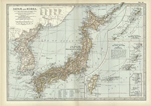
Background imageBoundary Collection: Map of Japan and Korea, c.1900 (engraving)

Map of Japan and Korea, c.1900 (engraving)
533031 Map of Japan and Korea, c.1900 (engraving); (add.info.: Map of Japan and Korea, with insets of Kurile Islands, Liu-Kiu Islands and Formosa, circa 1902)

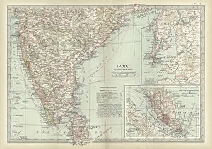
Background imageBoundary Collection: Map of southern India with Bombay, c.1900 (engraving)

Map of southern India with Bombay, c.1900 (engraving)
533019 Map of southern India with Bombay, c.1900 (engraving); (add.info.: Map showing historical boundaries of Southern India with inset map of Bombay (now Mumbai) and the Malay Peninsula

Background imageBoundary Collection: Map of Italy, c.1900 (engraving)

Map of Italy, c.1900 (engraving)
532983 Map of Italy, c.1900 (engraving); (add.info.: Map of Italy, with insets of Rome and Venice, circa 1902, from the 10th edition of Encyclopaedia Britannica.); Encyclopaedia Britannica/UIG

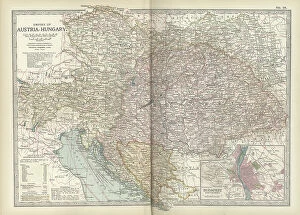
Background imageBoundary Collection: Map of the Empire of Austria-Hungary, c.1900 (engraving)

Map of the Empire of Austria-Hungary, c.1900 (engraving)
532977 Map of the Empire of Austria-Hungary, c.1900 (engraving); (add.info.: Map of Empire of Austria-Hungary and inset of Budapest and Vicinity, circa 1902)

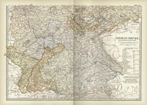
Background imageBoundary Collection: Map of the southwestern part of the German Empire, c.1900 (engraving)

Map of the southwestern part of the German Empire, c.1900 (engraving)
532961 Map of the southwestern part of the German Empire, c.1900 (engraving); (add.info.: Map of the southwestern German Empire, circa 1902)

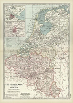
Background imageBoundary Collection: Map of Netherlands and Belgium, c.1900 (engraving)

Map of Netherlands and Belgium, c.1900 (engraving)
532956 Map of Netherlands and Belgium, c.1900 (engraving); (add.info.: Map showing the historical boundaries of Netherlands, Belgium, Luxemburg, with insets of Amsterdam and Brussels, circa 1902)

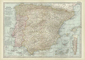
Background imageBoundary Collection: Map of Spain with Portugal and Andorra, c.1900 (engraving)

Map of Spain with Portugal and Andorra, c.1900 (engraving)
532952 Map of Spain with Portugal and Andorra, c.1900 (engraving); (add.info.: Map of Spain with Portugal and Andorra, with insets of the Azores Islands, Canary Islands, and Madeira Island)

Background imageBoundary Collection: Map of France, c.1900 (engraving)

Map of France, c.1900 (engraving)
532942 Map of France, c.1900 (engraving); (add.info.: Map of northern France with insets showing the provinces of France and Paris and Vicinity, circa 1902)

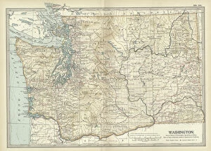
Background imageBoundary Collection: Map of Washington State, c.1900 (engraving)

Map of Washington State, c.1900 (engraving)
533220 Map of Washington State, c.1900 (engraving); (add.info.: Map of Washington State, United States, circa 1902, from the 10th edition of Encyclopaedia Britannica.); Encyclopaedia Britannica/UIG

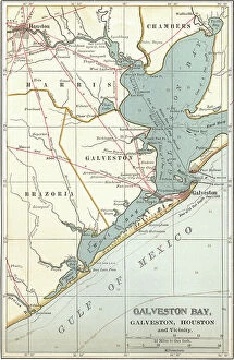
Background imageBoundary Collection: Map of Galveston Bay, Houston and vicinity, c.1900 (engraving)

Map of Galveston Bay, Houston and vicinity, c.1900 (engraving)
532761 Map of Galveston Bay, Houston and vicinity, c.1900 (engraving); (add.info.: Map of Galveston Bay, Houston, circa 1900)

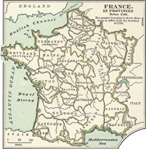
Background imageBoundary Collection: Map of France in Provinces, c.1900 (engraving)

Map of France in Provinces, c.1900 (engraving)
533288 Map of France in Provinces, c.1900 (engraving); (add.info.: Map of the provinces of France before the French Revolution in 1789, circa 1902)

Background imageBoundary Collection: Map of Minnesota, c.1900 (engraving)

Map of Minnesota, c.1900 (engraving)
533188 Map of Minnesota, c.1900 (engraving); (add.info.: Map of Minnesota, United States, with inset maps of Duluth and Minneapolis, circa 1902)

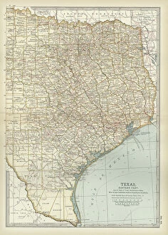
Background imageBoundary Collection: Map of eastern Texas, c.1900 (engraving)

Map of eastern Texas, c.1900 (engraving)
533161 Map of eastern Texas, c.1900 (engraving); (add.info.: Map of the eastern part of Texas, circa 1902, from the 10th edition of Encyclopaedia Britannica.); Encyclopaedia Britannica/UIG

Background imageBoundary Collection: Map of eastern Tennessee, c.1900 (engraving)

Map of eastern Tennessee, c.1900 (engraving)
533145 Map of eastern Tennessee, c.1900 (engraving); (add.info.: Map of the eastern part of Tennessee with inset map of Chattanooga, circa 1902)

Background imageBoundary Collection: Map of North Carolina, c.1900 (engraving)

Map of North Carolina, c.1900 (engraving)
533130 Map of North Carolina, c.1900 (engraving); (add.info.: Map of North Carolina, United States, circa 1902, from the 10th edition of Encyclopaedia Britannica.); Encyclopaedia Britannica/UIG

Background imageBoundary Collection: Map of Canada, c.1900 (engraving)

Map of Canada, c.1900 (engraving)
533072 Map of Canada, c.1900 (engraving); (add.info.: Map showing historical boundaries of Canada and Newfoundland, circa 1902)

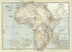
Background imageBoundary Collection: Map of colonial Africa, c.1900 (engraving)

Map of colonial Africa, c.1900 (engraving)
533053 Map of colonial Africa, c.1900 (engraving); (add.info.: Map of colonial Africa, with insets of Ascension Island, St)

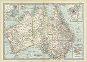
Background imageBoundary Collection: Map of Australia and Tasmania. c1902 (engraving)

Map of Australia and Tasmania. c1902 (engraving)
533041 Map of Australia and Tasmania. c1902 (engraving); (add.info.: Map showing Australia with insets of Melbourne and Port Phillip, Tasmania, and Sydney and Vicinity, circa 1902)

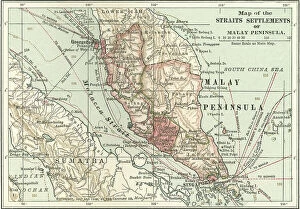
Background imageBoundary Collection: Map of the Malay Peninsula, c.1900 (engraving)

Map of the Malay Peninsula, c.1900 (engraving)
533325 Map of the Malay Peninsula, c.1900 (engraving); (add.info.: Map showing historical boundaries of the Malay Peninsula, Sumatra, and Singapore, circa 1902)

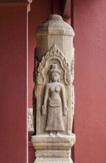
Background imageBoundary Collection: Brahmanist boundary post, unknown provenance, angkorian period, Angkor wat style

Brahmanist boundary post, unknown provenance, angkorian period, Angkor wat style, probably 12th century, sandstone
930456 Brahmanist boundary post, unknown provenance, angkorian period, Angkor wat style, probably 12th century, sandstone, national museum of Cambodia, Phnom Penh


For sale as Licensed Images

Choose your image, Select your licence and Download the media

"Exploring Boundaries: From Ancient Empires to Modern Territories" This captivating collection of images highlights the significance and diversity of boundaries across various realms. Starting with Boundary Park Art in Oldham Athletic, we witness how art can transcend physical limits and connect communities. Moving on to Scotland, UK, a satellite image showcases the intricate lines that define national borders. Delving into history, we encounter the Map of the Macedonian Empire after Alexander the Great's conquests. This map symbolizes both territorial expansion and cultural exchange during one of history's most influential periods. Shifting our focus to geology, a Map of the World reveals lines marking tectonic plate boundaries—a reminder of Earth's ever-changing nature. In contrast, two majestic lions patrolling their territorial boundary remind us that animals too have distinct territories they fiercely protect. As we explore further, maps depicting The Apostle Paul's travels and ancient-modern Jerusalem offer glimpses into religious boundaries shaped by faith and historical events. Meanwhile, an Africa Political Map emphasizes geopolitical divisions shaping nations' identities today. Closer to home in London, arms and seals represent local authority while highlighting administrative boundaries within this bustling metropolis. Additionally, Earth’s tectonic plates illustrate how invisible forces shape our planet beneath its surface. Lastly, we reflect on U. S territory gained from Mexico—a testament to political negotiations defining international borders throughout history. Concluding with LCC-LFB Plumstead fire station in SE London signifies how even emergency services are organized based on geographical boundaries for efficient response times. In this diverse array of images lies a common thread—the concept of "boundary. " Whether physical or abstract; natural or man-made.