Navigational Equipment Collection (#7)

"Unveiling the Past: Navigational Equipment Guides Us Through History" Exploring ancient civilizations

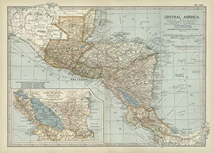
Background imageNavigational Equipment Collection: Map of Central America, c.1900 (engraving)

Map of Central America, c.1900 (engraving)
533254 Map of Central America, c.1900 (engraving); (add.info.: Map of Central America, with an inset map of Lake Nicaragua, circa 1902)

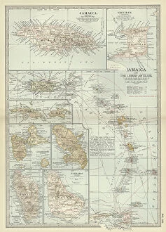
Background imageNavigational Equipment Collection: Map of Jamaica and the Lesser Antilles, c.1900 (engraving)

Map of Jamaica and the Lesser Antilles, c.1900 (engraving)
533243 Map of Jamaica and the Lesser Antilles, c.1900 (engraving); (add.info.: Map of Jamaica and the Lesser Antilles, circa 1902)

Background imageNavigational Equipment Collection: Map of the German Empire with Berlin and Hamburg, c.1900 (engraving)

Map of the German Empire with Berlin and Hamburg, c.1900 (engraving)
532964 Map of the German Empire with Berlin and Hamburg, c.1900 (engraving); (add.info.: Map showing the eastern part of the German Empire, with inset maps of Berlin and Hamburg, circa 1902)

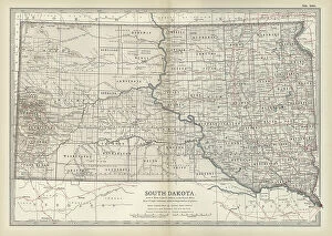
Background imageNavigational Equipment Collection: Map of South Dakota, c.1900 (engraving)

Map of South Dakota, c.1900 (engraving)
533193 Map of South Dakota, c.1900 (engraving); (add.info.: State map of South Dakota, United States, circa 1902, from the 10th edition of Encyclopaedia Britannica.); Encyclopaedia Britannica/UIG

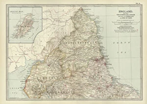
Background imageNavigational Equipment Collection: Map of England, c.1900 (engraving)

Map of England, c.1900 (engraving)
532908 Map of England, c.1900 (engraving); (add.info.: Map of England, including an inset of the Isle of Man, circa 1902, from the 10th edition of Encyclopaedia Britannica)

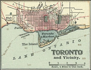
Background imageNavigational Equipment Collection: Map of Toronto, c.1900 (engraving)

Map of Toronto, c.1900 (engraving)
532875 Map of Toronto, c.1900 (engraving); (add.info.: Map of Toronto, Canada, circa 1900, from the 10th edition of Encyclopaedia Britannica.); Encyclopaedia Britannica/UIG

Background imageNavigational Equipment Collection: Map of San Francisco Bay, c.1900 (engraving)

Map of San Francisco Bay, c.1900 (engraving)
532857 Map of San Francisco Bay, c.1900 (engraving); (add.info.: Map of San Francisco Bay, circa 1900, from the 10th edition of Encyclopaedia Britannica.); Encyclopaedia Britannica/UIG

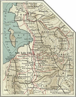
Background imageNavigational Equipment Collection: Map of Salt Lake City, c.1900 (engraving)

Map of Salt Lake City, c.1900 (engraving)
532851 Map of Salt Lake City, c.1900 (engraving); (add.info.: Map of Salt Lake City, Utah, circa 1900, from the 10th edition of Encyclopaedia Britannica.); Encyclopaedia Britannica/UIG

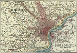
Background imageNavigational Equipment Collection: Map of Philadelphia, c.1900 (engraving)

Map of Philadelphia, c.1900 (engraving)
532825 Map of Philadelphia, c.1900 (engraving); (add.info.: Map of Philadelphia, Pennsylvania, circa 1900, from the 10th edition of Encyclopaedia Britannica.); Encyclopaedia Britannica/UIG

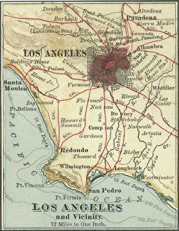
Background imageNavigational Equipment Collection: Map of Los Angeles, c.1900 (engraving)

Map of Los Angeles, c.1900 (engraving)
532788 Map of Los Angeles, c.1900 (engraving); (add.info.: Map of Los Angeles, California, circa 1900, from the 10th edition of Encyclopaedia Britannica.); Encyclopaedia Britannica/UIG

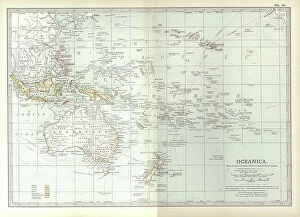
Background imageNavigational Equipment Collection: Map of Oceania, c.1900 (engraving)

Map of Oceania, c.1900 (engraving)
533039 Map of Oceania, c.1900 (engraving); (add.info.: Map of Oceanica (Oceania): Australia, New Zealand, Polynesia, Melanesia, and Hawaiian Islands, circa 1902

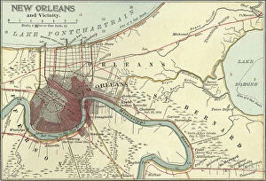
Background imageNavigational Equipment Collection: Map of New Orleans, c.1900 (engraving)

Map of New Orleans, c.1900 (engraving)
532801 Map of New Orleans, c.1900 (engraving); (add.info.: Map of New Orleans, Louisiana, circa 1900, from the 10th edition of Encyclopaedia Britannica.); Encyclopaedia Britannica/UIG

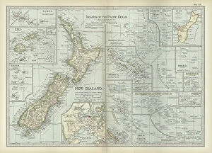
Background imageNavigational Equipment Collection: Map of Pacific Ocean Islands, c.1900 (engraving)

Map of Pacific Ocean Islands, c.1900 (engraving)
533048 Map of Pacific Ocean Islands, c.1900 (engraving); (add.info.: Map of Pacific Ocean Islands: New Zealand, Samoa, Fiji, Tonga, Guam, Marshall Islands, Solomon Islands, Mariana Islands)

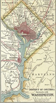
Background imageNavigational Equipment Collection: Map of Washington DC, c.1900 (engraving)

Map of Washington DC, c.1900 (engraving)
532884 Map of Washington DC, c.1900 (engraving); (add.info.: Map of Washington, D.C. circa 1900, from the 10th edition of Encyclopaedia Britannica.); Encyclopaedia Britannica/UIG

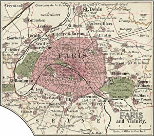
Background imageNavigational Equipment Collection: Map of Paris, c.1900 (engraving)

Map of Paris, c.1900 (engraving)
532819 Map of Paris, c.1900 (engraving); (add.info.: Map of Paris, circa 1900, from the 10th edition of Encyclopaedia Britannica.); Encyclopaedia Britannica/UIG

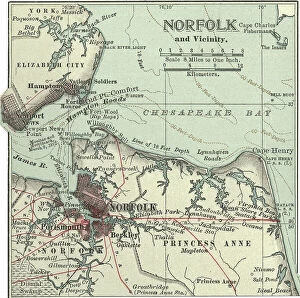
Background imageNavigational Equipment Collection: Map of Norfolk, c.1900 (engraving)

Map of Norfolk, c.1900 (engraving)
532810 Map of Norfolk, c.1900 (engraving); (add.info.: Map of Norfolk, Portsmouth, Newport News, Hampton, and Hampton Roads, circa 1900)

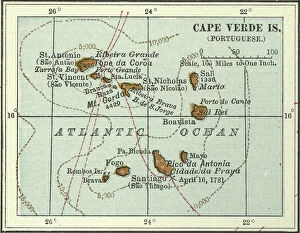
Background imageNavigational Equipment Collection: Map of Cape Verde Islands, c.1900 (engraving)

Map of Cape Verde Islands, c.1900 (engraving)
533379 Map of Cape Verde Islands, c.1900 (engraving); (add.info.: Map of Cape Verde Islands, circa 1902, from the 10th edition of Encyclopaedia Britannica.); Encyclopaedia Britannica/UIG

Background imageNavigational Equipment Collection: Map of Greece with Crete and Samos, c.1900 (engraving)

Map of Greece with Crete and Samos, c.1900 (engraving)
533001 Map of Greece with Crete and Samos, c.1900 (engraving); (add.info.: Map showing detail of Greece with Crete and Samos, with insets of Crete and Athens, circa 1902)

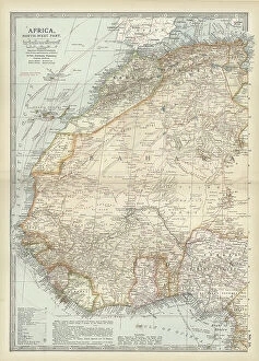
Background imageNavigational Equipment Collection: Map of northwestern Africa, c.1900 (engraving)

Map of northwestern Africa, c.1900 (engraving)
533056 Map of northwestern Africa, c.1900 (engraving); (add.info.: Map of northwest Africa with Morocco, Algeria, Tunis, Sahara, Senegal, Portuguese Guinea, circa 1902)

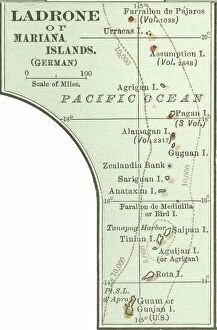
Background imageNavigational Equipment Collection: Map of Ladrone or Mariana Islands, c.1900 (engraving)

Map of Ladrone or Mariana Islands, c.1900 (engraving)
533360 Map of Ladrone or Mariana Islands, c.1900 (engraving); (add.info.: Map of Ladrone or Mariana Islands, South Pacific, Oceania, circa 1902)

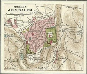
Background imageNavigational Equipment Collection: Map of Jerusalem, c.1900 (engraving)

Map of Jerusalem, c.1900 (engraving)
532776 Map of Jerusalem, c.1900 (engraving); (add.info.: Map of Jerusalem, circa 1900, from the 10th edition of Encyclopaedia Britannica.); Encyclopaedia Britannica/UIG

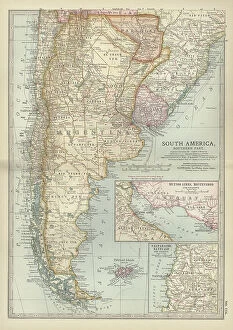
Background imageNavigational Equipment Collection: Map of the southern part of South America, c.1900 (engraving)

Map of the southern part of South America, c.1900 (engraving)
533267 Map of the southern part of South America, c.1900 (engraving); (add.info.: Map of southern South America, with inset maps of Buenos Aires, Montevideo, Valparaiso, and Santiago, circa 1902)

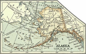
Background imageNavigational Equipment Collection: Map of Alaska, c.1900 (engraving)

Map of Alaska, c.1900 (engraving)
533418 Map of Alaska, c.1900 (engraving); (add.info.: Map of Alaska, United States, circa 1902, from the 10th edition of Encyclopaedia Britannica.); Encyclopaedia Britannica/UIG

Background imageNavigational Equipment Collection: Map of the Shetland Islands, c.1900 (engraving)

Map of the Shetland Islands, c.1900 (engraving)
533285 Map of the Shetland Islands, c.1900 (engraving); (add.info.: Map of Shetland Islands, Scotland, circa 1902, from the 10th edition of Encyclopaedia Britannica.); Encyclopaedia Britannica/UIG

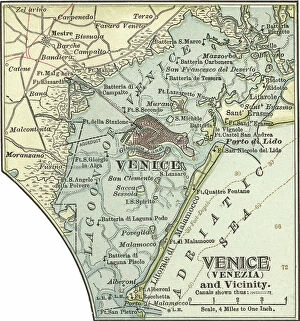
Background imageNavigational Equipment Collection: Map of Venice, c.1900 (engraving)

Map of Venice, c.1900 (engraving)
532878 Map of Venice, c.1900 (engraving); (add.info.: Map of Venice, Italy, circa 1900, from the 10th edition of Encyclopaedia Britannica.); Encyclopaedia Britannica/UIG

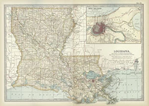
Background imageNavigational Equipment Collection: Map of Louisiana, c.1900 (engraving)

Map of Louisiana, c.1900 (engraving)
533158 Map of Louisiana, c.1900 (engraving); (add.info.: Map of Louisiana, United States, with inset map of New Orleans and Vicinity, circa 1902)

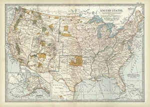
Background imageNavigational Equipment Collection: Map of the United States with inset of Alaska, c.1900 (engraving)

Map of the United States with inset of Alaska, c.1900 (engraving)
533086 Map of the United States with inset of Alaska, c.1900 (engraving); (add.info.: Map of United States with inset of Alaska, circa 1902)

Background imageNavigational Equipment Collection: Map of Newfoundland, c.1900 (engraving)

Map of Newfoundland, c.1900 (engraving)
533415 Map of Newfoundland, c.1900 (engraving); (add.info.: Map of Newfoundland, Canada, circa 1902, from the 10th edition of Encyclopaedia Britannica.); Encyclopaedia Britannica/UIG

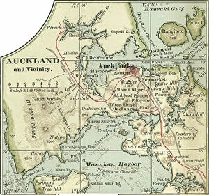
Background imageNavigational Equipment Collection: Map of Auckland, c.1900 (engraving)

Map of Auckland, c.1900 (engraving)
533349 Map of Auckland, c.1900 (engraving); (add.info.: Map of Auckland, New Zealand, circa 1902, from the 10th edition of Encyclopaedia Britannica.); Encyclopaedia Britannica/UIG

Background imageNavigational Equipment Collection: Map of Manitoba and British Columbia, c.1900 (engraving)

Map of Manitoba and British Columbia, c.1900 (engraving)
533074 Map of Manitoba and British Columbia, c.1900 (engraving); (add.info.: Map of Manitoba, British Columbia, and the Northwest Territories, Canada, circa 1902)

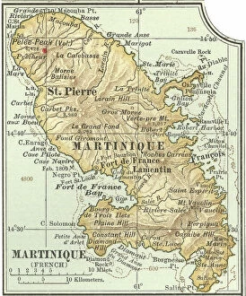
Background imageNavigational Equipment Collection: Map of Martinique, c.1900 (engraving)

Map of Martinique, c.1900 (engraving)
533483 Map of Martinique, c.1900 (engraving); (add.info.: Map of Martinique, circa 1902, from the 10th edition of Encyclopaedia Britannica.); Encyclopaedia Britannica/UIG

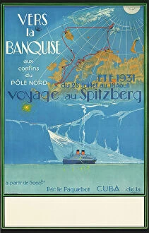
Background imageNavigational Equipment Collection: Poster advertising travel to Spitzberg, Norway, c.1931 (colour lithograph)

Poster advertising travel to Spitzberg, Norway, c.1931 (colour lithograph)
1197962 Poster advertising travel to Spitzberg, Norway, c.1931 (colour lithograph) by Sebille, Albert (1874-1953); 101x65 cm; Private Collection; Photo © Christie's Images

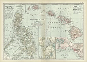
Background imageNavigational Equipment Collection: Map of Philippine Islands with Hawaii, c.1900 (engraving)

Map of Philippine Islands with Hawaii, c.1900 (engraving)
533033 Map of Philippine Islands with Hawaii, c.1900 (engraving); (add.info.: Map of Philippine Islands and Hawaii, with inset maps of Manila, Honolulu, and Pearl Harbor, circa 1902)

Background imageNavigational Equipment Collection: Map of colonial Africa with Madagascar, c.1900 (engraving)

Map of colonial Africa with Madagascar, c.1900 (engraving)
533062 Map of colonial Africa with Madagascar, c.1900 (engraving); (add.info.: Map of southern colonial Africa, with an inset of Madagascar, circa 1902)

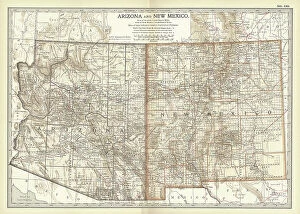
Background imageNavigational Equipment Collection: Map of Arizona and New Mexico, c.1900 (engraving)

Map of Arizona and New Mexico, c.1900 (engraving)
533218 Map of Arizona and New Mexico, c.1900 (engraving); (add.info.: Map of Arizona and New Mexico, circa 1902, from the 10th edition of Encyclopaedia Britannica.); Encyclopaedia Britannica/UIG

Background imageNavigational Equipment Collection: Map of Europe, c.1900 (engraving)

Map of Europe, c.1900 (engraving)
532897 Map of Europe, c.1900 (engraving); (add.info.: Map of Europe, circa 1902, from the 10th edition of Encyclopaedia Britannica.); Encyclopaedia Britannica/UIG

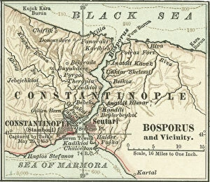
Background imageNavigational Equipment Collection: Map of Bosporus, c.1900 (engraving)

Map of Bosporus, c.1900 (engraving)
532714 Map of Bosporus, c.1900 (engraving); (add.info.: Map of Bosporus, circa 1900, from the 10th edition of Encyclopaedia Britannica.); Encyclopaedia Britannica/UIG

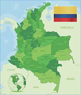
Background imageNavigational Equipment Collection: Green Map of Colombia - states, cities and flag

Green Map of Colombia - states, cities and flag
Colombia, country of northwestern South America. Its 1, 000 miles (1, 600 km) of coast to the north are bathed by the waters of the Caribbean Sea, and its 800 miles (1)

Background imageNavigational Equipment Collection: A Vanitas Still Life of Musical Instruments and Manuscripts

A Vanitas Still Life of Musical Instruments and Manuscripts
827963 A Vanitas Still Life of Musical Instruments and Manuscripts, an Overturned Gilt Covered Goblet, a Jewellery Casket, a Candlestick, an Astrological Globe, a String of Pearls, Jewels, Shells

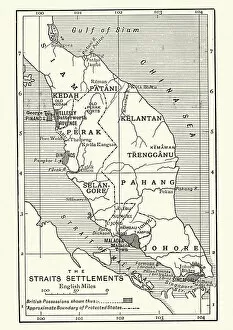
Background imageNavigational Equipment Collection: Map of British Malaya and Singapore, 1890s

Map of British Malaya and Singapore, 1890s
Vintage engraving of Map of British Malaya and Singapore, 1890s, 19th Century

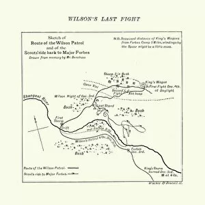
Background imageNavigational Equipment Collection: Map of the Shangani Patrol and Major Wilsons Last Stand

Map of the Shangani Patrol and Major Wilsons Last Stand
Vintage engraving of a Map of the Shangani Patrol and Major Wilsons Last Stand. The Shangani Patrol (or Wilsons Patrol), comprising 34 soldiers in the service of the British South Africa Company

Background imageNavigational Equipment Collection: Battle of Belmont

Battle of Belmont
Vintage engraving from 1863 of a map of the Battle of Belmont which was fought on November 7, 1861, in Mississippi County, Missouri. It was the first combat test in the American Civil War for Brig

Background imageNavigational Equipment Collection: Map of Victorian London and its environs, England, 1870s

Map of Victorian London and its environs, England, 1870s
Vintage engraving of a Map of Victorian London and its environs, England, 1870s, 19th Century

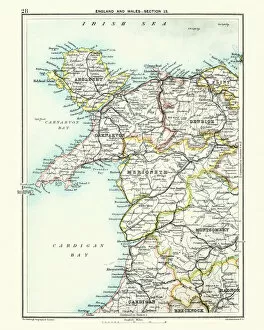
Background imageNavigational Equipment Collection: Antique map, North Wales, Anglesey, Carnarvon, 19th Century

Antique map, North Wales, Anglesey, Carnarvon, 19th Century
Vintage engraving of a Antique map, North Wales, Anglesey, Carnarvon, Denbigh, Merionete, Montgomery19th Century

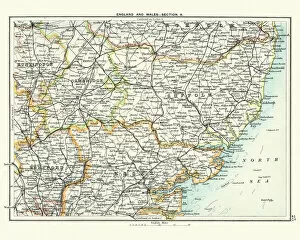
Background imageNavigational Equipment Collection: Antique map, Cambridge, Hertford, Essex, Suffolk, England 19th Century

Antique map, Cambridge, Hertford, Essex, Suffolk, England 19th Century
Vintage engraving of a Antique map, Cambridge, Hertford, Essex, Suffolk, England 19th Century

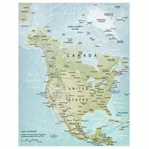
Background imageNavigational Equipment Collection: North America map

North America map
Vector illustration of a detailed map of North America. Reference map was created by the US Central Intelligence Agency and is available as a public domain map at the University of Texas Libraries

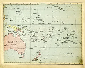
Background imageNavigational Equipment Collection: Antique Map of Oceania 1897

Antique Map of Oceania 1897
Antique Map of the Oceania from 1897

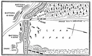
Background imageNavigational Equipment Collection: Battle of Big Bethel

Battle of Big Bethel
Vintage engraving from 1863 of a map of the Battle of Big Bethel also known as the Battle of Bethel Church or Great Bethel was an American Civil War battle that took place on June 10, 1861


For sale as Licensed Images

Choose your image, Select your licence and Download the media

"Unveiling the Past: Navigational Equipment Guides Us Through History" Exploring ancient civilizations: An antique map of the Roman Empire reveals their vast territories and navigational prowess. Tracing Anglo-Saxon roots: Delve into history with an antique map showcasing Britain under the Anglo Saxons, a captivating glimpse into early English heritage. Byzantine marvels in ink: Step back in time as a 9th-century map of the Byzantine Empire unfolds its intricate details, guiding us through this remarkable era. Unraveling Liverpool's maritime legacy: A fascinating 19th-century antique map takes us on a journey through Liverpool and Birkenhead, England, offering insights into their rich nautical history. Ireland's enchanting landscapes mapped: Discover Ireland's allure through an exquisite antique map that showcases its diverse geography and invites exploration. Scottish Isles beckon adventurers: Embark on a virtual voyage to Jura, Mull, Argyll, Islay with a stunning 19th-century antique map that captures Scotland's rugged beauty. Charting New Zealand's discovery: Travel back to 1873 with an extraordinary antique map of New Zealand; witness how explorers navigated these uncharted lands centuries ago. The allure of vintage cartography continues: Immerse yourself in nostalgia with an enchanting vintage map of Magna Graecia - relish its timeless charm and historical significance. Island paradise revealed - Cyprus unveiled. Explore this Mediterranean gem as you trace your fingers across an alluringly detailed vintage map capturing Cyprus' unique essence. Saint Lucia whispers tales from yesteryears: Transport yourself to the Caribbean island paradise as you explore a mesmerizing 19th-century antique map depicting Saint Lucia’s vibrant past. The road less traveled across America awaits.