Navigational Equipment Collection (#4)

"Unveiling the Past: Navigational Equipment Guides Us Through History" Exploring ancient civilizations

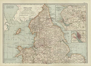
Background imageNavigational Equipment Collection: Map of England and Wales, c.1900 (engraving)

Map of England and Wales, c.1900 (engraving)
532903 Map of England and Wales, c.1900 (engraving); (add.info.: Map showing the historical boundaries of northern England and Wales, including insets of Liverpool, Manchester and Vicinity)

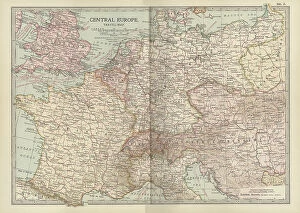
Background imageNavigational Equipment Collection: Map of Central Europe, c.1900 (engraving)

Map of Central Europe, c.1900 (engraving)
532900 Map of Central Europe, c.1900 (engraving); (add.info.: Map of Central Europe, circa 1902, From the 10th edition of Encyclopaedia Britannica.); Encyclopaedia Britannica/UIG

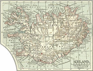
Background imageNavigational Equipment Collection: Map of Iceland, c.1900 (engraving)

Map of Iceland, c.1900 (engraving)
533307 Map of Iceland, c.1900 (engraving); (add.info.: Map of Iceland showing glaciers (Jokull), fjords and other geographical features, circa 1902

Background imageNavigational Equipment Collection: Map of Marseille, France, c.1900 (engraving)

Map of Marseille, France, c.1900 (engraving)
533294 Map of Marseille, France, c.1900 (engraving); (add.info.: Map of Marseille, France, circa 1902, from the 10th edition of Encyclopaedia Britannica.); Encyclopaedia Britannica/UIG

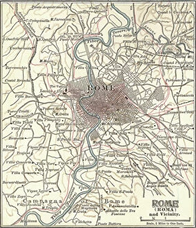
Background imageNavigational Equipment Collection: Map of Rome, c.1900 (engraving)

Map of Rome, c.1900 (engraving)
532848 Map of Rome, c.1900 (engraving); (add.info.: Map of Rome, circa 1900, from the 10th edition of Encyclopaedia Britannica.); Encyclopaedia Britannica/UIG

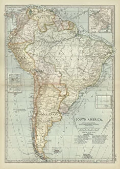
Background imageNavigational Equipment Collection: Map of South America, c.1900 (engraving)

Map of South America, c.1900 (engraving)
533256 Map of South America, c.1900 (engraving); (add.info.: Map of South America with inset maps of Isthmus of Panama, Galapagos Islands and Trinidad, circa 1902)

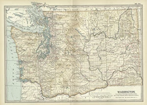
Background imageNavigational Equipment Collection: Map of Washington State, c.1900 (engraving)

Map of Washington State, c.1900 (engraving)
533220 Map of Washington State, c.1900 (engraving); (add.info.: Map of Washington State, United States, circa 1902, from the 10th edition of Encyclopaedia Britannica.); Encyclopaedia Britannica/UIG

Background imageNavigational Equipment Collection: Map of Melbourne, c.1900 (engraving)

Map of Melbourne, c.1900 (engraving)
532791 Map of Melbourne, c.1900 (engraving); (add.info.: Map of Melbourne, Australia, circa 1900, from the 10th edition of Encyclopaedia Britannica.); Encyclopaedia Britannica/UIG

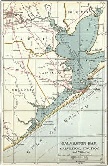
Background imageNavigational Equipment Collection: Map of Galveston Bay, Houston and vicinity, c.1900 (engraving)

Map of Galveston Bay, Houston and vicinity, c.1900 (engraving)
532761 Map of Galveston Bay, Houston and vicinity, c.1900 (engraving); (add.info.: Map of Galveston Bay, Houston, circa 1900)

Background imageNavigational Equipment Collection: Map of the colonial powers, 1902, c.1900 (engraving)

Map of the colonial powers, 1902, c.1900 (engraving)
532894 Map of the colonial powers, 1902, c.1900 (engraving); (add.info.: Map of the world showing "the Chief Countries and their Colonies, " circa 1902)

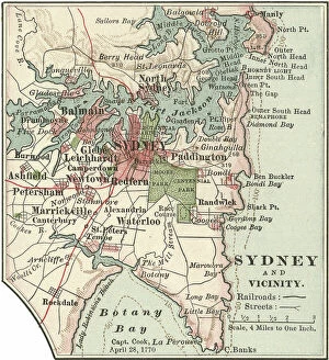
Background imageNavigational Equipment Collection: Map of Sydney, c.1900 (engraving)

Map of Sydney, c.1900 (engraving)
532872 Map of Sydney, c.1900 (engraving); (add.info.: Map of Sydney, Australia, circa 1900, from the 10th edition of Encyclopaedia Britannica.); Encyclopaedia Britannica/UIG

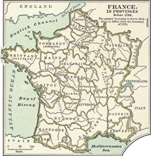
Background imageNavigational Equipment Collection: Map of France in Provinces, c.1900 (engraving)

Map of France in Provinces, c.1900 (engraving)
533288 Map of France in Provinces, c.1900 (engraving); (add.info.: Map of the provinces of France before the French Revolution in 1789, circa 1902)

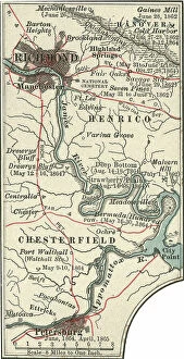
Background imageNavigational Equipment Collection: Map of Richmond, c.1900 (engraving)

Map of Richmond, c.1900 (engraving)
532839 Map of Richmond, c.1900 (engraving); (add.info.: Map illustrating battles of the American Civil War held around the Richmond, Virginia, area)

Background imageNavigational Equipment Collection: Map of Minnesota, c.1900 (engraving)

Map of Minnesota, c.1900 (engraving)
533188 Map of Minnesota, c.1900 (engraving); (add.info.: Map of Minnesota, United States, with inset maps of Duluth and Minneapolis, circa 1902)

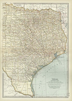
Background imageNavigational Equipment Collection: Map of eastern Texas, c.1900 (engraving)

Map of eastern Texas, c.1900 (engraving)
533161 Map of eastern Texas, c.1900 (engraving); (add.info.: Map of the eastern part of Texas, circa 1902, from the 10th edition of Encyclopaedia Britannica.); Encyclopaedia Britannica/UIG

Background imageNavigational Equipment Collection: Map of eastern Tennessee, c.1900 (engraving)

Map of eastern Tennessee, c.1900 (engraving)
533145 Map of eastern Tennessee, c.1900 (engraving); (add.info.: Map of the eastern part of Tennessee with inset map of Chattanooga, circa 1902)

Background imageNavigational Equipment Collection: Map of North Carolina, c.1900 (engraving)

Map of North Carolina, c.1900 (engraving)
533130 Map of North Carolina, c.1900 (engraving); (add.info.: Map of North Carolina, United States, circa 1902, from the 10th edition of Encyclopaedia Britannica.); Encyclopaedia Britannica/UIG

Background imageNavigational Equipment Collection: Map of Canada, c.1900 (engraving)

Map of Canada, c.1900 (engraving)
533072 Map of Canada, c.1900 (engraving); (add.info.: Map showing historical boundaries of Canada and Newfoundland, circa 1902)

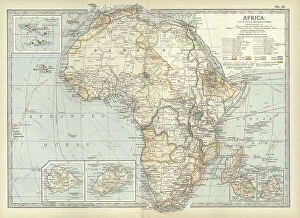
Background imageNavigational Equipment Collection: Map of colonial Africa, c.1900 (engraving)

Map of colonial Africa, c.1900 (engraving)
533053 Map of colonial Africa, c.1900 (engraving); (add.info.: Map of colonial Africa, with insets of Ascension Island, St)

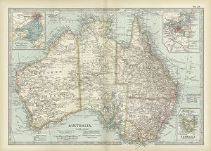
Background imageNavigational Equipment Collection: Map of Australia and Tasmania. c1902 (engraving)

Map of Australia and Tasmania. c1902 (engraving)
533041 Map of Australia and Tasmania. c1902 (engraving); (add.info.: Map showing Australia with insets of Melbourne and Port Phillip, Tasmania, and Sydney and Vicinity, circa 1902)

Background imageNavigational Equipment Collection: Map of Dublin, c.1900 (engraving)

Map of Dublin, c.1900 (engraving)
532758 Map of Dublin, c.1900 (engraving); (add.info.: Map of Dublin, circa 1900, from the 10th edition of Encyclopaedia Britannica.); Encyclopaedia Britannica/UIG

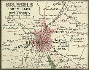
Background imageNavigational Equipment Collection: Map of Brussels, c.1900 (engraving)

Map of Brussels, c.1900 (engraving)
532721 Map of Brussels, c.1900 (engraving); (add.info.: Map of the city of Brussels, Belgium, circa 1900, from the 10th edition of Encyclopaedia Britannica.); Encyclopaedia Britannica/UIG

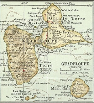
Background imageNavigational Equipment Collection: Map of Guadeloupe, c.1900 (engraving)

Map of Guadeloupe, c.1900 (engraving)
533480 Map of Guadeloupe, c.1900 (engraving); (add.info.: Map of Guadeloupe, circa 1902, from the 10th edition of Encyclopaedia Britannica.); Encyclopaedia Britannica/UIG

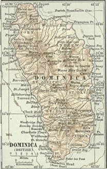
Background imageNavigational Equipment Collection: Map of Dominica, c.1900 (engraving)

Map of Dominica, c.1900 (engraving)
533477 Map of Dominica, c.1900 (engraving); (add.info.: Map of Dominica, circa 1902, from the 10th edition of Encyclopaedia Britannica.); Encyclopaedia Britannica/UIG

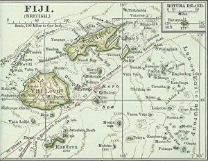
Background imageNavigational Equipment Collection: Map of Fiji Islands, c.1900 (engraving)

Map of Fiji Islands, c.1900 (engraving)
533354 Map of Fiji Islands, c.1900 (engraving); (add.info.: Map of Fiji Islands, South Pacific with inset map of Rotuma Island, circa 1902)

Background imageNavigational Equipment Collection: Map of New Guinea and Bismarck Archipelago, c.1900 (engraving)

Map of New Guinea and Bismarck Archipelago, c.1900 (engraving)
533344 Map of New Guinea and Bismarck Archipelago, c.1900 (engraving); (add.info.: Map of New Guinea and the Bismarck Archipelago, circa 1902)

Background imageNavigational Equipment Collection: Map of Bonin Islands and Sulphur Islands, c.1900 (engraving)

Map of Bonin Islands and Sulphur Islands, c.1900 (engraving)
533329 Map of Bonin Islands and Sulphur Islands, c.1900 (engraving); (add.info.: Inset map of Bonin Islands and Sulphur Islands, circa 1902)

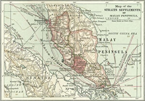
Background imageNavigational Equipment Collection: Map of the Malay Peninsula, c.1900 (engraving)

Map of the Malay Peninsula, c.1900 (engraving)
533325 Map of the Malay Peninsula, c.1900 (engraving); (add.info.: Map showing historical boundaries of the Malay Peninsula, Sumatra, and Singapore, circa 1902)

Background imageNavigational Equipment Collection: Map of Crete, c.1900 (engraving)

Map of Crete, c.1900 (engraving)
533320 Map of Crete, c.1900 (engraving); (add.info.: Map of Crete, Greece, circa 1902, From the 10th edition of Encyclopaedia Britannica.); Encyclopaedia Britannica/UIG

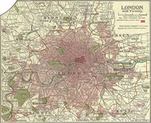
Background imageNavigational Equipment Collection: Map of London and Vicinity, 1902, c.1900 (engraving)

Map of London and Vicinity, 1902, c.1900 (engraving)
533273 Map of London and Vicinity, 1902, c.1900 (engraving); (add.info.: Map of London, England, circa 1902, from the 10th edition of Encyclopaedia Britannica.); Encyclopaedia Britannica/UIG

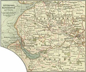
Background imageNavigational Equipment Collection: Map of Liverpool, Manchester, c.1900 (engraving)

Map of Liverpool, Manchester, c.1900 (engraving)
533270 Map of Liverpool, Manchester, c.1900 (engraving); (add.info.: Map of Liverpool and Manchester, England, circa 1902)

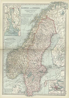
Background imageNavigational Equipment Collection: Map of Norway and Sweden, c.1900 (engraving)

Map of Norway and Sweden, c.1900 (engraving)
532971 Map of Norway and Sweden, c.1900 (engraving); (add.info.: Map of Norway, Sweden, with insets of Kristianiafjord and Stockholm, circa 1902)

Background imageNavigational Equipment Collection: Map of Scotland, c.1900 (engraving)

Map of Scotland, c.1900 (engraving)
532936 Map of Scotland, c.1900 (engraving); (add.info.: Map of the central part of Scotland, circa 1902, from the 10th edition of Encyclopaedia Britannica.); Encyclopaedia Britannica/UIG

Background imageNavigational Equipment Collection: Map of northern Illinois, c.1900 (engraving)

Map of northern Illinois, c.1900 (engraving)
533173 Map of northern Illinois, c.1900 (engraving); (add.info.: Map of the northern part of Illinois, United States, circa 1902)

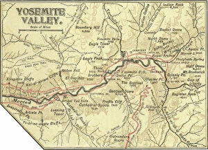
Background imageNavigational Equipment Collection: Map of Yosemite Valley, c.1900 (engraving)

Map of Yosemite Valley, c.1900 (engraving)
532892 Map of Yosemite Valley, c.1900 (engraving); (add.info.: Map of Yosemite Valley, circa 1900, from the 10th edition of Encyclopaedia Britannica.); Encyclopaedia Britannica/UIG

Background imageNavigational Equipment Collection: Map of South Carolina with inset of Charleston, c.1900 (engraving)

Map of South Carolina with inset of Charleston, c.1900 (engraving)
533136 Map of South Carolina with inset of Charleston, c.1900 (engraving); (add.info.: Map showing the historical boundaries of South Carolina, United States, with an inset map of Charleston)

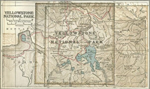
Background imageNavigational Equipment Collection: Map of Yellowstone National Park, c.1900 (engraving)

Map of Yellowstone National Park, c.1900 (engraving)
532887 Map of Yellowstone National Park, c.1900 (engraving); (add.info.: Map of Yellowstone National Park, highlighting major mountain ranges and other features, circa 1900)

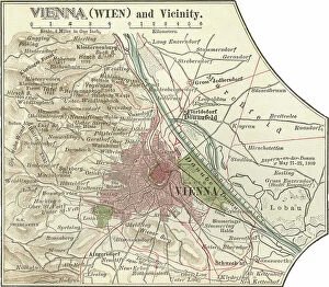
Background imageNavigational Equipment Collection: Map of Vienna, c.1900 (engraving)

Map of Vienna, c.1900 (engraving)
532881 Map of Vienna, c.1900 (engraving); (add.info.: Map of Vienna, Austria, circa 1900, from the 10th edition of Encyclopaedia Britannica.); Encyclopaedia Britannica/UIG

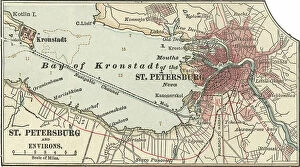
Background imageNavigational Equipment Collection: Map of St. Petersburg, c.1900 (engraving)

Map of St. Petersburg, c.1900 (engraving)
532866 Map of St. Petersburg, c.1900 (engraving); (add.info.: Map of St. Petersburg, circa 1900, from the 10th edition of Encyclopaedia Britannica.); Encyclopaedia Britannica/UIG

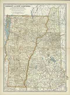
Background imageNavigational Equipment Collection: Map of Vermont and New Hampshire, c.1900 (engraving)

Map of Vermont and New Hampshire, c.1900 (engraving)
533091 Map of Vermont and New Hampshire, c.1900 (engraving); (add.info.: Map showing the historical boundaries of Vermont and New Hampshire, United States, circa 1902)

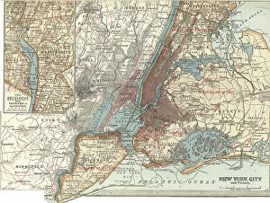
Background imageNavigational Equipment Collection: Map of New York City, c.1900 (engraving)

Map of New York City, c.1900 (engraving)
532804 Map of New York City, c.1900 (engraving); (add.info.: Map of New York City, with an inset of the Hudson River from Yonkers to Kingston, circa 1900)

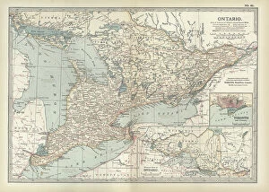
Background imageNavigational Equipment Collection: Map of Ontario, Canada, c.1900 (engraving)

Map of Ontario, Canada, c.1900 (engraving)
533076 Map of Ontario, Canada, c.1900 (engraving); (add.info.: Map of Ontario, Canada, with an inset of Toronto, circa 1902)

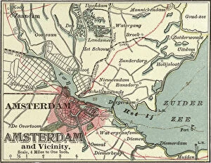
Background imageNavigational Equipment Collection: Map of Amsterdam, c.1900 (engraving)

Map of Amsterdam, c.1900 (engraving)
532699 Map of Amsterdam, c.1900 (engraving); (add.info.: Map of the city of Amsterdam, circa 1900, from the 10th edition of Encyclopaedia Britannica.); Encyclopaedia Britannica/UIG

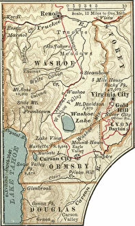
Background imageNavigational Equipment Collection: Map of Carson City with Virginia City and Reno, c.1900 (engraving)

Map of Carson City with Virginia City and Reno, c.1900 (engraving)
533459 Map of Carson City with Virginia City and Reno, c.1900 (engraving); (add.info.: Map of Reno, Carson City, and Virginia City, Nevada, circa 1902)

Background imageNavigational Equipment Collection: Map of St. Marys River and Sault Ste. Marie, MI, c.1900 (engraving)

Map of St. Marys River and Sault Ste. Marie, MI, c.1900 (engraving)
533450 Map of St. Marys River and Sault Ste. Marie, MI, c.1900 (engraving); (add.info.: Map of St. Marys River and Sault Ste)

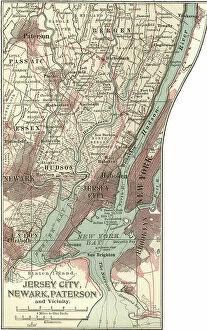
Background imageNavigational Equipment Collection: Map of Jersey City, Paterson and Newark, c.1900 (engraving)

Map of Jersey City, Paterson and Newark, c.1900 (engraving)
533430 Map of Jersey City, Paterson and Newark, c.1900 (engraving); (add.info.: Map of Jersey City, Newark, and Paterson, New Jersey, circa 1902)

Background imageNavigational Equipment Collection: Map of Quebec, c.1900 (engraving)

Map of Quebec, c.1900 (engraving)
533412 Map of Quebec, c.1900 (engraving); (add.info.: Map of Quebec, Canada, circa 1902, from the 10th edition of Encyclopaedia Britannica.); Encyclopaedia Britannica/UIG

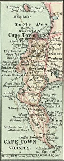
Background imageNavigational Equipment Collection: Map of Cape Town, c.1900 (engraving)

Map of Cape Town, c.1900 (engraving)
533400 Map of Cape Town, c.1900 (engraving); (add.info.: Map of Cape Town, South Africa, circa 1902, from the 10th edition of Encyclopaedia Britannica.); Encyclopaedia Britannica/UIG


For sale as Licensed Images

Choose your image, Select your licence and Download the media

"Unveiling the Past: Navigational Equipment Guides Us Through History" Exploring ancient civilizations: An antique map of the Roman Empire reveals their vast territories and navigational prowess. Tracing Anglo-Saxon roots: Delve into history with an antique map showcasing Britain under the Anglo Saxons, a captivating glimpse into early English heritage. Byzantine marvels in ink: Step back in time as a 9th-century map of the Byzantine Empire unfolds its intricate details, guiding us through this remarkable era. Unraveling Liverpool's maritime legacy: A fascinating 19th-century antique map takes us on a journey through Liverpool and Birkenhead, England, offering insights into their rich nautical history. Ireland's enchanting landscapes mapped: Discover Ireland's allure through an exquisite antique map that showcases its diverse geography and invites exploration. Scottish Isles beckon adventurers: Embark on a virtual voyage to Jura, Mull, Argyll, Islay with a stunning 19th-century antique map that captures Scotland's rugged beauty. Charting New Zealand's discovery: Travel back to 1873 with an extraordinary antique map of New Zealand; witness how explorers navigated these uncharted lands centuries ago. The allure of vintage cartography continues: Immerse yourself in nostalgia with an enchanting vintage map of Magna Graecia - relish its timeless charm and historical significance. Island paradise revealed - Cyprus unveiled. Explore this Mediterranean gem as you trace your fingers across an alluringly detailed vintage map capturing Cyprus' unique essence. Saint Lucia whispers tales from yesteryears: Transport yourself to the Caribbean island paradise as you explore a mesmerizing 19th-century antique map depicting Saint Lucia’s vibrant past. The road less traveled across America awaits.