Navigational Equipment Collection (#6)

"Unveiling the Past: Navigational Equipment Guides Us Through History" Exploring ancient civilizations

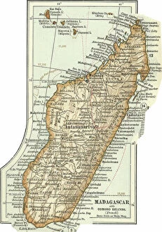
Background imageNavigational Equipment Collection: Map of Madagascar and Comoro Islands, c.1900 (engraving)

Map of Madagascar and Comoro Islands, c.1900 (engraving)
533398 Map of Madagascar and Comoro Islands, c.1900 (engraving); (add.info.: Map of Madagascar and Comoro Islands, circa 1902)

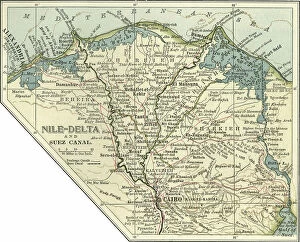
Background imageNavigational Equipment Collection: Map of the Nile Delta and Suez Canal, c.1900 (engraving)

Map of the Nile Delta and Suez Canal, c.1900 (engraving)
533396 Map of the Nile Delta and Suez Canal, c.1900 (engraving); (add.info.: Map of Nile Delta and Suez Canal, Egypt, circa 1902)

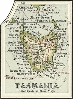
Background imageNavigational Equipment Collection: Map of Tasmania, Australia, c.1902 (engraving)

Map of Tasmania, Australia, c.1902 (engraving)
533347 Map of Tasmania, Australia, c.1902 (engraving); (add.info.: Map of Tasmania, Australia, circa 1902, from the 10th edition of Encyclopaedia Britannica.); Encyclopaedia Britannica/UIG

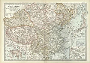
Background imageNavigational Equipment Collection: Map of the Chinese Empire, c.1900 (engraving)

Map of the Chinese Empire, c.1900 (engraving)
533025 Map of the Chinese Empire, c.1900 (engraving); (add.info.: Map showing the historical boundaries of the Chinese Empire, with insets of Hong Kong, Peking (now Beijing), and Tientsin

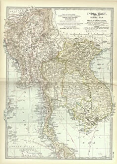
Background imageNavigational Equipment Collection: Map of Eastern India, c.1900 (engraving)

Map of Eastern India, c.1900 (engraving)
533022 Map of Eastern India, c.1900 (engraving); (add.info.: Map showing historical boundaries of eastern India, Burma, Siam and French Indo-China, circa 1902)

Background imageNavigational Equipment Collection: Map of Asia with Siberia and Central Asia, c.1900 (engraving)

Map of Asia with Siberia and Central Asia, c.1900 (engraving)
533003 Map of Asia with Siberia and Central Asia, c.1900 (engraving); (add.info.: Map of Asia, circa 1902, from the 10th edition of Encyclopaedia Britannica.); Encyclopaedia Britannica/UIG

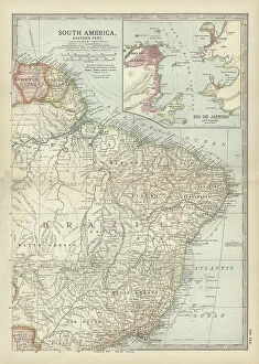
Background imageNavigational Equipment Collection: Map of the eastern part of South America, c.1900 (engraving)

Map of the eastern part of South America, c.1900 (engraving)
533262 Map of the eastern part of South America, c.1900 (engraving); (add.info.: Map showing the historical boundaries of eastern South America, with an inset map of Rio de Janeiro, circa 1902)

Background imageNavigational Equipment Collection: Map of the West Indies, c.1900 (engraving)

Map of the West Indies, c.1900 (engraving)
533240 Map of the West Indies, c.1900 (engraving); (add.info.: Map of the West Indies, circa 1902, from the 10th edition of Encyclopaedia Britannica.); Encyclopaedia Britannica/UIG

Background imageNavigational Equipment Collection: Map of the southern part of California, c.1900 (engraving)

Map of the southern part of California, c.1900 (engraving)
533233 Map of the southern part of California, c.1900 (engraving); (add.info.: Map of the southern part of California, United States, with inset maps of Los Angeles, San Diego)

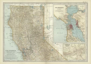
Background imageNavigational Equipment Collection: Map of the northern part of California, c.1900 (engraving)

Map of the northern part of California, c.1900 (engraving)
533231 Map of the northern part of California, c.1900 (engraving); (add.info.: Map of the northern part of California, United States, with inset maps of San Francisco and Yosemite Valley, circa 1902)

Background imageNavigational Equipment Collection: Map of Oregon, c.1900 (engraving)

Map of Oregon, c.1900 (engraving)
533223 Map of Oregon, c.1900 (engraving); (add.info.: Map of Oregon, United States, circa 1902, from the 10th edition of Encyclopaedia Britannica.); Encyclopaedia Britannica/UIG

Background imageNavigational Equipment Collection: Map of Kansas, c.1900 (engraving)

Map of Kansas, c.1900 (engraving)
533205 Map of Kansas, c.1900 (engraving); (add.info.: Map of Kansas, United States, circa 1902, from the 10th edition of Encyclopaedia Britannica.); Encyclopaedia Britannica/UIG

Background imageNavigational Equipment Collection: Map of the southern part of Missouri, c.1900 (engraving)

Map of the southern part of Missouri, c.1900 (engraving)
533203 Map of the southern part of Missouri, c.1900 (engraving); (add.info.: Map of the southern part of Missouri, United States, circa 1902)

Background imageNavigational Equipment Collection: Map of France, c.1900 (engraving)

Map of France, c.1900 (engraving)
532946 Map of France, c.1900 (engraving); (add.info.: Map of France with inset map of Vicinity of Marseille and the Mediterranean Coast of France, and Corsica, circa 1902)

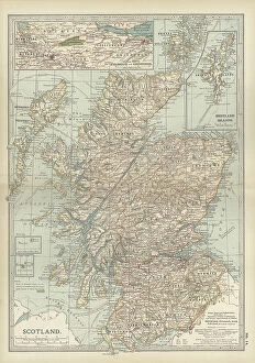
Background imageNavigational Equipment Collection: Map of Scotland, c.1900 (engraving)

Map of Scotland, c.1900 (engraving)
532933 Map of Scotland, c.1900 (engraving); (add.info.: Map of Scotland with inset of Shetland Islands, circa 1902, from the 10th edition of Encyclopaedia Britannica.); Encyclopaedia Britannica/UIG

Background imageNavigational Equipment Collection: Map of Florida with insets of cities, c.1900 (engraving)

Map of Florida with insets of cities, c.1900 (engraving)
533142 Map of Florida with insets of cities, c.1900 (engraving); (add.info.: Map of Florida, United States, with inset maps of Jacksonville, Tampa, St)

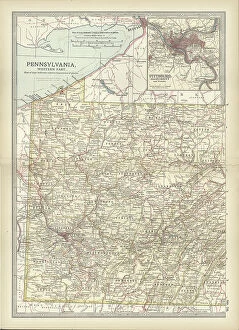
Background imageNavigational Equipment Collection: Map of Pennsylvania, with inset map of Pittsburg, c.1900 (engraving)

Map of Pennsylvania, with inset map of Pittsburg, c.1900 (engraving)
533118 Map of Pennsylvania, with inset map of Pittsburg, c.1900 (engraving); (add.info.: Map of Pennsylvania, with inset map of Pittsburg, circa 1902)

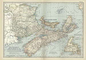
Background imageNavigational Equipment Collection: New Brunswick, Nova Scotia & Prince Edward Island, c.1900 (engraving)

New Brunswick, Nova Scotia & Prince Edward Island, c.1900 (engraving)
533083 New Brunswick, Nova Scotia & Prince Edward Island, c.1900 (engraving); (add.info.: Map of New Brunswick, Nova Scotia, and Prince Edward Island, Canada, with an inset of Newfoundland)

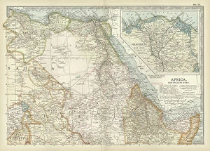
Background imageNavigational Equipment Collection: Map of northeastern Africa, c.1900 (engraving)

Map of northeastern Africa, c.1900 (engraving)
533059 Map of northeastern Africa, c.1900 (engraving); (add.info.: Map of northeast Africa, with insets of the Nile Delta and Suez Canal, circa 1902)

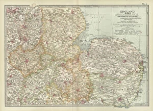
Background imageNavigational Equipment Collection: Map of England, c.1900 (engraving)

Map of England, c.1900 (engraving)
532914 Map of England, c.1900 (engraving); (add.info.: Map of England, including Nottingham, Leicester, Rutland, Northampton, Huntingdon, Cambridge, Norfolk, circa 1902)

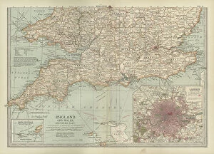
Background imageNavigational Equipment Collection: Map of England and Wales, c.1900 (engraving)

Map of England and Wales, c.1900 (engraving)
532905 Map of England and Wales, c.1900 (engraving); (add.info.: Map of southern England and Wales, including insets of London and Vicinity, and the Isles of Sicily, circa 1902)

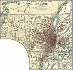
Background imageNavigational Equipment Collection: Map of St. Louis, c.1900 (engraving)

Map of St. Louis, c.1900 (engraving)
532863 Map of St. Louis, c.1900 (engraving); (add.info.: Map of St. Louis, Missouri, circa 1900, from the 10th edition of Encyclopaedia Britannica.); Encyclopaedia Britannica/UIG

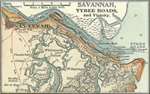
Background imageNavigational Equipment Collection: Map of Savannah, c.1900 (engraving)

Map of Savannah, c.1900 (engraving)
532860 Map of Savannah, c.1900 (engraving); (add.info.: Map of Savannah, Georgia, circa 1900, from the 10th edition of Encyclopaedia Britannica.); Encyclopaedia Britannica/UIG

Background imageNavigational Equipment Collection: Map of Saint Clair River and Port Huron, c.1900 (engraving)

Map of Saint Clair River and Port Huron, c.1900 (engraving)
532830 Map of Saint Clair River and Port Huron, c.1900 (engraving); (add.info.: Map of Saint Clair River, Port Huron and Sarnia, circa 1900)

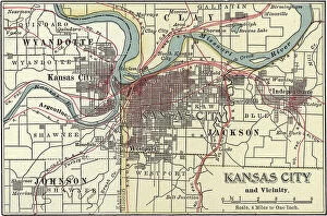
Background imageNavigational Equipment Collection: Map of Kansas City, c.1900 (engraving)

Map of Kansas City, c.1900 (engraving)
532779 Map of Kansas City, c.1900 (engraving); (add.info.: Map of Kansas City, Kansas, circa 1900, from the 10th edition of Encyclopaedia Britannica.); Encyclopaedia Britannica/UIG

Background imageNavigational Equipment Collection: A selection of Eastern edged weapons including Javanese and Indonesian kris, Indian katars

A selection of Eastern edged weapons including Javanese and Indonesian kris, Indian katars, kards and patas
1764820 A selection of Eastern edged weapons including Javanese and Indonesian kris, Indian katars, kards and patas; Private Collection; (add.info)

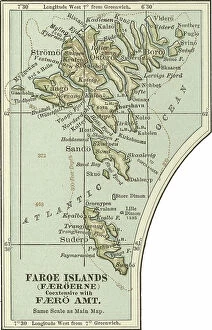
Background imageNavigational Equipment Collection: Map of the Faroe Island, c.1900 (engraving)

Map of the Faroe Island, c.1900 (engraving)
533304 Map of the Faroe Island, c.1900 (engraving); (add.info.: Map of Faroe Island, circa 1902, from the 10th edition of Encyclopaedia Britannica.); Encyclopaedia Britannica/UIG

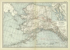
Background imageNavigational Equipment Collection: Map of Alaska, c.1900 (engraving)

Map of Alaska, c.1900 (engraving)
533237 Map of Alaska, c.1900 (engraving); (add.info.: Map of Alaska, United States, with inset maps of Sitka and the Aleutian Islands, circa 1902)

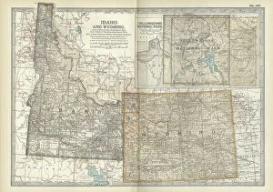
Background imageNavigational Equipment Collection: Map of Idaho and Wyoming, c.1900 (engraving)

Map of Idaho and Wyoming, c.1900 (engraving)
533214 Map of Idaho and Wyoming, c.1900 (engraving); (add.info.: Map of Idaho and Wyoming, United States, with an inset map of Yellowstone National Park, circa 1902)

Background imageNavigational Equipment Collection: Map of France, c.1900 (engraving)

Map of France, c.1900 (engraving)
532949 Map of France, c.1900 (engraving); (add.info.: Map of north central France, in the vicinity of Paris, circa 1902, from the 10th edition of Encyclopaedia Britannica)

Background imageNavigational Equipment Collection: Map of Ireland, c.1900 (engraving)

Map of Ireland, c.1900 (engraving)
532939 Map of Ireland, c.1900 (engraving); (add.info.: Map of Ireland with inset map of Dublin, circa 1902, from the 10th edition of Encyclopaedia Britannica.); Encyclopaedia Britannica/UIG

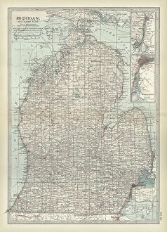
Background imageNavigational Equipment Collection: Map of the southern part of Michigan, c.1900 (engraving)

Map of the southern part of Michigan, c.1900 (engraving)
533184 Map of the southern part of Michigan, c.1900 (engraving); (add.info.: Map of the southern part of Michigan, United States, with inset maps of Detroit and the St)

Background imageNavigational Equipment Collection: Map of western Tennessee, c.1900 (engraving)

Map of western Tennessee, c.1900 (engraving)
533148 Map of western Tennessee, c.1900 (engraving); (add.info.: Map of the western part of Tennessee, circa 1902, from the 10th edition of Encyclopaedia Britannica.); Encyclopaedia Britannica/UIG

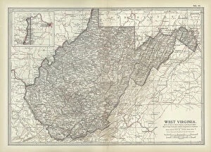
Background imageNavigational Equipment Collection: Map of West Virginia, c.1900 (engraving)

Map of West Virginia, c.1900 (engraving)
533127 Map of West Virginia, c.1900 (engraving); (add.info.: Map of West Virginia, United States, circa 1902, from the 10th edition of Encyclopaedia Britannica.); Encyclopaedia Britannica/UIG

Background imageNavigational Equipment Collection: Map of Virginia, c.1900 (engraving)

Map of Virginia, c.1900 (engraving)
533124 Map of Virginia, c.1900 (engraving); (add.info.: Map showing historical boundaries of Virginia, with inset maps of Richmond and Norfolk, circa 1902)

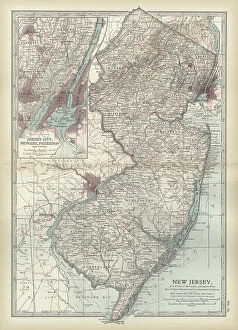
Background imageNavigational Equipment Collection: Map of New Jersey, c.1900 (engraving)

Map of New Jersey, c.1900 (engraving)
533112 Map of New Jersey, c.1900 (engraving); (add.info.: Map of New Jersey with inset map of Jersey City, Newark and Paterson, circa 1902)

Background imageNavigational Equipment Collection: Map of Massachusetts, c.1900 (engraving)

Map of Massachusetts, c.1900 (engraving)
533096 Map of Massachusetts, c.1900 (engraving); (add.info.: State map of Massachusetts, United States, with inset map of Boston, circa 1902)

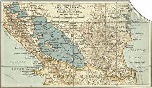
Background imageNavigational Equipment Collection: Map of Lake Nicaragua, c.1900 (engraving)

Map of Lake Nicaragua, c.1900 (engraving)
532783 Map of Lake Nicaragua, c.1900 (engraving); (add.info.: Map of Lake Nicaragua, circa 1900, from the 10th edition of Encyclopaedia Britannica.); Encyclopaedia Britannica/UIG

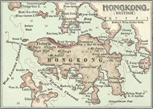
Background imageNavigational Equipment Collection: Map of Hong Kong, c.1900 (engraving)

Map of Hong Kong, c.1900 (engraving)
532770 Map of Hong Kong, c.1900 (engraving); (add.info.: Map of Hong Kong, circa 1900, from the 10th edition of Encyclopaedia Britannica.); Encyclopaedia Britannica/UIG

Background imageNavigational Equipment Collection: Map of Gibraltar, c.1900 (engraving)

Map of Gibraltar, c.1900 (engraving)
532764 Map of Gibraltar, c.1900 (engraving); (add.info.: Map of Gibraltar, circa 1900, from the 10th edition of Encyclopaedia Britannica.); Encyclopaedia Britannica/UIG

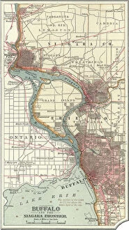
Background imageNavigational Equipment Collection: Map of Buffalo and the Niagara Frontier, c.1900 (engraving)

Map of Buffalo and the Niagara Frontier, c.1900 (engraving)
532728 Map of Buffalo and the Niagara Frontier, c.1900 (engraving); (add.info.: Map of Buffalo, New York, and the Niagara Frontier, circa 1900)

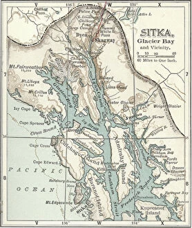
Background imageNavigational Equipment Collection: Map of Sitka and Glacier Bay, Alaska, c.1900 (engraving)

Map of Sitka and Glacier Bay, Alaska, c.1900 (engraving)
533464 Map of Sitka and Glacier Bay, Alaska, c.1900 (engraving); (add.info.: Map of Sitka and Glacier Bay, Alaska, circa 1902)

Background imageNavigational Equipment Collection: Map of Duluth, Minnesota, c.1900 (engraving)

Map of Duluth, Minnesota, c.1900 (engraving)
533452 Map of Duluth, Minnesota, c.1900 (engraving); (add.info.: Map of Duluth, Minnesota, circa 1902, from the 10th edition of Encyclopaedia Britannica.); Encyclopaedia Britannica/UIG

Background imageNavigational Equipment Collection: Map of Mackinac Island, Michigan, c.1900 (engraving)

Map of Mackinac Island, Michigan, c.1900 (engraving)
533446 Map of Mackinac Island, Michigan, c.1900 (engraving); (add.info.: Map of Mackinac Island and the Straits of Mackinac, Michigan, circa 1902)

Background imageNavigational Equipment Collection: Map of the Hudson River, New York, c.1900 (engraving)

Map of the Hudson River, New York, c.1900 (engraving)
533427 Map of the Hudson River, New York, c.1900 (engraving); (add.info.: Map of Hudson River, New York, from Yonkers to Kingston, circa 1902)

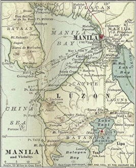
Background imageNavigational Equipment Collection: Map of Manila, c.1900 (engraving)

Map of Manila, c.1900 (engraving)
533340 Map of Manila, c.1900 (engraving); (add.info.: Map of Manila Bay, Philippines, circa 1902, from the 10th edition of Encyclopaedia Britannica.); Encyclopaedia Britannica/UIG

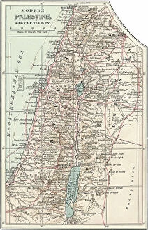
Background imageNavigational Equipment Collection: Map of Palestine part of Turkey, c.1900 (engraving)

Map of Palestine part of Turkey, c.1900 (engraving)
533323 Map of Palestine part of Turkey, c.1900 (engraving); (add.info.: Map of Palestine (then part of Turkey), circa 1902

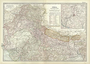
Background imageNavigational Equipment Collection: Map of northern India with Calcutta, c.1900 (engraving)

Map of northern India with Calcutta, c.1900 (engraving)
533016 Map of northern India with Calcutta, c.1900 (engraving); (add.info.: Map showing the historical boundaries of the northern part of India with an inset map of Calcutta (now Kolkata)


For sale as Licensed Images

Choose your image, Select your licence and Download the media

"Unveiling the Past: Navigational Equipment Guides Us Through History" Exploring ancient civilizations: An antique map of the Roman Empire reveals their vast territories and navigational prowess. Tracing Anglo-Saxon roots: Delve into history with an antique map showcasing Britain under the Anglo Saxons, a captivating glimpse into early English heritage. Byzantine marvels in ink: Step back in time as a 9th-century map of the Byzantine Empire unfolds its intricate details, guiding us through this remarkable era. Unraveling Liverpool's maritime legacy: A fascinating 19th-century antique map takes us on a journey through Liverpool and Birkenhead, England, offering insights into their rich nautical history. Ireland's enchanting landscapes mapped: Discover Ireland's allure through an exquisite antique map that showcases its diverse geography and invites exploration. Scottish Isles beckon adventurers: Embark on a virtual voyage to Jura, Mull, Argyll, Islay with a stunning 19th-century antique map that captures Scotland's rugged beauty. Charting New Zealand's discovery: Travel back to 1873 with an extraordinary antique map of New Zealand; witness how explorers navigated these uncharted lands centuries ago. The allure of vintage cartography continues: Immerse yourself in nostalgia with an enchanting vintage map of Magna Graecia - relish its timeless charm and historical significance. Island paradise revealed - Cyprus unveiled. Explore this Mediterranean gem as you trace your fingers across an alluringly detailed vintage map capturing Cyprus' unique essence. Saint Lucia whispers tales from yesteryears: Transport yourself to the Caribbean island paradise as you explore a mesmerizing 19th-century antique map depicting Saint Lucia’s vibrant past. The road less traveled across America awaits.