
Maps Collection
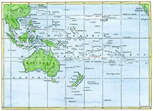
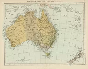
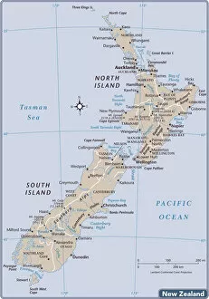
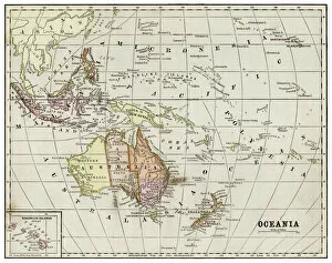
Maps of New Zealand Oceania are a type of map that provide detailed information about the geography and culture of the region
Choose a picture from our Maps Collection for your Wall Art and Photo Gifts
279 items

All Professionally Made to Order for Quick Shipping
-
Maps Collection
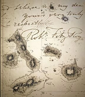
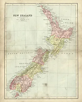
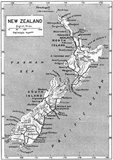
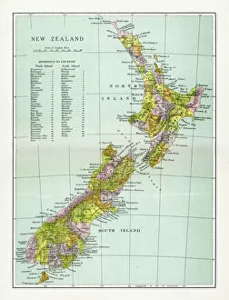
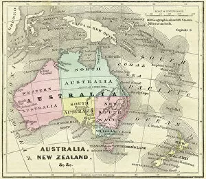
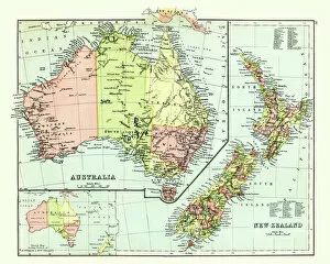
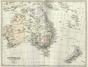
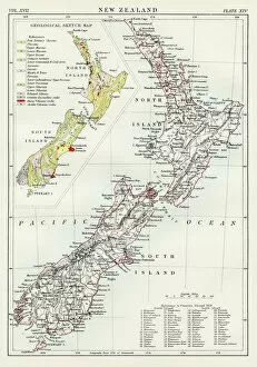
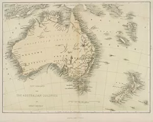
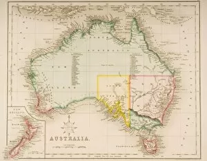
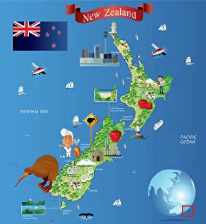
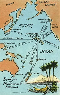
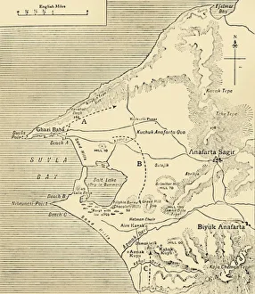
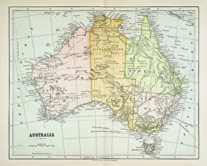
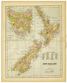
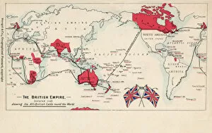
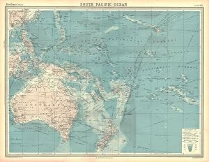
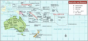
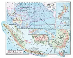
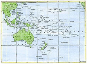
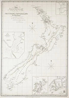
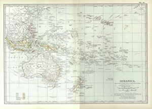
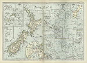
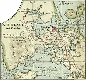
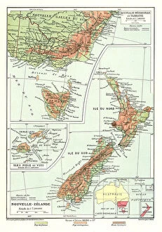
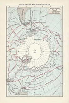
Maps of New Zealand Oceania are a type of map that provide detailed information about the geography and culture of the region. These they are be used for a variety of purposes, including navigation, research, and education. They typically include physical features such as rivers, mountains, lakes, and coastlines; political boundaries; cities and towns; points of interest; roads and highways; airports; national parks; protected areas; cultural sites such as museums or monuments; and other features. Maps of New Zealand Oceania also often include information about local flora and fauna, climate zones, population density data, historical events or landmarks related to the region's history. With these maps in hand it is possible to explore this unique part of the world with greater understanding.
+
Our beautiful pictures are available as Framed Prints, Photos, Wall Art and Photo Gifts
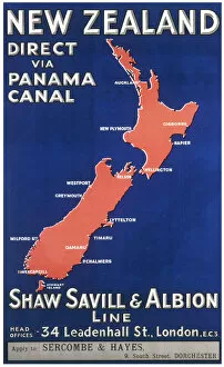
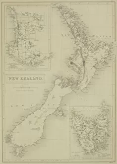
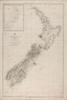
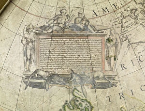
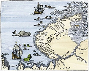
The Maps of New Zealand Oceania collection from Media Storehouse is a stunning assortment of wall art and framed prints that showcase the beauty and diversity of New Zealand's geography. Our collection features an array of maps, including topographical maps, vintage maps, and satellite images that capture the country's rugged coastlines, majestic mountains, lush forests, and sparkling lakes. Each print in our collection is expertly crafted using high-quality materials to ensure long-lasting durability and vibrant colors. Whether you're looking for a unique piece to add to your home decor or a thoughtful gift for someone special, these prints are sure to impress. From the iconic landmarks like Mount Cook National Park to lesser-known gems like Fiordland National Park, our collection offers something for everyone who loves exploring the natural wonders of New Zealand. With its breathtaking landscapes and rich cultural heritage, it's no wonder why so many people are drawn to this beautiful part of the world.
+
What are Maps of New Zealand Oceania art prints?
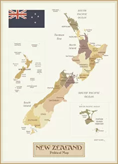
Maps of New Zealand Oceania art prints are high-quality reproductions of maps that depict the geography, topography, and landmarks of New Zealand and its surrounding islands in the Pacific Ocean. These prints are designed to be both informative and visually appealing, making them a popular choice for home decor or office spaces. The maps featured in these prints showcase the unique features of New Zealand's landscape, including its mountains, rivers, lakes, forests, and coastlines. They also highlight key cities and towns throughout the country as well as neighboring islands such as Fiji and Samoa. Whether you're a history buff looking to explore New Zealand's past or simply seeking an eye-catching piece of wall art for your home or office space, Maps of New Zealand Oceania art prints offer something for everyone. With their stunning detail and vibrant colors, they make a great addition to any collection.
+
What Maps of New Zealand Oceania art prints can I buy from Media Storehouse?
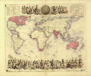
We offer a wide range of Maps of New Zealand Oceania art prints that are perfect for anyone who loves geography or wants to add some cultural flair to their home decor. These maps showcase the stunning landscapes, coastlines, and cities of New Zealand and its surrounding islands in intricate detail. You can choose from vintage-style maps that evoke a sense of nostalgia or modern designs with bold colors and typography. Some popular options include antique maps from the 19th century, topographical maps that highlight the country's natural features, and political maps that show borders and territories. Media Storehouse also offers customizable map prints where you can add your own text or markers to make it unique to your preferences. Whether you're looking for a gift for someone who loves travel or want to decorate your own space with beautiful artwork, we have plenty of Maps of New Zealand Oceania art prints to choose from.
+
How do I buy Maps of New Zealand Oceania art prints?
To buy Maps of New Zealand Oceania art prints from Media Storehouse, you can browse our extensive collection online. Simply search for the specific print or category that interests you and add it to your cart. Once you have selected all the items you wish to purchase, proceed to checkout where you will be prompted to enter your payment and shipping information. We offer a variety of payment options including credit card and PayPal. If you prefer not to shop online, Media Storehouse also has a customer service team available by phone who can assist with placing an order over the phone. Once your order is processed, Media Storehouse will carefully package your artwork and ship it directly to your chosen address. You can expect high-quality prints that are true-to-life representations of the original artwork. Whether as a gift or for personal use, Maps of New Zealand Oceania art prints from Media Storehouse are sure to impress any art lover or enthusiast.
+
How much do Maps of New Zealand Oceania art prints cost?
We offer a wide range of Maps of New Zealand Oceania art prints at various price points to suit different budgets. Our collection includes high-quality reproductions of antique maps as well as contemporary designs that showcase the beauty and diversity of this region. Each print is carefully crafted using premium materials and printing techniques to ensure maximum clarity, detail, and durability. We understand that our customers have different needs and preferences when it comes to art prints, which is why we offer a variety of sizes and framing options for our Maps of New Zealand Oceania collection. Whether you're looking for a small print to add some color to your home office or a large statement piece for your living room wall, we've got you covered. Our Maps of New Zealand Oceania art prints are an affordable way to bring some unique style and personality into your space while celebrating the rich history and culture of this fascinating part of the world.
+
How will my Maps of New Zealand Oceania art prints be delivered to me?
We take great care in delivering your Maps of New Zealand Oceania art prints to you. We use high-quality packaging materials that ensure the safety and protection of your artwork during transit. Your art prints will be carefully rolled and placed into a sturdy tube for delivery. We work with trusted courier services to deliver your order directly to your doorstep. Once dispatched, you will receive an email notification containing tracking information so that you can monitor the progress of your delivery. Our team is committed to providing exceptional customer service, and we are always available to answer any questions or concerns you may have about your order. If for any reason there are issues with the delivery of your Maps of New Zealand Oceania art prints, please do not hesitate to contact us so that we can resolve it as quickly as possible.