Photographic Print > North America > Cuba > Cuba Heritage Sites > Old Havana and its Fortification System
Photographic Print : Geography: map showing the Gulf of Mexico, the Caribbean Islands, Central America (Mexico, Yucatan, Honduras, Nicaragua and Costa Rica) part of the United States, and South America from an Atlas of 1783, Bibliotheque Jose Marti, Havana, Cuba
 part of the United States, and South America from an Atlas of 1783, Bibliotheque Jose Marti, Havana, Cuba")

![]()
Photo Prints from Fine Art Finder
Geography: map showing the Gulf of Mexico, the Caribbean Islands, Central America (Mexico, Yucatan, Honduras, Nicaragua and Costa Rica) part of the United States, and South America from an Atlas of 1783, Bibliotheque Jose Marti, Havana, Cuba
VEN5031226 Geography: map showing the Gulf of Mexico, the Caribbean Islands, Central America (Mexico, Yucatan, Honduras, Nicaragua and Costa Rica) part of the United States, and South America from an Atlas of 1783, Bibliotheque Jose Marti, Havana, Cuba; (add.info.: Geography: map showing the Gulf of Mexico, the Caribbean Islands, Central America (Mexico, Yucatan, Honduras, Nicaragua and Costa Rica) part of the United States, and South America from an Atlas of 1783, Bibliotheque Jose Marti, Havana, Cuba); © Marage Photos
Media ID 38164354
© © Marage Photos / Bridgeman Images
Amerique Centrale Amerique Du Nord Caraïbes Caribbean Caribbean Island Carte Geographique Central America Etats Unis Geographie Honduras Mexicans Mexico Mexican Mexique Stockravenna 18eme Siecle Geographical Map
11"x8.5" Photo Print
Explore the rich history of the Americas with this stunning vintage map print from Media Storehouse. Featuring detailed geography of the Gulf of Mexico, Caribbean Islands, Central America, and parts of the United States and South America from an Atlas dating back to 1783. A perfect addition to any home or office decor for those who appreciate historical cartography.
Photo prints are produced on Kodak professional photo paper resulting in timeless and breath-taking prints which are also ideal for framing. The colors produced are rich and vivid, with accurate blacks and pristine whites, resulting in prints that are truly timeless and magnificent. Whether you're looking to display your prints in your home, office, or gallery, our range of photographic prints are sure to impress. Dimensions refers to the size of the paper in inches.
Our Photo Prints are in a large range of sizes and are printed on Archival Quality Paper for excellent colour reproduction and longevity. They are ideal for framing (our Framed Prints use these) at a reasonable cost. Alternatives include cheaper Poster Prints and higher quality Fine Art Paper, the choice of which is largely dependant on your budget.
Estimated Image Size (if not cropped) is 27.9cm x 18.6cm (11" x 7.3")
Estimated Product Size is 27.9cm x 21.6cm (11" x 8.5")
These are individually made so all sizes are approximate
Artwork printed orientated as per the preview above, with landscape (horizontal) orientation to match the source image.
FEATURES IN THESE COLLECTIONS
> Maps and Charts
> Early Maps
> Maps and Charts
> Related Images
> North America
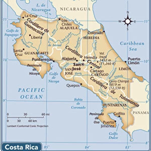
> Costa Rica
> Maps
> North America
> Costa Rica
> Related Images
> North America
> Cuba
> Cuba Heritage Sites
> Old Havana and its Fortification System
> North America
> Cuba
> Havana
> North America
> Cuba
> Maps
> North America
> Cuba
> Related Images
> North America
> Honduras
> Maps
EDITORS COMMENTS
This stunning print captures a piece of history from an Atlas of 1783, showcasing the intricate details of the Gulf of Mexico, the Caribbean Islands, Central America (including Mexico, Yucatan, Honduras, Nicaragua and Costa Rica), part of the United States, and South America. The map is a true work of art with its delicate engravings and precise geographical markings.
As we gaze upon this 18th-century masterpiece housed in the Bibliotheque Jose Marti in Havana, Cuba, we are transported back in time to an era when exploration and discovery were at their peak. The map not only serves as a tool for navigation but also as a window into the past, offering insight into how our world was perceived centuries ago.
From the lush landscapes of Central America to the vibrant waters surrounding the Caribbean islands, every inch of this map tells a story waiting to be discovered. It is a reminder of how interconnected our world truly is and how geography has shaped civilizations throughout history.
This image is not just a mere representation of landmasses; it is a testament to human curiosity and ingenuity. It serves as a reminder that even in today's modern age, there is still so much left to explore and learn about our planet Earth.
MADE IN THE USA
Safe Shipping with 30 Day Money Back Guarantee
FREE PERSONALISATION*
We are proud to offer a range of customisation features including Personalised Captions, Color Filters and Picture Zoom Tools
SECURE PAYMENTS
We happily accept a wide range of payment options so you can pay for the things you need in the way that is most convenient for you
* Options may vary by product and licensing agreement. Zoomed Pictures can be adjusted in the Cart.