Poster Print > North America > Cuba > Cuba Heritage Sites > Old Havana and its Fortification System
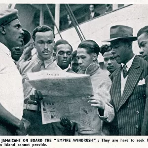
Poster Print : Geography Atlas: representation of South America and the Caribbean Sea region, Caribbean (Cuba, Jamaica, Hispaniola). Map from an Atlas by Arnold Floris van Langren (circa 1571-1644), 1578. Biblioteca Jose Marti, Havana, Cuba
. Map from an Atlas by Arnold Floris van Langren (circa 1571-1644), 1578. Biblioteca Jose Marti, Havana, Cuba")


![]()
Poster Prints from Fine Art Finder
Geography Atlas: representation of South America and the Caribbean Sea region, Caribbean (Cuba, Jamaica, Hispaniola). Map from an Atlas by Arnold Floris van Langren (circa 1571-1644), 1578. Biblioteca Jose Marti, Havana, Cuba
VEN5030051 Geography Atlas: representation of South America and the Caribbean Sea region, Caribbean (Cuba, Jamaica, Hispaniola). Map from an Atlas by Arnold Floris van Langren (circa 1571-1644), 1578. Biblioteca Jose Marti, Havana, Cuba.; (add.info.: Geography Atlas: representation of South America and the Caribbean Sea region, Caribbean (Cuba, Jamaica, Hispaniola). Map from an Atlas by Arnold Floris van Langren (circa 1571-1644), 1578. Biblioteca Jose Marti, Havana, Cuba.); © Marage Photos
Media ID 38349104
© © Marage Photos / Bridgeman Images
16eme Siecle Amerique Centrale Amerique Du Nord Caraïbes Caribbean Caribbean Island Carte Geographique Central America Cuba Cuba Cubain Cubaine Cubains Cubaines Cuban Etats Unis Geographie Jamaica Jamaican Stockravenna Geographical Map
18x24 inch Poster Print
"Explore the rich history of exploration and discovery with our stunning Poster Print from Media Storehouse. This beautiful reproduction features a 16th-century map of South America and the Caribbean Sea region, showcasing the work of Arnold Floris van Langren from his atlas published in 1578. The intricate details and vibrant colors bring to life the early cartography of this fascinating region, making it a must-have for anyone interested in geography, history, or vintage maps. Perfect for decorating your home office or study, this poster is sure to spark conversation and inspire curiosity about the world around us."
Poster prints are budget friendly enlarged prints in standard poster paper sizes. Printed on 150 gsm Matte Paper for a natural feel and supplied rolled in a tube. Great for framing and should last many years. To clean wipe with a microfiber, non-abrasive cloth or napkin. Our Archival Quality Photo Prints and Fine Art Paper Prints are printed on higher quality paper and the choice of which largely depends on your budget.
Poster prints are budget friendly enlarged prints in standard poster paper sizes (A0, A1, A2, A3 etc). Whilst poster paper is sometimes thinner and less durable than our other paper types, they are still ok for framing and should last many years. Our Archival Quality Photo Prints and Fine Art Paper Prints are printed on higher quality paper and the choice of which largely depends on your budget.
Estimated Product Size is 61.6cm x 46.3cm (24.3" x 18.2")
These are individually made so all sizes are approximate
Artwork printed orientated as per the preview above, with landscape (horizontal) orientation to match the source image.
FEATURES IN THESE COLLECTIONS
> Fine Art Finder
> Artists
> Frank Reynolds
> Maps and Charts
> Related Images
> North America
> Cuba
> Cuba Heritage Sites
> Old Havana and its Fortification System
> North America
> Cuba
> Havana
> North America
> Cuba
> Maps
> North America
> Cuba
> Related Images
> North America
> Jamaica
> Maps
> North America
> Jamaica
> Related Images
> North America
> United States of America
> Maps
> Popular Themes
> North Island
EDITORS COMMENTS
This stunning print captures a detailed representation of South America and the Caribbean Sea region from an Atlas by Arnold Floris van Langren, dating back to 1578. The map showcases countries such as Cuba, Jamaica, and Hispaniola with intricate engravings that highlight the geographical features of the area.
Displayed in the Biblioteca Jose Marti in Havana, Cuba, this historical piece provides a glimpse into the cartography of the 16th century. The vibrant colors and precise lines used in this engraving showcase the artistry and skill of early mapmakers like van Langren.
As you study this map, you can't help but be transported back in time to an era when exploration and discovery were at their peak. The attention to detail in depicting coastlines, rivers, and mountains is truly remarkable and serves as a testament to the dedication of those who created it centuries ago.
Whether you have a passion for geography or simply appreciate fine art from different periods in history, this print is sure to captivate your imagination. It's a window into the past that allows us to marvel at how much our understanding of the world has evolved over time.
MADE IN THE USA
Safe Shipping with 30 Day Money Back Guarantee
FREE PERSONALISATION*
We are proud to offer a range of customisation features including Personalised Captions, Color Filters and Picture Zoom Tools
SECURE PAYMENTS
We happily accept a wide range of payment options so you can pay for the things you need in the way that is most convenient for you
* Options may vary by product and licensing agreement. Zoomed Pictures can be adjusted in the Cart.