Premium Framed Print > North America > Cuba > Cuba Heritage Sites > Old Havana and its Fortification System
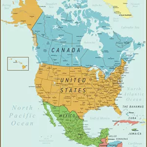
Premium Framed Print : Geography Atlas: representation of South America and the Caribbean Sea region, Caribbean (Cuba, Jamaica, Hispaniola). Map from an Atlas by Arnold Floris van Langren (circa 1571-1644), 1578. Biblioteca Jose Marti, Havana, Cuba
. Map from an Atlas by Arnold Floris van Langren (circa 1571-1644), 1578. Biblioteca Jose Marti, Havana, Cuba")
. Map from an Atlas by Arnold Floris van Langren (circa 1571-1644), 1578. Biblioteca Jose Marti, Havana, Cuba")


![]()
Framed Photos from Fine Art Finder
Geography Atlas: representation of South America and the Caribbean Sea region, Caribbean (Cuba, Jamaica, Hispaniola). Map from an Atlas by Arnold Floris van Langren (circa 1571-1644), 1578. Biblioteca Jose Marti, Havana, Cuba
VEN5030051 Geography Atlas: representation of South America and the Caribbean Sea region, Caribbean (Cuba, Jamaica, Hispaniola). Map from an Atlas by Arnold Floris van Langren (circa 1571-1644), 1578. Biblioteca Jose Marti, Havana, Cuba.; (add.info.: Geography Atlas: representation of South America and the Caribbean Sea region, Caribbean (Cuba, Jamaica, Hispaniola). Map from an Atlas by Arnold Floris van Langren (circa 1571-1644), 1578. Biblioteca Jose Marti, Havana, Cuba.); © Marage Photos
Media ID 38349104
© © Marage Photos / Bridgeman Images
16eme Siecle Amerique Centrale Amerique Du Nord Caraïbes Caribbean Caribbean Island Carte Geographique Central America Cuba Cuba Cubain Cubaine Cubains Cubaines Cuban Etats Unis Geographie Jamaica Jamaican Stockravenna Geographical Map
14"x18" Premium Frame
Contemporary style Premium Wooden Frame with 8"x12" Print. Complete with 2" White Mat and 1.25" thick MDF frame. Printed on 260 gsm premium paper. Glazed with shatter proof UV coated acrylic glass. Backing is paper covered backing with rubber bumpers. Supplied ready to hang with a pre-installed sawtooth/wire hanger. Care Instructions: Spot clean with a damp cloth. Securely packaged in a clear plastic bag and envelope in a reinforced cardboard shipper
FSC Real Wood Frame and Double Mounted with White Conservation Mountboard - Professionally Made and Ready to Hang
Estimated Image Size (if not cropped) is 30.4cm x 20.3cm (12" x 8")
Estimated Product Size is 45.8cm x 35.6cm (18" x 14")
These are individually made so all sizes are approximate
Artwork printed orientated as per the preview above, with landscape (horizontal) orientation to match the source image.
FEATURES IN THESE COLLECTIONS
> Fine Art Finder
> Artists
> Frank Reynolds
> Maps and Charts
> Related Images
> North America
> Cuba
> Cuba Heritage Sites
> Old Havana and its Fortification System
> North America
> Cuba
> Havana
> North America
> Cuba
> Maps
> North America
> Cuba
> Related Images
> North America
> Jamaica
> Maps
> North America
> Jamaica
> Related Images
> North America
> United States of America
> Maps
> Popular Themes
> North Island
EDITORS COMMENTS
This stunning print captures a detailed representation of South America and the Caribbean Sea region from an Atlas by Arnold Floris van Langren, dating back to 1578. The map showcases countries such as Cuba, Jamaica, and Hispaniola with intricate engravings that highlight the geographical features of the area.
Displayed in the Biblioteca Jose Marti in Havana, Cuba, this historical piece provides a glimpse into the cartography of the 16th century. The vibrant colors and precise lines used in this engraving showcase the artistry and skill of early mapmakers like van Langren.
As you study this map, you can't help but be transported back in time to an era when exploration and discovery were at their peak. The attention to detail in depicting coastlines, rivers, and mountains is truly remarkable and serves as a testament to the dedication of those who created it centuries ago.
Whether you have a passion for geography or simply appreciate fine art from different periods in history, this print is sure to captivate your imagination. It's a window into the past that allows us to marvel at how much our understanding of the world has evolved over time.
MADE IN THE USA
Safe Shipping with 30 Day Money Back Guarantee
FREE PERSONALISATION*
We are proud to offer a range of customisation features including Personalised Captions, Color Filters and Picture Zoom Tools
SECURE PAYMENTS
We happily accept a wide range of payment options so you can pay for the things you need in the way that is most convenient for you
* Options may vary by product and licensing agreement. Zoomed Pictures can be adjusted in the Cart.