
Maps Collection
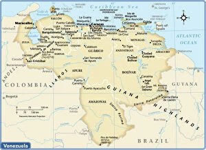
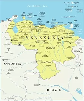
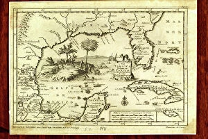
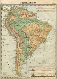
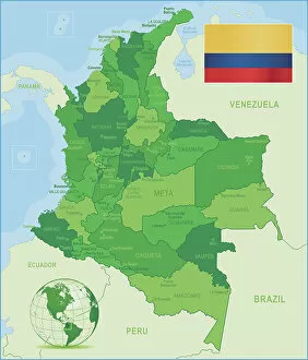
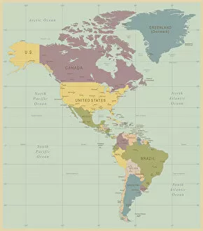
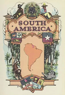
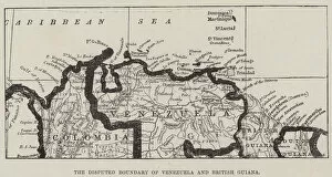
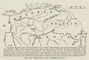
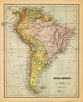
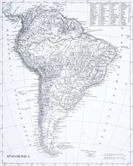
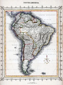
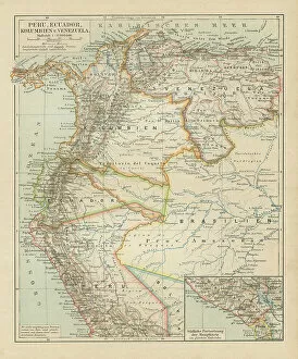
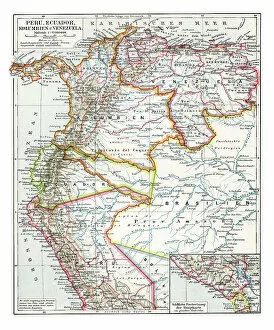
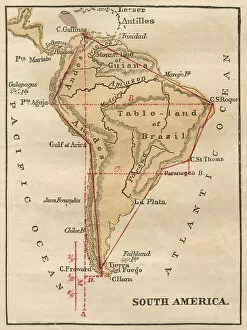
Venezuela is a country located in South America, bordered by Colombia, Guyana and Brazil and has a total area of 916,445 km2 and its capital is Caracas
Choose a picture from our Maps Collection for your Wall Art and Photo Gifts
103 items

All Professionally Made to Order for Quick Shipping
-
Maps Collection
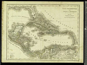
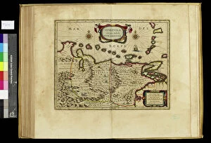
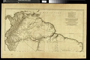
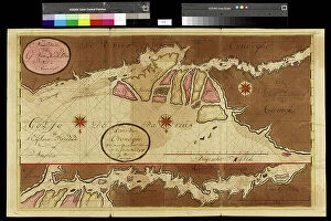
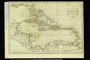
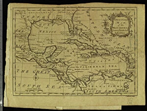
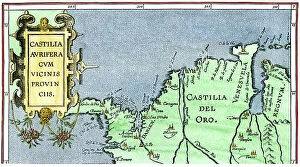
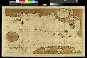
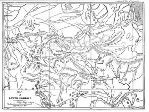
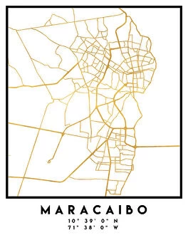
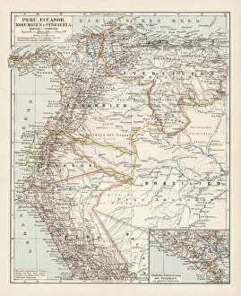
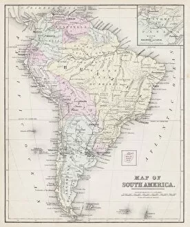
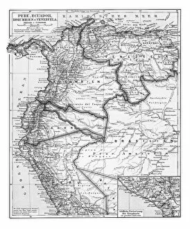
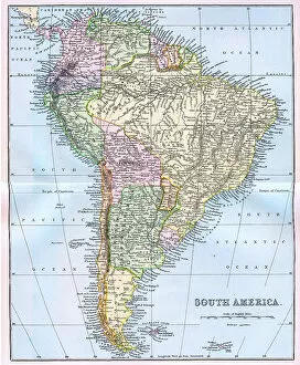
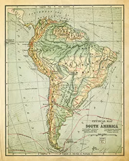
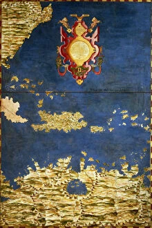
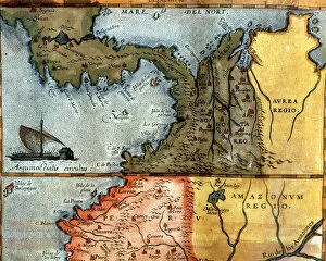
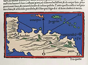
Venezuela is a country located in South America, bordered by Colombia, Guyana and Brazil and has a total area of 916,445 km2 and its capital is Caracas. Venezuela is home to many different geographical features such as the Andes Mountains, the Caribbean Sea and the Amazon rainforest. The country also has numerous rivers including the Orinoco River which flows through much of Venezuela. Maps of Venezuela show its diverse terrain with its mountainous regions in the north and plains in the south. they also highlight important cities such as Maracaibo, Barquisimeto and Valencia as well as national parks like Canaima National Park which are popular tourist destinations. Additionally, maps of Venezuela can be used to explore its various islands including Isla Margarita and Los Roques archipelago which are known for their stunning beaches and coral reefs.
+
Our beautiful pictures are available as Framed Prints, Photos, Wall Art and Photo Gifts
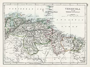
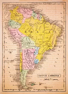
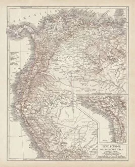
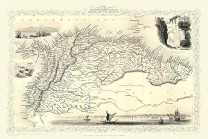
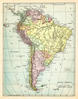
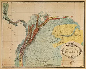
The Maps of Venezuela South America collection from Media Storehouse is a stunning compilation of vintage and contemporary maps that capture the beauty and diversity of this South American country. Our collection features a range of maps, including topographical, political, geological, and historical maps that showcase the different regions and landscapes of Venezuela. Each map is carefully selected for its unique style, color scheme, and level of detail to provide an accurate representation of the country's geography. These high-quality prints are perfect for anyone who loves history or geography or wants to add some cultural flair to their home decor. They come in various sizes and framing options so you can choose the best fit for your space. Whether you're looking for a statement piece or something more subtle, there's sure to be a map in our collection that will catch your eye. The Maps of Venezuela South America collection offers a fascinating glimpse into one of the most beautiful countries in Latin America through its rich cartographic heritage.
+
What are Maps of Venezuela South America art prints?
Maps of Venezuela South America art prints are high-quality reproductions of maps that depict the geography and topography of Venezuela. These prints showcase the country's diverse landscape, including its mountains, rivers, forests, and coastlines. They are created using advanced printing techniques to ensure that every detail is captured accurately. These art prints are not only informative but also visually stunning. They make great additions to any home or office decor and can be used as educational tools in classrooms or libraries. Maps of Venezuela South America art prints come in a variety of sizes and formats to suit different preferences. Whether you're a geography enthusiast or simply looking for unique wall art, these prints offer something for everyone. With their vibrant colors and intricate details, they are sure to capture your attention and spark your imagination.
+
What Maps of Venezuela South America art prints can I buy from Media Storehouse?
We offer a wide range of Maps of Venezuela South America art prints that are perfect for those who love geography or want to add some cultural flair to their home decor. These maps showcase the various regions and cities within Venezuela, including Caracas, Maracaibo, and Valencia. They also highlight important landmarks such as Angel Falls, the Orinoco River, and Lake Maracaibo. In addition to traditional paper prints, Media Storehouse also offers canvas prints which provide a more textured look and feel. You can choose from a variety of sizes to fit their specific needs. Whether you're looking for a unique gift idea or simply want to decorate your own space with something meaningful and educational, these Maps of Venezuela South America art prints from Media Storehouse are sure to impress.
+
How do I buy Maps of Venezuela South America art prints?
To buy Maps of Venezuela South America art prints from Media Storehouse, you can browse through our extensive collection of maps and select the one that suits your needs. The website offers a variety of sizes and formats for each print, including canvas, framed or unframed prints. Once you have selected your preferred size and format, simply add it to your cart and proceed to checkout. We accept various payment methods such as credit cards, PayPal and Apple Pay. We also offer worldwide shipping options so you can receive your order wherever you are located. Maps of Venezuela South America art prints are perfect for those who love geography or want to decorate their home with unique artwork. These maps showcase the beauty of Venezuela's landscape while providing valuable information about its geography. Buying Maps of Venezuela South America art prints from Media Storehouse is easy and convenient. With their wide selection of high-quality prints and secure payment options, you can trust them to deliver a beautiful piece of artwork straight to your doorstep.
+
How much do Maps of Venezuela South America art prints cost?
As a leading provider of art prints, we offer a wide range of maps of Venezuela South America at various prices. The cost of these art prints depends on several factors such as the size, quality, and type of paper used to print them. You can choose from different sizes ranging from small to large formats that suit their preferences and budget. Moreover, the price may also vary depending on whether the map is an antique or modern version. Antique maps are generally more expensive due to their rarity and historical significance. On the other hand, modern maps are relatively cheaper but still offer excellent quality. We provide affordable options for customers who want to purchase high-quality maps of Venezuela South America art prints without breaking the bank. With its vast collection and competitive pricing policy, you can find something that suits their taste and budget while enjoying exceptional customer service from start to finish.
+
How will my Maps of Venezuela South America art prints be delivered to me?
Your Maps of Venezuela South America art prints will be delivered to you in a safe and secure manner. We take great care in packaging your order so that it arrives at your doorstep in pristine condition. Our team uses high-quality materials to ensure that your artwork is protected during transit. We offer various delivery options, including standard shipping and express delivery, depending on your location and preferences. You can track the progress of your shipment online using the tracking number provided once we dispatch your order. We are committed to providing our customers with an exceptional shopping experience from start to finish. If you have any questions or concerns about the delivery of your Maps of Venezuela South America art prints, please do not hesitate to contact us for assistance. We are always happy to help.