Home > Europe > Italy > Emilia-Romagna > Ravenna
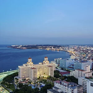
Geographic Atlas: representation of the Caribbean Sea and the Greater Antilles (Cuba, Hispaniola, Puerto Rico and Jamaica), the Bahamas Islands, the South of the United States, the North of South America (Venezuela) and the Lesser Antilles
, the Bahamas Islands, the South of the United States, the North of South America (Venezuela) and the Lesser Antilles")
![]()
Wall Art and Photo Gifts from Fine Art Finder
Geographic Atlas: representation of the Caribbean Sea and the Greater Antilles (Cuba, Hispaniola, Puerto Rico and Jamaica), the Bahamas Islands, the South of the United States, the North of South America (Venezuela) and the Lesser Antilles
VEN5029600 Geographic Atlas: representation of the Caribbean Sea and the Greater Antilles (Cuba, Hispaniola, Puerto Rico and Jamaica), the Bahamas Islands, the South of the United States, the North of South America (Venezuela) and the Lesser Antilles. Map from an Atlas of American Odds by J. Rufsell, 1794s. Biblioteca Jose Marti, Havana, Cuba.; (add.info.: Geographic Atlas: representation of the Caribbean Sea and the Greater Antilles (Cuba, Hispaniola, Puerto Rico and Jamaica), the Bahamas Islands, the South of the United States, the North of South America (Venezuela) and the Lesser Antilles. Map from an Atlas of American Odds by J. Rufsell, 1794s. Biblioteca Jose Marti, Havana, Cuba.); Photo © Marco Ravenna
Media ID 38274978
© Photo © Marco Ravenna / Bridgeman Images
18eme Siecle Amerique (continent) Amerique Centrale Amerique Du Nord Caraïbes Caribbean Caribbean Island Carte Geographique Central America Cuba Cuba Cubain Cubaine Cubains Cubaines Cuban Etats Unis Geographical Map Geographie Jamaica Jamaican Stockravenna Venezuela Venezuelan
FEATURES IN THESE COLLECTIONS
> Europe
> Italy
> Emilia-Romagna
> Ravenna
> Fine Art Finder
> Artists
> Marcantonio Bassetti
> Maps and Charts
> Early Maps
> North America
> The Bahamas
> Maps
> North America
> The Bahamas
> Related Images
> North America
> Cuba
> Cuba Heritage Sites
> Old Havana and its Fortification System
> North America
> Cuba
> Havana
> North America
> Cuba
> Maps
> North America
> Cuba
> Related Images
> North America
> Jamaica
> Maps
EDITORS COMMENTS
This stunning print captures a piece of history from an 18th-century Geographic Atlas, showcasing the intricate details of the Caribbean Sea and the surrounding islands. The map includes the Greater Antilles such as Cuba, Hispaniola, Puerto Rico, and Jamaica, as well as the Bahamas Islands, the South of the United States, Venezuela in North America, and the Lesser Antilles.
The delicate engravings on this map provide a glimpse into how these regions were perceived centuries ago. Each island is meticulously labeled and depicted with precision, offering a valuable insight into early cartography.
As you study this image closely, you can almost feel yourself being transported back in time to when explorers first navigated these waters and discovered new lands. The rich history of each island comes alive through this detailed representation.
Whether you have a personal connection to any of these locations or simply appreciate historical maps, this print is sure to spark curiosity and admiration for the beauty of our world's geography. Display it proudly in your home or office as a conversation starter and a reminder of the vast wonders that lie beyond our shores.
MADE IN THE USA
Safe Shipping with 30 Day Money Back Guarantee
FREE PERSONALISATION*
We are proud to offer a range of customisation features including Personalised Captions, Color Filters and Picture Zoom Tools
SECURE PAYMENTS
We happily accept a wide range of payment options so you can pay for the things you need in the way that is most convenient for you
* Options may vary by product and licensing agreement. Zoomed Pictures can be adjusted in the Cart.