Guidance Collection (page 5)

"Guidance: Illuminating Paths Across Time and Space" Step into the world of guidance, where ancient maps like the Mappa Mundi

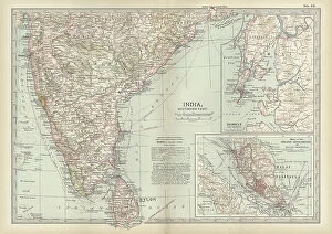
Background imageGuidance Collection: Map of southern India with Bombay, c.1900 (engraving)

Map of southern India with Bombay, c.1900 (engraving)
533019 Map of southern India with Bombay, c.1900 (engraving); (add.info.: Map showing historical boundaries of Southern India with inset map of Bombay (now Mumbai) and the Malay Peninsula

Background imageGuidance Collection: Map of Italy, c.1900 (engraving)

Map of Italy, c.1900 (engraving)
532983 Map of Italy, c.1900 (engraving); (add.info.: Map of Italy, with insets of Rome and Venice, circa 1902, from the 10th edition of Encyclopaedia Britannica.); Encyclopaedia Britannica/UIG

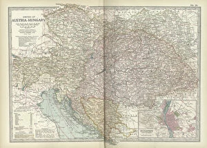
Background imageGuidance Collection: Map of the Empire of Austria-Hungary, c.1900 (engraving)

Map of the Empire of Austria-Hungary, c.1900 (engraving)
532977 Map of the Empire of Austria-Hungary, c.1900 (engraving); (add.info.: Map of Empire of Austria-Hungary and inset of Budapest and Vicinity, circa 1902)

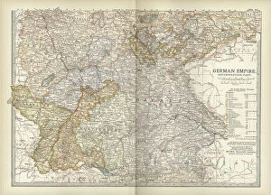
Background imageGuidance Collection: Map of the southwestern part of the German Empire, c.1900 (engraving)

Map of the southwestern part of the German Empire, c.1900 (engraving)
532961 Map of the southwestern part of the German Empire, c.1900 (engraving); (add.info.: Map of the southwestern German Empire, circa 1902)

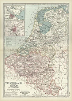
Background imageGuidance Collection: Map of Netherlands and Belgium, c.1900 (engraving)

Map of Netherlands and Belgium, c.1900 (engraving)
532956 Map of Netherlands and Belgium, c.1900 (engraving); (add.info.: Map showing the historical boundaries of Netherlands, Belgium, Luxemburg, with insets of Amsterdam and Brussels, circa 1902)

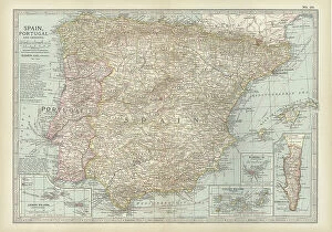
Background imageGuidance Collection: Map of Spain with Portugal and Andorra, c.1900 (engraving)

Map of Spain with Portugal and Andorra, c.1900 (engraving)
532952 Map of Spain with Portugal and Andorra, c.1900 (engraving); (add.info.: Map of Spain with Portugal and Andorra, with insets of the Azores Islands, Canary Islands, and Madeira Island)

Background imageGuidance Collection: Map of France, c.1900 (engraving)

Map of France, c.1900 (engraving)
532942 Map of France, c.1900 (engraving); (add.info.: Map of northern France with insets showing the provinces of France and Paris and Vicinity, circa 1902)

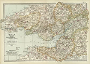
Background imageGuidance Collection: Map of England and Wales, c.1900 (engraving)

Map of England and Wales, c.1900 (engraving)
532924 Map of England and Wales, c.1900 (engraving); (add.info.: Map of England and Wales, with Hereford, Monmouth, Gloucester, Somerset, and parts of Worchester and Wiltshire, circa 1902)

Background imageGuidance Collection: Map of London, England, c.1900 (engraving)

Map of London, England, c.1900 (engraving)
532921 Map of London, England, c.1900 (engraving); (add.info.: Map of London, England, and vicinity, circa 1902, from the 10th edition of Encyclopaedia Britannica.); Encyclopaedia Britannica/UIG

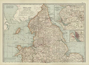
Background imageGuidance Collection: Map of England and Wales, c.1900 (engraving)

Map of England and Wales, c.1900 (engraving)
532903 Map of England and Wales, c.1900 (engraving); (add.info.: Map showing the historical boundaries of northern England and Wales, including insets of Liverpool, Manchester and Vicinity)

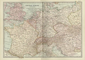
Background imageGuidance Collection: Map of Central Europe, c.1900 (engraving)

Map of Central Europe, c.1900 (engraving)
532900 Map of Central Europe, c.1900 (engraving); (add.info.: Map of Central Europe, circa 1902, From the 10th edition of Encyclopaedia Britannica.); Encyclopaedia Britannica/UIG

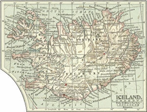
Background imageGuidance Collection: Map of Iceland, c.1900 (engraving)

Map of Iceland, c.1900 (engraving)
533307 Map of Iceland, c.1900 (engraving); (add.info.: Map of Iceland showing glaciers (Jokull), fjords and other geographical features, circa 1902

Background imageGuidance Collection: Map of Marseille, France, c.1900 (engraving)

Map of Marseille, France, c.1900 (engraving)
533294 Map of Marseille, France, c.1900 (engraving); (add.info.: Map of Marseille, France, circa 1902, from the 10th edition of Encyclopaedia Britannica.); Encyclopaedia Britannica/UIG

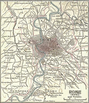
Background imageGuidance Collection: Map of Rome, c.1900 (engraving)

Map of Rome, c.1900 (engraving)
532848 Map of Rome, c.1900 (engraving); (add.info.: Map of Rome, circa 1900, from the 10th edition of Encyclopaedia Britannica.); Encyclopaedia Britannica/UIG

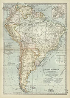
Background imageGuidance Collection: Map of South America, c.1900 (engraving)

Map of South America, c.1900 (engraving)
533256 Map of South America, c.1900 (engraving); (add.info.: Map of South America with inset maps of Isthmus of Panama, Galapagos Islands and Trinidad, circa 1902)

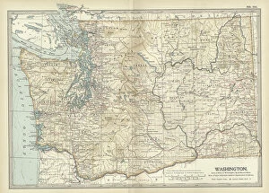
Background imageGuidance Collection: Map of Washington State, c.1900 (engraving)

Map of Washington State, c.1900 (engraving)
533220 Map of Washington State, c.1900 (engraving); (add.info.: Map of Washington State, United States, circa 1902, from the 10th edition of Encyclopaedia Britannica.); Encyclopaedia Britannica/UIG

Background imageGuidance Collection: Map of Melbourne, c.1900 (engraving)

Map of Melbourne, c.1900 (engraving)
532791 Map of Melbourne, c.1900 (engraving); (add.info.: Map of Melbourne, Australia, circa 1900, from the 10th edition of Encyclopaedia Britannica.); Encyclopaedia Britannica/UIG

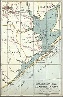
Background imageGuidance Collection: Map of Galveston Bay, Houston and vicinity, c.1900 (engraving)

Map of Galveston Bay, Houston and vicinity, c.1900 (engraving)
532761 Map of Galveston Bay, Houston and vicinity, c.1900 (engraving); (add.info.: Map of Galveston Bay, Houston, circa 1900)

Background imageGuidance Collection: Map of the colonial powers, 1902, c.1900 (engraving)

Map of the colonial powers, 1902, c.1900 (engraving)
532894 Map of the colonial powers, 1902, c.1900 (engraving); (add.info.: Map of the world showing "the Chief Countries and their Colonies, " circa 1902)

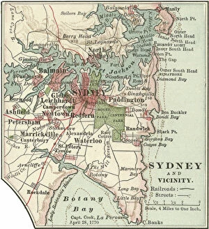
Background imageGuidance Collection: Map of Sydney, c.1900 (engraving)

Map of Sydney, c.1900 (engraving)
532872 Map of Sydney, c.1900 (engraving); (add.info.: Map of Sydney, Australia, circa 1900, from the 10th edition of Encyclopaedia Britannica.); Encyclopaedia Britannica/UIG

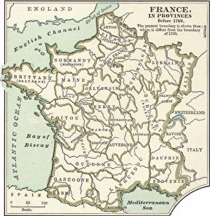
Background imageGuidance Collection: Map of France in Provinces, c.1900 (engraving)

Map of France in Provinces, c.1900 (engraving)
533288 Map of France in Provinces, c.1900 (engraving); (add.info.: Map of the provinces of France before the French Revolution in 1789, circa 1902)

Background imageGuidance Collection: Map of Minnesota, c.1900 (engraving)

Map of Minnesota, c.1900 (engraving)
533188 Map of Minnesota, c.1900 (engraving); (add.info.: Map of Minnesota, United States, with inset maps of Duluth and Minneapolis, circa 1902)

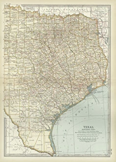
Background imageGuidance Collection: Map of eastern Texas, c.1900 (engraving)

Map of eastern Texas, c.1900 (engraving)
533161 Map of eastern Texas, c.1900 (engraving); (add.info.: Map of the eastern part of Texas, circa 1902, from the 10th edition of Encyclopaedia Britannica.); Encyclopaedia Britannica/UIG

Background imageGuidance Collection: Map of eastern Tennessee, c.1900 (engraving)

Map of eastern Tennessee, c.1900 (engraving)
533145 Map of eastern Tennessee, c.1900 (engraving); (add.info.: Map of the eastern part of Tennessee with inset map of Chattanooga, circa 1902)

Background imageGuidance Collection: Map of North Carolina, c.1900 (engraving)

Map of North Carolina, c.1900 (engraving)
533130 Map of North Carolina, c.1900 (engraving); (add.info.: Map of North Carolina, United States, circa 1902, from the 10th edition of Encyclopaedia Britannica.); Encyclopaedia Britannica/UIG

Background imageGuidance Collection: Map of Canada, c.1900 (engraving)

Map of Canada, c.1900 (engraving)
533072 Map of Canada, c.1900 (engraving); (add.info.: Map showing historical boundaries of Canada and Newfoundland, circa 1902)

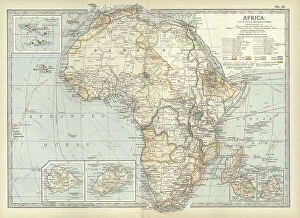
Background imageGuidance Collection: Map of colonial Africa, c.1900 (engraving)

Map of colonial Africa, c.1900 (engraving)
533053 Map of colonial Africa, c.1900 (engraving); (add.info.: Map of colonial Africa, with insets of Ascension Island, St)

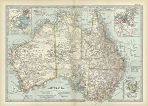
Background imageGuidance Collection: Map of Australia and Tasmania. c1902 (engraving)

Map of Australia and Tasmania. c1902 (engraving)
533041 Map of Australia and Tasmania. c1902 (engraving); (add.info.: Map showing Australia with insets of Melbourne and Port Phillip, Tasmania, and Sydney and Vicinity, circa 1902)

Background imageGuidance Collection: Map of Dublin, c.1900 (engraving)

Map of Dublin, c.1900 (engraving)
532758 Map of Dublin, c.1900 (engraving); (add.info.: Map of Dublin, circa 1900, from the 10th edition of Encyclopaedia Britannica.); Encyclopaedia Britannica/UIG

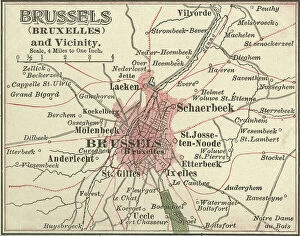
Background imageGuidance Collection: Map of Brussels, c.1900 (engraving)

Map of Brussels, c.1900 (engraving)
532721 Map of Brussels, c.1900 (engraving); (add.info.: Map of the city of Brussels, Belgium, circa 1900, from the 10th edition of Encyclopaedia Britannica.); Encyclopaedia Britannica/UIG

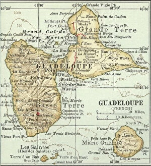
Background imageGuidance Collection: Map of Guadeloupe, c.1900 (engraving)

Map of Guadeloupe, c.1900 (engraving)
533480 Map of Guadeloupe, c.1900 (engraving); (add.info.: Map of Guadeloupe, circa 1902, from the 10th edition of Encyclopaedia Britannica.); Encyclopaedia Britannica/UIG

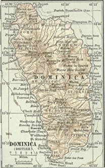
Background imageGuidance Collection: Map of Dominica, c.1900 (engraving)

Map of Dominica, c.1900 (engraving)
533477 Map of Dominica, c.1900 (engraving); (add.info.: Map of Dominica, circa 1902, from the 10th edition of Encyclopaedia Britannica.); Encyclopaedia Britannica/UIG

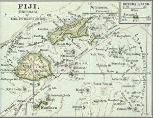
Background imageGuidance Collection: Map of Fiji Islands, c.1900 (engraving)

Map of Fiji Islands, c.1900 (engraving)
533354 Map of Fiji Islands, c.1900 (engraving); (add.info.: Map of Fiji Islands, South Pacific with inset map of Rotuma Island, circa 1902)

Background imageGuidance Collection: Map of New Guinea and Bismarck Archipelago, c.1900 (engraving)

Map of New Guinea and Bismarck Archipelago, c.1900 (engraving)
533344 Map of New Guinea and Bismarck Archipelago, c.1900 (engraving); (add.info.: Map of New Guinea and the Bismarck Archipelago, circa 1902)

Background imageGuidance Collection: Map of Bonin Islands and Sulphur Islands, c.1900 (engraving)

Map of Bonin Islands and Sulphur Islands, c.1900 (engraving)
533329 Map of Bonin Islands and Sulphur Islands, c.1900 (engraving); (add.info.: Inset map of Bonin Islands and Sulphur Islands, circa 1902)

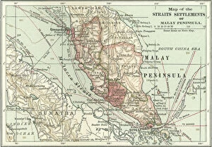
Background imageGuidance Collection: Map of the Malay Peninsula, c.1900 (engraving)

Map of the Malay Peninsula, c.1900 (engraving)
533325 Map of the Malay Peninsula, c.1900 (engraving); (add.info.: Map showing historical boundaries of the Malay Peninsula, Sumatra, and Singapore, circa 1902)

Background imageGuidance Collection: Map of Crete, c.1900 (engraving)

Map of Crete, c.1900 (engraving)
533320 Map of Crete, c.1900 (engraving); (add.info.: Map of Crete, Greece, circa 1902, From the 10th edition of Encyclopaedia Britannica.); Encyclopaedia Britannica/UIG

Background imageGuidance Collection: Description of treatment for malaria. 19th century (print)

Description of treatment for malaria. 19th century (print)
672859 Description of treatment for malaria. 19th century (print); (add.info.: Malaria, a mosquito-borne infectious disease of humans)

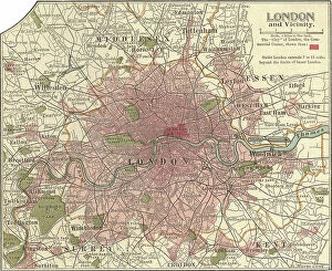
Background imageGuidance Collection: Map of London and Vicinity, 1902, c.1900 (engraving)

Map of London and Vicinity, 1902, c.1900 (engraving)
533273 Map of London and Vicinity, 1902, c.1900 (engraving); (add.info.: Map of London, England, circa 1902, from the 10th edition of Encyclopaedia Britannica.); Encyclopaedia Britannica/UIG

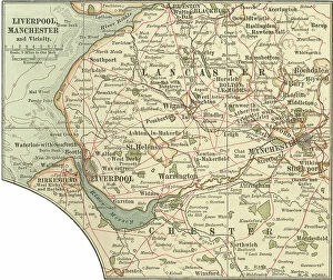
Background imageGuidance Collection: Map of Liverpool, Manchester, c.1900 (engraving)

Map of Liverpool, Manchester, c.1900 (engraving)
533270 Map of Liverpool, Manchester, c.1900 (engraving); (add.info.: Map of Liverpool and Manchester, England, circa 1902)

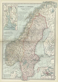
Background imageGuidance Collection: Map of Norway and Sweden, c.1900 (engraving)

Map of Norway and Sweden, c.1900 (engraving)
532971 Map of Norway and Sweden, c.1900 (engraving); (add.info.: Map of Norway, Sweden, with insets of Kristianiafjord and Stockholm, circa 1902)

Background imageGuidance Collection: Map of Scotland, c.1900 (engraving)

Map of Scotland, c.1900 (engraving)
532936 Map of Scotland, c.1900 (engraving); (add.info.: Map of the central part of Scotland, circa 1902, from the 10th edition of Encyclopaedia Britannica.); Encyclopaedia Britannica/UIG

Background imageGuidance Collection: Map of northern Illinois, c.1900 (engraving)

Map of northern Illinois, c.1900 (engraving)
533173 Map of northern Illinois, c.1900 (engraving); (add.info.: Map of the northern part of Illinois, United States, circa 1902)

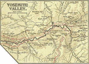
Background imageGuidance Collection: Map of Yosemite Valley, c.1900 (engraving)

Map of Yosemite Valley, c.1900 (engraving)
532892 Map of Yosemite Valley, c.1900 (engraving); (add.info.: Map of Yosemite Valley, circa 1900, from the 10th edition of Encyclopaedia Britannica.); Encyclopaedia Britannica/UIG

Background imageGuidance Collection: Map of South Carolina with inset of Charleston, c.1900 (engraving)

Map of South Carolina with inset of Charleston, c.1900 (engraving)
533136 Map of South Carolina with inset of Charleston, c.1900 (engraving); (add.info.: Map showing the historical boundaries of South Carolina, United States, with an inset map of Charleston)

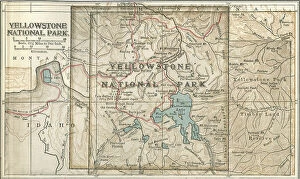
Background imageGuidance Collection: Map of Yellowstone National Park, c.1900 (engraving)

Map of Yellowstone National Park, c.1900 (engraving)
532887 Map of Yellowstone National Park, c.1900 (engraving); (add.info.: Map of Yellowstone National Park, highlighting major mountain ranges and other features, circa 1900)

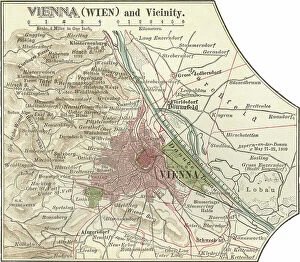
Background imageGuidance Collection: Map of Vienna, c.1900 (engraving)

Map of Vienna, c.1900 (engraving)
532881 Map of Vienna, c.1900 (engraving); (add.info.: Map of Vienna, Austria, circa 1900, from the 10th edition of Encyclopaedia Britannica.); Encyclopaedia Britannica/UIG

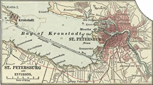
Background imageGuidance Collection: Map of St. Petersburg, c.1900 (engraving)

Map of St. Petersburg, c.1900 (engraving)
532866 Map of St. Petersburg, c.1900 (engraving); (add.info.: Map of St. Petersburg, circa 1900, from the 10th edition of Encyclopaedia Britannica.); Encyclopaedia Britannica/UIG


For sale as Licensed Images

Choose your image, Select your licence and Download the media

"Guidance: Illuminating Paths Across Time and Space" Step into the world of guidance, where ancient maps like the Mappa Mundi, inked with vibrant colors on delicate parchment, reveal the journeys of explorers in 1265 London. Feel the guiding light emanating from Sturgeon Bay Lighthouse in Door County, Wisconsin. Its beacon has guided countless sailors through treacherous waters to safety. In Pyongyang, Democratic People's Republic of Korea (DPRK), a painting depicting Great Leaders Kim Jong Il and Kim Il Sung stands as a symbol of unwavering guidance for their nation amidst turbulent times. At Fanad Head Lighthouse, witness how its steadfast presence guides ships along Ireland's rugged coastline, offering solace in stormy seas. Gaze upon Christ the Redeemer overlooking Rio de Janeiro from atop Sugar Loaf mountain. His outstretched arms serve as a constant reminder that they are be found even in towering heights. Discover unexpected guidance through "The Vegetabull" poster—a whimsical depiction reminding us to embrace nature's bounty and nourish our souls with its colorful offerings. As mid-summer sunrise bathes The Mull of Galloway Lighthouse in golden hues, let it remind you that each dawn brings new possibilities and fresh opportunities for personal growth. Travel across continents to Cape Neddick (The Nubble) Lighthouse in Maine. Witness how this stoic structure has provided unwavering guidance to mariners navigating New England's rocky shores since time immemorial. Enter "The New Jerusalem, " an enchanting vision crafted around 1900. This utopian cityscape serves as a testament to humanity's eternal quest for spiritual enlightenment and divine guidance. Underneath moonlit skies at Whitefish Point Lighthouse, allow yourself to be captivated by its ethereal glow. It stands as a guardian guiding lost souls home amidst Lake Superior’s vast expanse.