Territory Collection (#3)

"Exploring the Rich Tapestry of Territory

Background imageTerritory Collection: British Cat Protects

British Cat Protects
" Wouldn t you like to see the back of me?" - the British cat protects his territory 1915

Background imageTerritory Collection: Bald Eagles - Squabble over perch BE5571

Bald Eagles - Squabble over perch BE5571
TOM-698 Bald Eagles - Squabble over perch Alaska, USA Haliaeetus leucocephalus Tom & Pat Leeson Please note that prints are for personal display purposes only and may not be reproduced in any way

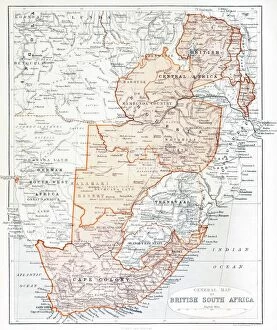
Background imageTerritory Collection: General Map Of British South Africa. From The Book South Africa And The Transvaal War

General Map Of British South Africa. From The Book South Africa And The Transvaal War, Volume 1 By Louis Creswicke, Published 1900

Background imageTerritory Collection: Camana Bay, George Town, Grand Cayman, Cayman Islands

Camana Bay, George Town, Grand Cayman, Cayman Islands

Background imageTerritory Collection: The Devils Hangout Gift Shop, detailed view, Hell, West Bay, Grand Cayman, Cayman Islands

The Devils Hangout Gift Shop, detailed view, Hell, West Bay, Grand Cayman, Cayman Islands

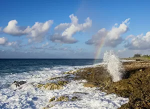
Background imageTerritory Collection: The Blowholes, East End, Grand Cayman, Cayman Islands

The Blowholes, East End, Grand Cayman, Cayman Islands

Background imageTerritory Collection: The Expulsion of the Money-changers from the Temple, 1724. Creator: Giovanni Paolo Panini

The Expulsion of the Money-changers from the Temple, 1724. Creator: Giovanni Paolo Panini
The Expulsion of the Money-changers from the Temple, 1724.

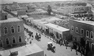
Background imageTerritory Collection: Italians taking possession of Tripoli, 1911. Creator: Bain News Service

Italians taking possession of Tripoli, 1911. Creator: Bain News Service
Italians taking possession of Tripoli, 1911. Shows Italian troops entering Tripoli, Libya during the Turco-Italian War (Italo-Turkish War) which took place between September 1911 and October 1912.

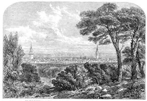
Background imageTerritory Collection: The War in Denmark: view of Aalborg, in Jutland, now occupied by the Prussian army, 1864

The War in Denmark: view of Aalborg, in Jutland, now occupied by the Prussian army, 1864. Creator: Unknown
The War in Denmark: view of Aalborg, in Jutland, now occupied by the Prussian army, 1864. Engraving of a sketch '...by Mr. C

Background imageTerritory Collection: Illustrations of the War in Denmark: interior of No. 4 Redoubt at Düppel, 1864. Creator: Unknown

Illustrations of the War in Denmark: interior of No. 4 Redoubt at Düppel, 1864. Creator: Unknown
Illustrations of the War in Denmark: interior of No. 4 Redoubt at Duppel, 1864. Engraving '...from a sketch by our Special Artist...[showing] the aspect of Duppel since the storm of war has swept

Background imageTerritory Collection: The War in Denmark: rear view of the Düppel position, from the Church Battery, Sonderburg, 1864

The War in Denmark: rear view of the Düppel position, from the Church Battery, Sonderburg, 1864. Creator: Unknown
The War in Denmark from a sketch by our special artist: rear view of the Duppel position, from the Church Battery, Sonderburg, 1864

Background imageTerritory Collection: The War in Schleswig: distributing medals to Austrian troops at Hoptrup..., 1864. Creator: Unknown

The War in Schleswig: distributing medals to Austrian troops at Hoptrup..., 1864. Creator: Unknown
The War in Schleswig: distributing medals to Austrian troops at Hoptrup - from a sketch by our special artist, 1864. The Sketch...was taken at Hoptrup

Background imageTerritory Collection: The War in Schleswig: chapel at Gravenstein used as a Prussian barrack..., 1864. Creator: Unknown

The War in Schleswig: chapel at Gravenstein used as a Prussian barrack..., 1864. Creator: Unknown
The War in Schleswig: chapel at Gravenstein [in Denmark] used as a Prussian barrack - from a sketch by our special artist, 1864

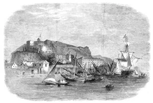
Background imageTerritory Collection: Destruction of the fortifications of the Ionian Islands: Fort Neuf, in the harbour of Corfu, 1864

Destruction of the fortifications of the Ionian Islands: Fort Neuf, in the harbour of Corfu, 1864. Creator: Unknown
Destruction of the fortifications of the Ionian Islands: Fort Neuf, in the harbour of Corfu, 1864. 'The conduct of her Majesty's Government in demolishing the fortifications of Corfu before

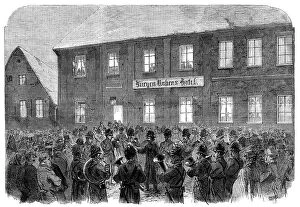
Background imageTerritory Collection: The War in Schleswig: band playing before Marshal Wrangel's head-quarters at Hadersleben..., 1864

The War in Schleswig: band playing before Marshal Wrangel's head-quarters at Hadersleben..., 1864. Creator: Unknown
The War in Schleswig: band playing before Marshal Wrangel's head-quarters at Hadersleben - from a sketch by our special artist, 1864

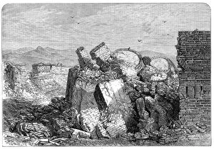
Background imageTerritory Collection: Destruction of the fortifications of the Ionian Islands: the escarp of the Keep of Vido..., 1864

Destruction of the fortifications of the Ionian Islands: the escarp of the Keep of Vido..., 1864. Creator: Unknown
Destruction of the fortifications of the Ionian Islands: the escarp of the Keep of Vido after the explosion on March 11, 1864

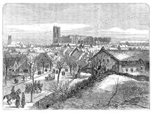
Background imageTerritory Collection: The War in Denmark: Kolding, Jutland, the head-quarters of the Allied armies..., 1864

The War in Denmark: Kolding, Jutland, the head-quarters of the Allied armies..., 1864. Creator: Unknown
The War in Denmark: Kolding, Jutland, the head-quarters of the Allied armies - from a sketch by our special artist, 1864. 'This small town, which has but four thousand inhabitants

Background imageTerritory Collection: The War in New Zealand: stronghold of the Maoris at Rangariri, 1864. Creator: Unknown

The War in New Zealand: stronghold of the Maoris at Rangariri, 1864. Creator: Unknown
The War in New Zealand: stronghold of the Maoris at Rangariri, 1864. Engraving from a photograph, of the scene of '...General Cameron's victory on the 20th of November...The British

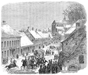
Background imageTerritory Collection: The War in Schleswig: High-Street, Hadersleben - from a sketch by our special artist, 1864

The War in Schleswig: High-Street, Hadersleben - from a sketch by our special artist, 1864. Creator: Unknown
The War in Schleswig: High-Street, Hadersleben - from a sketch by our special artist, 1864. View of '...the principal street of Hadersleben

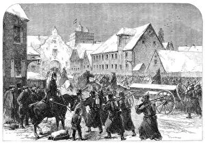
Background imageTerritory Collection: The War in Schleswig: Prussian ammunition-train entering Flensburg - by our special artist, 1864

The War in Schleswig: Prussian ammunition-train entering Flensburg - by our special artist, 1864. Creator: Unknown
The War in Schleswig: Prussian ammunition-train entering Flensburg - from a sketch by our special artist, 1864. '...the Prussians...have brought up heavy siege-guns and trains of ammunition

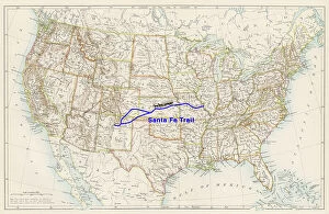
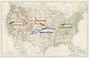
Background imageTerritory Collection: Santa Fe Trail route on an 1870s map of the US

Santa Fe Trail route on an 1870s map of the US
NWI4712668 Santa Fe Trail route on an 1870s map of the US.; (add.info.: Santa Fe Trail route on an 1870s map of the US.); Photo © North Wind Pictures

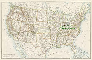
Background imageTerritory Collection: National Road route on an 1870s map of the US

National Road route on an 1870s map of the US
NWI4712666 National Road route on an 1870s map of the US.; (add.info.: National Road route on an 1870s map of the US.); Photo © North Wind Pictures

Background imageTerritory Collection: Routes of the great westward trails on an 1870s map of the US

Routes of the great westward trails on an 1870s map of the US
NWI4712693 Routes of the great westward trails on an 1870s map of the US.; (add.info.: Routes of the great westward trails on an 1870s map of the US.); Photo © North Wind Pictures

Background imageTerritory Collection: Oregon Trail and California Trail routes on an 1870s map of the US

Oregon Trail and California Trail routes on an 1870s map of the US
NWI4712662 Oregon Trail and California Trail routes on an 1870s map of the US.; (add.info.: Oregon Trail and California Trail routes on an 1870s map of the US.); Photo © North Wind Pictures

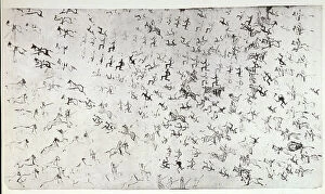
Background imageTerritory Collection: Battle of the Little Bighorn (drawing) by Amos Bad Heart Bull

Battle of the Little Bighorn (drawing) by Amos Bad Heart Bull, also known as Wanbli Waphaha (Eagle Bonnet) (ca)
5669729 Battle of the Little Bighorn (drawing) by Amos Bad Heart Bull, also known as Wanbli Waphaha (Eagle Bonnet) (ca. 1868-1913); (add.info)

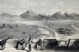
Background imageTerritory Collection: The Neutral Ground at Gibraltar, 1870 (engraving)

The Neutral Ground at Gibraltar, 1870 (engraving)
1575590 The Neutral Ground at Gibraltar, 1870 (engraving); (add.info.: Engraving depicts the neutral ground at Gibraltar. The neutral ground was established due to disputes between the British)

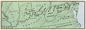
Background imageTerritory Collection: Map showing center of US population moving westward along the National Road, 1790-1900

Map showing center of US population moving westward along the National Road, 1790-1900
NWI4712731 Map showing center of US population moving westward along the National Road, 1790-1900.; (add.info.: Map showing center of US population moving westward along the National Road)

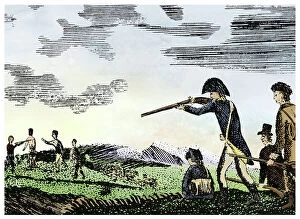
Background imageTerritory Collection: Meriwether Lewis shoots a Native American for disobedience, Corps of Discovery expedition

Meriwether Lewis shoots a Native American for disobedience, Corps of Discovery expedition
NWI4712736 Meriwether Lewis shoots a Native American for disobedience, Corps of Discovery expedition.; (add.info.: Meriwether Lewis shoots a Native American for disobedience)

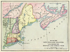
Background imageTerritory Collection: New England colonies just before the French and Indian War

New England colonies just before the French and Indian War
NWI4853909 New England colonies just before the French and Indian War.; (add.info.: New England colonies just before the French and Indian War.); Photo © North Wind Pictures

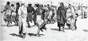
Background imageTerritory Collection: USA History: The revolt of the Sioux Indians. in North America

USA History: The revolt of the Sioux Indians. in North America. The dance of Espirits by Oglala Sioux at the Pine Ridge
5313594 USA History: The revolt of the Sioux Indians. in North America. The dance of Espirits by Oglala Sioux at the Pine Ridge Agency. Dakota Territory.; SeM Studio/UIG

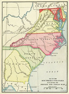
Background imageTerritory Collection: Southern colonies just before the French and Indian War

Southern colonies just before the French and Indian War
NWI4712671 Southern colonies just before the French and Indian War.; (add.info.: Southern colonies just before the French and Indian War.); Photo © North Wind Pictures

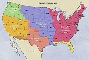
Background imageTerritory Collection: USA territory origins - Map of territorial acquisition by the United States

USA territory origins - Map of territorial acquisition by the United States
NWI4712632 USA territory origins - Map of territorial acquisition by the United States.; (add.info.: USA territory origins - Map of territorial acquisition by the United States)

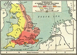
Background imageTerritory Collection: Map of the settlements of Angles, Saxons and Jutes in Britain c. 600 (print)

Map of the settlements of Angles, Saxons and Jutes in Britain c. 600 (print)
2603521 Map of the settlements of Angles, Saxons and Jutes in Britain c. 600 (print); (add.info.: From Historical Atlas, published 1923.)

Background imageTerritory Collection: Original 13 states and (inset) original Enlish land grants

Original 13 states and (inset) original Enlish land grants
NWI4712678 Original 13 states and (inset) original Enlish land grants.; (add.info.: Original 13 states and (inset) original Enlish land grants.); Photo © North Wind Pictures

Background imageTerritory Collection: Oregon Trail route on an 1870s map of the US

Oregon Trail route on an 1870s map of the US
NWI4712599 Oregon Trail route on an 1870s map of the US.; (add.info.: Oregon Trail route on an 1870s map of the US.); Photo © North Wind Pictures

Background imageTerritory Collection: Tecumseh's War 1811-1813: Battle of Tippecanoe, 7 November 1811

Tecumseh's War 1811-1813: Battle of Tippecanoe, 7 November 1811, fought on Indian Territory between US forces under
528601 Tecumseh's War 1811-1813: Battle of Tippecanoe, 7 November 1811, fought on Indian Territory between US forces under Governor William Harrison

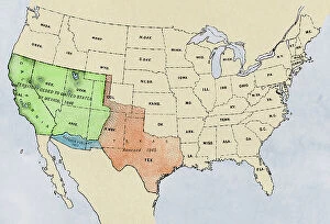
Background imageTerritory Collection: USA territory from Mexico - Map of territory from Mexico added to the southwestern United States

USA territory from Mexico - Map of territory from Mexico added to the southwestern United States, 1800s
NWI4712617 USA territory from Mexico - Map of territory from Mexico added to the southwestern United States, 1800s.; (add.info)

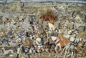
Background imageTerritory Collection: The Battle of Pavia, February 24, 1525 (tapestry)

The Battle of Pavia, February 24, 1525 (tapestry)
529631 The Battle of Pavia, February 24, 1525 (tapestry); (add.info.: It was the decisive engagement of the Italian War of 1521-25)

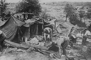
Background imageTerritory Collection: British artillery officers mess on captured ground, 10 Jun 1917. Creator: Bain News Service

British artillery officers mess on captured ground, 10 Jun 1917. Creator: Bain News Service
British artillery officers mess on captured ground, 10 Jun 1917. British artillery officers mess tent in front of Kemmel, Belgium, June 10, 1917, during the Battle of Messines during World War I

Background imageTerritory Collection: Russian Church at Suwalki in German hands, between c1914 and c1915. Creator: Bain News Service

Russian Church at Suwalki in German hands, between c1914 and c1915. Creator: Bain News Service
Russian Church at Suwalki in German hands, between c1914 and c1915. German soldiers outside a Russian church in Suwalki, Poland during World War I

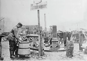
Background imageTerritory Collection: German Sanitary sign near Lodz, between 1914 and c1915. Creator: Bain News Service

German Sanitary sign near Lodz, between 1914 and c1915. Creator: Bain News Service
German Sanitary sign near Lodz, between 1914 and c1915. A sign in German "Trinkwasser" (drinking water) next to a pump in Lodz, Poland during World War I

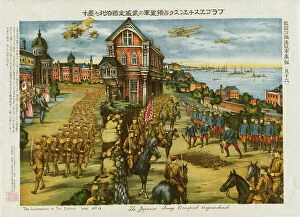
Background imageTerritory Collection: The Japanese Army occupied Vragaeschensk, 1919. Creator: Unknown

The Japanese Army occupied Vragaeschensk, 1919. Creator: Unknown
The Japanese Army occupied Vragaeschensk, 1919. The Japanese army marching through Blagoveshchensk, Russia, with airplanes overhead

Background imageTerritory Collection: General view of the Chincha Islands, lately seized by the Spaniards, 1864. Creator: Unknown

General view of the Chincha Islands, lately seized by the Spaniards, 1864. Creator: Unknown
General view of the Chincha Islands, lately seized by the Spaniards, 1864. Engraving from a sketch by Oswald Younghusband

Background imageTerritory Collection: Germans in a town in Russian Poland holding religious service, between 1914 and c1915

Germans in a town in Russian Poland holding religious service, between 1914 and c1915. Creator: Bain News Service
Germans in a town in Russian Poland holding religious service, between 1914 and c1915. German soldiers holding a service in Poland during World War I

Background imageTerritory Collection: Battle for territory

Battle for territory
Elroee Assaraf

Background imageTerritory Collection: USA, South Texas. Northern cardinal males

USA, South Texas. Northern cardinal males

Background imageTerritory Collection: USA, Oregon, Malheur National Wildlife Refuge, trumpeter swans, territory dispute

USA, Oregon, Malheur National Wildlife Refuge, trumpeter swans, territory dispute


For sale as Licensed Images

Choose your image, Select your licence and Download the media

"Exploring the Rich Tapestry of Territory: From Ancient Empires to Majestic Landscapes" Embark on a captivating journey through time and space as we delve into the concept of territory. Let us begin our expedition with a glance at Scotland in the 1870s, where an intricate map unravels tales of clans and their territorial disputes. Shifting our focus eastward, we encounter a mesmerizing Map of the Ancient Persian Empire. Marvel at its vast expanse, once ruled by mighty kings who sought to expand their dominion across ancient lands. Transporting ourselves to Britain in 597 AD, another map reveals how territories evolved over centuries. Witness the birth of kingdoms and empires that shaped this island nation's history. As dusk descends upon Uluru, Ayers Rock in Australia, soak in nature's splendor while contemplating indigenous peoples' connection to their ancestral territories. The sunset paints vibrant hues across this sacred land. Journeying back to Europe, let us explore Ireland through a map from the 1870s. Discover its lush landscapes and ponder upon historical struggles for control over this enchanting island. Expand your horizons further with the World Map Empire McVitie; marvel at how various nations carved out their territories during different eras – each stroke representing power dynamics and conquests. Venturing into antiquity, immerse yourself in Alexander the Great's empire through an awe-inspiring map. Uncover his audacious quest for dominance as he conquered vast stretches of land under his rule. Witnessing nature's wonders takes flight as we observe a majestic Red Kite soaring above its nest territory in Lower Saxony, Germany. A symbol of freedom within defined boundaries - it reminds us that even wildlife has territorial instincts ingrained within them. Turning towards spiritual realms brings us face-to-face with Palestine and Holy Land on an intricately detailed map. Contemplate millennia-old conflicts rooted deeply in territorial claims and religious significance.