Territory Collection (#7)

"Exploring the Rich Tapestry of Territory

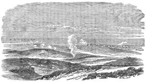
Background imageTerritory Collection: Sebastopol during the Siege - general view, 1854. Creator: Unknown

Sebastopol during the Siege - general view, 1854. Creator: Unknown
Sebastopol during the Siege - general view, 1854. Crimean War. View of warships on the Black Sea, the battlefield, and positions of the allies and the Russians

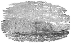
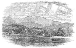
Background imageTerritory Collection: Capes Pherient and Aia, and Balaclava Bay, 1854. Creator: Unknown

Capes Pherient and Aia, and Balaclava Bay, 1854. Creator: Unknown
Capes Pherient and Aia, and Balaclava Bay, 1854. Crimean War. Cape Fiolent and Cape Aya, headlands at the entrance to Balaclava Harbour on the Black Sea. From "Illustrated London News", 1854

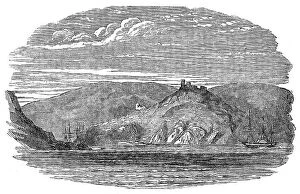
Background imageTerritory Collection: Entrance to Balaclava Harbour, 1854. Creator: Unknown

Entrance to Balaclava Harbour, 1854. Creator: Unknown
Entrance to Balaclava Harbour, 1854. Crimean War. The town of Balaclava is situated close to the harbour, along the foot of the mountain, but it is not provided with good water

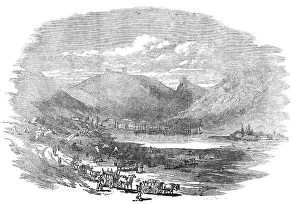
Background imageTerritory Collection: Balaclava - view inside the port, 1854. Creator: Unknown

Balaclava - view inside the port, 1854. Creator: Unknown
Balaclava - view inside the port, 1854. Crimean War. View of the'...inside of the port, which is only accessible through a very narrow circuitous channel, in the form of the letter S

Background imageTerritory Collection: Balaclava Harbour, 1854. Creator: Unknown

Balaclava Harbour, 1854. Creator: Unknown
Balaclava Harbour, 1854. Crimean War....Balaclava has been completely changed into a Greek town...[It] is situated close to the harbour, along the foot of the mountain

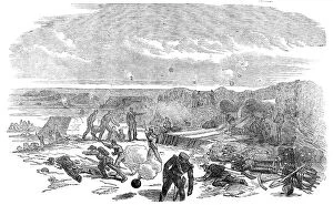
Background imageTerritory Collection: Opening of the Bombardment of Sebastopol - Chapman's Battery, 1854. Creator: Unknown

Opening of the Bombardment of Sebastopol - Chapman's Battery, 1854. Creator: Unknown
Opening of the Bombardment of Sebastopol - Chapman's Battery, 1854. Crimean War. The Russian fire, though well directed

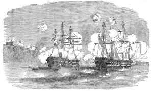
Background imageTerritory Collection: The 'Agamemnon' and 'Sanspareil' attacking Sebastopol, 1854. Creator: Unknown

The "Agamemnon" and "Sanspareil" attacking Sebastopol, 1854. Creator: Unknown
The "Agamemnon" and "Sanspareil" attacking Sebastopol, 1854. Crimean War: Royal Navy ships....the Agamemnon...opened fire from her large pivot gun on the "Wasp" Fort

Background imageTerritory Collection: Siege of Sebastopol - Preparing a Train for the Trenches, 1854. Creator: Unknown

Siege of Sebastopol - Preparing a Train for the Trenches, 1854. Creator: Unknown
Siege of Sebastopol - Preparing a Train for the Trenches, 1854. Crimean War: British Army position. Sebastopol will fall, no one doubts it - the question is only one of time...It is satisfactory...to

Background imageTerritory Collection: The Road to Sebastopol - Commissariat Waggons, Conveyances of Fascines, etc, 1854. Creator: Unknown

The Road to Sebastopol - Commissariat Waggons, Conveyances of Fascines, etc, 1854. Creator: Unknown
The Road to Sebastopol - Commissariat Waggons, Conveyances of Fascines, etc, 1854. Crimean War: equipment being moved to forward positions

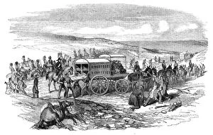
Background imageTerritory Collection: Siege of Sebastopol - Mr. Guthrie's Ambulance Waggons, 1854. Creator: Unknown

Siege of Sebastopol - Mr. Guthrie's Ambulance Waggons, 1854. Creator: Unknown
Siege of Sebastopol - Mr. Guthrie's Ambulance Waggons, 1854. The latest accounts from the Crimea inform us that the Ambulances...have at length reached the spot where they are wanted...although a

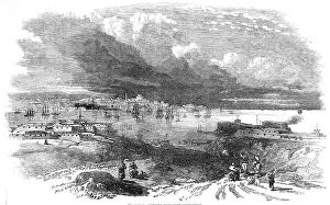
Background imageTerritory Collection: Sebastopol, sketched from Fort Constantine, 1854. Creator: Unknown

Sebastopol, sketched from Fort Constantine, 1854. Creator: Unknown
Sebastopol, sketched from Fort Constantine, 1854. Crimean War: strategic port on the Black Sea under siege. [British commander] Lord Raglan, it is said, received a few days ago

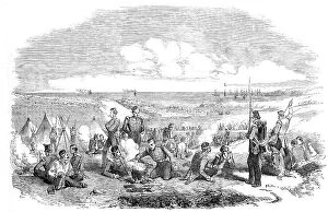
Background imageTerritory Collection: Camp of the 21st Fusiliers, on the Heights of Sebastopol, 1854. Creator: Unknown
Camp of the 21st Fusiliers, on the Heights of Sebastopol, 1854. Creator: Unknown
Camp of the 21st Fusiliers, on the Heights of Sebastopol, 1854. Crimean War: British soldiers repairing uniforms, cooking, and cleaning guns

Background imageTerritory Collection: The Sunken Ships at the Mouth of the Harbour of Sebastopol, sketched by Lieut. Montagu... 1854

The Sunken Ships at the Mouth of the Harbour of Sebastopol, sketched by Lieut. Montagu... 1854. Creator: Unknown
The Sunken Ships at the Mouth of the Harbour of Sebastopol, sketched by Lieut. Montagu O'Reilly, H.M.S. Retribution, 1854. Crimean War

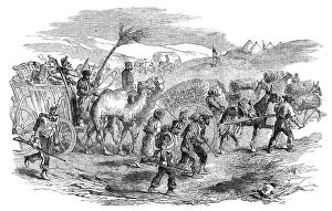
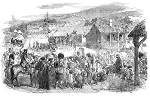
Background imageTerritory Collection: The Inhabitants leaving Balaclava, by Order of Lord Raglan, 1854. Creator: Unknown

The Inhabitants leaving Balaclava, by Order of Lord Raglan, 1854. Creator: Unknown
The Inhabitants leaving Balaclava, by Order of Lord Raglan, 1854. Crimean War: expulsion of Greek civilians by the British Army

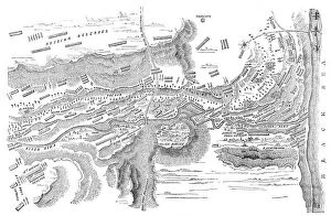
Background imageTerritory Collection: Plan of the Battle of the Alma, 1854. Creator: Unknown

Plan of the Battle of the Alma, 1854. Creator: Unknown
Plan of the Battle of the Alma, 1854. Crimean War. The accompanying plan has been drawn by Major Hopkins, K.H. The different armies are represented by the variety of lines of shade

Background imageTerritory Collection: Battle of the Alma, 1854. Creator: Unknown

Battle of the Alma, 1854. Creator: Unknown
Battle of the Alma, 1854. Scene from the Crimean War. View of this important action, from a Sketch by Lieut. E. C. Gordon

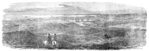
Background imageTerritory Collection: British Outposts, near Sebastopol, 1854. Creator: Unknown

British Outposts, near Sebastopol, 1854. Creator: Unknown
British Outposts, near Sebastopol, 1854. Crimean War: panorama showing Cossacks; Fort; English Steamer; Russian Soldiers Camp Cooking Houses

Background imageTerritory Collection: Lord Raglan's Head-Quarters, at Balaclava, 1854. Creator: Unknown

Lord Raglan's Head-Quarters, at Balaclava, 1854. Creator: Unknown
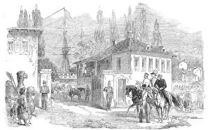
Lord Raglan's Head-Quarters, at Balaclava, 1854. Crimean War: view of a house at Balaclava in the Crimea, used by field marshal FitzRoy Somerset of the British Army

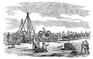
Background imageTerritory Collection: Heaving Guns, at Balaclava, 1854. Creator: Unknown

Heaving Guns, at Balaclava, 1854. Creator: Unknown
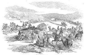
Heaving Guns, at Balaclava, 1854. Crimean War. British soldiers in the Crimea, engaged in the...heaving of the siege train...we must remember that the work is not half done when the guns

Background imageTerritory Collection: Lord Raglan and General Canrobert visiting the French Outposts opposite Sebastopol, 1854

Lord Raglan and General Canrobert visiting the French Outposts opposite Sebastopol, 1854. Creator: Unknown
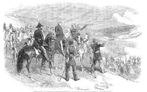
Lord Raglan and General Canrobert visiting the French Outposts opposite Sebastopol, 1854. Crimean War. General Canrobert...is looking at Sebastopol through his telescope...In the distance...may be

Background imageTerritory Collection: Lieutenant Montagu O'Reilly explaining his Sketch of Sebastopol to the Sultan, 1854

Lieutenant Montagu O'Reilly explaining his Sketch of Sebastopol to the Sultan, 1854. Creator: Unknown
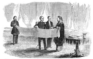
Lieutenant Montagu O'Reilly explaining his Sketch of Sebastopol to the Sultan, 1854. Crimean War: Royal Navy officer with Ottoman sultan Abdulmejid I

Background imageTerritory Collection: English Encampment on the Coast near Toula, in the Crimea, 1854. Creator: Smyth

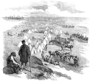
English Encampment on the Coast near Toula, in the Crimea, 1854. Creator: Smyth
English Encampment on the Coast near Toula, in the Crimea, 1854. Crimean War: British military camp at the time the Battle of the Alma was fought

Background imageTerritory Collection: Official Plan of the Battle of the Alma - Distribution of the British Troops at the... 1854

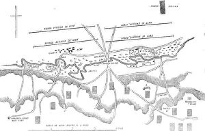
Official Plan of the Battle of the Alma - Distribution of the British Troops at the... 1854. Creator: Unknown
Official Plan of the Battle of the Alma - Distribution of the British Troops at the Commencement of the Action, 1854. Crimean War. A. Battery of twelve heavy guns (24 lbs); B. Four heavy guns; C

Background imageTerritory Collection: Embarkation of French and English Troops, in Varna Bay, 1854. Creator: Unknown

Embarkation of French and English Troops, in Varna Bay, 1854. Creator: Unknown
Embarkation of French and English Troops, in Varna Bay, 1854. Crimean War: British Army camp on the Black Sea in Bulgaria. Sketch...taken by Lieut

Background imageTerritory Collection: Encampment of Troops, at Varna, 1854. Creator: Unknown

Encampment of Troops, at Varna, 1854. Creator: Unknown
Encampment of Troops, at Varna, 1854. Crimean War: British Army camp in Bulgaria. Sketch...taken by Lieut. Bredin (Royal Artillery)

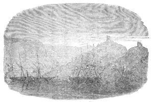
Background imageTerritory Collection: Sebastopol - from an original drawing, 1854. Creator: Edmund Evans

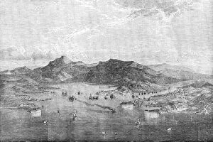
Sebastopol - from an original drawing, 1854. Creator: Edmund Evans
Sebastopol - from an original drawing, 1854. Crimean War. Warships on the Black Sea near the port of Sebastopol. The Siege of Sevastopol was the subject of Crimean soldier Leo Tolstoy's

Background imageTerritory Collection: Map of the Crimea and plan of Sebastopol, 1854. Creator: John Dower

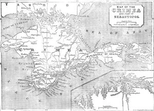
Map of the Crimea and plan of Sebastopol, 1854. Creator: John Dower
Map of the Crimea and plan of Sebastopol, 1854. Crimean War. In the expectation of great sacrifices and severe contests that must attend the attack upon Sebastopol

Background imageTerritory Collection: The Official Arrangement of the British Division off the coast of the Crimea, 1854. Creator: Unknown

The Official Arrangement of the British Division off the coast of the Crimea, 1854. Creator: Unknown
The Official Arrangement of the British Division off the coast of the Crimea, 1854. Crimean War: plan of attack. Diagram showing the positions of Royal Navy ships carrying troops of the Light

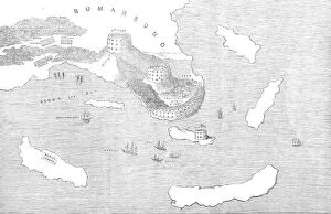
Background imageTerritory Collection: Fortifications of Bomarsund, 1854. Creator: Unknown

Fortifications of Bomarsund, 1854. Creator: Unknown
Fortifications of Bomarsund, 1854. Crimean War. Map of Russian forts on the Baltic Sea coast in Findland. Also shown are positions of the English and French armies

Background imageTerritory Collection: Boat Attack at the Sulineh Mouth of the Danube, 1854. Creator: Unknown

Boat Attack at the Sulineh Mouth of the Danube, 1854. Creator: Unknown
Boat Attack at the Sulineh Mouth of the Danube, 1854. Crimean War: the Royal Navy destroys a Romanian town under Russian control

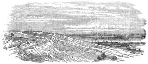
Background imageTerritory Collection: Arab Tabia and Islanli Tabia, Silistria, 1854. Creator: Unknown

Arab Tabia and Islanli Tabia, Silistria, 1854. Creator: Unknown
Arab Tabia and Islanli Tabia, Silistria, 1854. Crimean War. Interior of Arab Tabia, as it remains since the 25th of June, when the siege of Silistria was abandoned by the Russians...View of Arab

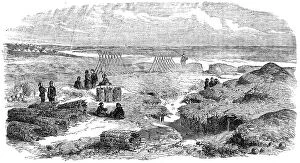
Background imageTerritory Collection: Arab Tabia, Silistria, 1854. Creator: Unknown

Arab Tabia, Silistria, 1854. Creator: Unknown
Arab Tabia, Silistria, 1854. Crimean War. Interior of Arab Tabia, as it remains since the 25th of June, when the siege of Silistria was abandoned by the Russians...View of Arab Tabia and Illanli

Background imageTerritory Collection: Christ Expelling the Money Changers, c. 1519. Creator: Albrecht Altdorfer

Christ Expelling the Money Changers, c. 1519. Creator: Albrecht Altdorfer
Christ Expelling the Money Changers, c. 1519

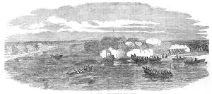
Background imageTerritory Collection: Fort Nottich, Bomarsund - Breach made by an English Three-gun Battery - from a sketch by... 1854

Fort Nottich, Bomarsund - Breach made by an English Three-gun Battery - from a sketch by... 1854. Creator: Unknown
Fort Nottich, Bomarsund - Breach made by an English Three-gun Battery - from a sketch by O.W. Brierly, 1854. Crimean War: view of the Russian-held Notvik Tower and Prasto Tower in Finland

Background imageTerritory Collection: Steam-ships reconnoitring at Sveaborg, in the Gulf of Finland, 1854. Creator: Unknown

Steam-ships reconnoitring at Sveaborg, in the Gulf of Finland, 1854. Creator: Unknown
Steam-ships reconnoitring at Sveaborg, in the Gulf of Finland, 1854. Crimean War: Royal Navy ships off Russian-held Sveaborg [modern Suomenlinna]

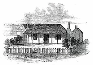
Background imageTerritory Collection: Settler's Station in Port Phillip, 1850. Creator: Unknown

Settler's Station in Port Phillip, 1850. Creator: Unknown
Settler's Station in Port Phillip, 1850. Sketch of the usual hut or "station" seen in the interior of the colony of Port Phillip, Australia

Background imageTerritory Collection: Tigre Island, 1850. Creator: Unknown

Tigre Island, 1850. Creator: Unknown
Tigre Island, [now in Honduras], 1850. From "Illustrated London News", 1850. Sketch by "a Traveller in Central America"...of...the interior of the island

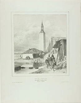
Background imageTerritory Collection: Turn by the Belltower, Framework Pending the Turkish Occupation, 1839. Creator: Auguste Raffet

Turn by the Belltower, Framework Pending the Turkish Occupation, 1839. Creator: Auguste Raffet
Turn by the Belltower, Framework Pending the Turkish Occupation, 1839

Background imageTerritory Collection: Neutralia, 1915. Creator: Edvard Munch

Neutralia, 1915. Creator: Edvard Munch
Neutralia, 1915

Background imageTerritory Collection: Indian Land for Sale, 1911 (litho)

Indian Land for Sale, 1911 (litho)
PNP246284 Indian Land for Sale, 1911 (litho) by American School, (20th century); Private Collection; (add.info.: issued by Commissioner of Indian Affairs; ); Peter Newark American Pictures; American

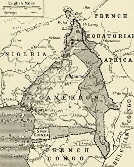
Background imageTerritory Collection: Map Showing the German Cameroon Colony, 1916. Creator: Unknown

Map Showing the German Cameroon Colony, 1916. Creator: Unknown
Map Showing the German Cameroon Colony, 1916. German Cameroon was an African colony of the German Empire from 1884 to 1916

Background imageTerritory Collection: Map of German South West Africa, First World War, (c1920). Creator: John Bartholomew & Son

Map of German South West Africa, First World War, (c1920). Creator: John Bartholomew & Son
Map of German South West Africa, First World War, (c1920). The German annexation of South West Africa took place in the 1880s

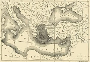
Background imageTerritory Collection: Map of the Byzantine Empire in the Ninth Century, 1890. Creator: Unknown

Map of the Byzantine Empire in the Ninth Century, 1890. Creator: Unknown
Map of the Byzantine Empire in the Ninth Century, 1890. The Byzantine Empire underwent a revival under Macedonian emperors from Basil I (867-886) in late 9th, 10th, and early 11th centuries

Background imageTerritory Collection: Map of India in 1856 (1906)

Map of India in 1856 (1906). From Cassells History of England, Vol. VI. [Cassell and Company, Limited, London, Paris, New York & Melbourne, 1906]

Background imageTerritory Collection: Heritage Kitchen Bar, Seven Mile Beach, West Bay, Grand Cayman, Cayman Islands

Heritage Kitchen Bar, Seven Mile Beach, West Bay, Grand Cayman, Cayman Islands

Background imageTerritory Collection: Blue iguana (Cyclura lewisi), Queen Elizabeth II Botanic Park, North Side, Grand Cayman

Blue iguana (Cyclura lewisi), Queen Elizabeth II Botanic Park, North Side, Grand Cayman, Cayman Islands

Background imageTerritory Collection: Bar Sign at George Town, Grand Cayman, Cayman Islands

Bar Sign at George Town, Grand Cayman, Cayman Islands

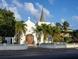
Background imageTerritory Collection: United Church, George Town, Grand Cayman, Cayman Islands

United Church, George Town, Grand Cayman, Cayman Islands


For sale as Licensed Images

Choose your image, Select your licence and Download the media

"Exploring the Rich Tapestry of Territory: From Ancient Empires to Majestic Landscapes" Embark on a captivating journey through time and space as we delve into the concept of territory. Let us begin our expedition with a glance at Scotland in the 1870s, where an intricate map unravels tales of clans and their territorial disputes. Shifting our focus eastward, we encounter a mesmerizing Map of the Ancient Persian Empire. Marvel at its vast expanse, once ruled by mighty kings who sought to expand their dominion across ancient lands. Transporting ourselves to Britain in 597 AD, another map reveals how territories evolved over centuries. Witness the birth of kingdoms and empires that shaped this island nation's history. As dusk descends upon Uluru, Ayers Rock in Australia, soak in nature's splendor while contemplating indigenous peoples' connection to their ancestral territories. The sunset paints vibrant hues across this sacred land. Journeying back to Europe, let us explore Ireland through a map from the 1870s. Discover its lush landscapes and ponder upon historical struggles for control over this enchanting island. Expand your horizons further with the World Map Empire McVitie; marvel at how various nations carved out their territories during different eras – each stroke representing power dynamics and conquests. Venturing into antiquity, immerse yourself in Alexander the Great's empire through an awe-inspiring map. Uncover his audacious quest for dominance as he conquered vast stretches of land under his rule. Witnessing nature's wonders takes flight as we observe a majestic Red Kite soaring above its nest territory in Lower Saxony, Germany. A symbol of freedom within defined boundaries - it reminds us that even wildlife has territorial instincts ingrained within them. Turning towards spiritual realms brings us face-to-face with Palestine and Holy Land on an intricately detailed map. Contemplate millennia-old conflicts rooted deeply in territorial claims and religious significance.