Territory Collection (#8)

"Exploring the Rich Tapestry of Territory

Background imageTerritory Collection: Bar Sign at George Town, Grand Cayman, Cayman Islands

Bar Sign at George Town, Grand Cayman, Cayman Islands

Background imageTerritory Collection: United Church, George Town, Grand Cayman, Cayman Islands

United Church, George Town, Grand Cayman, Cayman Islands

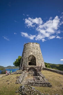
Background imageTerritory Collection: U. S. Virgin Islands, St. John, Leinster Bay, Annaberg Sugar Mill Ruins

U. S. Virgin Islands, St. John, Leinster Bay, Annaberg Sugar Mill Ruins
U.S. Virgin Islands, St. John, Leinster Bay, Annaberg Sugar Mill Ruins

Background imageTerritory Collection: U. S. Virgin Islands, St. Thomas, Great Bay, The Ritz Carlton St. Thomas

U. S. Virgin Islands, St. Thomas, Great Bay, The Ritz Carlton St. Thomas
U.S. Virgin Islands, St. Thomas, Great Bay, The Ritz Carlton St. Thomas

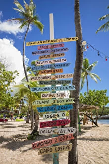
Background imageTerritory Collection: U. S. Virgin Islands, St. Thomas, Bolongo Bay, Bolongo Bay Beach, sign

U. S. Virgin Islands, St. Thomas, Bolongo Bay, Bolongo Bay Beach, sign
U.S. Virgin Islands, St. Thomas, Bolongo Bay, Bolongo Bay Beach, sign

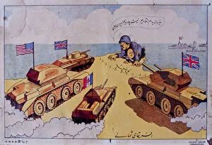
Background imageTerritory Collection: Cartoon with British and American tanks, WW2

Cartoon with British and American tanks, WW2
Cartoon, political map of Libya with British and American tanks during the Second World War. circa 1942

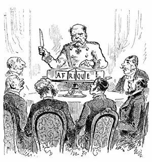
Background imageTerritory Collection: The scramble for Africa: the Berlin Conference, 1884-1885

The scramble for Africa: the Berlin Conference, 1884-1885
French commentary on the Berlin Conference of 1884-1885: Otto von Bismarck, then Chancellor of Germany, is portrayed here wielding a knife over a sliced up cake, marked Africa

Background imageTerritory Collection: Aerial view of Green Sea Turtles, Chelonia mydas, on the beach

Aerial view of Green Sea Turtles, Chelonia mydas, on the beach
These green sea turtles, Chelonia mydas, an endangered species, have pulled out of the water onto Ho'okipa Beach on Maui, Hawaii. Photographed at sunrise.
Background imageTerritory Collection: Map showing the territory (shaded dark) recaptured during the Russian winter offensive

Map showing the territory (shaded dark) recaptured during the Russian winter offensive
20th Century, Archival, Archive, Conflict, Countries, Country, December 1941, Engraving, Geographical, Geography, Historical, History, Illustration, May 1942, Offensive, Old, Period, Picture, Print

Background imageTerritory Collection: Sailors, probably American, and some civilians posed on a cruiser berthed in New York(?), c1905

Sailors, probably American, and some civilians posed on a cruiser berthed in New York(?), c1905

Background imageTerritory Collection: Japanese soldiers on a beach in Manchuria, c1905. Creator: Underwood & Underwood
Japanese soldiers on a beach in Manchuria, c1905. Creator: Underwood & Underwood
Japanese soldiers on a beach in Manchuria, c1905

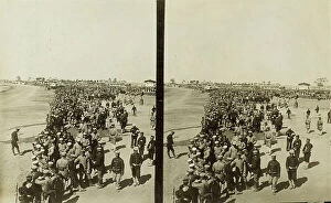
Background imageTerritory Collection: A crowd of Japanese soldiers; Chinese coolies in right foreground, Manchuria, c1905

A crowd of Japanese soldiers; Chinese coolies in right foreground, Manchuria, c1905. Creator: Underwood & Underwood
A crowd of Japanese soldiers; Chinese coolies in right foreground, Manchuria, c1905

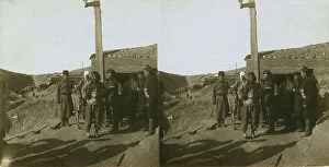
Background imageTerritory Collection: Carrying wounded Russian in a jinriksha from the front down to the hospital in Port Arthur, c1905

Carrying wounded Russian in a jinriksha from the front down to the hospital in Port Arthur, c1905

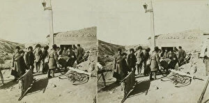
Background imageTerritory Collection: Bicycle stretchers bringing Russian wounded to a surgical station -- siege of Port Arthur, c1905

Bicycle stretchers bringing Russian wounded to a surgical station -- siege of Port Arthur, c1905

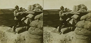
Background imageTerritory Collection: Inside a Russian fort during the siege - shell marks around a dummy gun - Port Arthur, c1905

Inside a Russian fort during the siege - shell marks around a dummy gun - Port Arthur, c1905

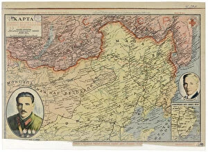
Background imageTerritory Collection: Map of the Far East of the USSR, Northern China (Manchuria) and Mongolia, 1930. Creator: Unknown

Map of the Far East of the USSR, Northern China (Manchuria) and Mongolia, 1930. Creator: Unknown
Map of the Far East of the USSR, Northern China (Manchuria) and Mongolia, 1930. This Soviet-era map is intended to serve a propaganda purpose

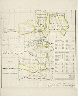
Background imageTerritory Collection: Map showing the lands assigned to emigrant Indians west of Arkansas and Missouri, 1836

Map showing the lands assigned to emigrant Indians west of Arkansas and Missouri, 1836. Creator: Topographical Bureau
Map showing the lands assigned to emigrant Indians west of Arkansas and Missouri, 1836. Following passage of the Indian Removal Act in 1830

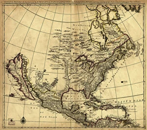
Background imageTerritory Collection: North America divided into its III principall [sic] parts, 1685. Creator: Philip Lea

North America divided into its III principall [sic] parts, 1685. Creator: Philip Lea
North America divided into its III principall [sic] parts, 1685. This map, North America Divided into its III Principal Parts

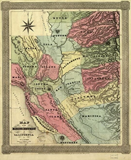
Background imageTerritory Collection: Map of the mining district of California, 1851. Creator: William A. Jackson

Map of the mining district of California, 1851. Creator: William A. Jackson
Map of the mining district of California, 1851. This map, produced in two parts in the early years after the California Gold Rush of 1849

Background imageTerritory Collection: Hi, It is My Territory

Hi, It is My Territory
John J. Chen

Background imageTerritory Collection: Arizona, Monument Valley, Mitten and Merrick Butte

Arizona, Monument Valley, Mitten and Merrick Butte

Background imageTerritory Collection: Arizona, Monument Valley, Sentinel Mesa

Arizona, Monument Valley, Sentinel Mesa

Background imageTerritory Collection: Arizona, Monument Valley, West & East Buttes

Arizona, Monument Valley, West & East Buttes

Background imageTerritory Collection: Arizona, Monument Valley, West, Mitten ad Merrick Buttes

Arizona, Monument Valley, West, Mitten ad Merrick Buttes

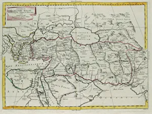
Background imageTerritory Collection: Empire of Alexander the Great covering Europe, Asia and Africa, engraving by G

Empire of Alexander the Great covering Europe, Asia and Africa, engraving by G. Zuliani taken from Tome IV of the "Newest Atlas" published in Venice in 1785 by Antonio Zatta

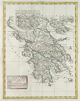
Background imageTerritory Collection: Ancient Greece, engraving by G. Zuliani taken from Tome IV of the 'Newest Atlas' published in

Ancient Greece, engraving by G. Zuliani taken from Tome IV of the "Newest Atlas" published in Venice in 1785 by Antonio Zatta, Private Collection Florence Engraving Eighteenth Century

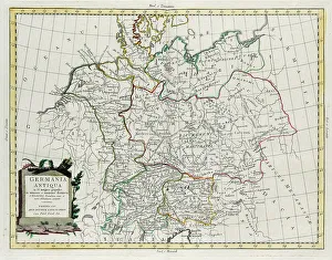
Background imageTerritory Collection: Ancient Germany divided into IV great peoples, distinguished by lesser and least tribes

Ancient Germany divided into IV great peoples, distinguished by lesser and least tribes and regions of the Danube contained between it and the Adriatic Sea, engraving by G

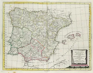
Background imageTerritory Collection: Ancient Spain divided into three distinct areas, namely Terraconensis, Lusitania and Baetica

Ancient Spain divided into three distinct areas, namely Terraconensis, Lusitania and Baetica and also divided into peoples, engraving by G

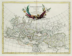
Background imageTerritory Collection: Western and Eastern Roman Empire, engraving by G. Zuliani taken from Tome IV of the 'Newest Atlas'

Western and Eastern Roman Empire, engraving by G. Zuliani taken from Tome IV of the "Newest Atlas" published in Venice in 1785 by Antonio Zatta

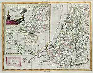
Background imageTerritory Collection: Land of Canaan, or the land promised to Abraham and his descendants

Land of Canaan, or the land promised to Abraham and his descendants, and the Twelve Tribes of Israel, engraving by G. Zuliani taken from Tome IV of the "Newest Atlas" published in Venice in

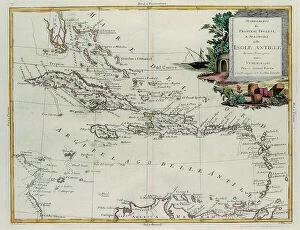
Background imageTerritory Collection: Establishments of the French, English and Spanish on the Antilles Islands, engraving by G

Establishments of the French, English and Spanish on the Antilles Islands, engraving by G. Zuliani taken from Tome IV of the "Newest Atlas" published in Venice in 1785 by Antonio Zatta

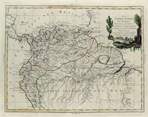
Background imageTerritory Collection: Terra Firma, Spanish, Dutch, French and Portguese Guyana and the northern part of Brazil

Terra Firma, Spanish, Dutch, French and Portguese Guyana and the northern part of Brazil, engraving by G. Zuliani taken from Tome IV of the "Newest Atlas" published in Venice in 1785 by

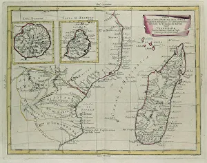
Background imageTerritory Collection: Part of the eastern coast of Africa with the Island of Madagascar

Part of the eastern coast of Africa with the Island of Madagascar and the detailed maps of the islands belonging to France and Bourbon, engraving by G

Background imageTerritory Collection: The Barbary Coast or The Kingdoms of Morocco, Fez, Algeria, Tunisia

The Barbary Coast or The Kingdoms of Morocco, Fez, Algeria, Tunisia and Tripoli with surrounding countries, engraving by G

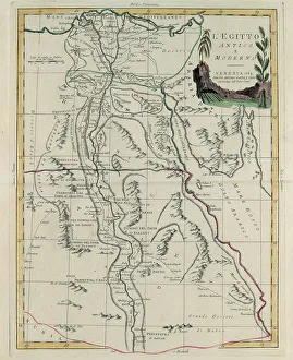
Background imageTerritory Collection: Ancient and Modern Egypt, engraving by G. Zuliani taken from Tome IV of the 'Newest Atlas'

Ancient and Modern Egypt, engraving by G. Zuliani taken from Tome IV of the "Newest Atlas" published in Venice in 1784 by Antonio Zatta

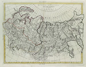
Background imageTerritory Collection: Asian Russia, divided into its provinces, engraving by G. Zuliani taken from Tome IV of

Asian Russia, divided into its provinces, engraving by G. Zuliani taken from Tome IV of the "Newest Atlas" published in Venice by Antonio Zatta

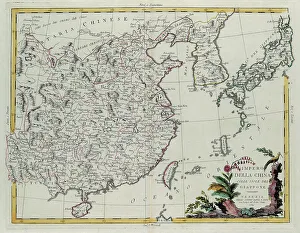
Background imageTerritory Collection: Chinese Empire with the islands of Japan, engraving by G. Zuliani taken from Tome IV of

Chinese Empire with the islands of Japan, engraving by G. Zuliani taken from Tome IV of the "Newest Atlas" published in Venice in 1784 by Antonio Zatta

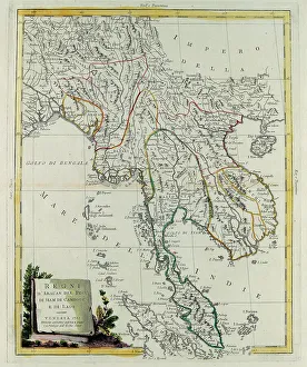
Background imageTerritory Collection: Kingdoms of Arakan, Pegu, Siam, Cambodia and Laos, engraving by G

Kingdoms of Arakan, Pegu, Siam, Cambodia and Laos, engraving by G. Zuliani taken from Tome IV of the "Newest Atlas" published in Venice in 1785 by Antonio Zatta

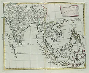
Background imageTerritory Collection: East Indies and their Archipelago, engraving by G. Zuliani taken from Tome IV of the 'Newest

East Indies and their Archipelago, engraving by G. Zuliani taken from Tome IV of the "Newest Atlas" published in Venice in 1784 by Antonio Zatta

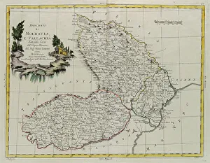
Background imageTerritory Collection: Principates of Moldavia and Vallakia, engraving by G. Zuliani taken from Tome III of the 'Newest

Principates of Moldavia and Vallakia, engraving by G. Zuliani taken from Tome III of the "Newest Atlas" published in Venice in 1782 by Antonio Zatta

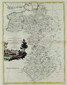
Background imageTerritory Collection: Duchies of Livonia and Estonia and the States of Novogorod, Bielogorod

Duchies of Livonia and Estonia and the States of Novogorod, Bielogorod and Kiovia with their Districts in European Russia, engraving by G

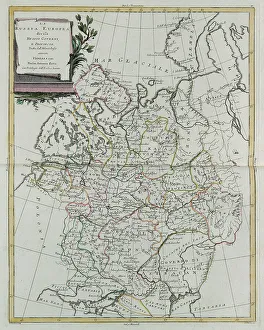
Background imageTerritory Collection: European Russia divided into its governances and provinces, engraving by G

European Russia divided into its governances and provinces, engraving by G. Zuliani taken from Tome III of the "Newest Atlas" published in Venice in 1781 by Antonio Zatta

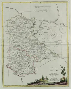
Background imageTerritory Collection: The Palatinates of Braclaw and Kiovia, engraving by G. Zuliani taken from Tome III of the 'Newest

The Palatinates of Braclaw and Kiovia, engraving by G. Zuliani taken from Tome III of the "Newest Atlas" published in Venice in 1781 by Antonio Zatta

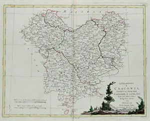
Background imageTerritory Collection: The Palatinates of Krakov, Lekzyca, Sieradz, Sandomir and Lublin, engraving by G

The Palatinates of Krakov, Lekzyca, Sieradz, Sandomir and Lublin, engraving by G. Zuliani taken from Tome III of the "Newest Atlas" published in Venice in 1781 by Antonio Zatta

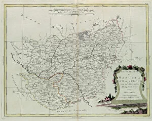
Background imageTerritory Collection: The Palatinates of Mazovia, Rava and Plock, engraving by G. Zuliani taken from Tome III of

The Palatinates of Mazovia, Rava and Plock, engraving by G. Zuliani taken from Tome III of the "Newest Atlas" published in Venice in 1781 by Antonio Zatta

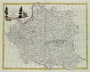
Background imageTerritory Collection: Poland divided into its Palatinates, engraving by G. Zuliani taken from Tome III of the 'Newest

Poland divided into its Palatinates, engraving by G. Zuliani taken from Tome III of the "Newest Atlas" published in Venice in 1782 by Antonio Zatta

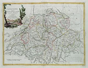
Background imageTerritory Collection: Helvetia divided into its 13 Cantons and its allies, engraving by G

Helvetia divided into its 13 Cantons and its allies, engraving by G. Zuliani taken from Tome III of the "Newest Atlas" published in Venice in 1781 by Antonio Zatta

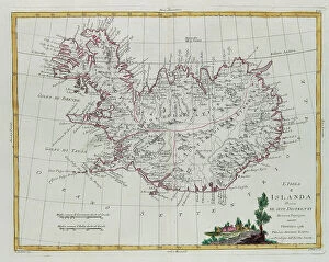
Background imageTerritory Collection: Iceland divided into its districts, engraving by G. Zuliani taken from Tome III of the 'Newest

Iceland divided into its districts, engraving by G. Zuliani taken from Tome III of the "Newest Atlas" published in Venice in 1781 by Antonio Zatta


For sale as Licensed Images

Choose your image, Select your licence and Download the media

"Exploring the Rich Tapestry of Territory: From Ancient Empires to Majestic Landscapes" Embark on a captivating journey through time and space as we delve into the concept of territory. Let us begin our expedition with a glance at Scotland in the 1870s, where an intricate map unravels tales of clans and their territorial disputes. Shifting our focus eastward, we encounter a mesmerizing Map of the Ancient Persian Empire. Marvel at its vast expanse, once ruled by mighty kings who sought to expand their dominion across ancient lands. Transporting ourselves to Britain in 597 AD, another map reveals how territories evolved over centuries. Witness the birth of kingdoms and empires that shaped this island nation's history. As dusk descends upon Uluru, Ayers Rock in Australia, soak in nature's splendor while contemplating indigenous peoples' connection to their ancestral territories. The sunset paints vibrant hues across this sacred land. Journeying back to Europe, let us explore Ireland through a map from the 1870s. Discover its lush landscapes and ponder upon historical struggles for control over this enchanting island. Expand your horizons further with the World Map Empire McVitie; marvel at how various nations carved out their territories during different eras – each stroke representing power dynamics and conquests. Venturing into antiquity, immerse yourself in Alexander the Great's empire through an awe-inspiring map. Uncover his audacious quest for dominance as he conquered vast stretches of land under his rule. Witnessing nature's wonders takes flight as we observe a majestic Red Kite soaring above its nest territory in Lower Saxony, Germany. A symbol of freedom within defined boundaries - it reminds us that even wildlife has territorial instincts ingrained within them. Turning towards spiritual realms brings us face-to-face with Palestine and Holy Land on an intricately detailed map. Contemplate millennia-old conflicts rooted deeply in territorial claims and religious significance.